
Land, dirt, territory, star dust, home, the standing place of one’s heart, whenua, tierra: however you say it, it’s powerful. It’s all about land, this particular post (and probably this whole blog, I’m finding).
This post covers days four to seven of my most recent jaunt down Te Araroa, the 3000-km, length-of-NZ trail I’m walking and blogging in short, contiguous sections, once or twice a year.
Though time constraints mean I can’t do it in one go, the idea is to maintain the sensation of walking (and, where necessary, kayaking) every metre of New Zealand, in order, from top to bottom. It will probably take me a decade. I started in January, 2017; I walked and kayaked this seven-day section in late May 2020.
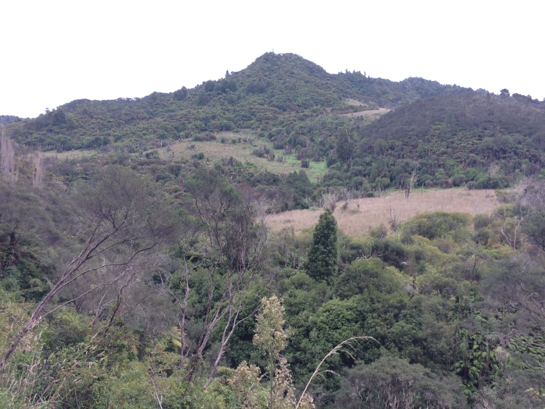
Day 66: Whakahoro to Mangapurua trig – 16km
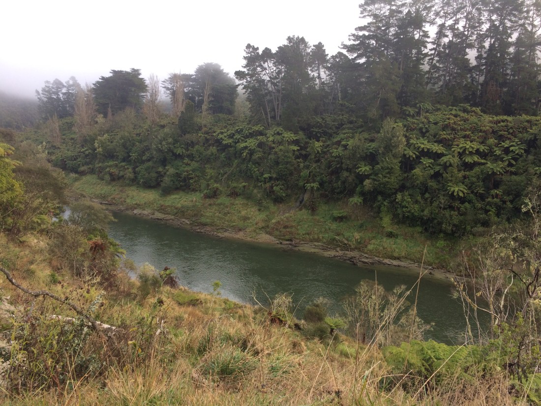
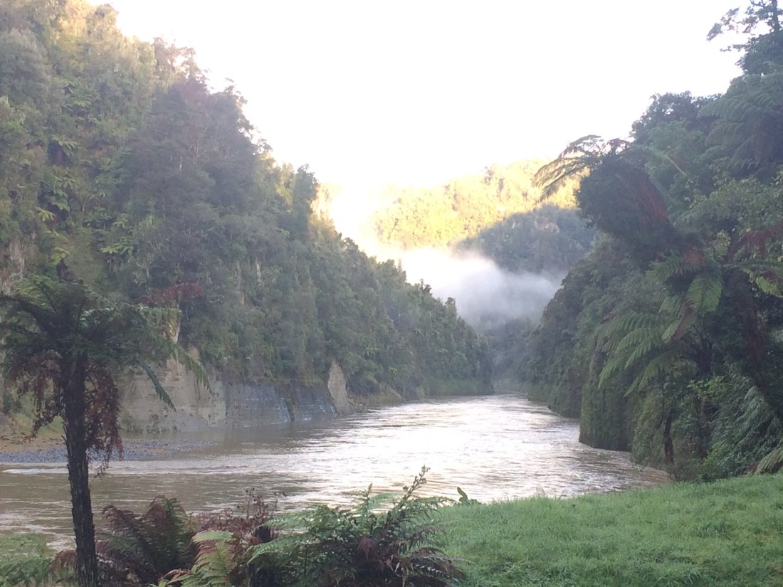
I ate my porridge outside the old school I’d slept in beside the Whanganui River, south of Taumarunui and two days’ walk west of National Park. Teeth half-chewing and half-chattering, I watched the river mist refuse to rise off the cold bush in the motionless morning.
Nothing moved in all that whitened stillness except my spoon and coffee cup. It was something to behold, but too cold to sit there beholding it for long. I packed up and charged into the scrub, walking fast for warmth.
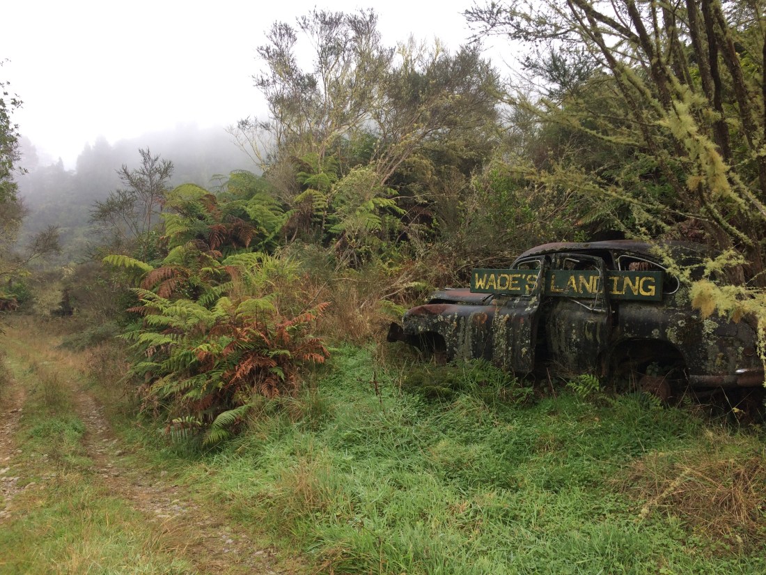
In the days when paddle steamers took settlers and travellers up and down the river, the Whakahoro port was known as Wade’s Landing. Here’s the remains of it – an old car being absorbed back into the land.
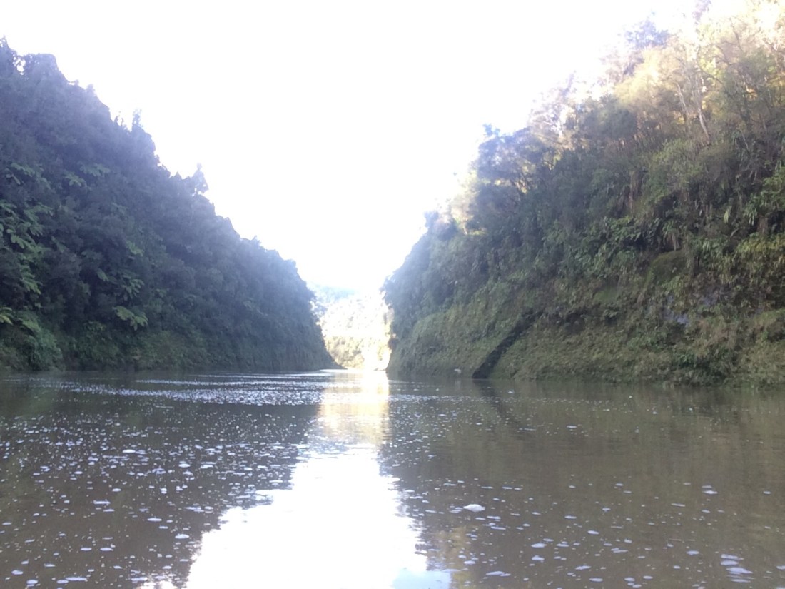
That was where I had my first glimpse of the Whanganui since I left my car and kayak beside it downriver in Pipiriki, several days earlier. The track I would follow over the next two days would eventually take me back to it at the Bridge to Nowhere landing.
I had been looking forward all trip to experiencing first-hand this famous “nowhere” that is very much a somewhere to a couple of special groups of people. One of the groups is comprised of returned soldiers, who were given blocks on their return from World War I. The other are this land’s original Māori owners, who had it taken off them, needless to say unjustly, before it was balloted out to the soldiers.
Descendants of both these groups, I was to discover, cherish this rugged place, despite, or perhaps because of, its resistance to occupation.
This photo marks the beginning of the Kaiwhakauka-Mangapurua Track, but also the beginning of a poignant, true story I’d be experiencing through the soles of my feet for the next two days: the story of the settler-soldiers.
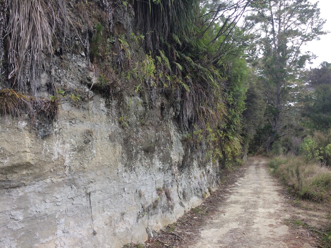
The land ballot was their chance at putting their lives back together after the war had cut along their seams. But the cutting wasn’t over – these valleys proved too steep, nutrient poor and erosion-prone to graze stock on in any sustainable way. And even if you could, you couldn’t reliably get your produce out to market – the access roads had to be carved across soft cliffs of crumbling papa rock, which kept falling down. Even today, the tramping and biking track that remains is constantly threatened by this territory’s unruly, fluid character.
After a couple of decades, all the returned soldiers had to walk off their blocks with nothing but memories.
As I said, though, this whole sad story only happened because the government had essentially seized this territory (all the land between the river and Mt Ruapehu) from its original Māori owners. And of course, there were no tangata whenua among the returned soldiers given plots.
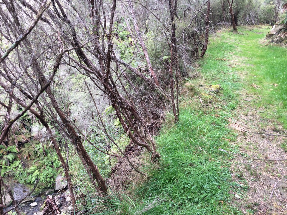
The track starts by heading away from the Whanganui up a tributary of it, the Kaiwhakauka Stream. Here’s the stream, quickly dropping away below:

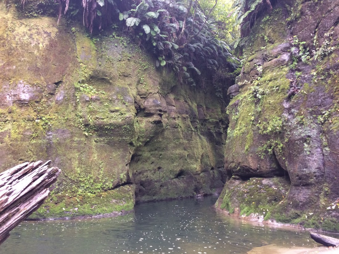
After an hour or so you reach a sign pointing to Blue Duck Falls. It’s a two-minute detour and well worth a look. The falls drop spectacularly from a sudden shelf:
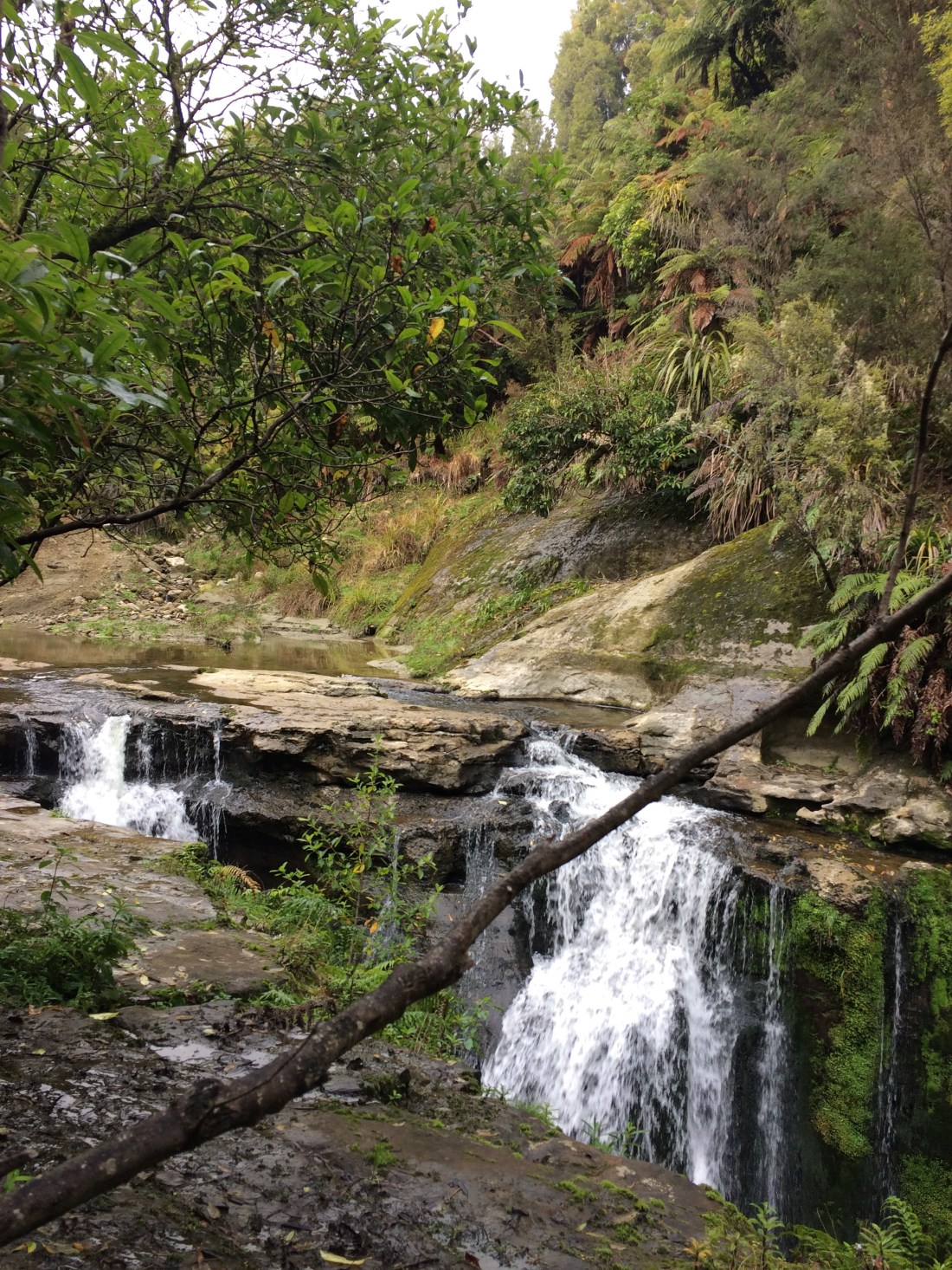
A steep track and ladder-like wooden stairs lead down to the bottom. It’s quite a magical, hidden place – a deep pool, carved out by floods, the sky a small window high above, lined with dark, dripping bush.

At the far end of the pool, the stream narrows into a canyon; it looked to me like the entrance to a lost world. There was a pile of colourful kayaks tied together and lashed to the rock wall; Blue Duck Station’s tourist services evidently include lost-world exploration.
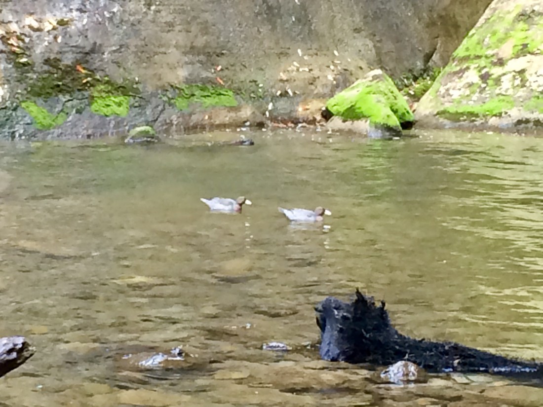
I scrambled down closer to the water, and there waiting for me were two rare whio (native blue duck). This was a real treat – they’re endangered and shy, are nearly always found in pairs, and only live on fast-flowing mountain streams. Their name comes from their piping cry, which really does sound like a sweet, slightly haunting “feee-or, feee-or“.
Back up on the main track, and a little further on I crossed a bridge and came on a few signs of civilisation, unexpected in all this wilderness: a hut, fencing and an actual sign. Te Mata Road, it said, and then some surnames, cleanly poker-worked on neatly milled boards – Carroll Bros, Gray, Russell, Shaw, Scanlon, Bolton, Dudson.
At first I thought these were the names of the current residents, and was surprised there would be such a little community in such a forsaken place. But as I tramped on, these named signs kept popping up, usually with just a name or two, sometimes in a lonely little clearing of pasture, often simply appearing in the middle of the bush.
I realised these must be the surnames of those returned soldiers I’d heard of, who had drawn lots for their sections and set out to clear and farm them, every half-mile or so along a proposed road.

In those days, this would have been untouched bush, and they would surely have recognised at a glance the suffering, solitude and work that lay ahead.

It made me think about what’s in a name. As I’ve written about before, as you tramp the length of this country you notice that many of our towns and cities have names that refer to people and places on the other side of the world. But the wildest and most inhospitable (to humans) places, on the other hand, have Māori names. I guess this is to do with how the land is seen, and how it’s occupied; where Pākehā settlers saw wasteland, minor hills and gullies too hard to extract anything from, Māori saw food sources, the life force of the land, natural features that spoke to them about their ancestors, their cosmology, their relationships with each other and with the world.
On that day’s walk, though, names seemed to be a theme. Not only the settler’s surnames, set onto posts in the middle of groves of bush; but also on, for example, predator traps. These are a common sight in NZ bush-walking; introduced weasels, stoats, ferrets, possums, rats and other nasties wreak mayhem and death on the native birds and other species. Usually the ubiquitous rectangular wood-and-wire traps, which the beastie crawls into after bait but then can’t escape from, are prosaically numbered. But that particular trapping group or authority, I noticed, preferred to name them: Lippy, Judith, Stray, Becky, G-Bell.
Near the falls, I came on a paddock of horses presumably used for Blue Duck Station’s horse trekking operation; their faded green blankets, necessary in the chilly, misty hills, were also emblazoned with evocative names – Rocky, Hangabout, Crockett, Jack, Gizmo.
But it was the settlers whose names were most prominent, the whole walk becoming a kind of living, long-distance memorial to their tenacity and disappointment. And, later, for me, a reminder that they should probably have never been there in the first place. No disrespect to them as individuals – my criticism is of colonisation itself, by which I, too, arrived in this land.
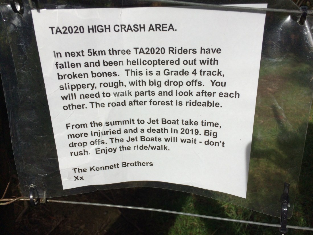
Further on, another sign – this one a sobering warning from the organisers of a length-of-NZ bike ride, which includes this trail:
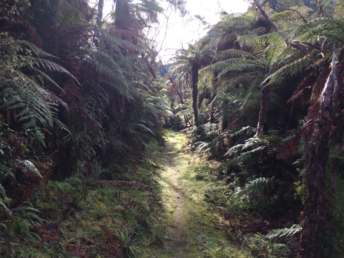
Initially there was little sign of the mortal danger mentioned there, but the surrounding terrain was certainly getting wilder by the minute:
I kept passing, every half a k or so, another one of those name-signs. It was haunting – all that was left of a couple of decades of energy and effort was a patch of weedy grass, encroaching bush, and a surname.
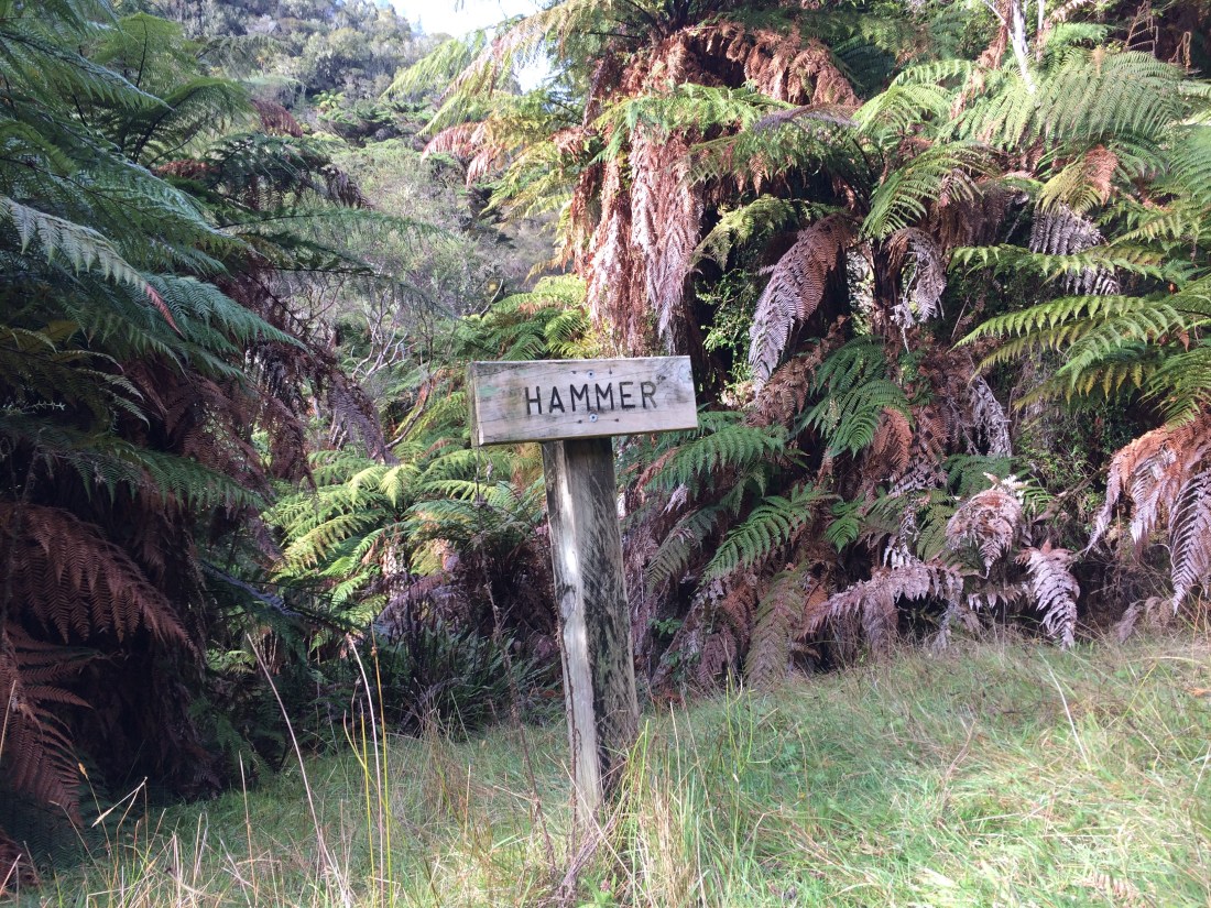
I’m sure Mr Hammer and all the others were just doing the best they could, arriving back in NZ from the appalling trenches, battling their traumas and trying to rebuild their lives. But this land was never theirs, not really, and eventually it simply shrugged them off. If anyone had asked its real owners, they would have told them these steep gullies were good for hunting, gathering and travelling through, but too unstable for a permanent settlement. But no one asked them, and Hammer and his peers learned the hard way.
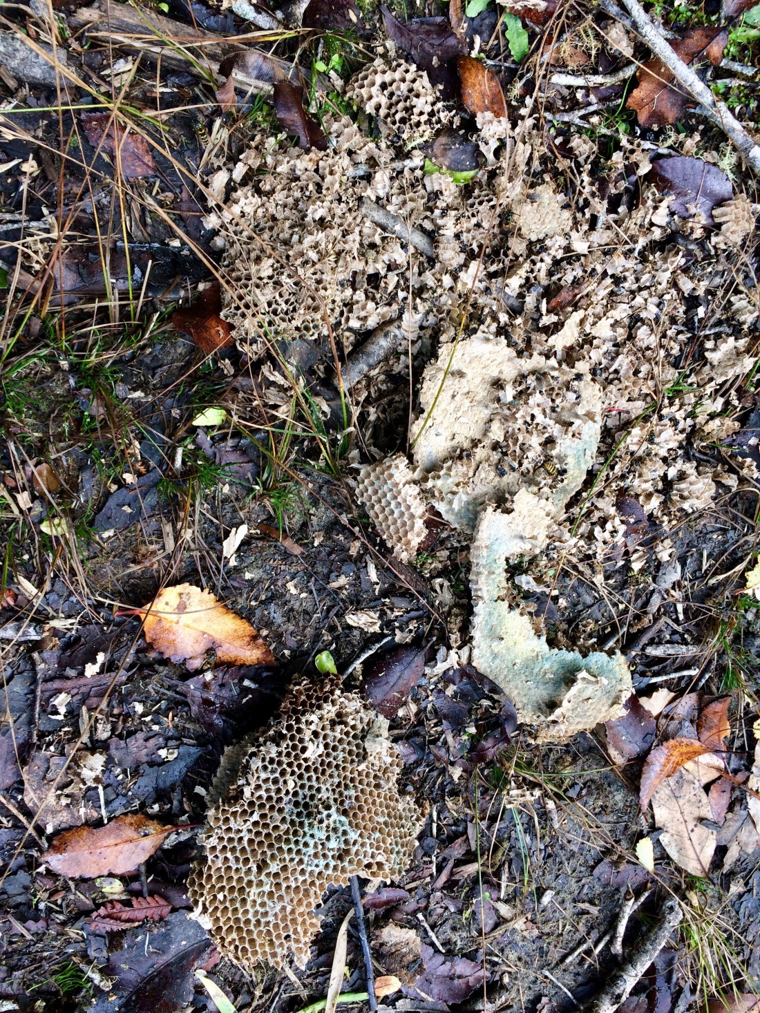
Pākehā like me, of course, have been only one of multiple species to invade this territory. Luckily, more and more is being done to repair the untold damage. I came across a shattered and apparently poisoned wasp’s nest on the track. We wrecked a lot of this land; it’s always good to see signs of efforts to fix it.
Further on, another warning sign. Kia tūpato – be careful. Generally a good thing to keep in mind. Be careful of the land. Be careful of each other. Be careful of the past and all its implications.

Ah, the breaks: I do love the breaks, when tramping. Feet up in a patch of sunshine, leaning against a mānuka trunk, munching banana chips, gazing into all that green. Such simple bliss.
Continuing, I kept thinking of those poor, determined ex-soldiers, the hell they must have gone through to carve this track across steep cliffs, so my feet could flop along, nearly a century on, with relative ease. Pick axe, shovel, maybe a bit of gelignite; hacking their way into what they hoped might be a fortune, a future, or at least a home.

All day I headed slowly higher. Big bluffs often loomed over me, like galleon prows above a dinghy. Later, it was satisfying to look down on them from above; as you’ll see in a subsequent photo, they looked quite different from that angle.
Sometimes you could see what all the warnings for bikers were about, as the track-edge fell away into space, a glint of water far below.
Further on, a jarring change. There’s been some kind of widespread damage to a block of private land that comes right up to the lush DOC reserve I’d been blissfully bowling through. They’ve sprayed it maybe, or there’s been a scrub fire. Beneath the ruined bush, I could see new grass so maybe this rolling country is being put into pasture. Or returned to it, if the bush is actually regrowth. Either way it felt sad, the contrast between the deadened, private land and the exuberant public reserve. I found myself mulling (not for the first time on this trail): Do we have to wreck the forest to grow things?

More and more signs of civilisation appeared. Some of them presumably remnants from the abandoned settlement, such as wilding pines on a bluff above a lonely chimney in an empty paddock:

Others were more modern – a brand new fence, someone burning branches, a small house tucked away in the trees.
Must be wonderful to live all the way out here. And trails like Te Araroa often only exist because of the goodwill, forbearance and support of the owners of private land, which the trails often border or cut across.
But still, for me, there was something a bit depressing about coming suddenly right up against the outside world – with its passion for straight lines and harsh treatment of unruly nature – when I had just been immersed in a world so untouched by all that.
Maybe it was those previously-settled spots I’d passed that morning, where no sign was left of the settler but the literal sign with his surname: no chimney, no fence, no exotic trees, not even pasture. Just a little, ever-diminishing, weedy space in the ungoverned bush. How quickly our traces vanish.
How good that seems to me, that what ultimately blots us out is the land itself, in all its unstoppable, living force.
And then to come across this scene, and to realise: sure, our footprints fade. But how hard and fast they can come back.

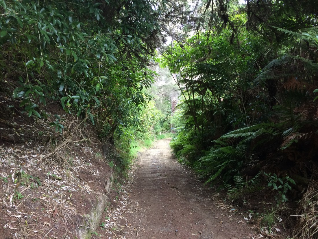
Just beyond this little reminder of the outside world, the track begins to rise toward the source of the Kaiwhakauka Stream near the Mangapurua Trig. That was what I was aiming for today and I pressed on. The track is much more developed from here on, obviously doing double duty as a farm track; it becomes much more engineered, with cuttings and cambers. Some of these more elaborate interventions, I imagine, were originally hewn with pick-axes, spades and dynamite by the first Pākehā settlers, those doubly shell-shocked returned soldiers (first by the war, then by these near-vertical back-blocks):

And before that, of course, routes like this one were first engraved on the land by the tangata whenua, padding over these hills for centuries before Cook or Tasman clocked them. But despite this long human history, there seems a clear message in the stealthy encroachment on the track of creepers, seedlings, vines and roots: if you humans drop your vigilance for just a month or two, your carefully machined route will be overrun. You might be able to continue on foot – maybe.
Here’s one of those reaching, sinuous roots, which for me, became emblematic of this unusual place where humans and nature have collided, and nature has largely won. I particularly liked these ones, flowing down the sides of cuttings – they create an underground atmosphere, as if you’re walking through the underworld and life is carrying on above:

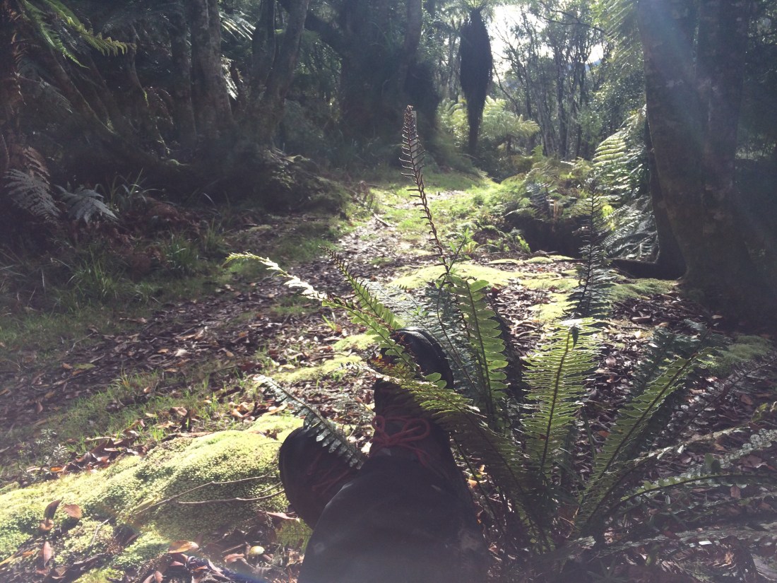
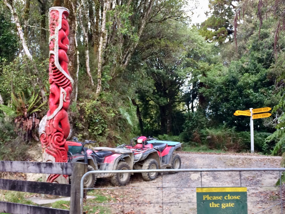
A couple of hours’ uphill slog ensued, through vibrant bush alongside the ever-more rugged upper reaches of the Kaiwhakauka. Then I emerged at a gate, and more signs of that jarring relationship humans sometimes have with the wild: yellow AA road signs, and two quad bikes parked hard up against a carved pou, its elegant lines much more in keeping with the surrounds than the bikes – even if they and the pou were a similar colour.
A DOC sign provided some useful orientation, then I was off into a long corridor of bush that closed over the road like a roof.

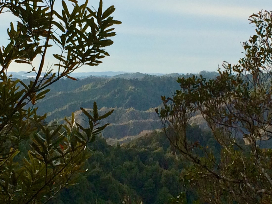
From near the trig point (661m), at a rare opening in the canopy I could see from above, to the north and east, the steep-sided bluffs I’d been walking beneath and gradually edging up all day:

The descending sunlight softened the harsh touch of humans on the land – this next photo shows from above that area of burnt or poisoned scrub I walked beside earlier.
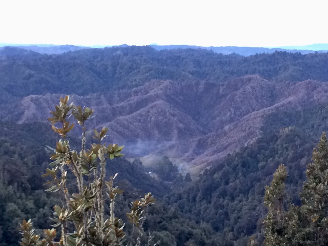
The next pic makes the effects a bit more visible; in the centre, an area of farmland with that rubbish fire still smoking. This is what this whole area would have been like back in the day, when dozens of families were trying to beat these feral slopes into submission. Smoke, smashed trunks, torn ground, the thud of machines, the clatter of flames.
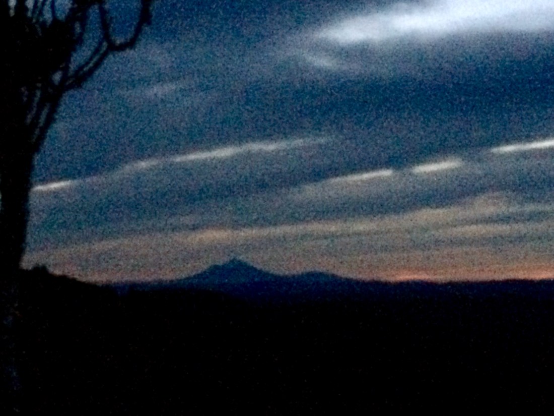
Away to the west, Mt Taranaki appeared, much bigger than when I last glimpsed him, from three days’ walk further east.
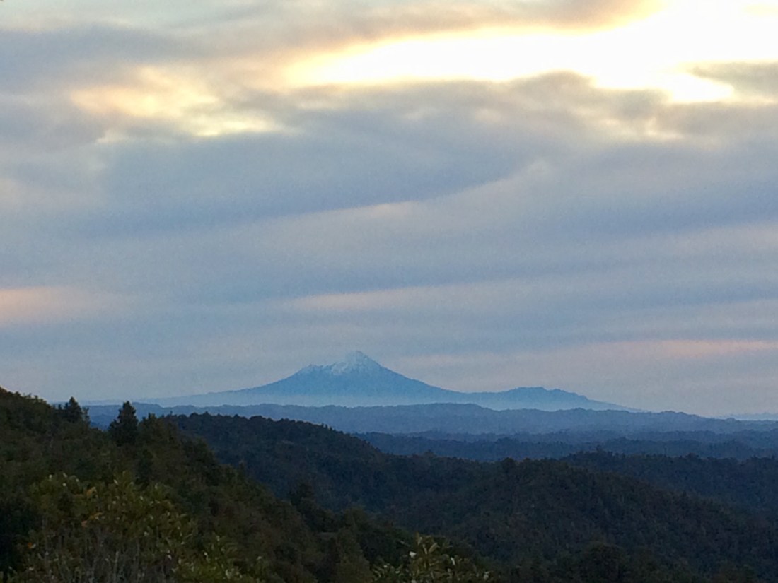
I love this aspect of long distance, multi-day tramping – seeing the land respond to your marching feet; how you can push its massive bulk far away from you or pull it near, just by putting one of your little feet after the other. Here’s where I started, four days ago, up on the flanks of the long, low peak to the left: Mt Tongariro (1,978m). On the right is Mt Ngāuruhoe (2,291m), which I skirted on day one. In an earlier post I described my first glimpse of them, from far to the north; now they’re falling away behind me. It’s a unique sensation.
The longest place-name in Aotearoa was given to a hill near where I grew up, in a far corner of Hawke’s Bay, east of Dannevirke:
Taumatawhakatangihangakoauauotamateaturipukakapikimaungahoronukupokaiwhenuakitanatahu.
It means, “the place where Tamatea, the man with the big knees, who slid, climbed and swallowed mountains, known as ‘land eater’, played his flute to his loved one.”
It commemorates the hilltop where Tamatea, a famous chief and warrior, went to grieve each day for his brother, killed in battle, by playing on his flute. “Land eater” always seemed a richly redolent idea to me; some people eat land by buying it up, others by warring for it. I think it’s better to walk over it for days, weeks and months, sleeping on it at night, watching it swell in front of you, then fall behind, all the while getting more and more under your skin and into your blood.
Mangapurua Trig is also the only cell phone access between National Park and Pipiriki, so I got online and made some calls. That brief stretch of land rearing up just enough toward the satellites let me check my kayak had been safely delivered, reassure people I hadn’t disappeared into the bush like all those returned soldiers’ dreams, and also check the property websites for somewhere for my beloved and I to live after I got back to Wellington. Land, land, land – no getting away from it, no doing without it.
Before it got dark there was just time to walk down from the trig, pitch my tent at the campsite beside the track, and have a look at the very moving settlers’ memorial next to the campsite.
It featured a historic map of all the original plots, and striking photos of all the men named on it.

The old map was cool, but the photos were even better. It was quite something to look right into the faces of these men, whose plots of land I’d been passing all day. Having just seen their surnames on the little signs; having seen how brave and determined they were, to try and make a go of this unforgiving country. How their ambition and energy had run up against forces no amount of bravery could subdue.
I liked how many of the photos were candid, not the formally posed ones you usually get of people shown in memorial-type settings. You could glimpse their pioneering character, their toughness, but also their humour, their normal human flaws, the expressions they wore when not necessarily trying to look staunch. It seemed an uncommon and refreshing portrayal of Kiwi men.
Like this feller, Percy Cootes. Yes, he was a private in the army, but someone’s chosen to present him as also a cheerful chap in jaunty hat; his hands are busy at one of his interminable tasks, but he still has time to chuck a dimpled smile over a shoulder:

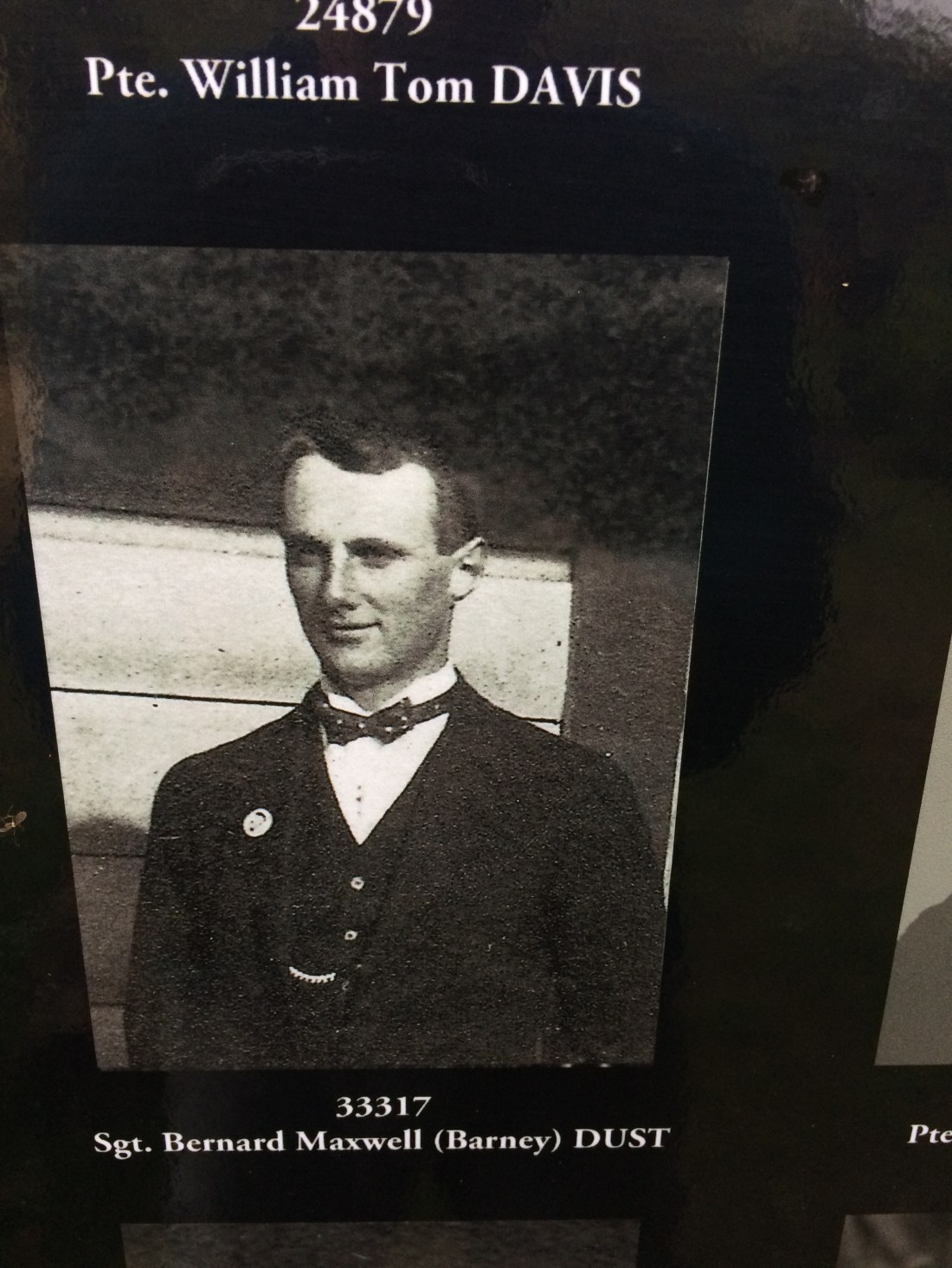
There’s William Davis, also wearing work clothes, and an expression which talks of work: the hard blankness of it, the endurance you need to face it down for decades:

Another Davis, Charlie, is captured in a more unguarded, relaxed mode – reading the paper, perhaps, or a letter from home.

It’s good to see these craggy bushmen in their finery, too; it wasn’t all hanging on by dirty fingernails. Exhibit A, the elegantly turned out (and named) Barney Dust:
Dust he was, and to it we’ll all return. A few of his neighbours are shown in that other quintessential NZ uniform, the rugby jersey; one of them is Robert Gibson, who looks like he would have a nice smile if that was allowed in rugby photos:

As you’d expect, quite a few of these returned soldiers are shown in uniform – for many, it may have been their only photo. But despite their increased formality, many of these photos still manage to capture the human behind the battle-dress. In some of them, such as Albert Hoddle’s, the touching aspect to me is how the warrior’s costume and his obvious determination to be brave don’t quite fully disguise his youthfulness:

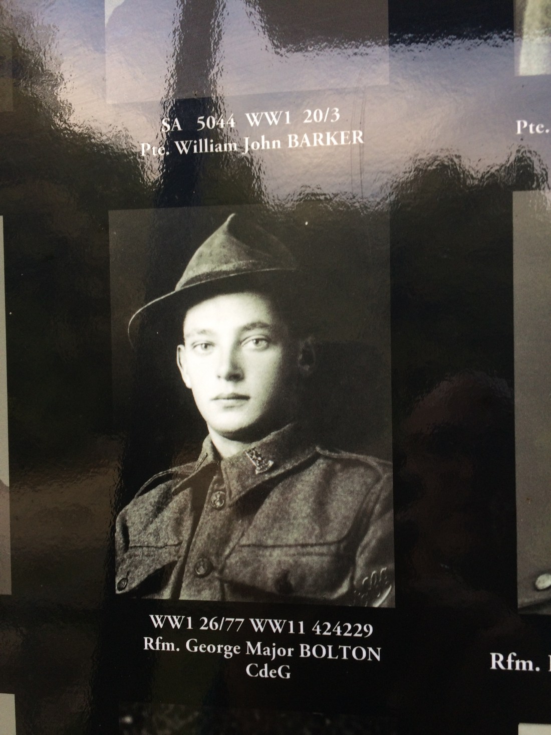
Often, I found the one-time youth of these hard men startling – how could they expect a smooth-faced young man such as George Bolton, below, to grapple first with war, then with these ferocious hills?
In others, it’s a certain haunting light in the eyes, perhaps because of something they’ve seen, or fear to see. It even seemed to foretell some of the hardship they no doubt went through, trying to break in this unbreakable country. This one especially got to me because I’d seen, earlier that day, all that remained of his efforts – his name on a sign in a clearing, which was the size of a small bedroom:

Others have a calm dignity, and a formidable style, in the face of all the difficulties life was throwing at them:

Despite all the hardship and heartbreak, they often don’t seem to take themselves too seriously:

Kenneth Wilson looks like he’d spin a yarn as quick as he’d split a log into five hundred battens:

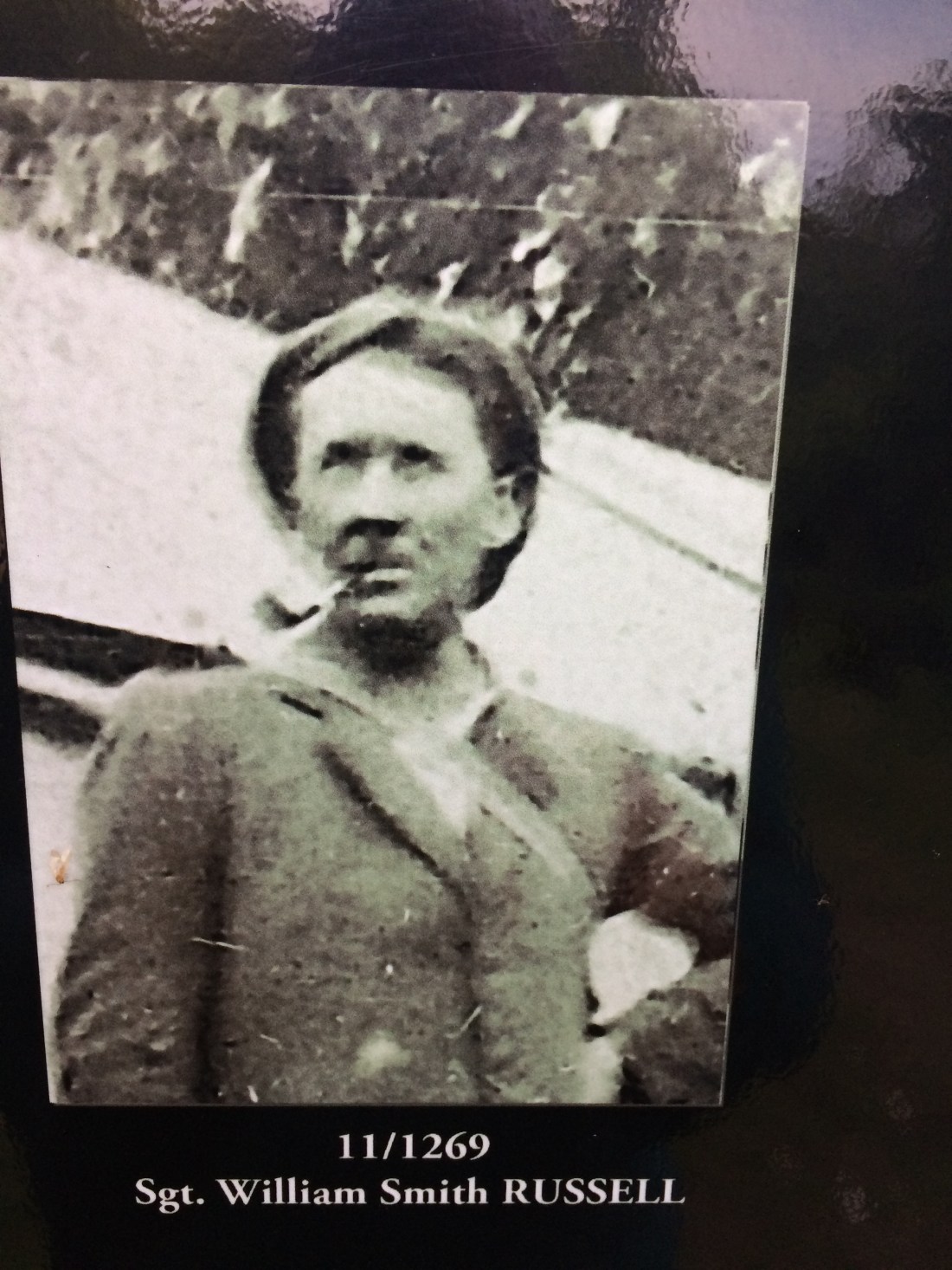
William Russell has seen a thing or two, but he’d rather keep most of it to himself while considering the horizon:
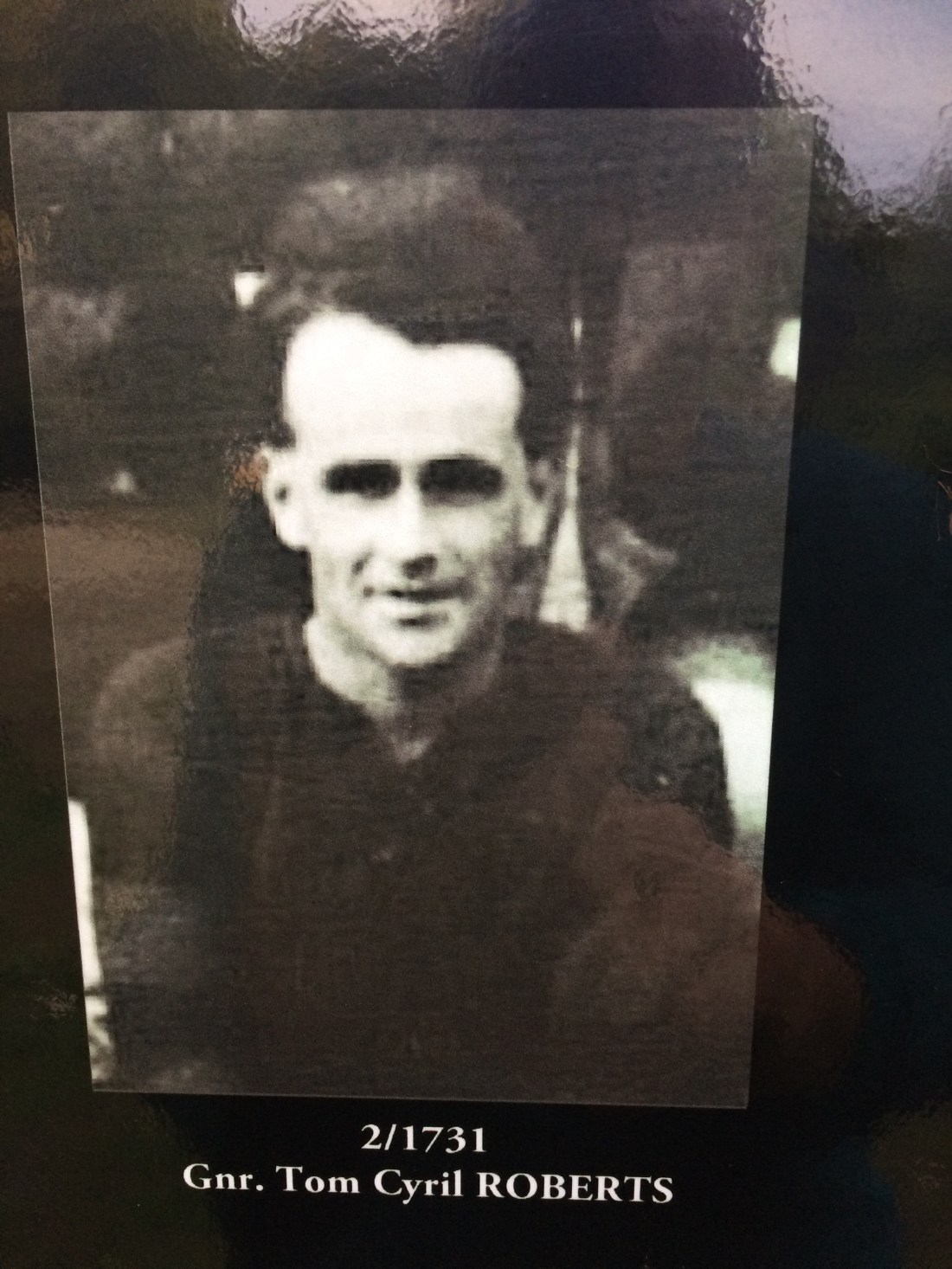
Ex-gunner Roberts also looked to have kept his sense of humour:
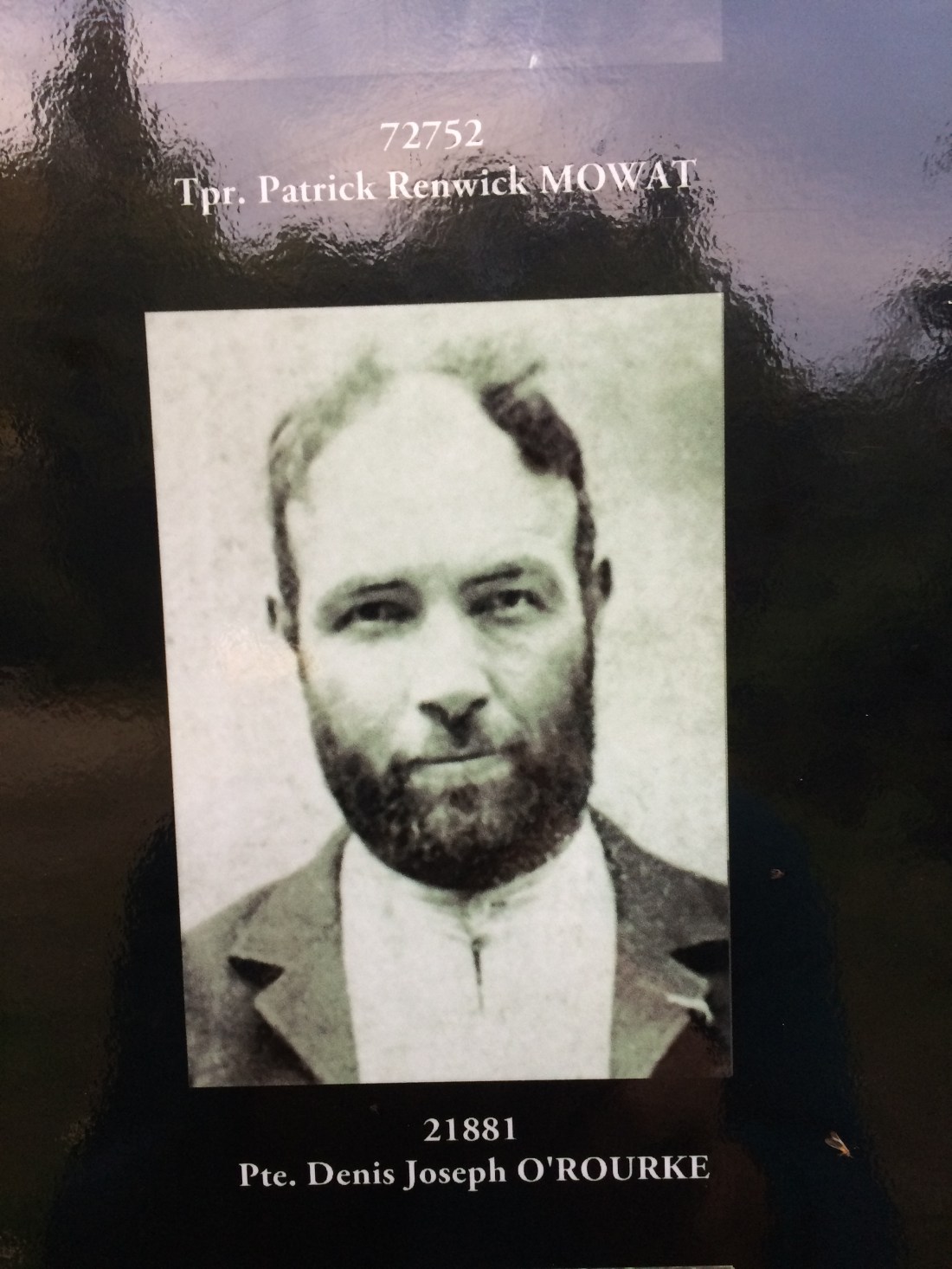
Denis O’Rourke caught my eye, partly because his face has a calm strength, but also a lack of pretention – he wears a beard because, it seemed to me, he feels like it, and doesn’t care about his bald patch. But also because the land I’d sleep on that night used to be his; his name was on the sign beside the camping area.
Sometimes, the photos summed up the astonishing work ethic many of these settlers must have had; sometimes they also hinted at an intriguing back story. Such as, why did Andrew Peters (below) also go by James Smith?
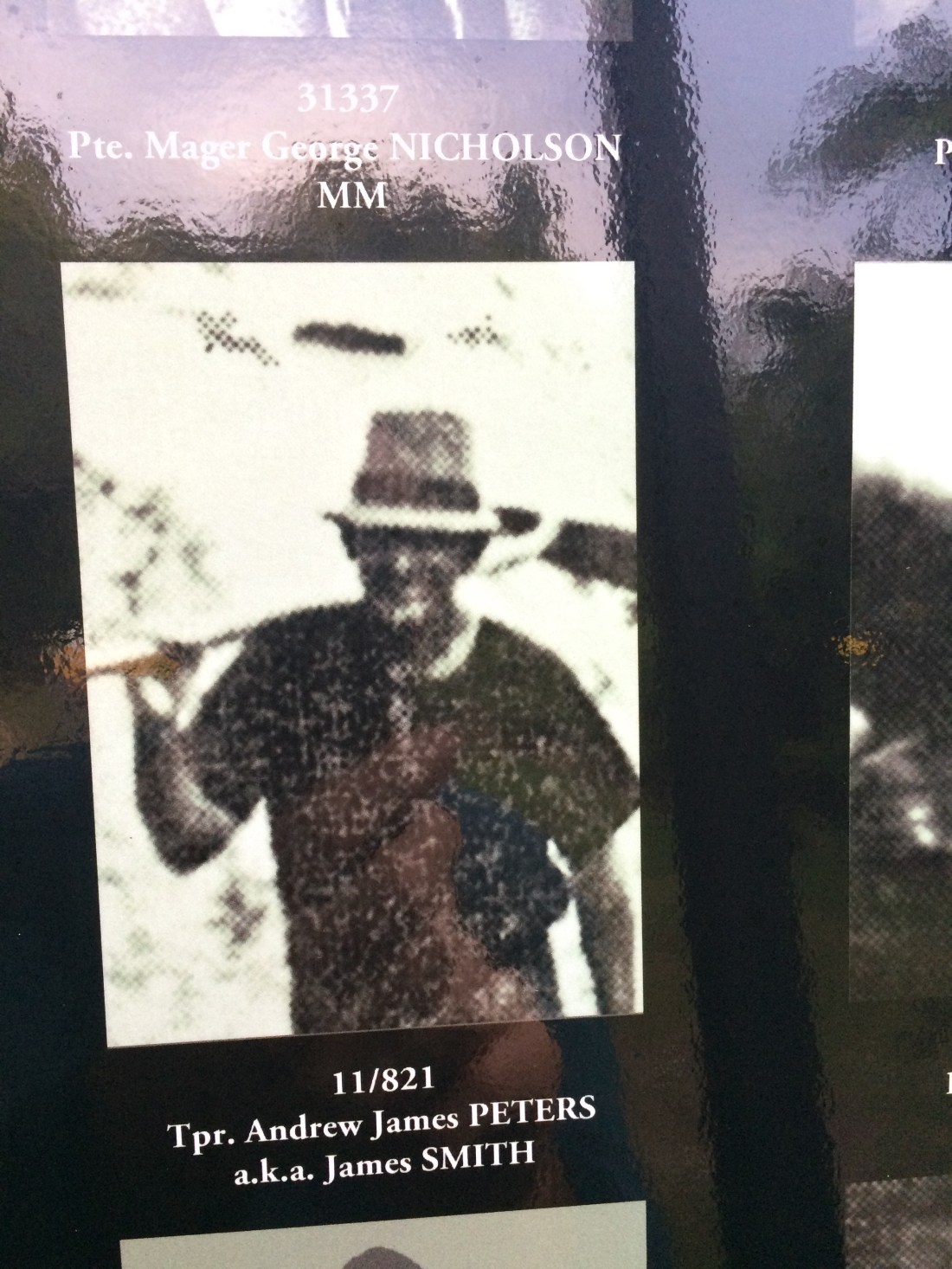
Thereby hangs a yarn. Sometimes, the photos suggested that for many of these men, their years in the Mangapurua and Kaiwhakauka Valleys was just one of many interesting chapters. There’s the dapper, business-like Mr Nicholson:

And Eric Mosley, who has a Kaiwhakauka Track campsite named after him, which I’d passed through that morning. But his thoughtful eyes suggest pioneering bushman might have been just one of his facets:

Finally, I think this next photo is my favourite. Edward Johnson, on his horse, apparently staring at the camera but his face hidden. Make of me whatever you want, he seems to say; I know who I am, and what I’ve been through, and what I’ve done, and what I haven’t.

Not all the men had photos. Some of them were represented by a generic, hatted shape; poignant in itself. How they had not only not managed to leave much impression on this obdurate land, they had apparently not left an image of themselves in the world, either.
The whole thing, map, photos, memorial axe in a log, is intended as a kind of war memorial:

But to me it was more than that. It was a memorial to competence, and hard work, and imagination – how these men had been able to see a cliff-sided, bush-choked valley, and imagine there a farm and a future, children walking to school, and a busy road taking traffic all the way to Taranaki.

Later, I’d find out about another side to this memorial – they’re not mentioned on it, but in some way it contained the memory of the original people of this land, the ones who never gave it up but had it taken from them, the Whanganui Māori. They knew this land could not be broken in; they used it for centuries as a place to travel through, to hunt and fish and gather, but not to settle. They knew that was an unwinnable battle. If only someone had asked, they could have saved all the men in these photos, and their families, a lot of pain.
As I looked at the photos, this man was nearby, planting a kowhai tree and erecting a protective length of netting around it. We got to talking, and it turned out this is Tom Mowat, the son of one of the men in the photos:

Tom told me he’d been involved in the planning and creation of the settler memorial. With the anniversary of World War I, he’d “come into” a large number of kowhai seedlings; so over the last couple of years he’d been going slowly around the valleys on his quad bike, planting a tree on each settler’s former land.
He finished erecting the wind- and pest-shelter around the one he’d just dug in and upended a plastic container of water of it. He nodded with satisfaction as the last drops splashed out onto the frail-looking little tree.
“Year or two, they’re up to fuckin’ here,” he said, his hand swishing the top of the chest-high netting.
Here’s his dad, Patrick Mowat:

And this next chap is his uncle, Colin. They have a sign together, Mowat Brothers, further down the valley:

Tom told me how his “old man” had loved his time in these hills. Wasn’t it an incredibly tough time, too, though?
“Oh yeah. Hell yeah. But all this…” – he gestured around at the trackless gullies and crags. “It just got into him.”
Patrick Mowat would have stayed if he could, his son said, but the government eventually made all the farmers leave.
“It was just too hard to keep the road open.”
After 1942, when the last families were finally made by the government to walk off the land, Mowat’s father managed to keep farming in easier country upriver from Wanganui city.
“But he never stopped talking about this place. Oh yeah, back when we were up in the Mangapurua, he’d say.”
After a few years, he brought a mob of cattle back up here.
“After that, they basically squatted it. There was still plenty of grass; oh, tons of it, good grass. They grazed it for years.”
He and his brother would leave the cattle to browse the abandoned runs and bushy valleys. They’d muster them once a year or so, sell some, give some to friends, take some back to the home farm, then turn the rest back out into the Mangapurua bush. Tom’s dad used to love staying out here with them, camping, for weeks at a time.
For mustering they’d drive a decoy mob the length of the main valley, Tom said. The semi-wild bush cattle would slowly come down to join them from the furthest tops and darkest gullies.
“We weren’t the only ones squatting out here. There were plenty of others. The department of lands and survey were in charge of this place, and they couldn’t have cared less. What did it matter to them?”
But eventually public service reform in the 1980s saw the end of that department and the creation of the department of conservation, he said.
“They were feeling their oats, and they said: oh no, you can’t run cattle in a reserve. And that was the end of that.”
His father kept coming up here to camp and reminisce, though, and young Tom would come too. Accompanying his dad and then as a professional trapper and hunter, he got to know every bend of the track, every peak and gully, every settler’s parcel.
He’d worked as a shearer and farmer around about, but, like his father, this was where he kept returning. I asked him what he loved about it and he just shrugged and looked around at the green, gathering dusk, eyes glowing, silent.
He was camped out now at Johnson’s, a former selection and now campsite half a day’s walk down the valley. He offered to give me a ride down on his quad, but I said I was keen to walk. He nodded.
“You’ll be right up here. Good sheltered spot.”
He told me how to get water from a spring in the papa cliff around the next bend.
“Don’t drink from the ditch. Crawl right up the cliff til you get to the spring itself. Comes straight out of the rock.”
When I asked him if he’d let me take a photo of him for my blog, Tom smiled.
“Why not. Better do it over here, eh, beside the old man.”
He told me to drop in for a cup of tea in the morning, and I said I would if I wasn’t cutting the daylight and forecast rain too fine – I needed to get down to Mangapurua landing by the next night, if I was to make it back to Wellington in time to put an offer on a house.
We shook hands and he swung himself aboard his quad and puttered off, easy in the saddle.
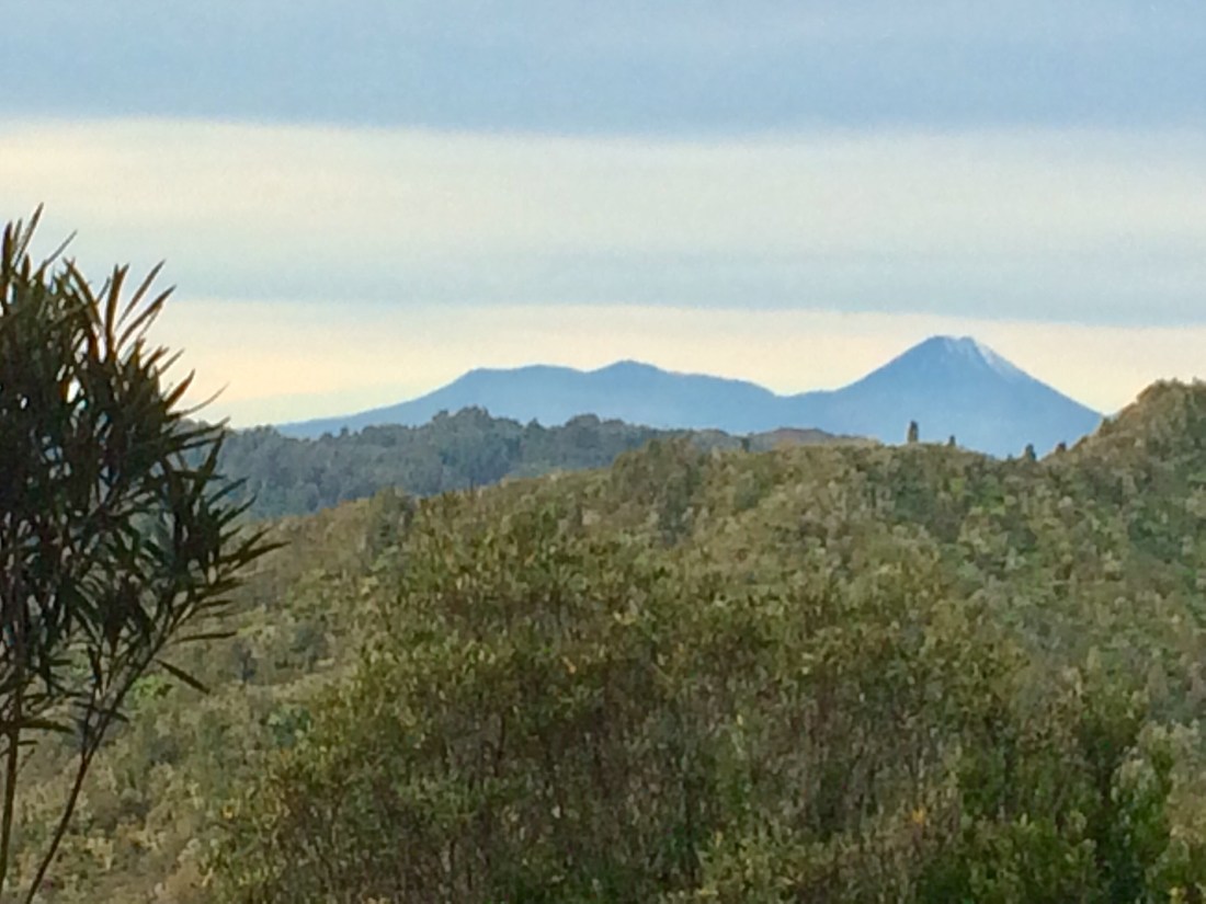
The last of the daylight faded over Taranaki as I cooked my noodles beside my tent, watching the bush darken.
Later I fell asleep listening to the wind breathing in the big trees all around. I was thinking of all the people who’d lived up here in these valleys, who’d fallen asleep to that same wind, probably sighing in some of the same trees.
Day 67: Mangapurua Trig to Mangapurua Landing – 24km
I got underway soon after first light, knowing I had a long way to go and the nearly-winter days were short. I wanted to get all the way to the river that night, since there was a kayak waiting for me – I’d had the Bridge to Nowhere jet deliver it to the landing for me from Pipiriki.
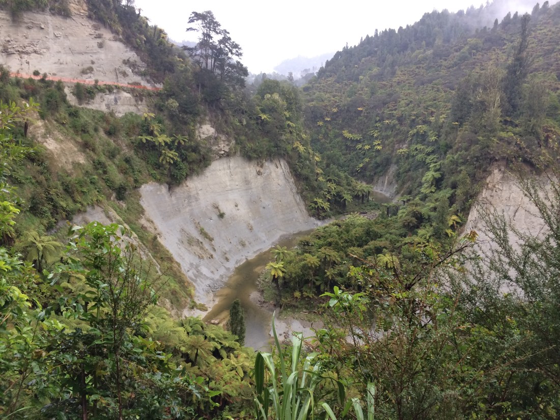
From the trig, I could see the track snaking down the side of the Mangapurua Valley:

Mangapurua, I found out later, means “stream of plentiful water”, and I could see the accuracy of the name: how this stream, after emerging from the papa near where I took this photo, has carved out this huge valley over millennia on its way down to the Whanganui, some 24km away. And more plentiful water was coming – after five sunny days, rain was forecast around lunchtime.
The sound of quad bikes burbled around the quiet hills; hunters ground up the narrow track towards me, guns racked on their handle bars, grinning kids waving from the rear seats. One of the men stopped for a chat; he said he loved how those who’d built the track had seen fit to also make it usable, on this section, by quad bikes.
“It’s awesome for us locals. We’re in here all the time, hunting, camping, just enjoying it.”
A bit later another quad bike rider pulled over for a chat. He was youngish, lean and blonde, another local farmer by the look of him – gumboots, Swanndri, beanie, open smile. His wife would come running past me in in a bit, he said.
“Just to let you know. I dropped her off at the top and she’s going all the way down the valley. Then I’ll give her a ride home.”
Sure enough shortly after that I was crouching to get water from a stream that crossed the track when she came steaming past, swift and relaxed, wearing trail shoes, a hair band and a grin of pure pleasure. It looked a blissful way to spend a morning off – a long glide down through wave after wave of green.
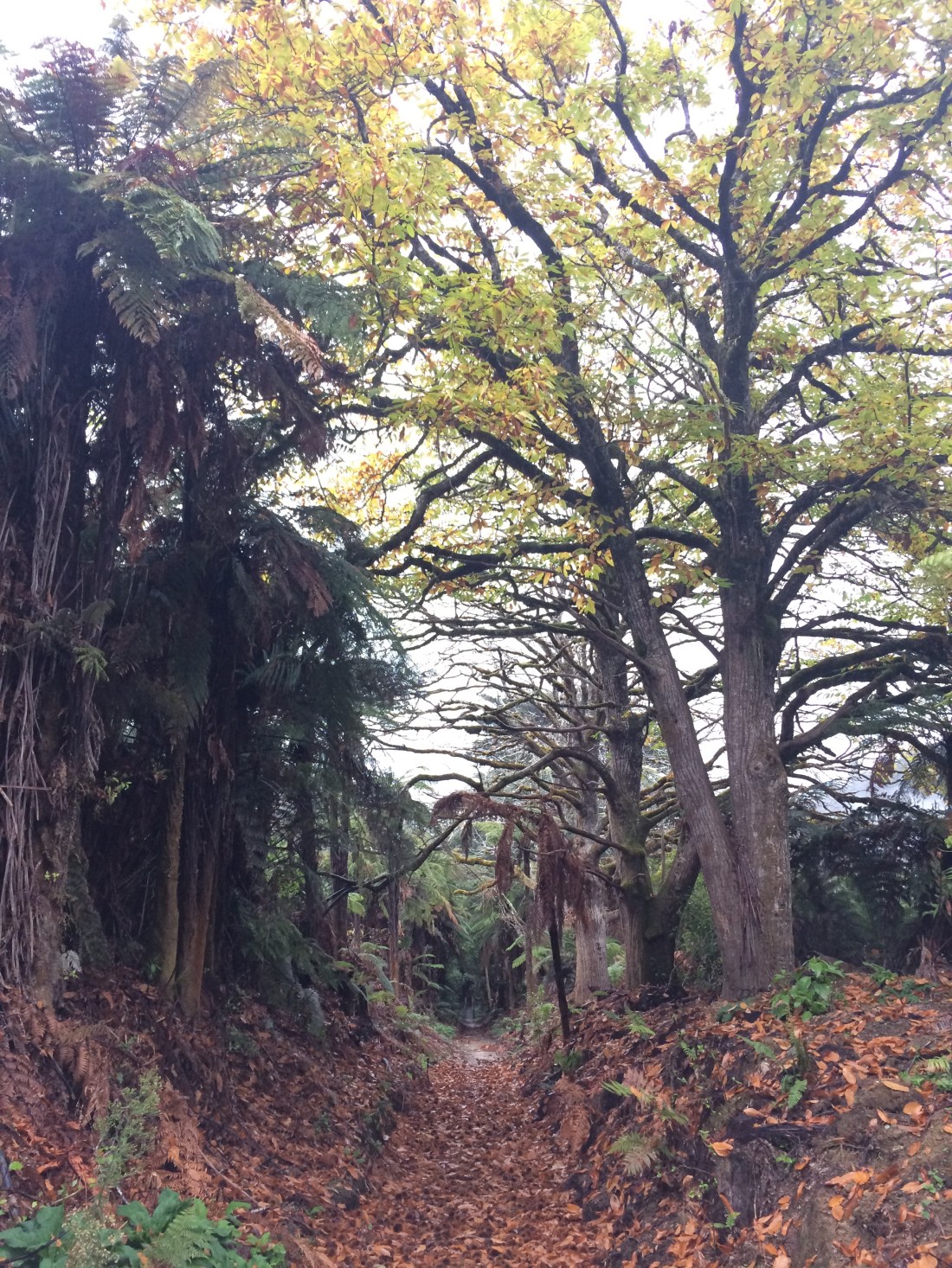
Once I reached the valley bottom, more and more signs of the old settlers began to appear – in particular, deciduous trees dropping the last of their leaves. The wide splashes of colour made by their banked leaves looked out of place, but had a sad, dreamy beauty of their own.
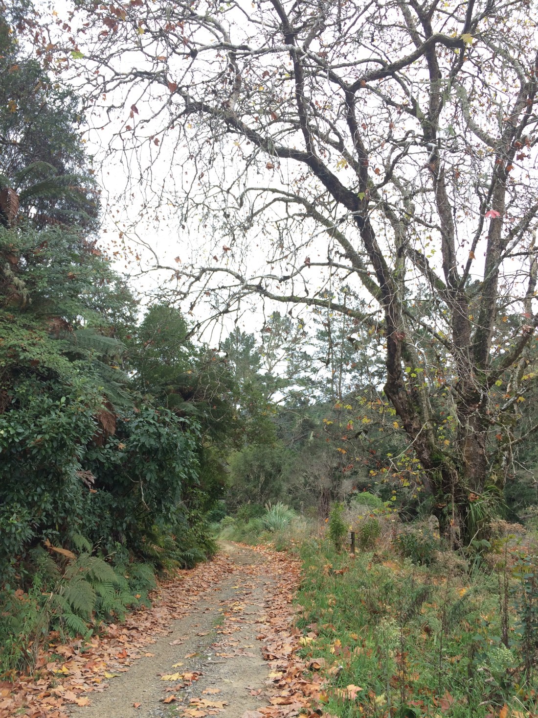
In many places these foreign trees are all that remains of the failed farming experiment, that and the ever-present surname plaques:

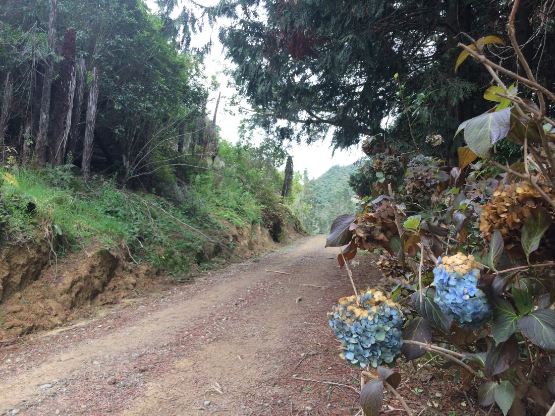
An abandoned hydrangea created an especially striking contrast:
At the site of one old homestead, or perhaps where the valley’s school once stood, a row of introduced pines was slowly breathing in an introduced fence.
The site of a vanished house was a tangle of pines and macrocarpas, many of them fallen, and the trunks overgrown with willows, poplars and holly. There’s a melancholy about these non-places, these overgrown ruins where the attempt to impose something foreign on the landscape has ended with a literal infestation.
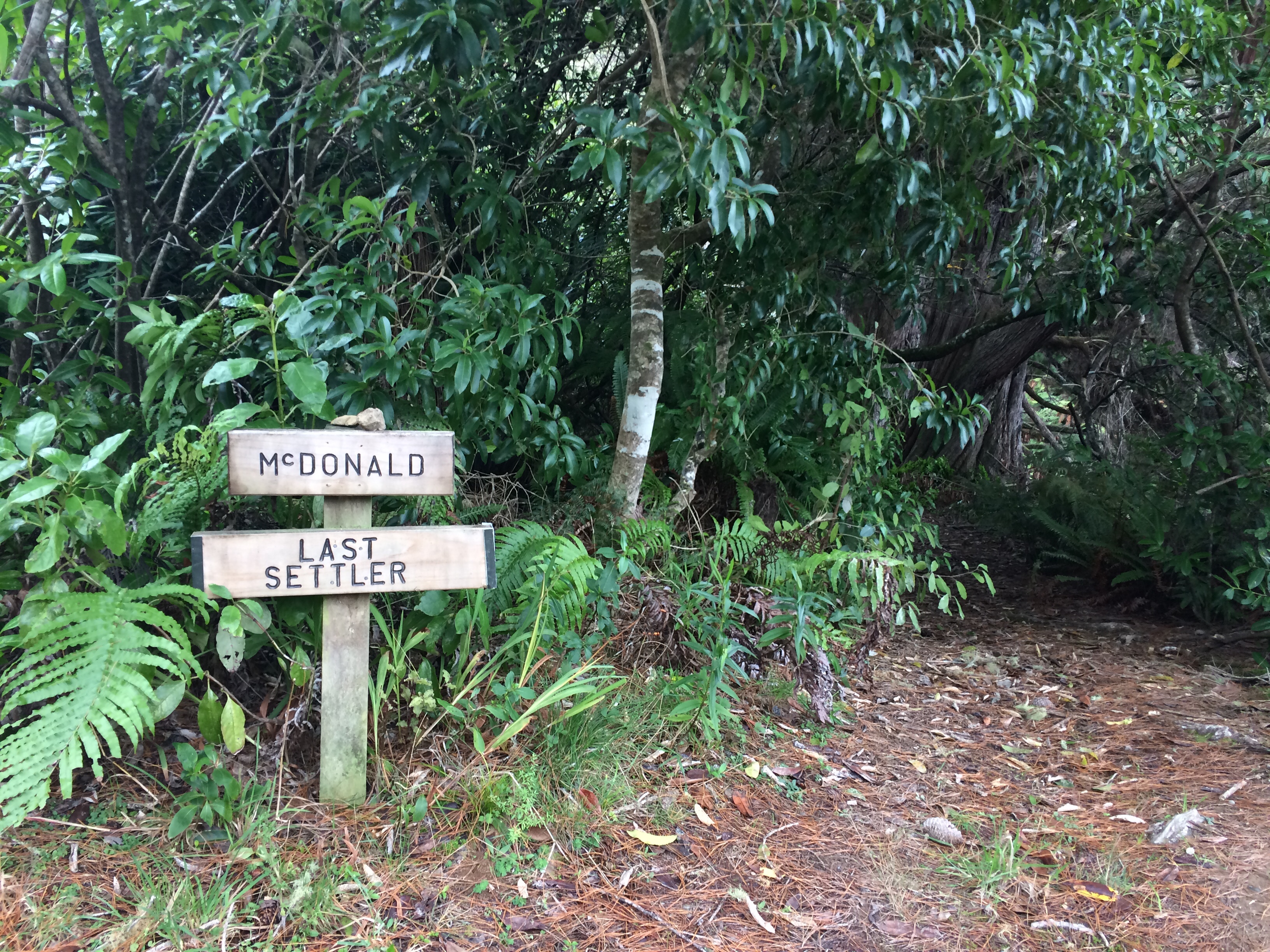
Still, you have to admire the settlers’ determination; you can imagine the last ones refusing to go, hanging on to the dream, until all infrastructural support was withdrawn and it was simply impossible to stay. One of them was McDonald, the last of his kind:

Patches of pasture remain, swathes of it sometimes, even reaching all the way up to the ridges. You can see why those squatters felt there was too much cattle-feed to waste. But now even these last, hardy traces are getting digested, like especially resistant bits of stalk, by the patient, slow-chewing bush.
The track through here is road-like and easy and it was very good to bowl along. I thought about stopping in to see Tom Mowat at his semi-permanent camp at one of the designated campsites, and could see the smoke from his fire through the trees. But I decided to press on.
Soon after that the runner appeared again; I jumped, and she apologised with a smile. I’d been strolling along in a beatific, footsore daze when she popped around a corner, long-striding and noiseless, not even slightly out of breath. She asked if I’d seen her husband. I said he was probably having a cuppa with Tom Mowat, and she grinned and said that’s where she’d left him, all right – she’d stopped in for one too.
“But he was supposed to have come to get me by now – he must have got carried away with the yarning.”
She sped off smiling, light-footed and easy, at home in the hills.
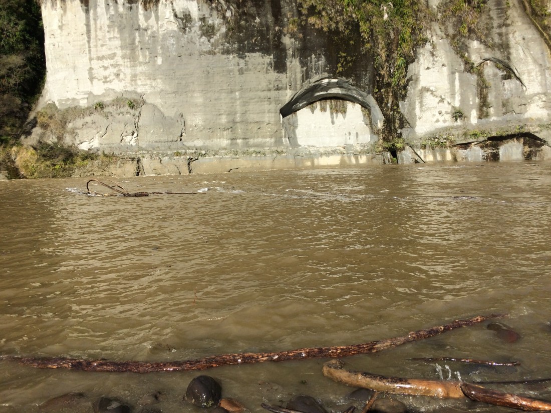
Closer to the river the track begins to hug the big papa cliffs, and you can see how hard it must have been, and must be still, to keep this route open.
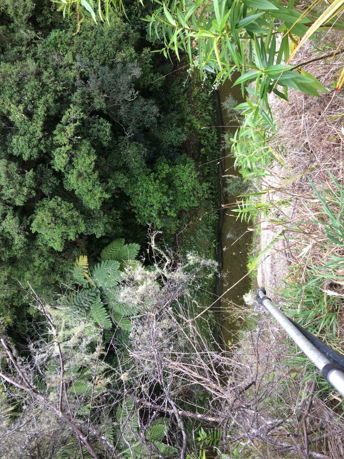
More signs warned of the dangers of going too fast on a bike; if you miscalculated you’d be riding on air before you knew it. Here’s a shot straight down off the edge of the track, past the tips of my trekking poles toward the Mangapurua River about 50 metres below:
In other places it’s even more of a drop than that:

Quaint old relics remain, like this gate, presumably hand made from timber milled on these same hills:

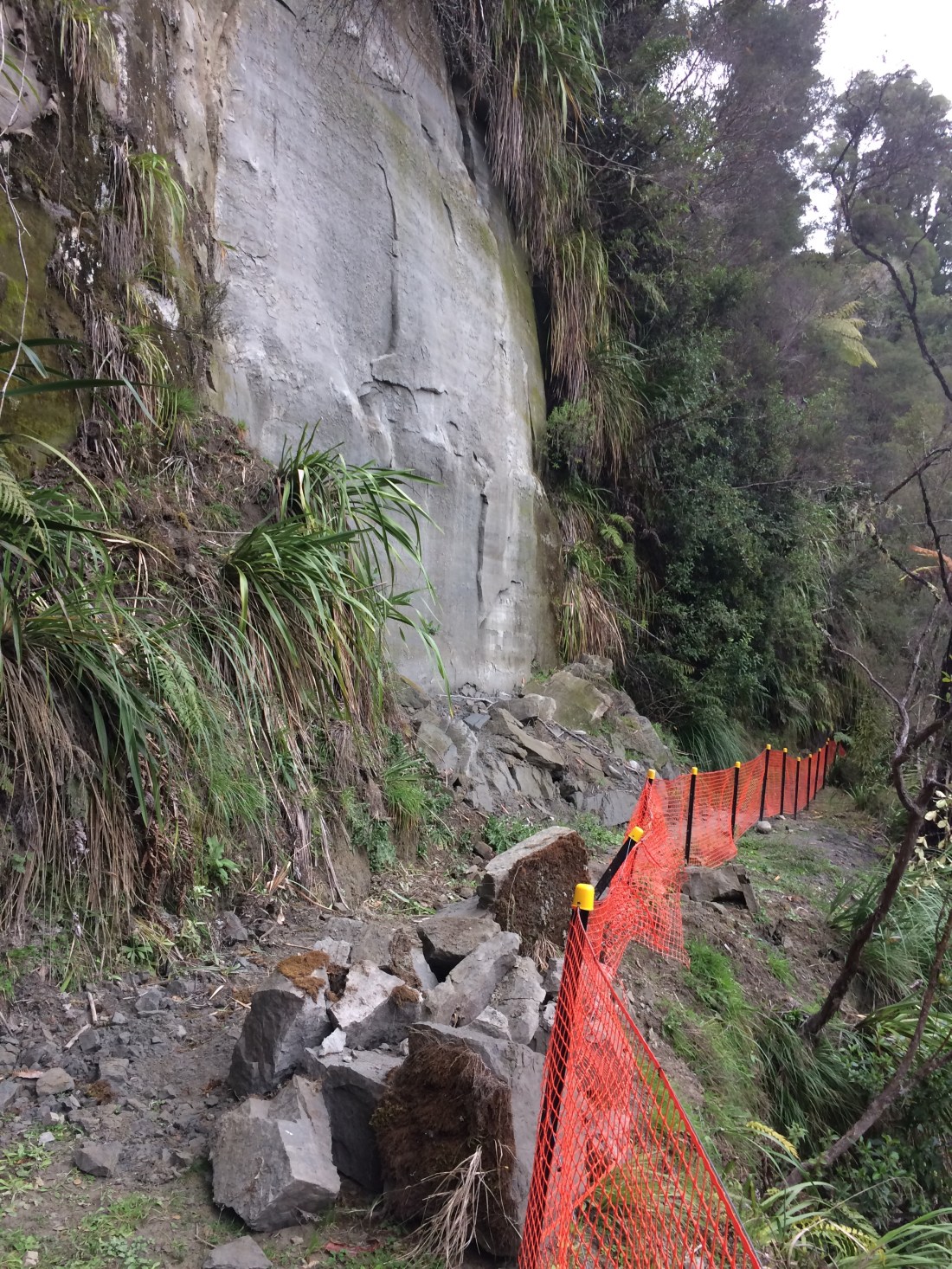
Increasingly, orange mesh was arranged to protect cyclists from the sheer drops; there was more and more rubble half-blocking the track, sometimes crushing the mesh.

In places I had to scramble over it or sidle past it; it had been raining on and off all afternoon and much of the rock-fall looked fresh. There was no option but to carry on, keeping an eye upward for anything large shrugging itself free of the perpendicular.
I’m glad I didn’t have to, of course, but if there had been a particularly poorly timed rocky bid for freedom, it would have been quite funny to see me dodging and weaving like Frank Bunce through a Wallaby backline, backpack and poles and all.
“Don’t linger,” warned the signs. It was spectacular country and I wanted to take it all in, but it seemed good advice.

Below, the Mangapurua Stream wound on, getting deeper and broader the closer it got to the Whanganui.
The pic above shows Battleship Bluff, where a cyclist died a year or so ago, a sign had said.
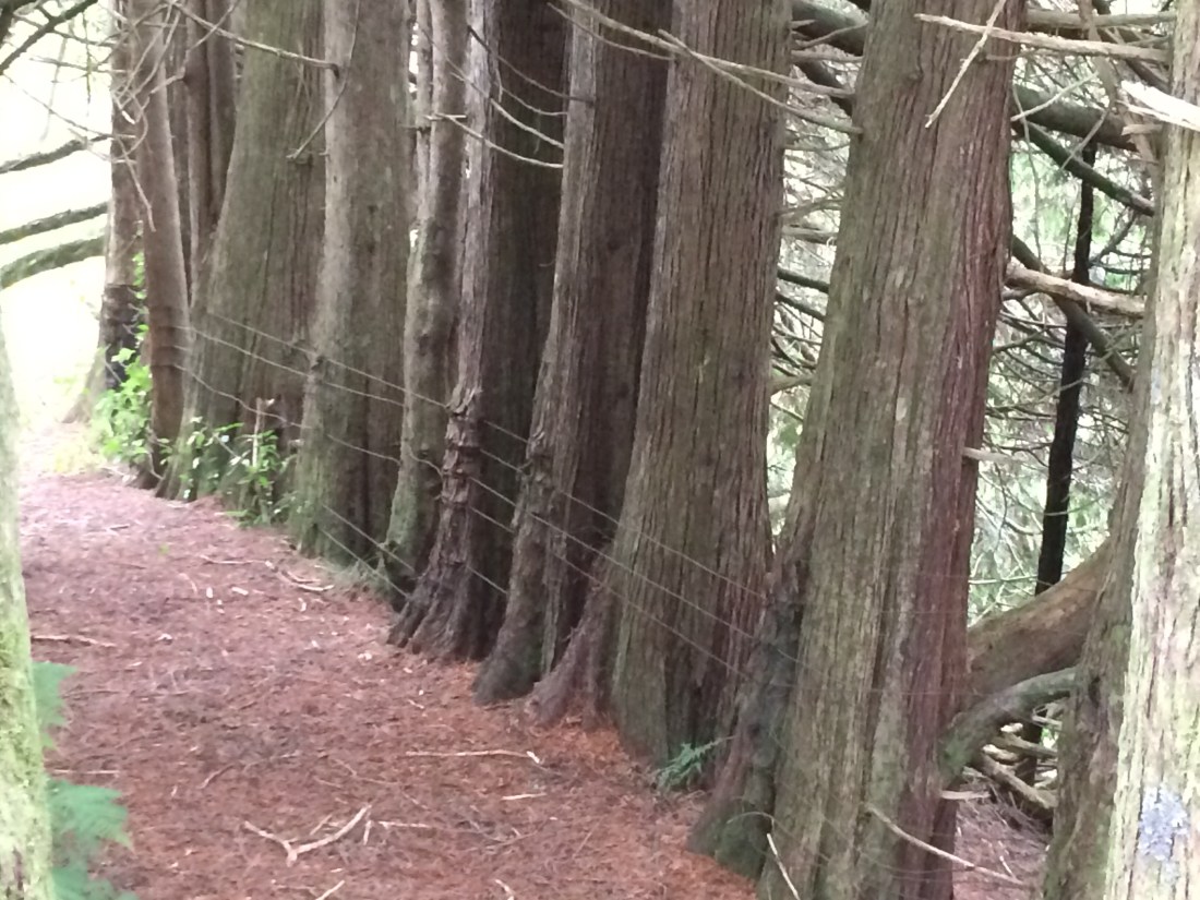
Further on the track crosses a creek via a swing bridge, and that’s the end of the quad bike access. Newly narrow, the track gets ever-more picturesque.
Sometimes the traces of abandoned farms are more haunting than others:

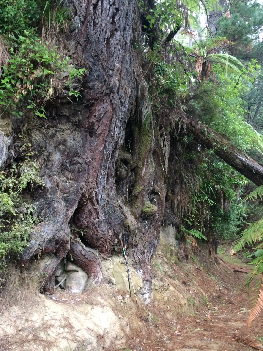
There were more of those spectacular root systems, exposed by the track cutting through a hill side. They looked like the roots of the World Tree itself, the Tree of Life, reaching down into the rainy underworld where I slogged along in the damp, gathering twilight. I left my hiking poles in this one, for scale:
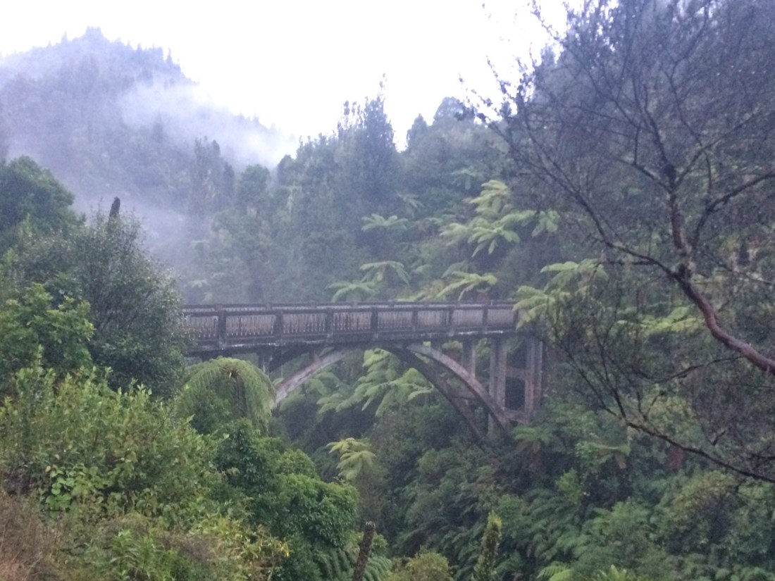
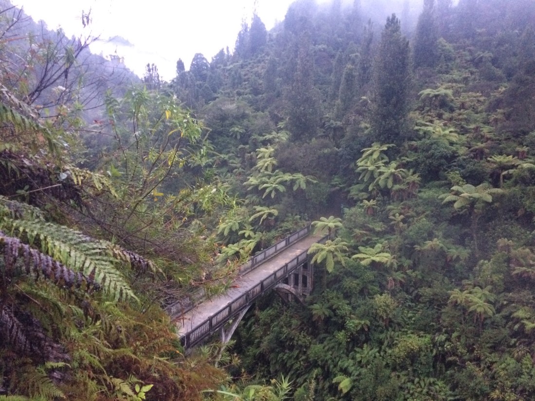
Finally I rounded a corner and there it was, the fabled Bridge to Nowhere:
A DOC information panel details how it came about. The original idea of the settlement was that there would be a road connecting the town of Raetihi, near Ruapehu, to Stratford near Mt Taranaki. It would pass through these valleys, over this bridge and then over a Whanganui River bridge (which was never built).
In the years after World War I, up to 40 families settled along the Mangapurua and Kaiwhakauka valleys. By 1942 only three of them were left.
Roads had, by then, linked the valleys to Raetihi, but there was a big landslide in 1943 and the government pulled the plug. In 1943 the last settlers left, empty-handed. One of them, Betjeman, has a campsite named after him further up the valley. The panel records his stoic, but slightly broken words on leaving:
“I was prepared to carry on but they would not let me. I am sure that I would have made a success of fully developing my property.”
Here’s a shot of one of the settler families, toughing it out in these fantastic, tumbling hills:
`
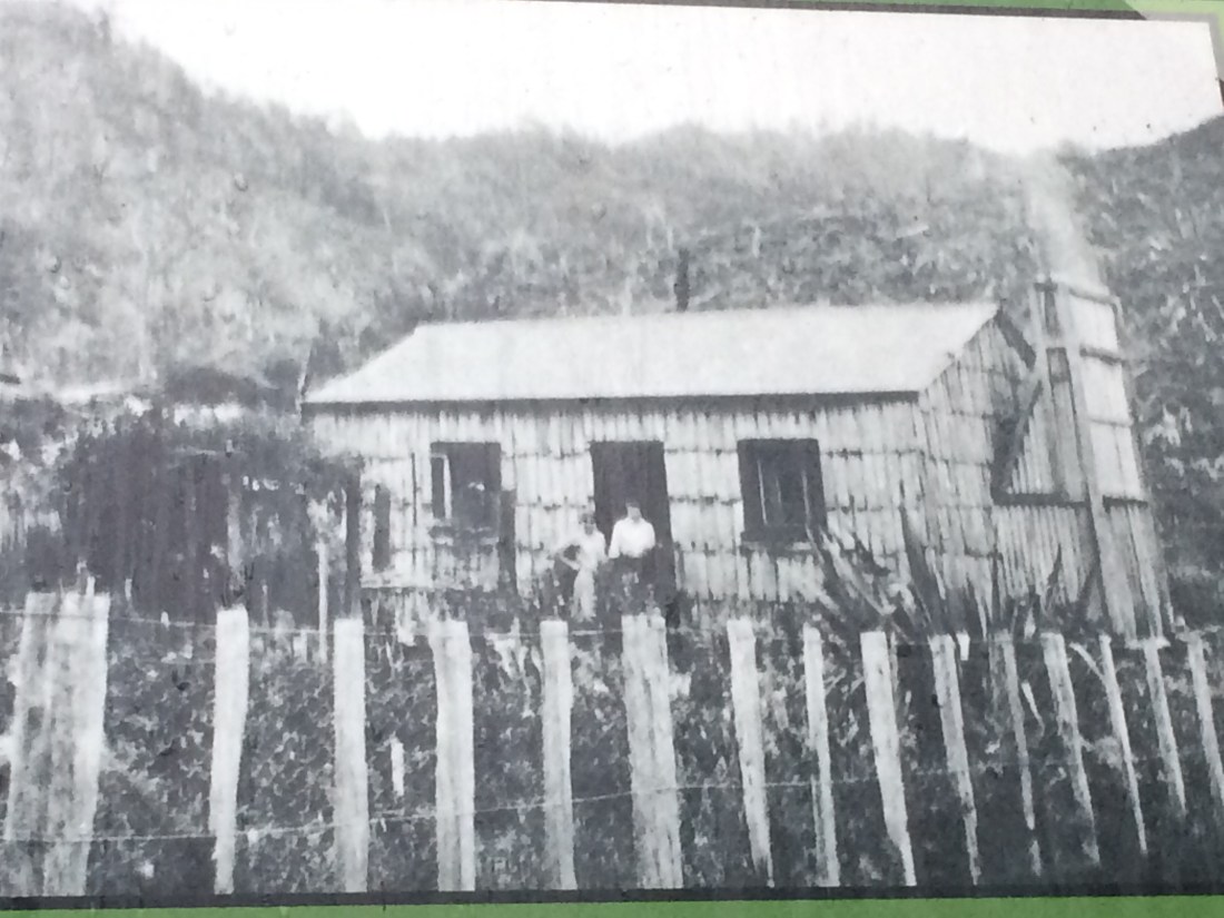
In the background, a hillside laid waste with fallen timber. But under its soil, hand-strewn with grass seed, the forest crouches; it’s ready to spring back up at them and devour the lot – new seed, batten fence, chimney smoke, neatly cut windows and all.
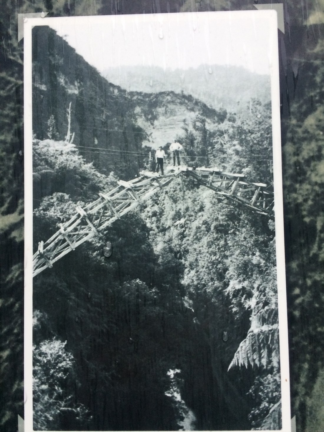
When the first settlers arrived, the panel says, they had to cross this deep, steep-sided Mangapurua stream by scrambling up and down its rock walls. Looking at the gorge’s slick, vertical cliffs I couldn’t imagine it – it looked daunting for a fully equipped rock-climbing crew, let alone a pioneering family. But nothing much daunted that lot. Everything in this photo (taken from the DOC panel) would have been either carted in on someone’s back, or made from wood they’d chopped down:

Soon they’d rigged up a wire cage to scoot across on, then built themselves a suspension bridge in 1919. Rusty remains still yaw beside the “new” bridge today.
Then in 1924 came plans for a proper bridge, one you could drive a dray across. But there wasn’t a lot of enthusiasm among the settlers; most of them had left the lower valley by then, and the few others got their supplies in by road from Raetihi. It was a pointless bridge from the start.
Still, the government went ahead and built it:
Who knows what arcane bureaucratic urge was in play – maybe someone had to spend a budget surplus; or maybe they hoped a magnificent bridge would kick-start the stalled Raetihi-Stratford road. Maybe it was a guilty, belated expression of support for the dying settlement.
Whatever it was, after a year of expensive toil there it stood: 34 metres long, 40 metres high – more than half the height of the Beehive in Wellington – containing 105 cubic metres of concrete and 15 tons of steel.

Getting all that material in to this jungly place cost almost as much as buying it. It was opened with fanfare, despite the settlers’ bemusement and the absence of any real call for it. Almost from its inauguration, it appealed as a symbol of something.
A symbol of what? Like the best symbols, I guess that’s in the eye of the beholder – but it’s surely something lost and lonely. A bit further below, I’ll have a go at putting into words what it symbolised to me, that dark green evening.
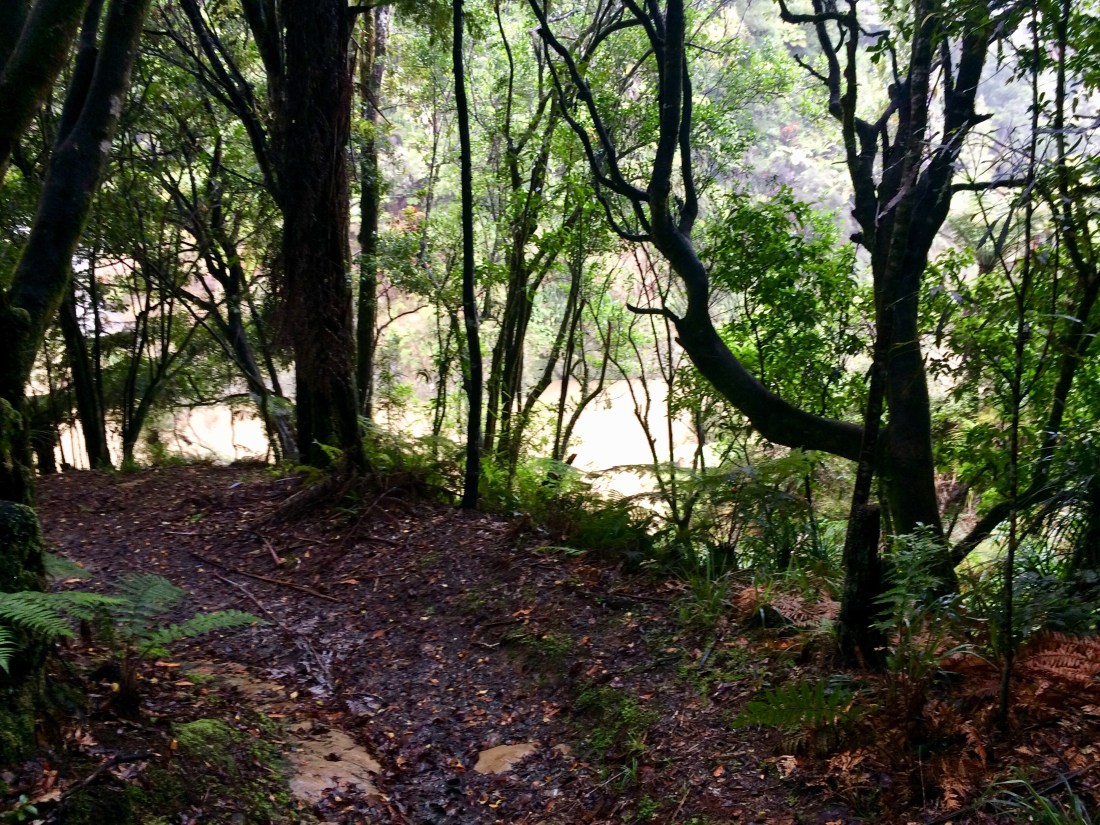
Between the bridge and the river there’s still a good 40 minutes or so of the muddy track down to the river. It was starting to get dark but there was time to snap a last bit of settler history:

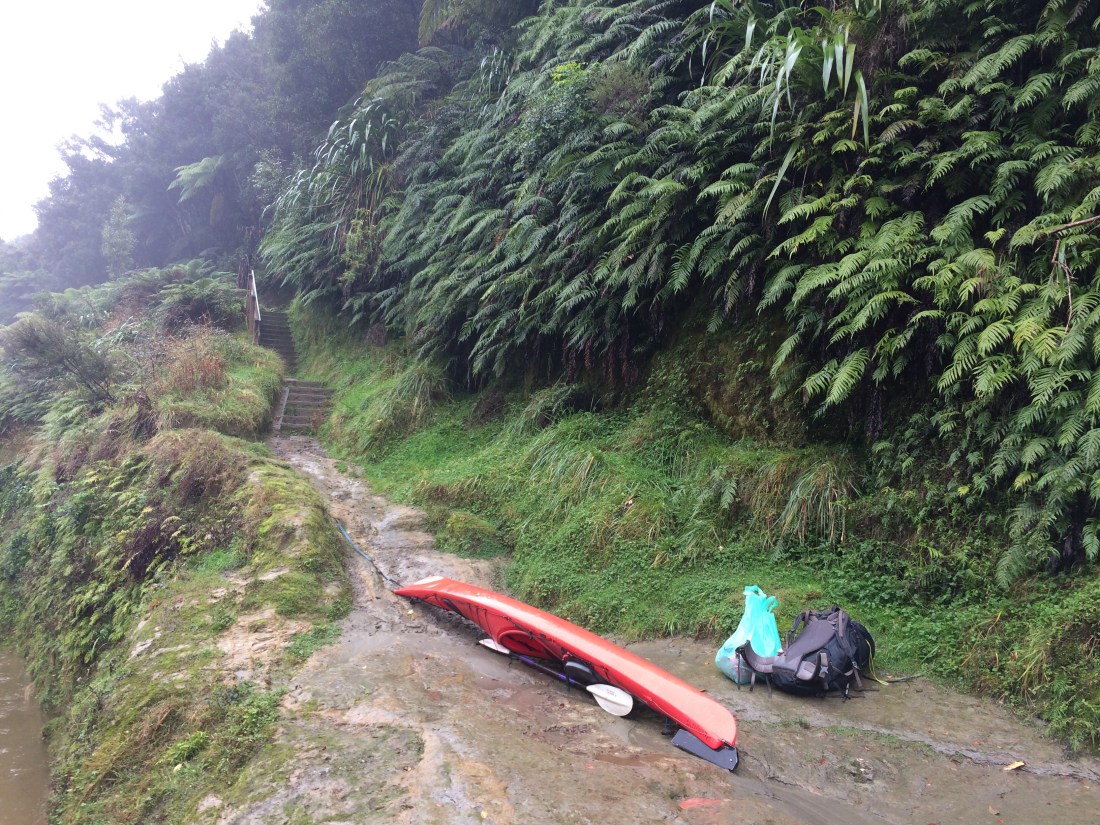
Finally I arrived at the DOC shelter at the end of the track. I couldn’t see the river through the trees in the rainy dark so I went down for a look. There was hardly any moon or starlight; but I could just make out the great watery bulk sliding by. By torchlight I saw my kayak, securely tied up on the landing, ready for the morning.
I was relieved: it would have been an awkward if it hadn’t been. There are no foot-tracks from this point in any direction except back the way I’d come; the river bank is impassable, sheer cliffs dropping into the river from virgin bush. The only cell phone reception anywhere around was Mangapurua Trig, 24km behind me; I would have probably just had to sit tight until the jet boat showed up.
But there my kayak was, red and shining in the drizzly torchlight. I checked the knots on the line lashing it to a rusty pole on the wide, flat slab of rock that serves as a natural landing.
Here’s a historical shot of this once-famous rock slab, from the info panel at the shelter just above it:

I like how, despite the precarious boarding set-up and the wilderness all around, the settlers are in their best gear – dress shoes and hats, and suitcases, not back-packs or even rolled-up swags. It’s a proper trip into town, to the flicks maybe, Sunday dinner at Mum’s, an appointment at the bank. They’ve woken up in the rough homes built from trees they milled themselves, polished their good shoes and, probably carrying them to keep them clean, walked carefully past the puddles and mud, down to their narrow, steam-powered connection to the world.
And this is the same slab of river-rock today (I took this pic the next day – it was too dark that evening). It’s now used by canoeists, cyclists and walkers rather than farmers boarding steamers, but otherwise it’s unchanged by the nine or so decades that have, like the river, flowed by since:
The actual Mangapurua campground is across the river but I wasn’t going to risk that in the dark. On this side there was a shelter with a rammed earth floor, which isn’t really designed for camping under but which was fine in the circumstances. There’s also a toilet a bit further up the track, a stream for drinking water, and in the shelter more of those useful information panels.
The authorship of these ones was unattributed as far as I could see, but they appeared to have been composed with at least the input of local Māori.
These ones spoke in more detail of the close, enduring relationship of the Whanganui tribes to their river, and outlined how the land around it was taken from them.
As mentioned in the previous post, the panel said the tribes associated with this area are Ngāti Hāua to the north, Ngāti Ruru toward the river, and Ngāti Uenuku and Ngāti Patutokotoko to the east.
The Mangapurua Valley, it went on, is part of a block of 500,000 or so acres, called the Waimarino Block. It stretches from the peaks of Ruapehu down to the Whanganui River, and was “acquired from the Māori owners by the government under contentious circumstances… large portions were subsequently sold or given to Pākehā settler families through a government-run ballot.”
This was news to me, but shouldn’t have been.
Now, I’ve known about the Bridge to Nowhere and the sad story of the soldiers and their families most of my life. I visited the famous Bridge when I was 21, and felt the sorrow in the hills. But what I didn’t know, and had never come across until that moment, was this other, older sorrow. Part of that is on me, a Pākehā, who, like many has still not learned enough about his land’s invasion by his own people. But part of it’s on all of us, as a nation, still wilfully blind to the injustices that run through our history, still failing to teach it properly in our schools, still failing to adequately memorialise, for example, the New Zealand Wars and ensuing land seizures.
Move on, move on is the mantra for some, but usually they’re ones who have, directly or indirectly, benefited from the wrongs of colonisation. Certain wrongs have to be fixed or those on the receiving end can never move on.
If your grandfather was locked up for “rebellion” (AKA: resisting land thieves) and his land “confiscated” as a result, if your grandmother was shot in the back as she ran from her burning whare – wouldn’t you find “move on” a pretty hard thing to hear, let alone do?
“The scheme,” the panel went on, “aimed to set returned servicemen on their feet. Sadly, Māori counterparts who fought alongside the Pākehā settlers were not included in the land allocation. Upon their return from the Great War, they had to watch their lands being settled and enjoyed by others.”
Reading this information by torchlight deep in the bush, I was moved by what seemed to me a clear connection between the theft of the land, and the heartbreak of the soldiers who were later given it.
“In pre-European times, this valley was only ever inhabited seasonally to hunt and collect food… [after Pākehā came] the valley proved difficult to farm and maintain access to, and the terrain won over, leaving little more than a ‘Bridge to Nowhere.’ If only they had taken notice of the fact that there was little Māori settlement here…”
If only they had taken notice: a one-line summary of the wrong-headedness and failure of colonisation. We just charged in and seized; we didn’t take notice of anything except potential enrichment.
It all made me feel this intriguing bridge could be seen as memorial not just to sacrifices in war and to the toughness of the Pākehā pioneers, nor even as a symbol of human hubris. I think there’s another memory that this bridge, somehow both forlorn and flinty, holds up to us.
It remembers theft.
You can’t just take someone’s land, the big, silent bridge says, and expect to settle peacefully on it.
The “nowhere” serviced by this bridge is arguably the most graphic example of this truth in Aotearoa: here, an entire colonial settlement has vanished into the bush. The so-called “nowhere” is the very act of invasion itself, because to the original owners of the land, the land beyond the bridge was never a nowhere. It was part of their home.
This land ended up being no good for Pākehā: nothing good comes from theft.
All over Aotearoa communities are grappling with the consequences of the dispossession of Māori by Pākehā, from Ihumātao in Auckland to Battle Hill in the Hutt Valley. It’s good that we grapple with it. It’s part of this country growing up.
After dinner I sat under the shelter listening to the rain on the leaves, and the softly massive sloshing of the old, imperturbable river, telling its long stories of joy and loss.
Day 68: Mangapurua Landing to Ngāporo Campsite – 23km (kayaking)
It was still raining in the morning, and I was a little concerned about the state of that river.
I made coffee and porridge and sat in my shelter, unable to take my eyes off it through the trees. How it glided along with such huge grace, like an apex predator moving through the forest, effortlessly owning it, but also part of it.
The guy from the jet boat company had told me not to get on this graceful beast if it was carrying a lot of flood-washed logs.
In a proper flood, they’d dwarf me. A jet boat could go around them but a kayak couldn’t.
“If that happens just stay put. We’ll come and get you.”
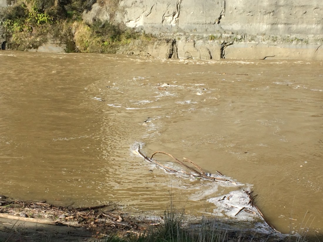
I went down to the landing and watched the Whanganui carefully. It slid by like a horizontal liquid mountain, quiet and enormous.
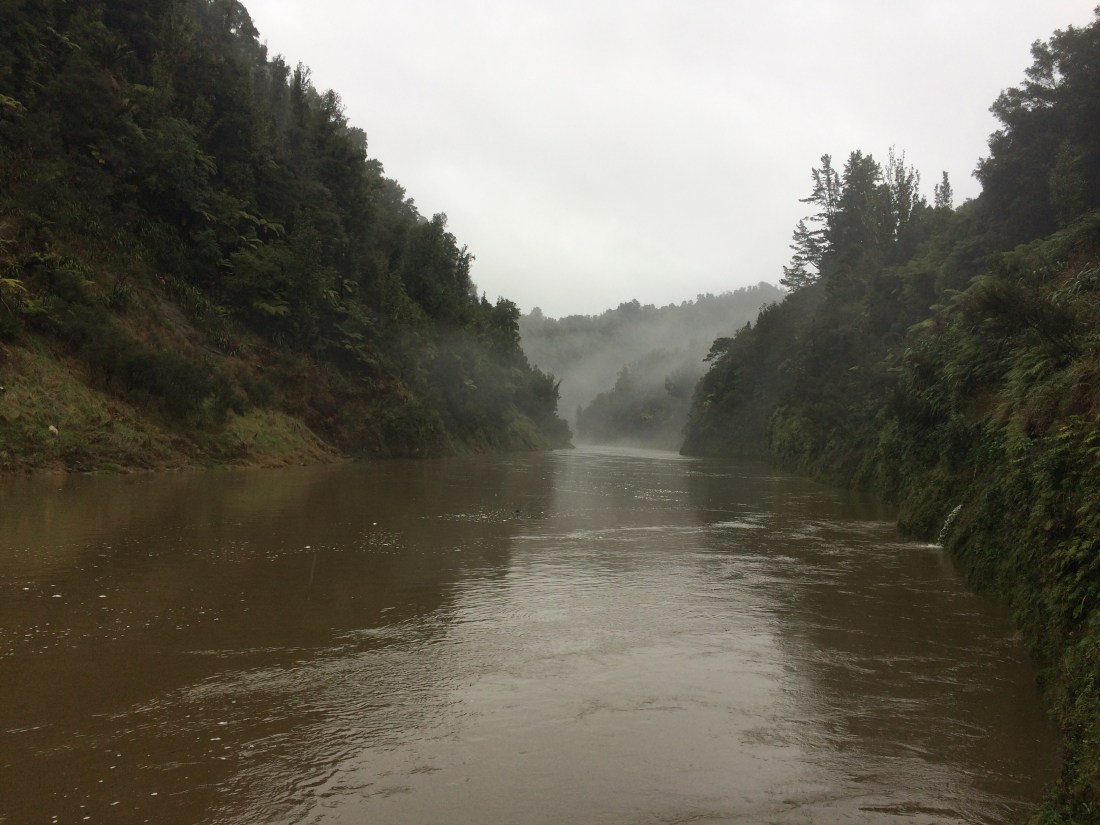
It looked immensely powerful, but carried only small twigs and sticks, and seemed not too much more swollen than I remembered from my first trip on it, one dry midsummer nearly 25 years ago. I’d checked the forecast for the headwaters a day earlier and it hadn’t been too bad. I decided to go for it.
Breaking camp and packing the kayak took a long time. I had to make sure everything was in well-sealed dry bags; and then I had to fit all these little packets into the slender spaces between the kayak’s bulkheads.
This kind of thing is part of the thrill of these solo trips. If anything dicey happens, you’re on your own to resolve it. I take all precautions and prepare well; I carry a personal locator beacon, GPS, paper maps in sealed bags, compass, emergency food and shelter, first aid. Still, there’s always some risk, and when you’re with others problems are more easily managed.
But in around 1200kms of solo travelling down the motu from Cape Rēinga to this point, I’d never had such a feeling of vulnerability as I did that morning. It’s one thing to stride out alone down a track on your own feet, carrying a pack; it’s another to load everything into a little boat, then launch out onto an unfamiliar, isolated, quietly boiling river.
Here’s my kayak, fully loaded and ready to go:
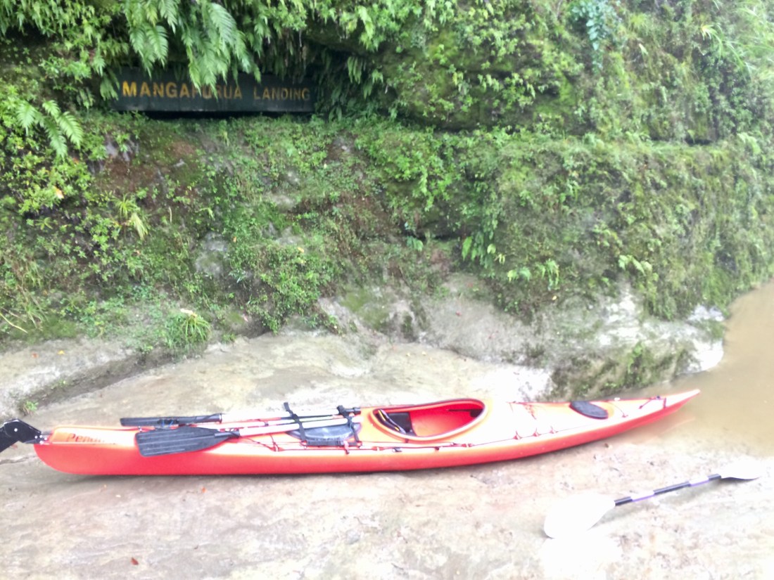
The night before, by torchlight, I’d been a bit concerned about how I was going to launch – the “loading area”, a lower shelf of rock, was knee-deep in swirling water and it would have been awkward or even dangerous to climb aboard. But by morning the water had risen enough for me to simply seal-launch into the brown eddy:
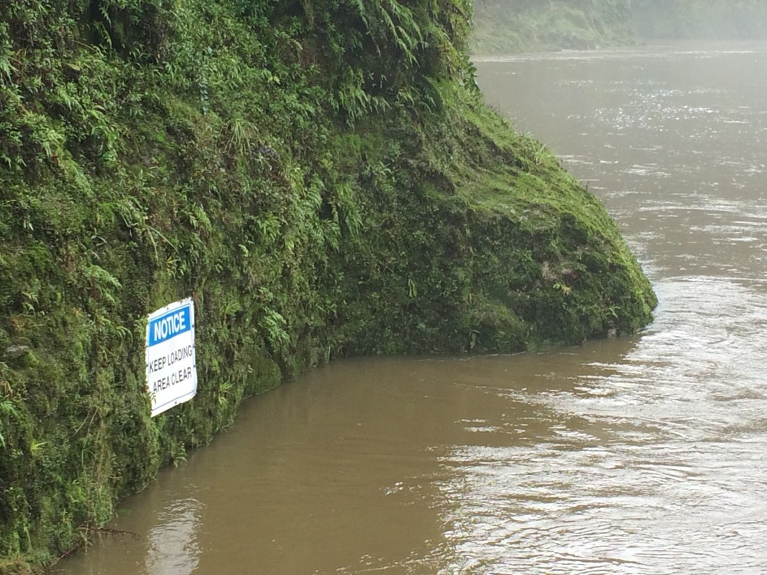
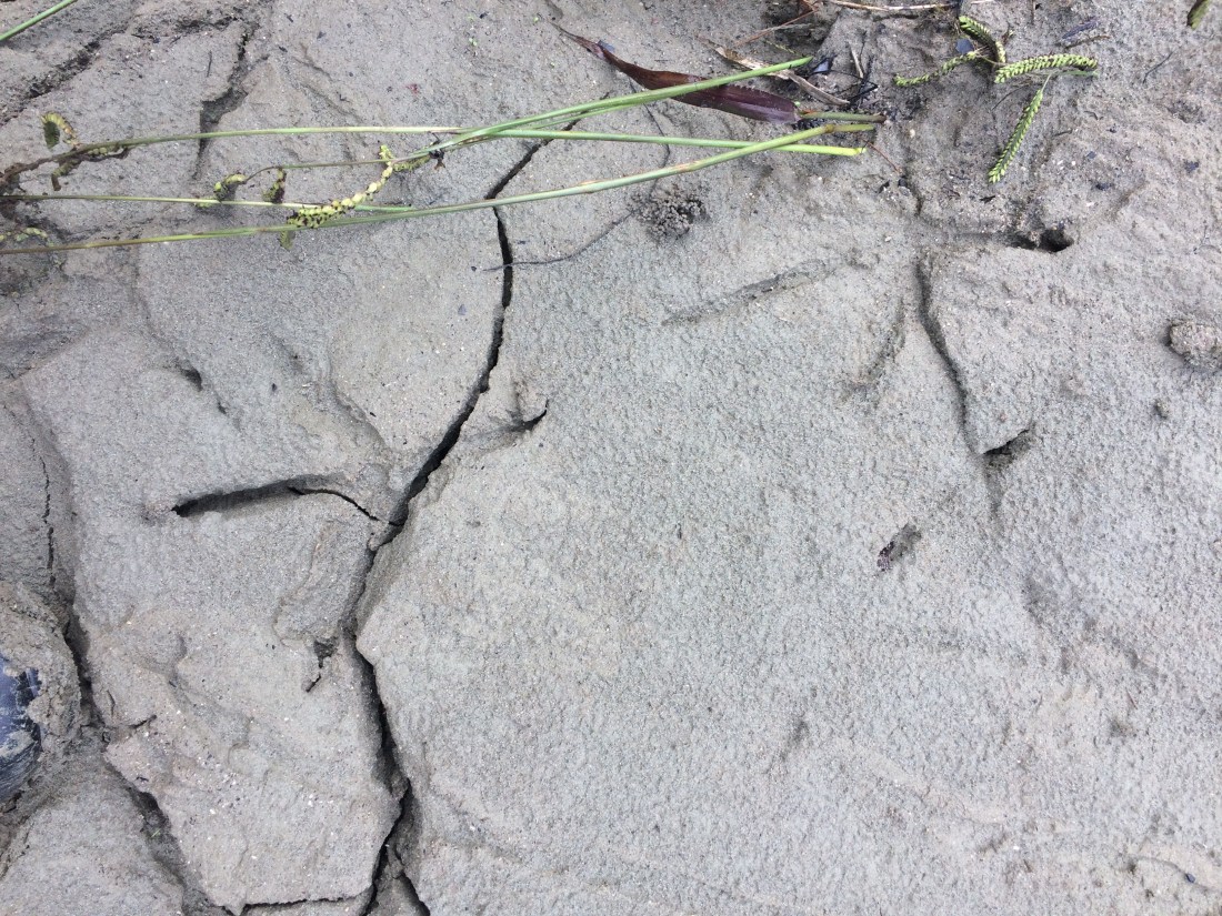
I nosed cautiously out into the main current, feeling the kayak’s stable trim in the water, but not sure what to expect – I hadn’t paddled this river in spate before. But it wasn’t bad; the current was discernible, but not fierce. I ferry-glided across to the other side and got out to adjust my foot-rests. Three-clawed prints in the mud got me briefly excited, thinking of kiwi. But later I realised they were probably just pūkeko:
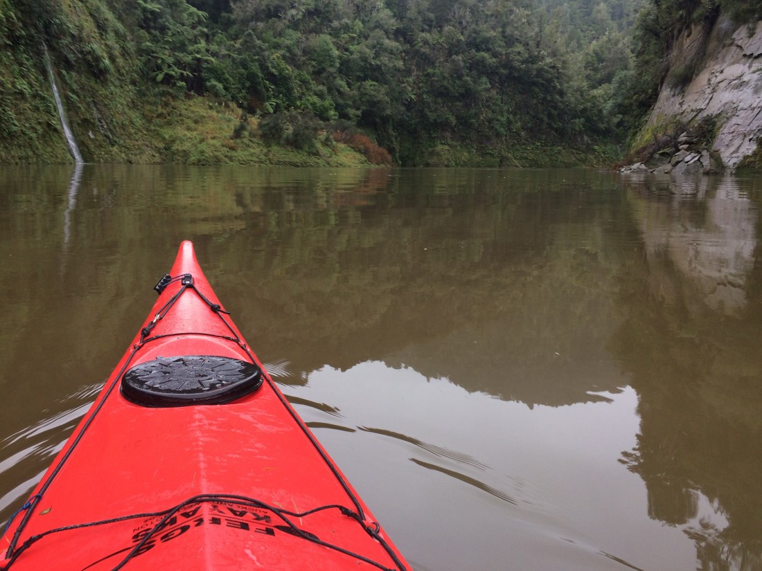
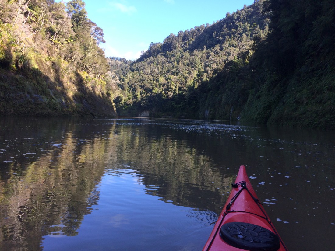
Once I realised I was safe on the river, solitude notwithstanding, I relaxed into a very quiet, dreamy, blissful afternoon. The soft winter light shone on the floodwater, the bush was still and dark, and a thousand little waterfalls and streams rushed down from the cliffs into the stately, potent march of the river.
And after five days straight of hard walking, averaging about 25km a day, I was very glad to sit down. I paddled a bit but mostly just drifted, letting the mighty river take me away and on and down to the wide, waiting sea.

The river runs through a series of gorges, steep and still and quiet. Occasionally the gorges narrow and steepen into rapids. You could tell they were coming by a growing, dull roar; and a thickening band of spray, so you couldn’t see what you were in for.
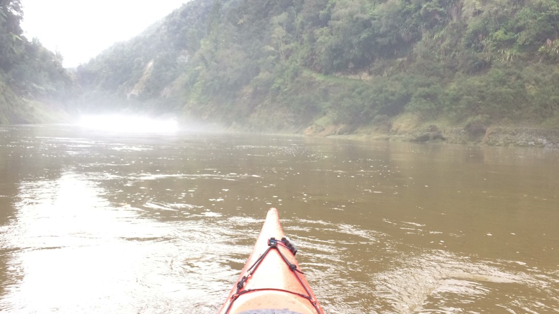
But they were never especially scary, and the beamy sea kayak bounced through, calm and clean as an otter (if otters were red and five metres long).
I stopped at Tieke Kainga, a Māori community and marae complete with a beautifully carved meeting house. Accommodation is normally available for river users, and a pōwhiri (welcoming) ceremony is sometimes held. But it was closed because of Covid and no one was home. I was still glad I’d stopped, just to get the feeling of the people living alongside their river as they have for so many generations.
I was getting hungry, but in the gorges there’s nowhere to come ashore – the cliffs plummet straight into the deep water.
So as soon as I came out of the hunger-pang gorge I scanned the rough, overgrown banks, finding an inviting-looking crescent to beach myself on. That was when I learned that Whanganui mud-banks might look inviting, but their true nature is an intense, sticky slipperiness, a painterly, Jackson Pollock nature, one that loves to coat things, to dye, tint and fling. You might wish to keep your gear, boat and person free of silty, clinging mud; your wish will be denied.
Even so, eventually I scrambled and slid and swore my way up onto the thick grass, scattered with goat pellets.
On these long trips I like a certain ceremony around the breaks, if I have the energy. Sometimes I just plop down when I’m too tired and hungry to keep moving; but you can’t really do that when kayaking, and I felt much restored today by the scenery and the novelty of moving faster than I had all trip, simply by floating along. So I scrambled around a bit more on the steep grassy bank until I found a comfortable-looking, picnic-sized piece of level ground with a mānuka shrub to lean against.
Then I settled back with a sigh, boiled the billy, drank my tea and munched my peanut-buttered crackers, watching the river’s regal seaward sliding.

After lunch I paddled on, and soon came across what looked like an ancient Māori carving on a gorge wall. Quite possibly it was the river that carved it, but it does look uncannily human. It reminded me that for Whanganui Māori, and in New Zealand law, the river has the status of a person. Judging by these intricate patterns, as well as a broad-shouldered and elegantly striding person, it’s an artistic one.

Several times during the afternoon I came across ducks, usually in pairs, which sped away in frantic, wing-whirring alarm as soon as they spotted me. Duck-shooting season had been delayed by lockdown but it seemed as though the ducks knew it had finally arrived. Groups of large, snowy geese were much more relaxed, ignoring me as they waddled around on the widening grassy banks.
That might have been a fatal attitude. Soon I began to pass dead geese, floating in the current, belly up, a bullet wound visible in their broad breasts. Someone had been up the river blasting, it looked like, and not caring where the bodies fell. Geese are introduced and often pests, but it still seemed an ugly thing to do.
I noticed that one small, blue-black duck didn’t whirr into action as I approached. Slowly I paddled up to it. It just bobbed tranquilly in the wash, eyeing me with what seemed sad, resigned knowledge. I saw that it had one wing tucked against its body, the other lying brokenly along the water. I hoped the goose-hunter wasn’t doing that as well – injuring prey, then leaving them to die.
It was eerie how the little live thing watched me, no doubt knowing in its every fibre there was nothing it could do about anything. Maybe even hoping, in its way, that I would end its quiet, painful wait. But in my imagination there was a neutrality in its dark little gaze, an acceptance. Life comes, life goes, the river flows.
Maybe I should have put it out of its misery, but I didn’t really know if I had it in me, and the river was pulling me on. Quietly, the broken bird watched me go.
It was only four o’clock but the light was already failing, especially in the gorges. I pushed ahead, paddling with purpose now; I was cold and tired, and didn’t want to be out on an even slightly swollen river in the dark.
It was delicious to build up some speed, a wide silky “V” trailing out from my prow as I sailed along on top of the long, brown flood.
Soon I shot around a wide bend and glimpsed on the right a building, flat land, steps, and realised my destination for the night, the Ngāporo campsite, was rearing up. At the same time I felt the river funnelling left into quite a rough rapid, the water sluicing hard in choppy waves against the left-hand cliff. Rapids that wash you against cliffs are not somewhere to linger.
Paddling hard for the right-hand shore, I realised there was a large whirlpool right across the river, circling from the cliff over toward the campground, then back around. Massive, powerful whirlpools were once notorious on the Whanganui – there are early accounts of them spinning large waka and even steam-boats. Some of the slips that created them have since been dynamited. But with the recent rain, it was impossible to know how dangerous this one would be. I dug my paddle blade deep.
Finally I made it across the rapid’s face and slid up onto Ngāporo’s wide, shingle beach.
This is the mesmerising whirlpool:

Among the banked logs, foam and forest debris collecting at the water’s edge was yet another dead goose, pearly throat feathers and strong belly to the sky, powerful orange legs with their big webbed feet wafting languidly. I watched while the current plucked at it, took it, whirled it away in an arc to the cliff, then brought it sailing back, like a dead, winged king whose funeral pyre won’t light, bobbing back on tide after tide.
I dragged my kayak up the bank, lashed it and went up onto the terraces to choose a campsite. I had the place to myself. There’s a lot to be said for off-season adventuring.

After dark the rain began again. I cooked dinner in the DOC shelter, then put my coat on and went down to the water’s edge to smoke a cigar and listen to the river in the dark.
The goose had finally gone.
Day 69: Ngāporo Campsite to Pipiriki – 9km (kayaking)
In the morning the sun was out, and I got a glimpse of the summery river I remember from 25 years ago – all golden light and gleaming mist. Relaxed breakfasts with these sorts of views justify any amount of sore muscles and long days.
I sat for a long time contemplating the whirlpool in the sun. It was utterly compelling, unnatural in a way, a place where nature disobeyed its own rules. It was uncanny how the river reached a point just below the rapid, then seemed to pause, turn en masse and flow back up. Sticks and foam and dead geese all stopped in their tracks, turned and flowed uphill. Enormous tonnes of water meeting some kind of weird riverbed topography and simply reversing their colossal momentum.
Flow to the sea, they snorted – hell no. We want the snow. But then they met the countless weight of all their following generations, coming after them, saying move, move, let us through, we want the sea. You could see the battle-line, a choppy scribble on the water where downward and upward met, and even the level of the river changed. It was like two rivers, one flowing up, the other down, meeting on a rotating plateau. I couldn’t look away.
I kept my eye on big logs, how they got washed back up to the shingle beach, then were tugged free and out to the cliff, then around, again and again. The one in mid-river in the photo below went around about 12 times while I watched. The big undercut hollow on the cliff seemed to watch too, like an ancient geological eye overseeing the eternal return. The universe expanding and retracting.
The tangata whenua say Te Awa Tupua, the sacred river, to refer to their relationship with the Whanganui. It certainly had plenty to say to me; especially through this strange, sunlit, endless whirlpool.
The whirlpool seemed like the present. The future is downstream, the past is upstream, and there are times and places in life where the future comes up to meet you really fast. Sometimes that can feel dangerous, like a chaotic piece of white-water.
Sometimes it’s because of a fear of something that belongs ahead, not here and now, like our own death. But we can’t stop thinking about it and so it circles in on us, again and again.
Sometimes it’s things from the past that get stuck in the present; they come whirling in and, instead of moving on into the future, just go around and around.
They need to get released, find their way into the slim bit of current along the cliff that’s only going downstream, that escapes the eternal return and continues toward the sea. Because even though the sea represents death, the end of the river, it’s also life – the river constantly renewing itself, flushing out the old water to make room for the new, not being dammed up.
The whirlpool represents chaos and destruction, confusion, the river trying to turn static, which is against its nature. Sometimes the return from the future brings death with it, or recycles death from the past; like shot geese, bobbing around. We just have to let it ride itself out, go around and around until it eventually gets free and disappears downstream where it belongs. To relax in the knowledge that eventually the river will send that kind of cargo on its way.
Because all the while there’s new water from the wilderness pouring down, a torrent of life, and that meets those dead things in the vortex, and eventually it overcomes them, cleans them out and sends them on.
The whirlpool is the moment, with all the complexity of being in the present, all its negatives, all its positives; all the difficulty, all the challenge, all the fun. All the creation, all the destruction.
It’s about being open to it and navigating it. I knew that in a few minutes, when I set off downriver, I had to go right through the whirlpool, the present, because that’s the safest way – if you try to skirt around it you’ll get, at best, continually rebuffed, and at worst, washed against the cliff and capsized. Because right before the maelstrom there’s always a patch of calm water, where the river is neither going up nor down, and into that you can launch, find your balance, get your bearings, then paddle strongly through the chaotic moment and on. You have to paddle hard, though – if you drift you’ll get washed back up, again and again, endlessly recycling in the same endless pattern.
Eventually I tore myself away from my riverbank ruminations, loaded up my kayak and launched out into that patch of calm before the storm. Paddling hard I speared through and in moments I was speeding away, as if the whirlpool had never happened.
Soon I was immersed again in long, shining stretches where the vivid reflections sometimes made it hard to remember which way was up.
Often I stopped to look over my shoulder, to see the silent landscape cleared of me, cleared of anyone, just a still and empty place with no people, only the wild.

But, as always, the wild was coming to an end. Little blocks of private land began to appear, and even stretches of pine forest; civilisation was pressing back in. Another sign of it was the increasing jet boat traffic, sightseers and hunters howling upstream like demented bee-swarms. It’s good that people can get out on the river and enjoy the national park, but they sure don’t add to the experience for anyone not motorised. It’s definitely the only “Great Walk” in NZ where you find yourself having to pull over to let a high-powered vehicle scream past.

Still, even getting close to Pipiriki, there were enough long, silent stretches and small gorges to keep the bewitched feeling going.

There’s a last, fairly challenging rapid to negotiate, and then you see a road snaking down to a jetty, strange sights after so much unrestrained nature.
It’s the first road access to the river since Whakahoro, fully 87 kilometres upstream (of which I paddled 31km, walking the rest via the Kaiwhakauka-Mangapurua track to the Bridge to Nowhere).
I pulled in and hauled my boat out with a little pang; the paddle had been a magical way to end this latest stint on Te Araroa. The trail continues down river to Wanganui city and I would have liked to keep going, all the way to the wide, waiting sea. When I can, I will. But our landlord was selling up and, because starting a family was calling, house-buying was calling, too.
Yep, after years of sleeping under hedges and other more or less precarious roofs, the urge to get some land of my own has finally hit me. Realising this as I drove home felt a little ironic, after such a visceral experience on the trail of the way so many people have been alienated from land, or defeated by it. But that’s the way land is – it gets into us, makes itself part of us and our stories. That’s why it causes so much strife, but also joy: a territory of your own is a deep part of being human, I suppose.
I loaded up my kayak and headed back to Wellington, already plotting my next stint on the trail, down the rest of the river to the sea, and then south across the Manawatu plains towards the Tararua Range, and on toward Bluff.

Thanks for reading! The rest of the journey, from Cape Rēinga to (so far) Pipiriki, can be found in sequential posts on this site. I hope to travel and blog another section soon. Mauri ora.
A note on dates: This post was written in July 2020, and walked in late May-early June 2020. I’ve given nominal publication dates to this and all Te Araroa post so that they display in their correct order. The first section was walked in Jan, 2017 and sections have been walked and blogged roughly every six months since.

Thanks for the reference! I enjoyed your account of this section too. Happy trails.
LikeLike