
Spending too long in a city in the twenty-first century is like eating too much fruitcake.
It’s delicious, nutty and complex, but an overdose makes you yearn for something simpler. For me, that necessary, simple thing is the land.
Sure, you can’t eat land, to cleanse your cake-clogged city palate. Or not literally. But you can definitely fill yourself with it.
You can get out on it, drift for days over its unpaved folds. You can wander along on it, or in it, as if it were water. After long enough, you can feel yourself becoming part of it, like a tick exploring and absorbing the amazing corrugations of an old elephant’s back. A millimetre at a time, drinking in your host. Tiny gulp by tiny gulp, until you’re more pachyderm than parasite.
I thought a lot about this endlessly compelling thing, the land, as I did my latest instalment of the Te Araroa trail. That’s the 3000-km, length-of-New Zealand path from Cape Rēinga to Bluff. I’ve been doing it in consecutive bits since 2017, managing a couple of hundred kms or so over two or three weeks, twice a year when I get annual leave. I always pick up exactly where I left off, which is slowly giving me the experience of walking every metre of Aotearoa, from top to bottom.
I drive to the designated spot, park my car, and start walking. Each evening I bed down when I’ve had enough or got somewhere suitable (be it a campsite, hut, hostel or homestay). Wherever I get to in the available time – between one and three weeks – that’s where I stop. Then I hitch-hike back to my car, and drive home to Wellington.
I carry everything I need on my back: clothes for rain, cold and sun, food, stove, tent, sleeping bag, mat, a novel to read, a notebook. If I keep going at my current rate (some 300km a year), it’s going to take me a decade to reach Bluff. It’s hard work at times, but mainly bliss.
This section happened in late May, 2020. It had been a good while since my last effort, in December, 2018, when I walked from Waitomo to the southern side of Mt Tongariro, 260-odd kms over a fortnight. I’d been really missing the trail, but twenty-first-century city living had been pretty compelling, too: uni, love, house-hunting, a pandemic.
A day or so post-lockdown, as soon as inter-regional travel was allowed, I loaded a kayak onto my car and drove to Pipiriki. This quiet village is the furthest point of road access to the Whanganui River as you head north from its mouth; on this section of Te Araroa, I’d be coming south downriver, so it would be my destination.
I’d arranged with the Bridge to Nowhere jet boat company to leave my kayak and car at their Pipiriki base, for them to deliver 35km upriver to Mangapurua. That’s an old riverboat landing, which is the river access to (and from) the Bridge to Nowhere; in six days that’s where I’d be emerging from the bush, on foot. From Mangapurua to Pipiriki there are no foot tracks, nor roads – only the river. But what a river it is.
Waiting for me in Pipiriki was a local named Ben, who I’d booked to drive me to the mountain. His parents run the Bridge to Nowhere jet and lodge, and he runs the campground in Raetihi, half an hour from Pipiriki. He also hires out canoes and organises trips on the river. He looked at my red sea kayak as I locked it to the fence, then at the rough, brown river tumbling by.
“Bit bloody cold for a paddle, isn’t it?”
It was, I said, but the trail was calling, and calling specifically for paddling. He shrugged and smiled his minimal rural smile, and we jumped into his van and rattled off east, at right angles to the river, toward the mountain.
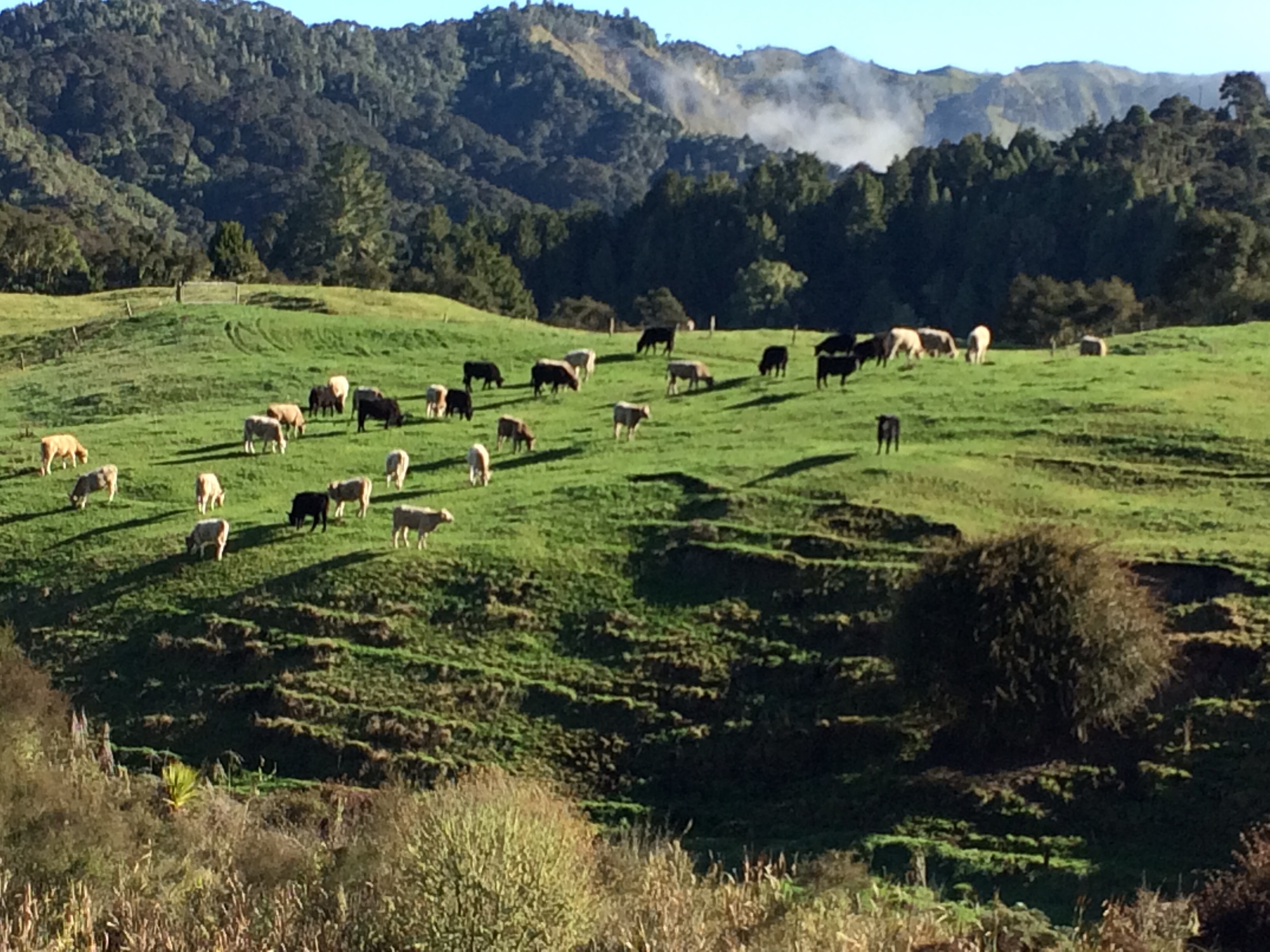
Ben had an off-sider with him, a worker from the holiday park, and as we undulated along through very green, very scenic farmland, they chatted together about work, colleagues, tourists and duck shooting. The off-sider had never done the latter, but liked the idea.
“I’d just sit back and blast anything that moved,” he said. “Ducks, any kind of birds, rabbits, cats – feral ones; stray dogs… Just blow it all away.”
“Yeah, nah, you can’t really do that,” Ben said. “Got to be in season, and you need a license, and permission, and that.”
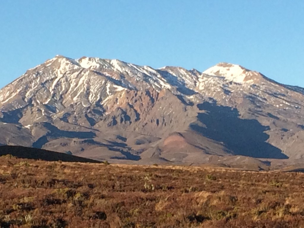
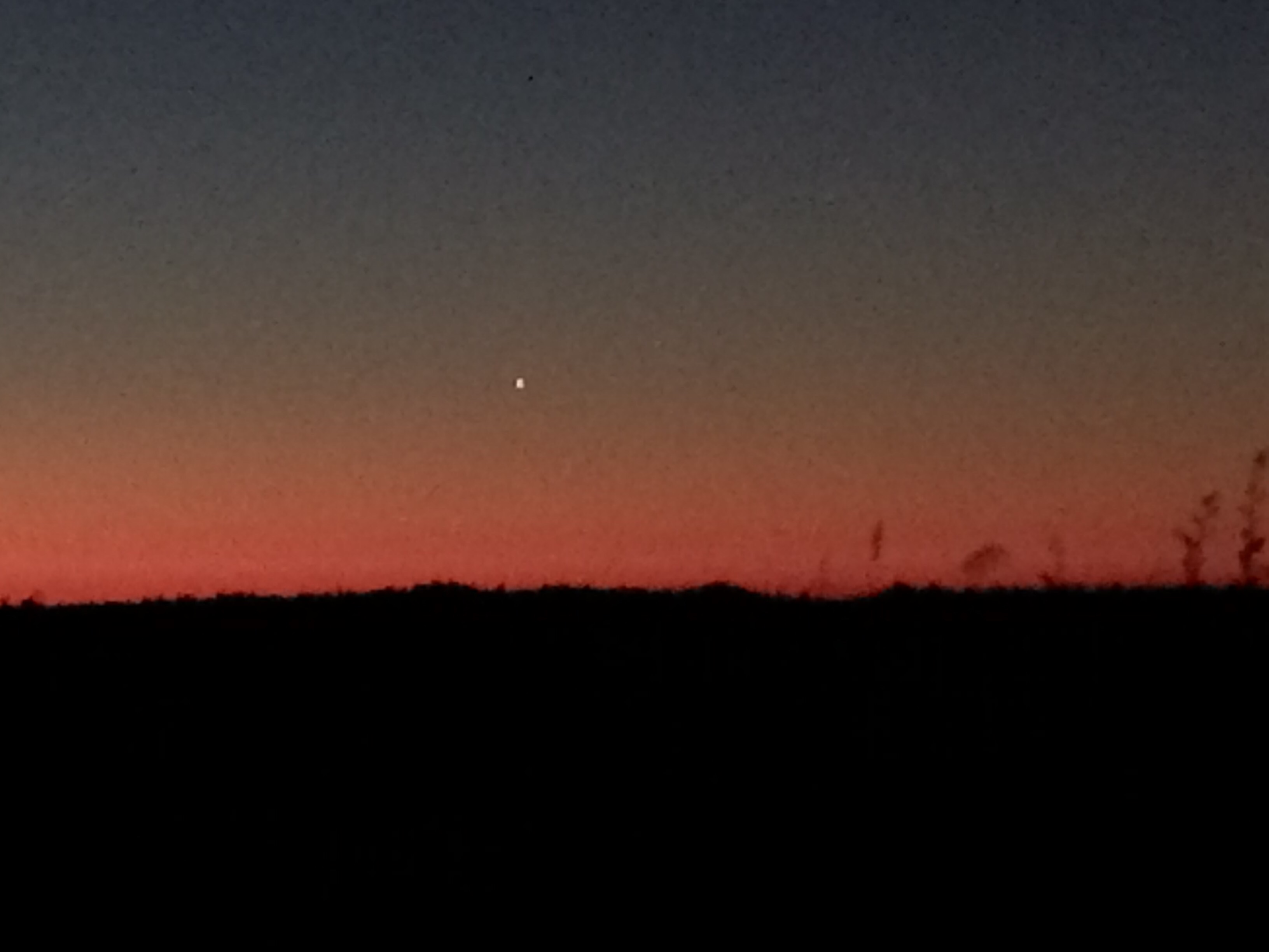
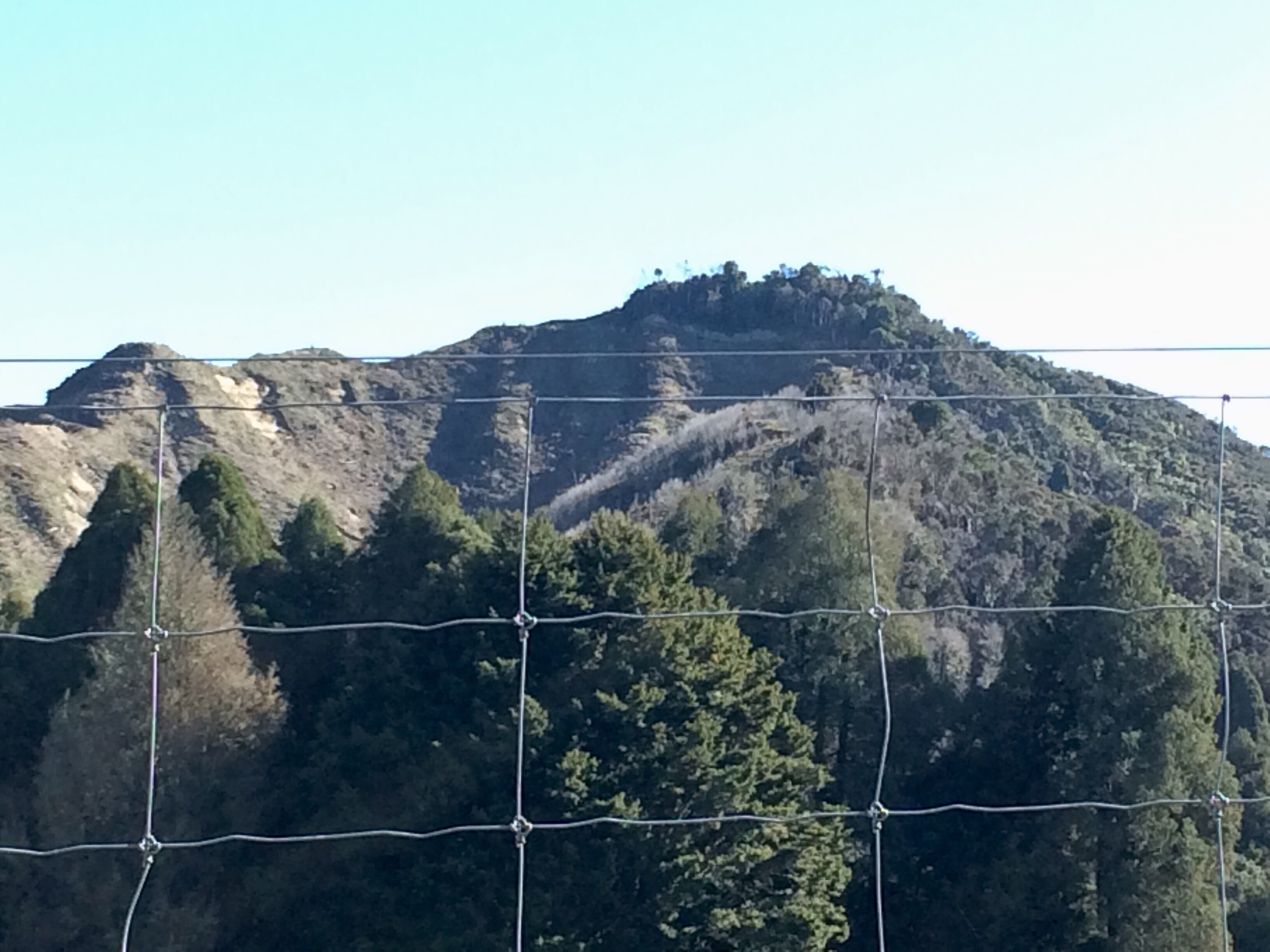
Soon Mt Ruapehu, that huge snowy surprising thing that the essayist Steve Braunias excellently calls “The Desert Rose”, bloomed above the horizon. Here it is from later in my journey:

I commented on how good it was to be back out here on the empty, vivid land, looking at the dramatic mountain. Ben and his off-sider made noncommittal noises. Ben stared around a bit at the plunging, rearing, lonely landscape.
“It’s funny eh,” he said. “We get that all the time, tourists going, man, you must love living here. But when you live here, ya sort of forget about it.”
His mate nodded. “Yeah. Every now and then, though, ya do see it, and you go: oh yeah, pretty cool.”
“And you go into a city,” Ben said, “Wellington and that, and it’s all bloody traffic and noise and people, and you can’t wait to get back here.”
From Raetihi you turn north toward National Park, through Tohunga Junction and Erua, where there’s a forest reserve I’d be walking through in a day or two. Coming over a crest there, Ben pointed west.
“Look. Taranaki.”
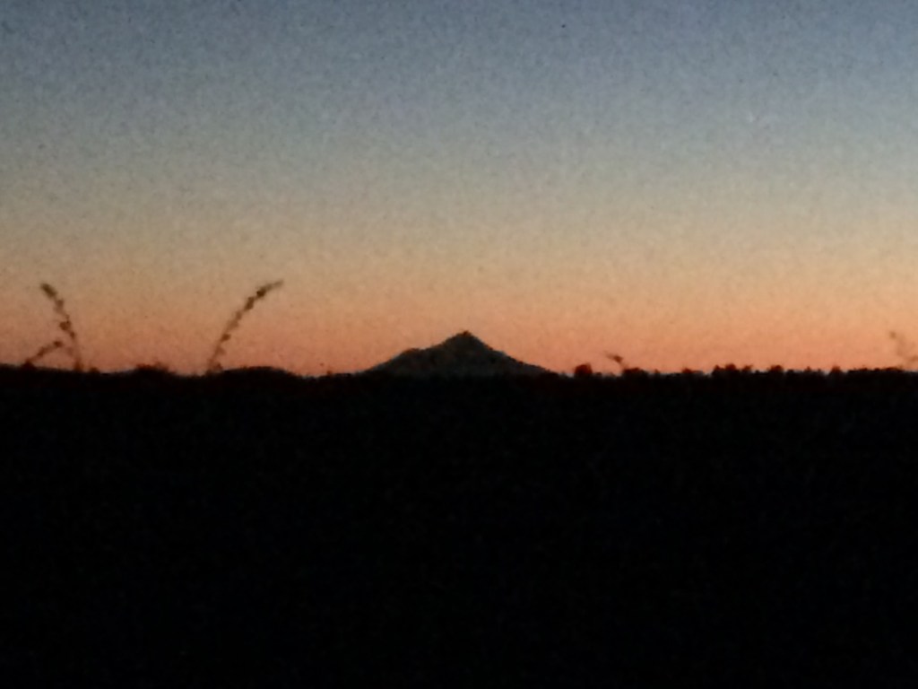
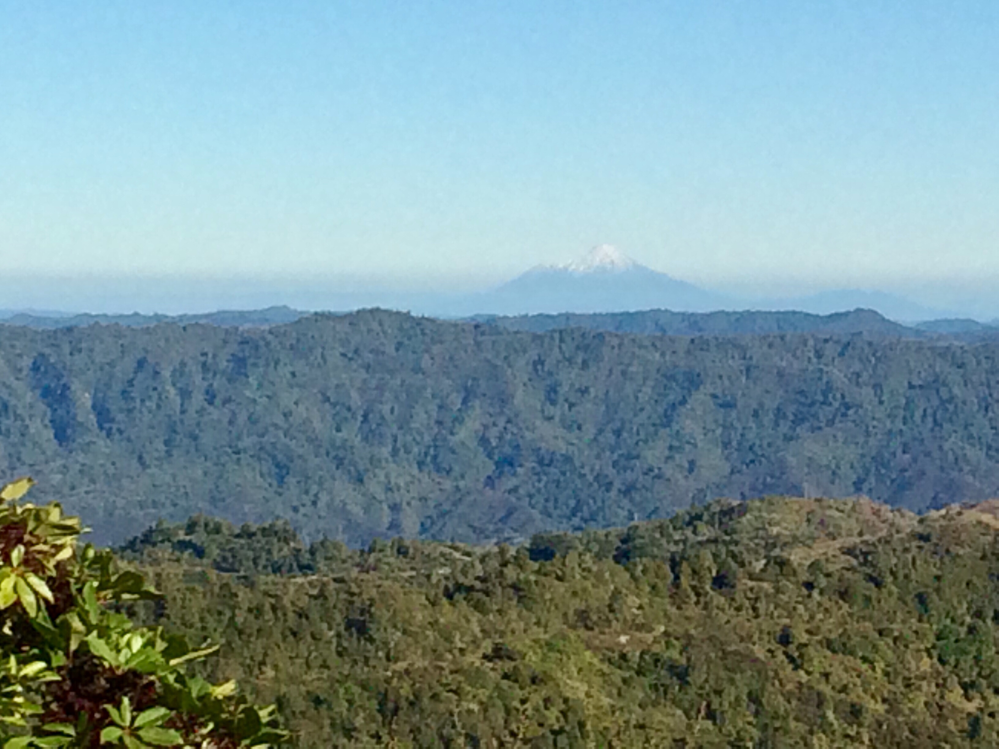
Sure enough, there it was on the horizon, where the land fell away toward the sea – the Desert Rose’s coastal brother. Its perfect cone was stark against the setting sun. I didn’t get a photo then, but here it is from a similar position on the next evening:
From National Park township we turned right to zip up SH47 onto the lower slopes of Tongariro, turning right again to grind up gravelled bends to the Mangatepopo road end, where the Tongariro Crossing track starts (or finishes). This was as far as I’d got on my last stint on the trail, nearly 18 months ago. Ben was slightly disbelieving.
“Here? You want to get out here?”
The early winter night was falling, and it was very cold and silent. There were no signs of life anywhere. A sign warned walkers that DOC did not currently recommend attempting the crossing. That day, according to a note on the sign, it had been 20 degrees below zero at the Red Crater (near the crossing’s highest point). Ben was shaking his head.
They’d told me on the way up that, despite living nearby their whole lives, and making a large part of their living from the 140,000 tourists the crossing annually attracts, they’d never done it.
“I don’t like this wide-open stuff,” Ben had said, gesturing around at the waves of tussock catching the last of the evening light. “I like a bit of bush around me, when I go for a hunt.”
“I’d have to give up smoking first,” the off-sider said.
But I suspected the hype the crossing generates in peak season was more to the point, the queues, the hordes of Instagrammers.
“You’ll be all right?” Ben said. I nodded, thanked them, and they roared off. Then I was alone in the gathering dark, suddenly aware, now that I was out of the fug of the van, of the fierce cold. Under an immense tent of brightening stars, I set off, walking hard to warm up.
It was only thirty minutes up to the hut. I stopped before entering, drinking in the sight of the tussock in the starlight.
It was a long moment before I remembered the piercing cold – it was just so good to be back on the trail.
Day 63: Mangatepopo Hut (southern end of Tongariro Crossing) to National Park village – 30km.
By 8am I was out onto the long, gentle, tussock-covered skirts of the mountains. To the west, where I was heading, Taranaki appeared faintly on the horizon:

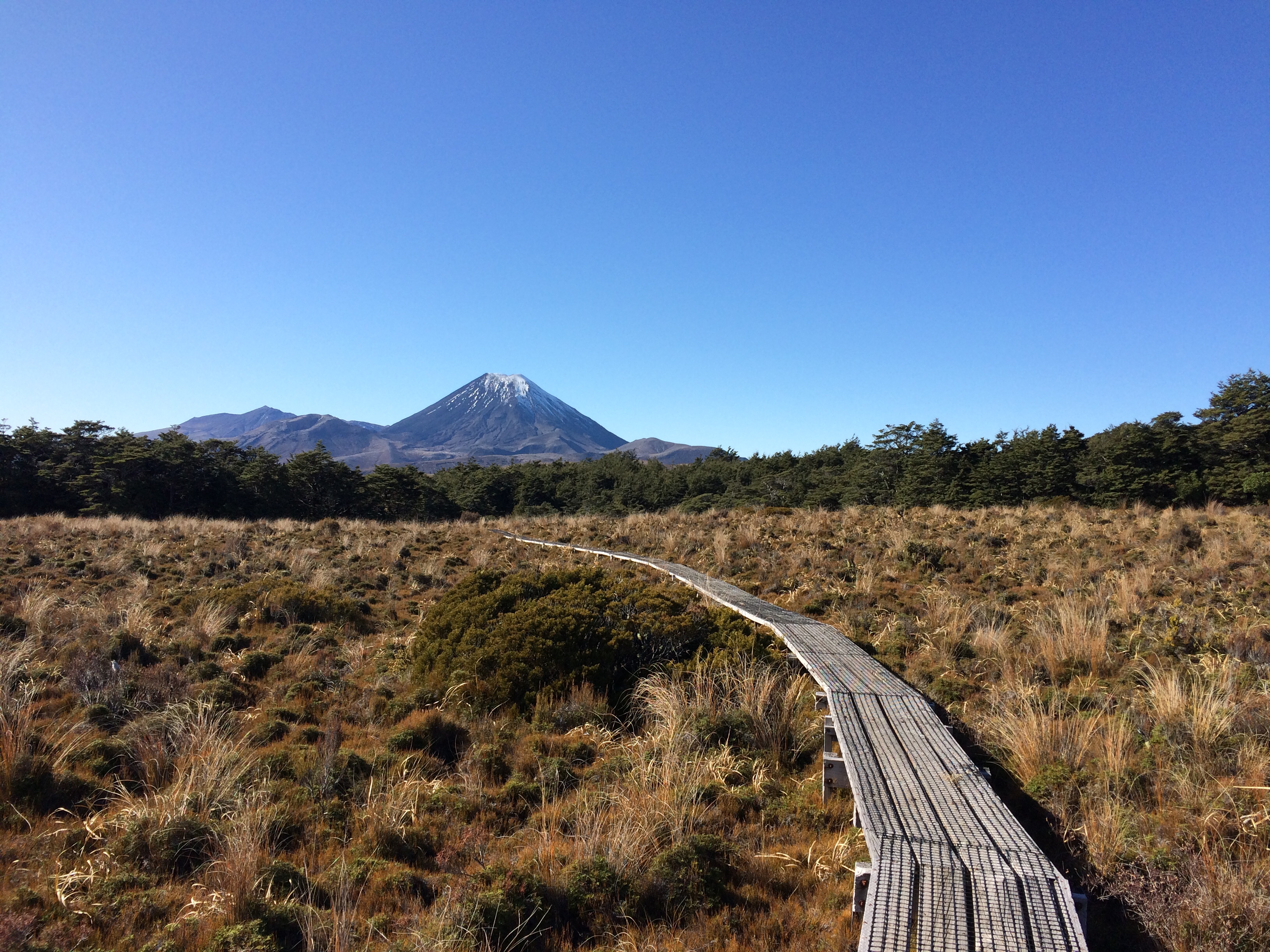
Behind me, to the east and north, Mt Tongariro reared. The crossing passes right up the valley pictured below, between Tongariro’s right shoulder and the steep slope that climbs away to the right. That’s the northern side of Mt Ngāuruhoe:

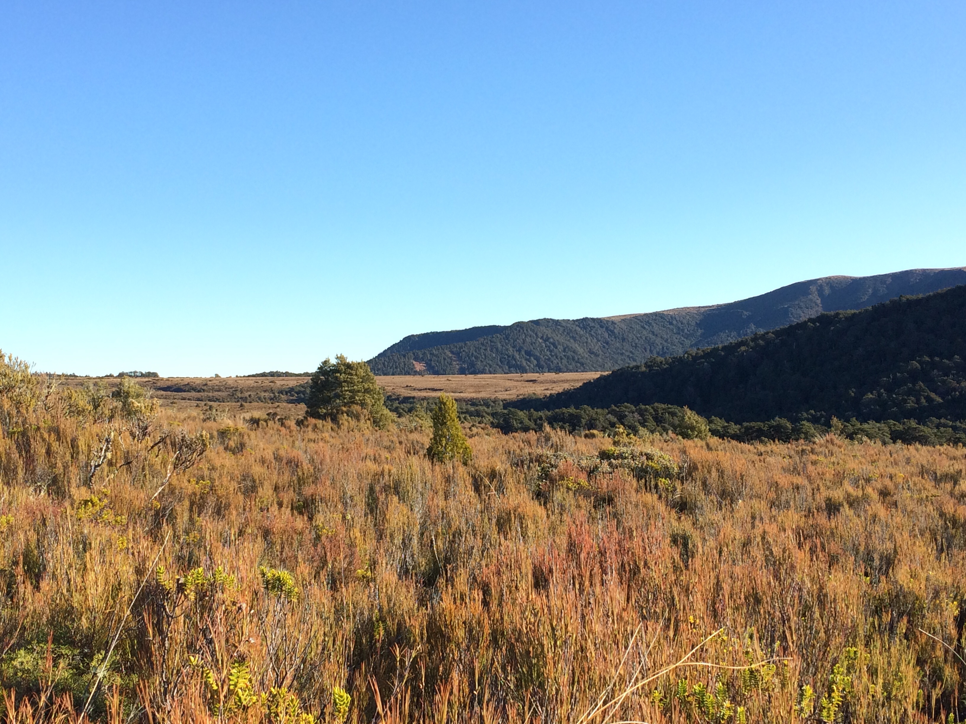
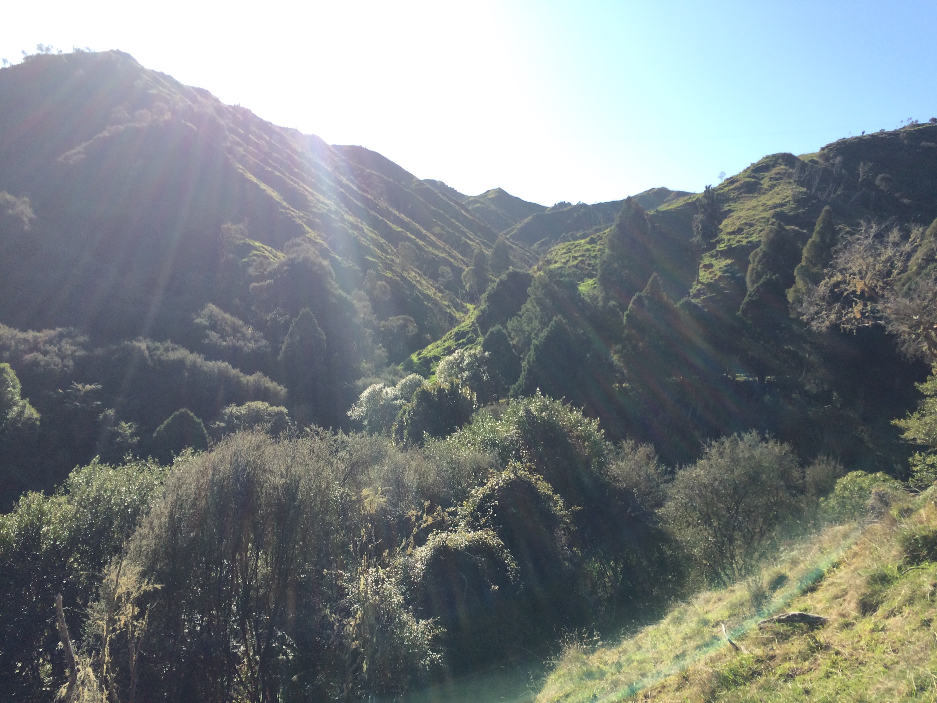
My path, though, was more to the south and east, through gently rolling shrub-land toward Whakapapa village:

The low hill above is, I think, the one you can see from the main road through National Park village – Hauhungatahi. At 1521 metres, it looks small compared to the monstrous peaks to its east – Tongariro is 1967m, Ngāuruhoe is 2287m and Ruapehu, 2797m. But for the North Island, Hauhungatahi is a decent hill – it would actually be among the highest peaks in the Tararua Range (that range’s highest, Mitre/Pukeamoamo, is 1571m). Having made the demanding ascent of Pukeamoamo, the comparison put the majestic country around me into perspective.
Before long the sun came up; the end of lockdown had coincided with a spell of absolutely bluebird weather. It’s always pretty special up here; but on a day like this, you feel like a kid having an especially good Christmas.

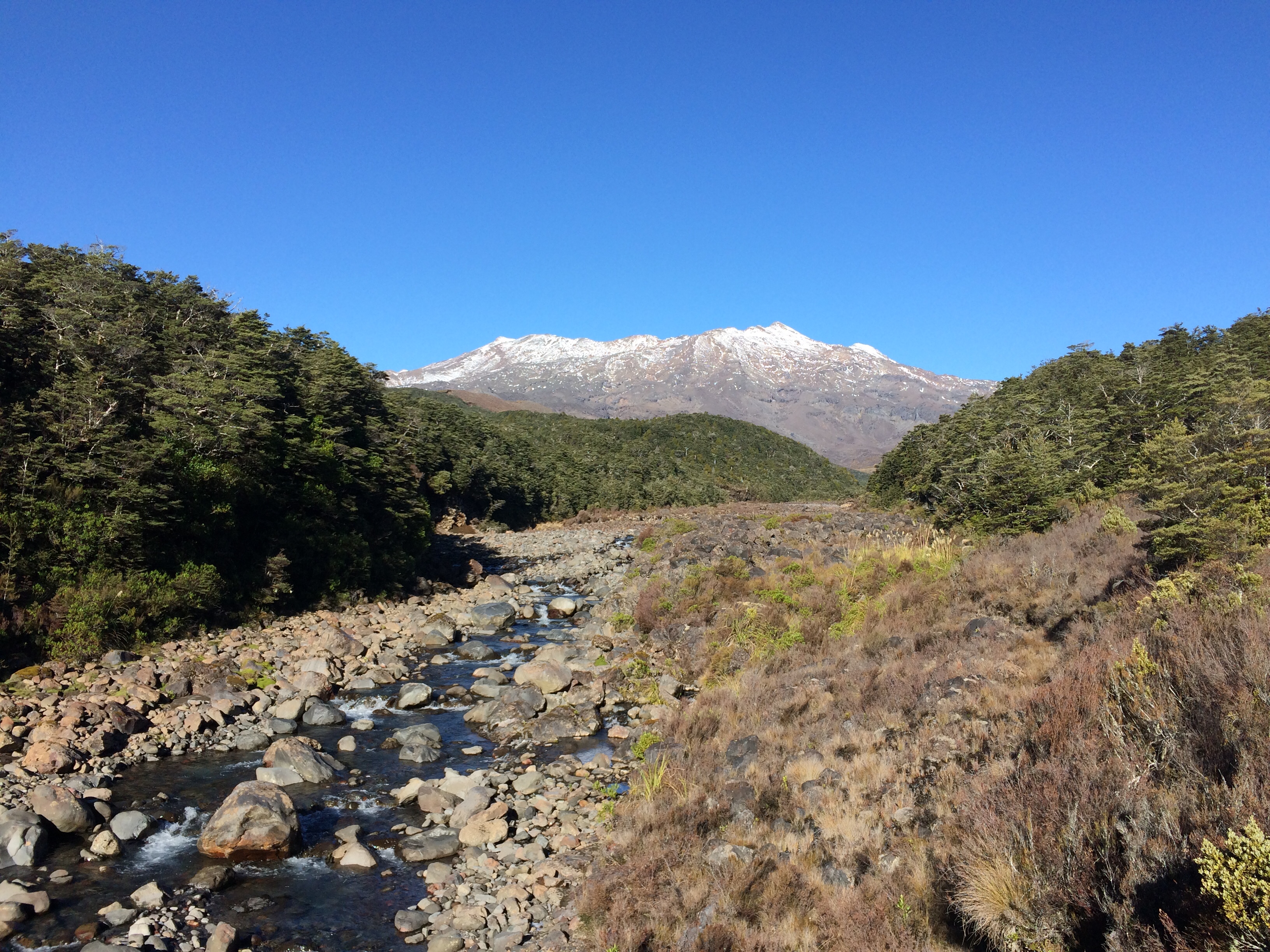
Ruapehu soon appeared. Not a lot of snow around in late May, but much more was surely on its way:
I could tell winter was beginning to bite, because I had to tread carefully around the icy patches in the deeper gulches and shrubby little canyons the track passed through:

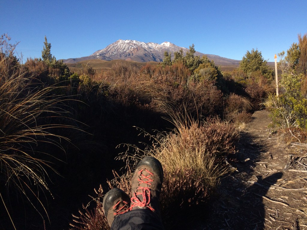
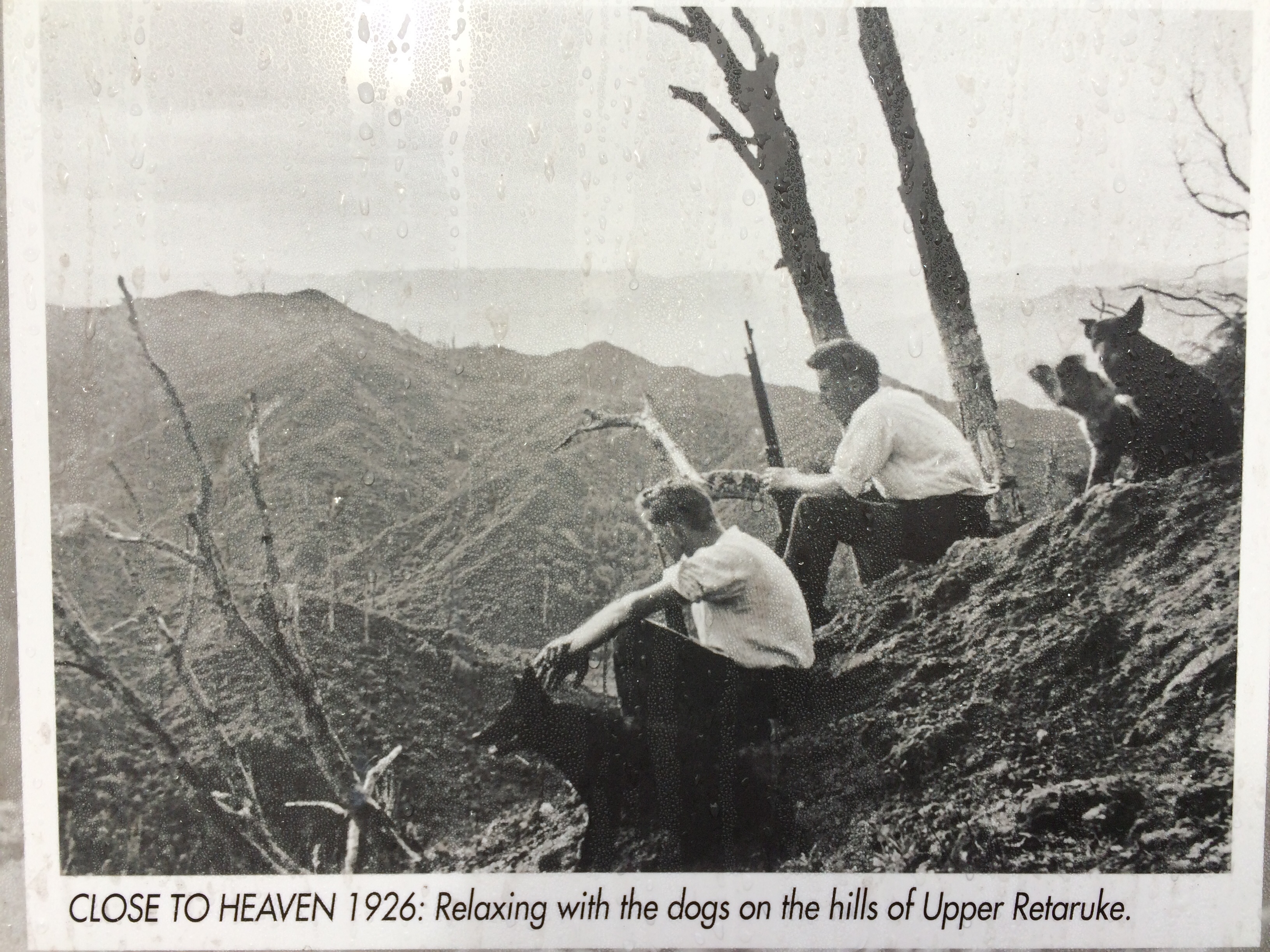
Below is a depiction of some of the best moments on the trail: the breaks. Kicking back with a handful of banana chips or biltong, a cup of tea, and a bit of quiet time with a tremendous maunga. A deep, slow silence; nobody around but me, a lonely alpine bird or two, and the wind in the tussock.
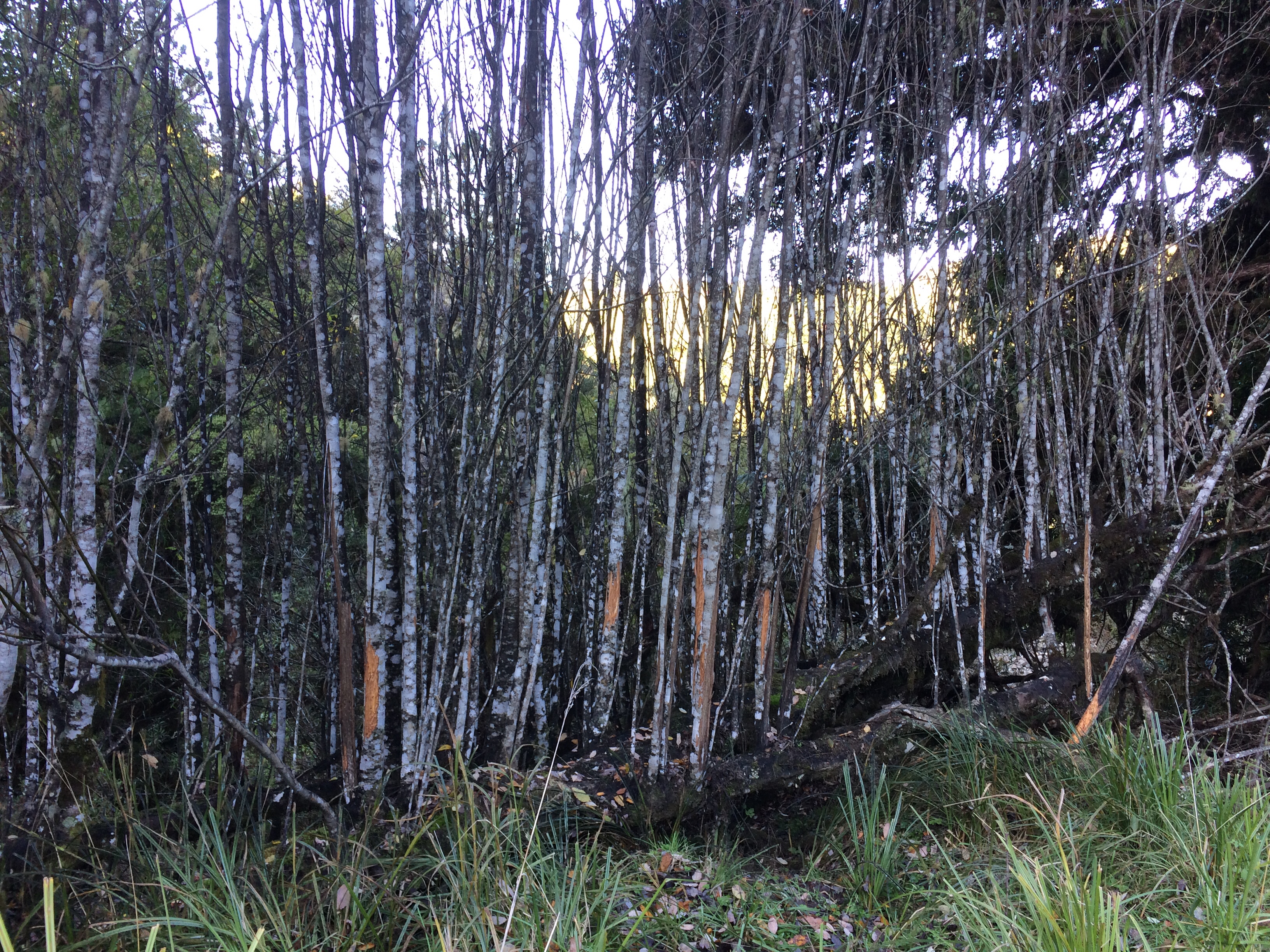
All day, no matter how hot the sun got, I came across icy little art works like the one below. Shady hollows the heat never reaches, so they’ll likely stay as delicately filigreed as this until they get buried in snow. Or until they thaw in summer.

Rounding the low shoulder of a hill called Pukekaikiore, I watched over my shoulder as Ngāuruhoe slowly emerged behind me. Mt Doom, some visitors insist on calling it, but there’s much more to this snowy old giant than its use in a somewhat racist old film.

I reached the famous chateau at Whakapapa by 11am, to find the window tables laid with fine bone china for High Tea. But a) the black-suited waiter looked a bit askance at my muddy shorts and b) it was 45 bucks, so I just had a huge bowl of wedges and a triple-shot flat white. More of a Tramper’s Tea.

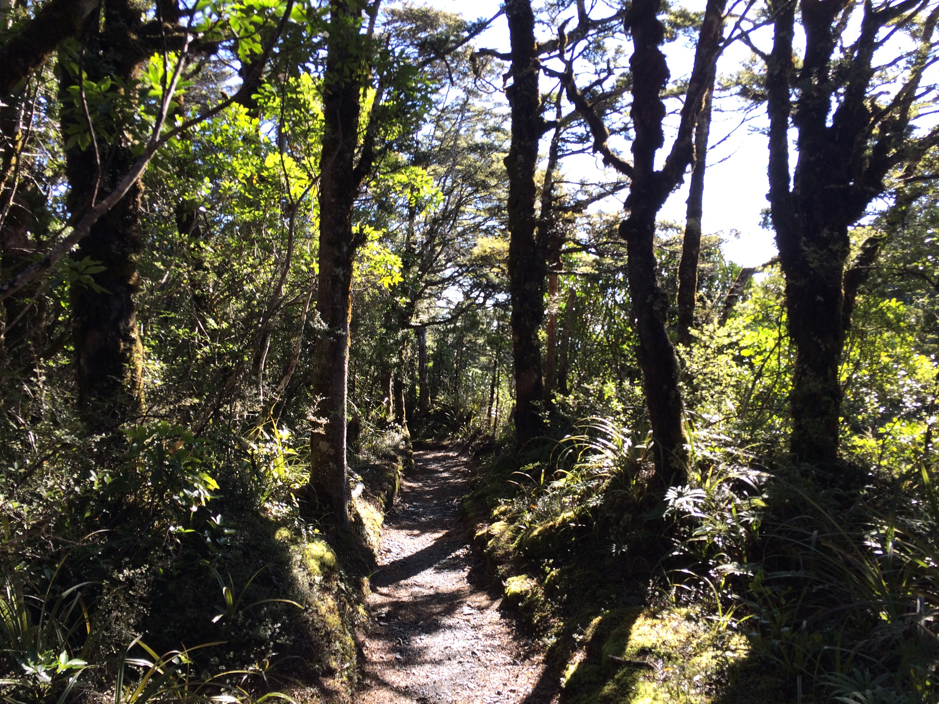
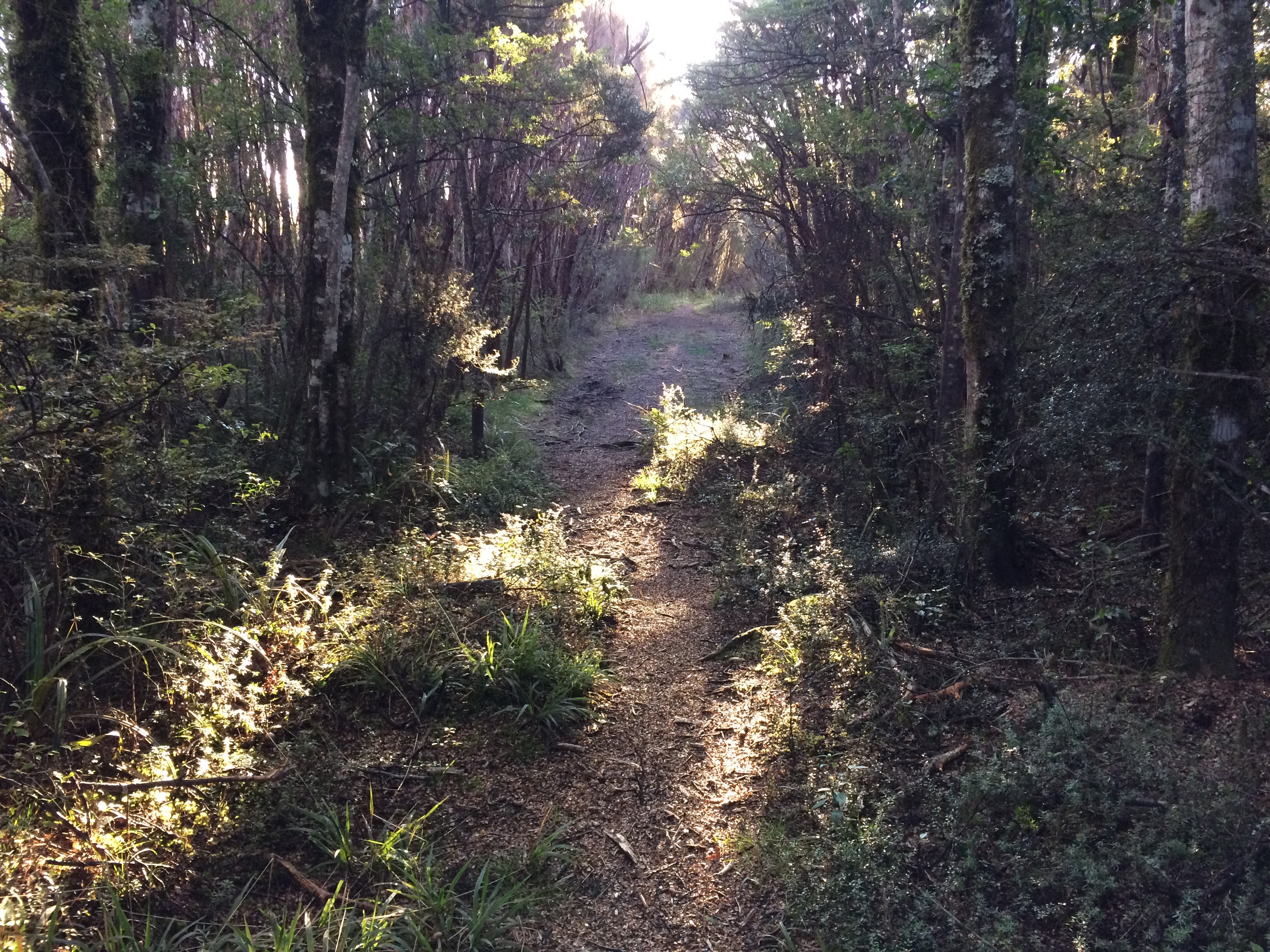
Thus turbo-charged, I headed off into the lush beech forests below the chateau along this track – the Whakapapaiti:
I followed boardwalks across still and silent marshlands, enjoying how my two feet were making whole, ferocious mountains fall away behind me. The power of a step (and another, and another).
All day long, though, Ruapehu kept reappearing to keep me company; it’s the big chief of these parts, and is much harder to diminish. Not that you’d want to:

Across streams I went, watching them run down from the bright crests:
Ngāuruhoe also refused to definitively disappear. All day, and the next, he’d poke up his snowy head when I least expected it. I’m still here, mortal. Your puny feet can’t defeat snow, distance, history, doom.

One thing I’ve long found intriguing about the map of the Tongariro National Park is the enormous, trackless areas with the designation Remote Experience Zones. The idea seems to be to leave a few parts of the park only for those properly equipped for the real, unadulterated wild. The Whakapapaiti Track runs right to the edge of one of these: The Hauhungatahi Wilderness. I like the weather-beaten warning: There are no marked tracks to follow in this region.

It was stirring, standing on the edge of that wild place and looking in.
Come in, there’s no entry fee, I heard the rough-neck hills and scoured scrub mutter. Come right in, but you’ll pay later… we’ll take it out of your hide.
But Te Araroa does follow a marked track, here at least; the Mangahuia Track joins the Whakapapaiti, skirts past the Remote Experience Zone, then plunges straight down a scrub- and sunlight-filled valley toward National Park.
I considered camping at DOC’s Mangahuia campsite but decided to crack on down the 6km road walk to National Park village. Partly because, right by the campsite, I saw a stoat stalking birds, and those things are dead-eyed, soul-chilling killers, and it looked straight at me.
(These invaders love chomping on native birds and other critters. Yet another lovely legacy of the big land-grab and land-wrecking that is colonisation.)
And partly because, speaking of land again, I had a long way to go and not many days to do it: I had to get back to Wellington in time for my partner and I to put an offer on a house.
That was partly why land was so much on my mind, I realised. Trackless, tracked or domesticated, we all need a bit to lie on, especially if we want to make a family.
Out here, though, in this potent emptiness, the idea of owning such a thing seemed ludicrous.
I was walking due west now, along SH47, watching the first stars come out above the distant, invisible Tasman:
And there it was again, the unmistakeable cone of Taranaki:

I checked in to the National Park YHA, devoured fish and chips and a quart of Waikato Draught from the Schnapps Bar across the carpark, and passed out in my narrow bunk.
First full day back on the trail, and man, did my old bones know it.
Day 64: National Park village to Kaitieke – 27km.
My feet crunched on the hard frost as I headed west out of the village, just after first light. Soon I was winding up a gravel road into the Erua Forest, a wilderness area favoured by mountain bikers – it’s an early stage of the Mountains to the Sea trail, which ends at the Whanganui river mouth, about three hundred kilometres away.

My old friend Taranaki soon reappeared, far beyond the Erua Forest, beckoning me on. It was special to see, because of the connection between this immaculate cone’s origin story, and the direction I was taking.
According to Taranaki Māori, this peak was first called Pukeonaki and stood alongside Tongariro and another, smaller mountain, Pihanga (1325m, between Tongariro and Lake Taupō).
“Pukeonaki and Tongariro both loved Pihanga and fought over her. But Tongariro was stronger and Pukeonaki (Taranaki), bearing the scars of battle, withdrew underground, carving out the bed of the Whanganui River on his journey to the sea. When he surfaced he saw the beautiful Pouākai range standing inland… Pouākai and Taranaki’s offspring became the trees, plants, birds, rocks and rivers flowing from their slopes.”
On this leg of Te Araroa, I’d be following in these legendary, lovelorn footsteps, from Tongariro, through the rugged back country down to the Whanganui, and then along it.
After a while the gravel road ended, flowing into the Fisher Track. Passing through very rugged bush, this old settler road has been allowed to revert to a simple earthen track.
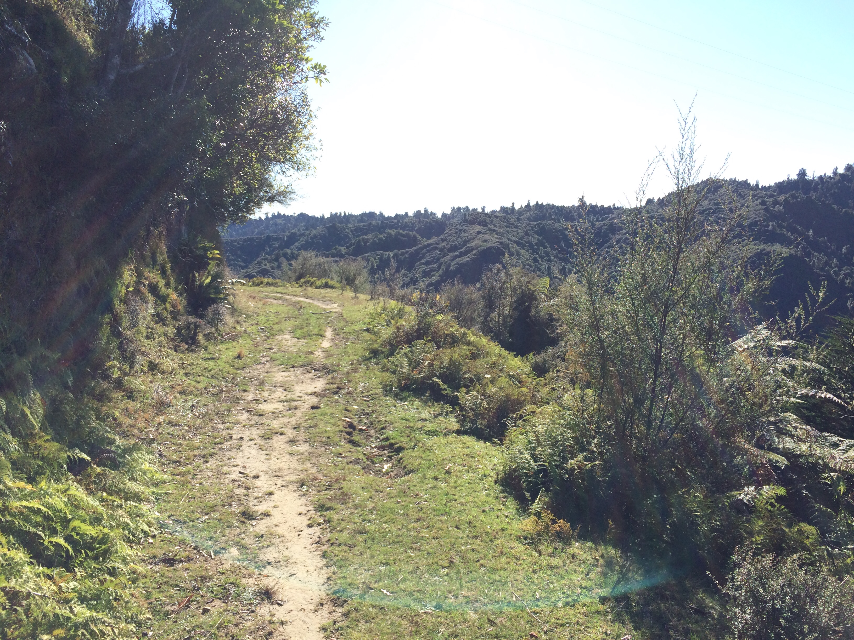
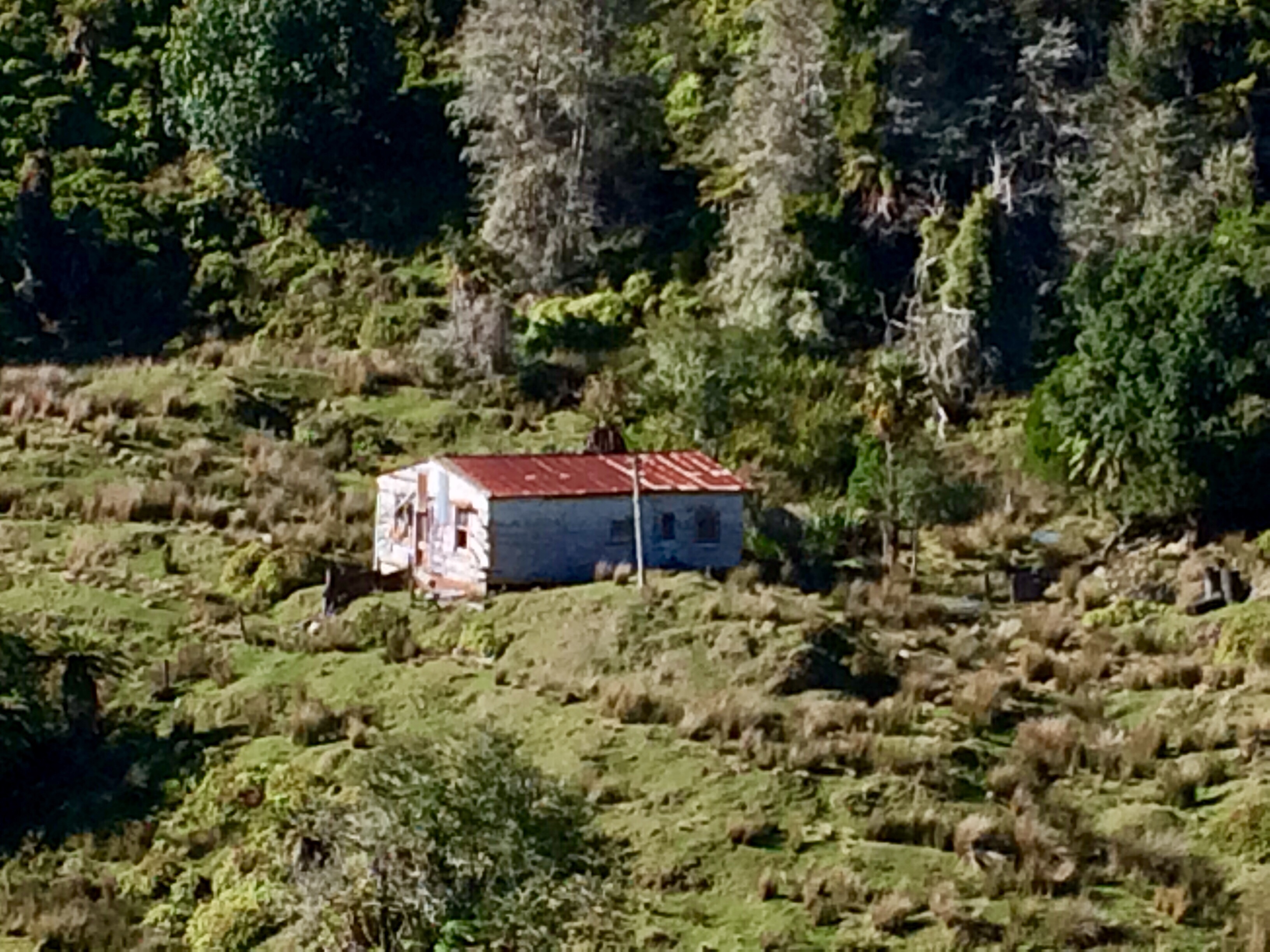
It winds its way down to once-cleared country, now returning to bush. Here and there are a few poignant remnants of attempts at farming. I liked this tough little cottage’s steadfast refusal, so far, to fall over, rust away and be swallowed by the vast, wild green:

Someone had carved out a life here, broken the land in, slaved to smash back the bush and plant grass. The blind, bloody-minded determination of it… there was a power or phone line running down to the old place, so maybe they’re there yet?
It was the beginning of an ongoing thread of reflection I followed through the week on the trail: humans versus the land, sometimes fighting it, sometimes listening to it and learning from it. The hubris and daring of it, the poignant failure of attempts to subdue nature, or the successes, which are often even more poignant. Like the one below. Bush crowds along a high ridge; then melds into denuded slopes, complete with slips, the land left without protecting roots, the topsoil sliding down toward the sea. You can’t see it in the photo but beside this rough hill is a billiard table-like paddock, bright green with fertilisers imported from Nauru or Africa, and at the bottom of the valley a luxurious manor. (A sign at the ornamental gate advertises that the whole lodge and working farm is for hire). It looked incongruous to me, a continuation of that old pioneering desire to erect a new slice of Europe.
The sun blasting down on that bare, serrated skyline; sprayed, burnt and stripped of bush. But somehow still itself.
At the end of the Fisher Track the trail follows Kurua Road through lush farmland and alongside the Tupapakurua Stream. I’d done about 18km by this time, a good five or six hours, so I stopped for lunch at this sunny stream-side spot:

From Kurua Rd you turn right onto Retaruke Rd, along the Retaruke River. Now, as I’ve mentioned before, some Te Araroa hikers think there’s too much road walking – compared to other internationally famous long-distance trails such as, say, the Appalachian. But these short connecting sections are only about 15 per cent of the whole 3000+ kms, and I can’t mind them since the views are so often like this:
Another feature of this stint on Te Araroa was the autumn foliage. As you’ll gather, I’m generally on the side of this southern land in its battle with attempts to turn it into a little England; but I do have to admire these glorious, fiery, northern leaves.

And it’s probably better not be too absolutist about such things. There were a lot of poplar or willow-type trees near the road and I liked their refusal to die. Someone or something bowls them over, and they just keep springing back to life, even on their own bones:
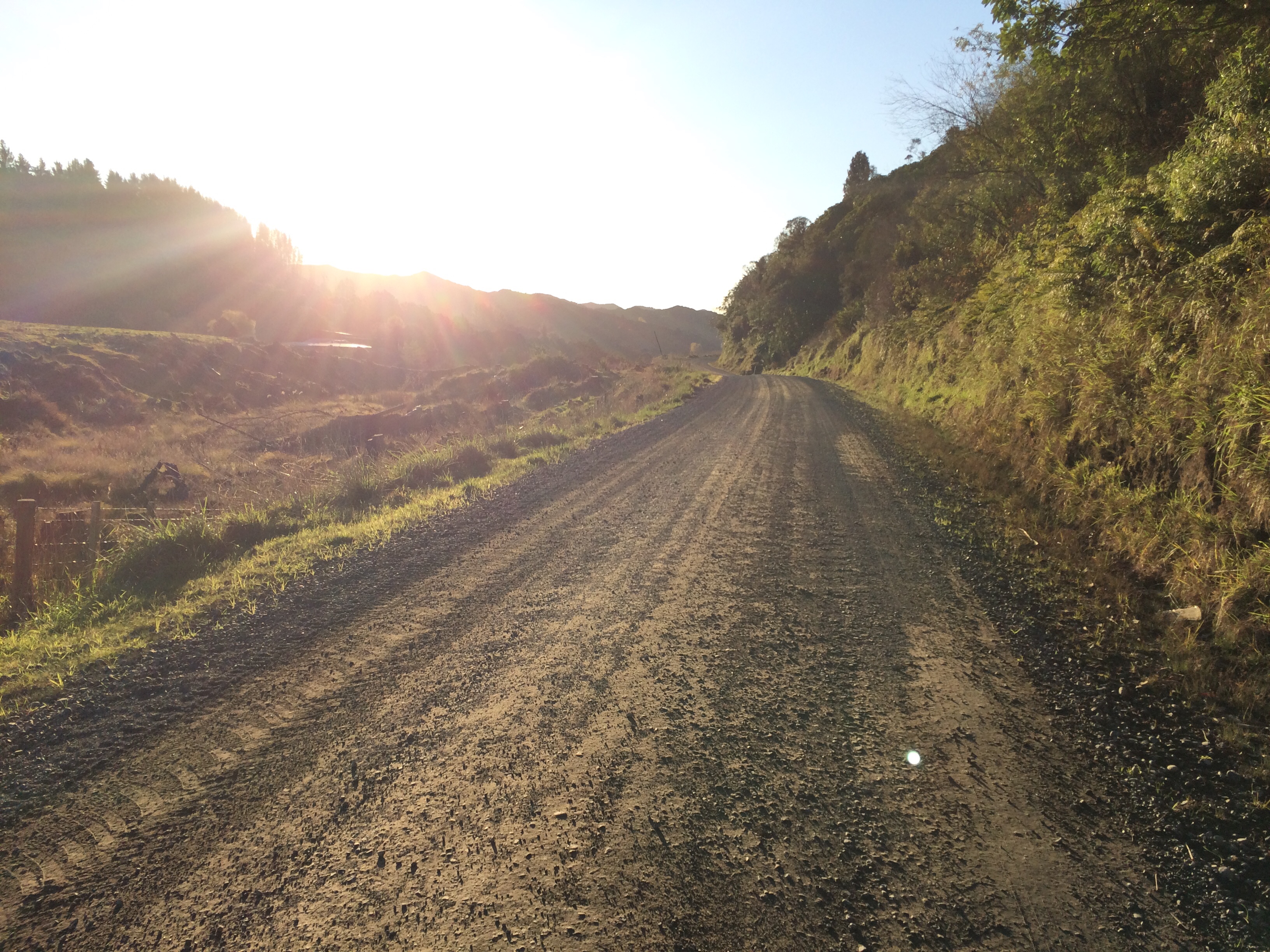
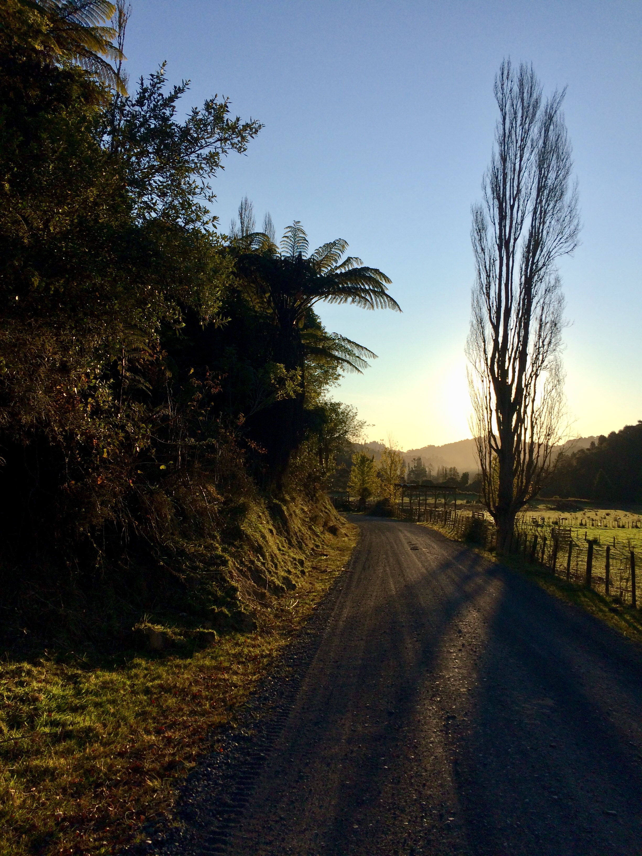
And yes, gravel roads carve access into pristine landscapes, but they often have a beauty of their own. Especially on a sunny, late afternoon, way out in the country. Nobody around, birds making going-home noises. Dead still, not a breeze. Every stone with its tiny shadow:
A couple in a mud-splashed blue ute pulled over, winding down the window. Beanies, swandris, smiles:
“Be a bit bloody freezing in the mornings, wouldn’t it? Yeah, I spose ya would soon warm up. Oh well, not far to the monument eh? Yeah, that’s where they usually stop. Seen many walkers? Yeah, nah, we haven’t seen any since lockdown, either, til you. Righto, better let ya keep going. Nearly there. Good on ya.”
By now I was deep into day two of my trek, and my feet were dragging, but encounters with generous back-roads characters like these always lighten the old boots.
I was also beginning to fall into that good meditative rhythm some call the walking blues. Step, tick, swish, tock, went my boots and poles; on and on, like the heart’s quiet, constant, chugging roll.

More wilderness/human confrontations: a ferny paddock very slowly swallowing up signs of human life, house, car, and all.

The road swooped down into a shady hollow, where all the surrounding cold air apparently flooded in and stayed all day. It was near dusk but the morning’s frost lay virtually untouched; by the road, an inch of ice sealed a watering trough. I had to stop to put on woollen gloves.

Soon after I reached the intersection of Upper Retaruke and Oio Roads, from which the Whanganui River is still a day’s walk away. Te Araroa trampers often freedom camp here on the roadside, beside the Kaitieki district war memorial – there are public toilets and, I think, a tap for drinking water. Normally I’m quite happy to camp on road sides, if there’s no one else around. I like the solitude. But this one was a cenotaph reserve, and I didn’t know how the locals feel about people camping there. Plus, it would mean be putting my tent up in the dark, and it was bloody cold.
Te Araroa trust’s trail notes mention that at the house nearest the intersection, 42 Upper Retaruke Rd, trampers can get a bed, hot meal and shower for $30. It’s only a few metres from the memorial reserve. Also, according to that classic long-distance tramping book The Hitchhiker’s Guide to the Galaxy, 42 is the meaning of life. I walked up the drive.
My sore feet got a little sorer as I took in the house’s darkened windows. No one home. Bugger. Then from an outbuilding I heard a storm of excited barking and a gentle rebuke. I went over and met Roger Couper, who was feeding his working dogs. His partner Sharon Wright, a hairdresser in Taumarunui, would be home any minute, he said.
He showed me into a warm downstairs guest room. “Grab a shower, then come upstairs for dinner.”
The guest room was doing temporary service as a storage area during renovations, and I liked the typical heartland homestead jumbling together of keep-sakes and tools. It reminded me of my rural childhood:

Roger grew up in Kaitieke, and over dinner he was full of stories about the district’s settler past. It was once a busy community with a general store, blacksmith and sale yards, all grouped around the nearby intersection; nothing now remains of that community but a school, the surrounding farms, and the war memorial. Roger’s family were among the earliest Pākehā settlers, and he knew all about the back-breaking labour that had gone into stripping off the ancient bush, sowing grass and spreading fertiliser by hand.
He also remembered stories of the violent displacement of the original inhabitants of the river valleys I’d spent the day walking down. In his matter-of-fact way, he told how, during the New Zealand Wars, many battles were fought and many Māori killed. According to Roger, the survivors mostly moved into Taumarunui where their descendants still live today. But, he said, you could still see many signs of the long-standing, long-gone Māori occupation of the valley. There was a steep face across the road from his house, covered in thick bush, never cut. In the right light, you could see how an ancient track climbed right across it.
“It’s an old Māori walkway – one of their old paths, been there for centuries.”
His father and uncle had gone to war and their names were on the war memorial, he said. Afterward the family were aviation pioneers, using Tiger Moth planes to spread fertiliser on the steep, raw hills. One time one of them demonstrated above Kaitieke an aerobatic technique called “the falling leaf” – the tiny, fabric-coated plane climbing, stalling then falling in a plunging spiral while the crowd below gaped and cheered. Someone caught it on film, one of the earliest pieces of aviation footage recorded in the country, Roger said.
He told of pig hunting, dogs getting ripped open by tusks, the time he sewed up a pulsing wound on his favourite bitch’s shoulder, then carried her out in his bush shirt, knotted in front of him like a baby-carrier.
“She just lay there, quiet as anything. She knew what I was doing.”
He showed me the head of the pig that had done that, now mounted on a wooden plaque and once serving as a trophy for an annual rugby game between Kaitieke and a country team from Taranaki.
“We stopped playing that game after about the third year. Too many punch-ups.”
Sharon had recently reopened her hairdressing business after lockdown, but didn’t think she’d keep making the long trip into Taumarunui much longer.
“I’ve had enough. Too far – and this time of year, too icy.”
Plus she wanted to hang out more with the newest family member, a pup called Ruby. The young Jack Russell’s brown eyes shone with energy and mischief.
“She’ll be a good mouser, once she gets the hang of it,” Roger said. “I trapped one for her tonight but she didn’t know what to do with it. But I knocked it on the head and then she gobbled it down, all right.”
Sharon and Roger had only recently moved in together, and they were slowly doing up Roger’s old place. They were gentle and sweet with each other, like teenagers, alternately deferring and teasing.
“Hey, you taking notes?” Sharon sang out to Roger when I ran hot water into the sink. “Been a bachelor way too long, him,” she grinned at me.
“I’ll get the hang of it,” Roger said, grabbing a tea towel.
Sharon had written up a list of chores for Roger on the blackboard in the kitchen: plant shrubs, weed the garden, phone plumber. The top item was: Love me every day.
Day 65: Kaitieke to Whakahoro – 25km.
In the morning Roger made us porridge and Sharon cooked us eggs.
“You should come and stay more often,” Roger said to me, scooping up more eggs.
Sharon arched an eyebrow. “You can make us eggs whenever you want,” she told him. “Why not? You make great porridge.”
Shouldering my pack, I felt wholly restored. Ruby the Champion Chewer and I had bonded while she destroyed the plastic ends of my shoelaces, and she appeared keen on coming with me to Pipiriki. We had a long stand-off in the road outside their place while Roger tried to catch her and I tried to shoo her back through the gate. The rural postie arrived in her red ute and pulled over to the side, watching and laughing.
I tottered around with my big pack and walking poles, ushering and blocking, while Roger made little swoops and Ruby dodged us both with lolloping ease, loving the game. Eventually I managed to scoop her up and deposit her back in Roger’s big hands. The tight, new little family watched after me as I poled off up the road, feeling full of good kai and country kindness.
The war memorial reserve was a fascinating little open-air museum, full of evidence of this community’s strong connection to the land. I had a long way to go before dark, but I couldn’t resist a browse.
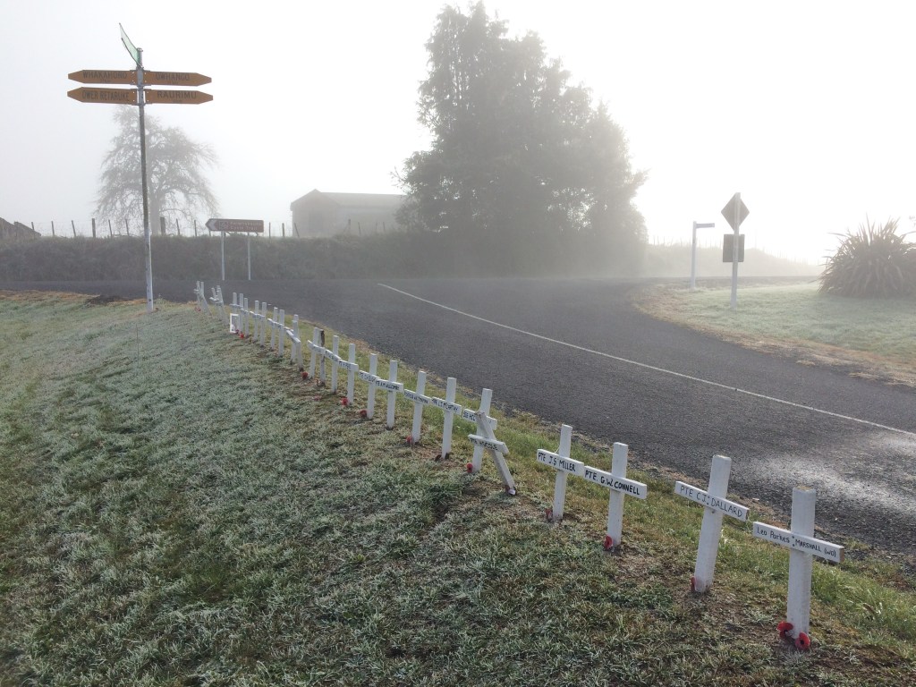
After the line of sombre crosses, I had a look at the sign board for the Mountains to Sea cycle way, Ngā Ara Tūhino. Te Araroa makes use of all sorts of existing paths and routes, and this was one of them. I like how New Zealanders are always coming up with new ways for people to get out onto the land.

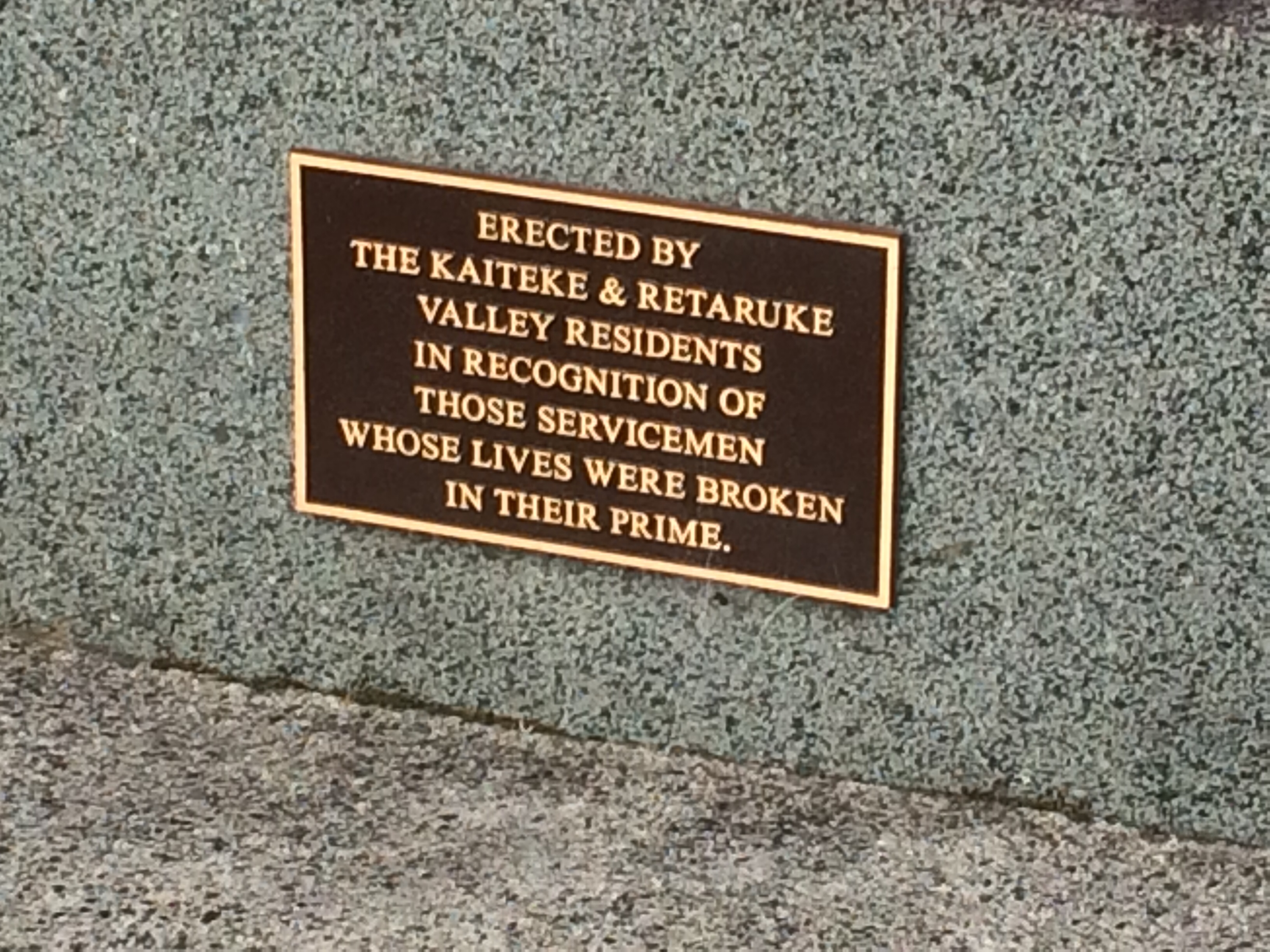
Next, a broken column on a plinth. This is the potent visual symbol the Kaitieke and Retaruke communities have chosen to remember the cut-off lives of dozens of their young people in the first and second world wars, and the broken families they left behind.
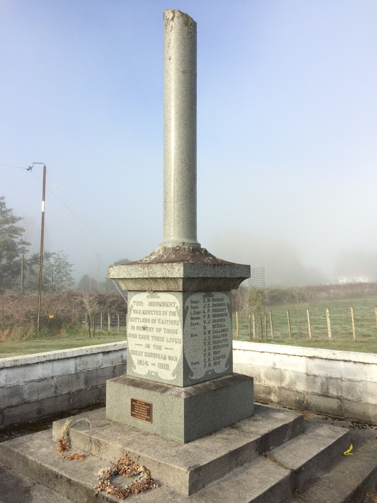
I grew up in a remote, rural place like this, in the Tararua district. People in these far-flung nooks aren’t usually much given to metaphor; they prefer a spade, rather than a suggestion of one. (Later on this tramp, I would come across a more typically prosaic back-country monument: an axe chopping a stump.) So to me, it’s all the more moving when they do put complex feelings about things like waste, grief and sacrifice into a monument:
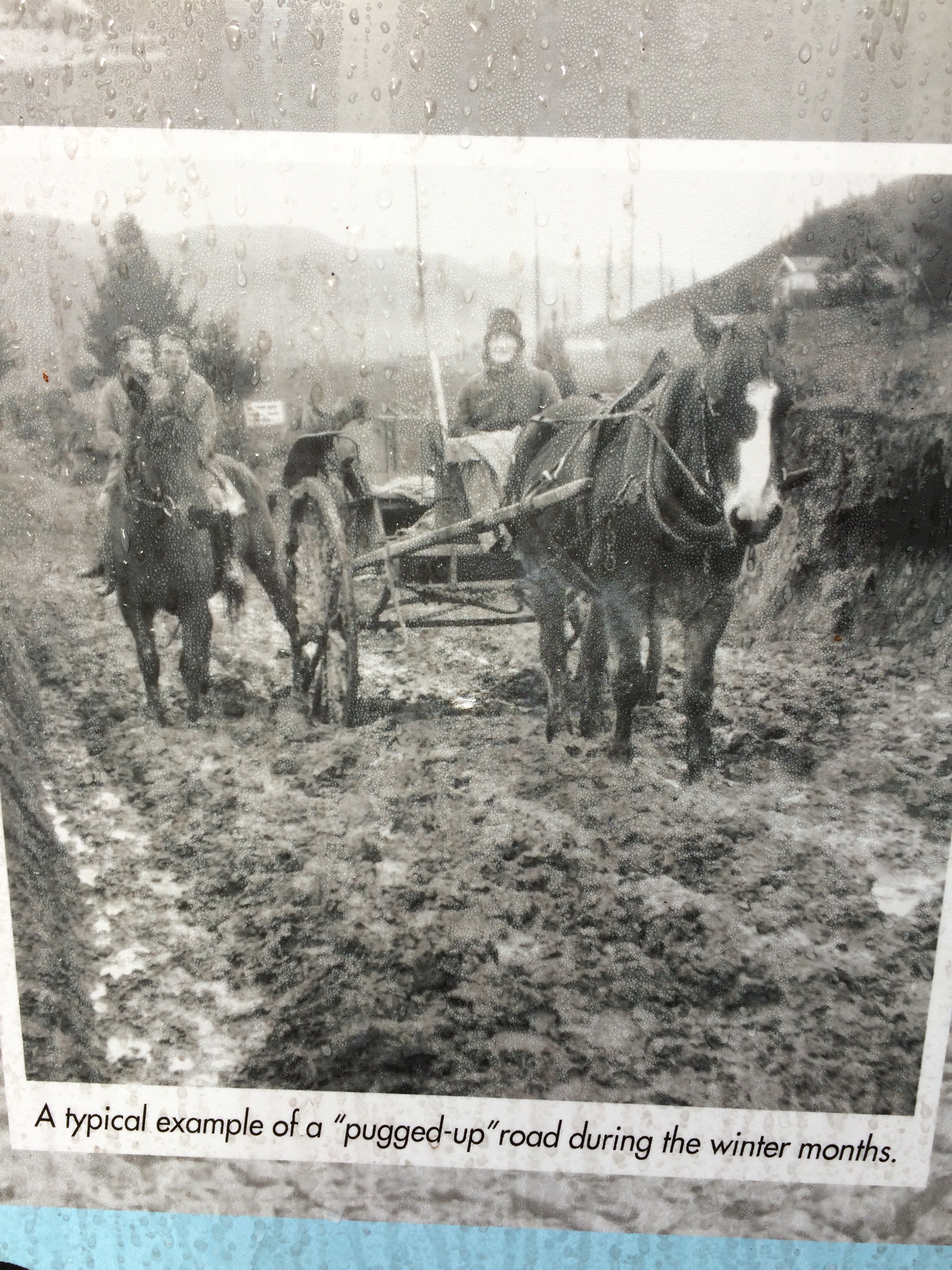
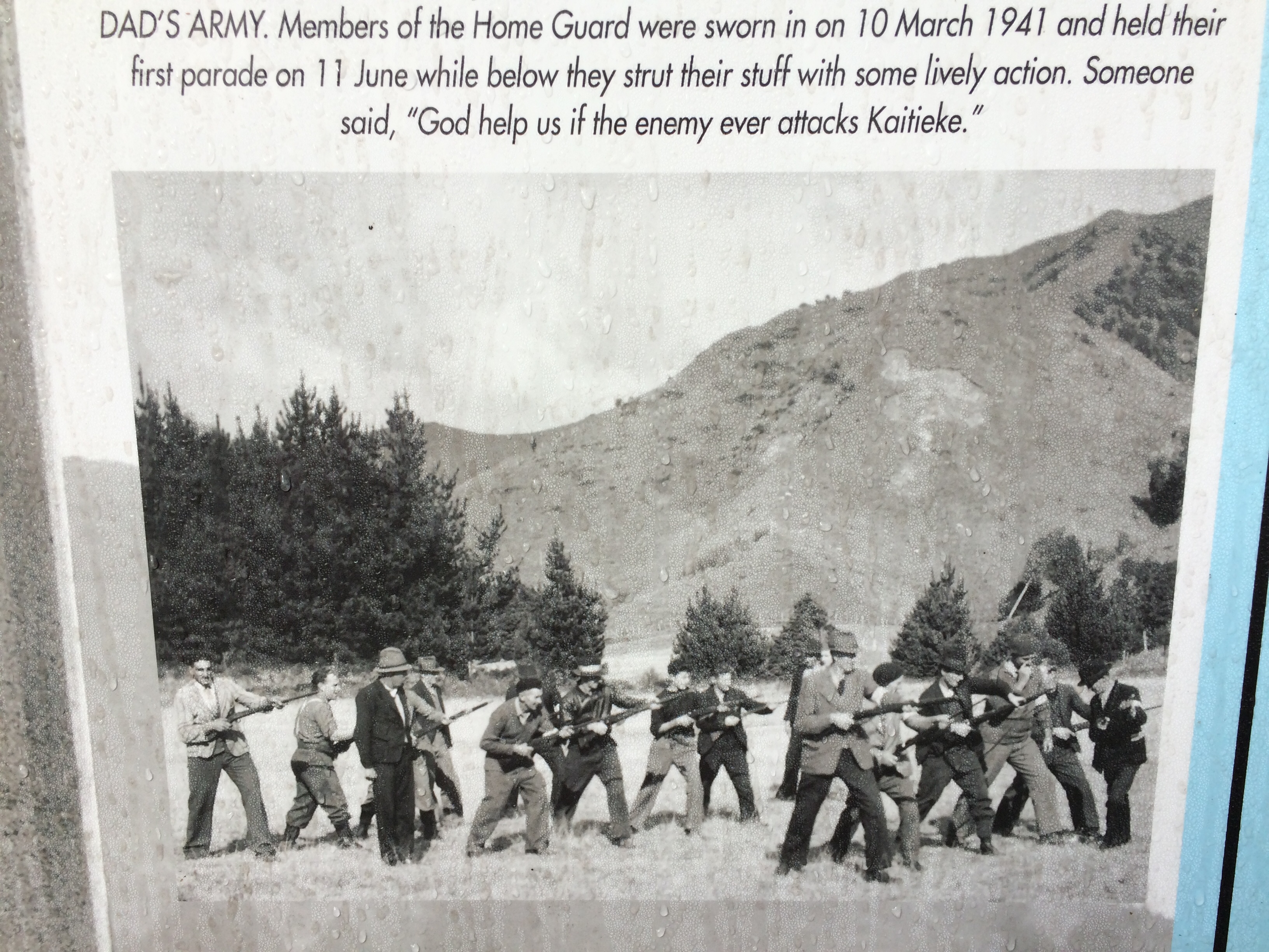
Information panels beside the cenotaph had evocative descriptions and images of the district’s rugged Pākehā past. These bloody-minded people from the other side of the world, carving out infrastructure and an economy, overcoming hills, distance and an unforgiving climate:
But it saddened me that there was nothing on the panels about of the centuries of Māori occupation before that. About that similarly tough-minded, resilient people who worked, lived and loved in these very same valleys until they were driven out at gun point in the 1800s – only a few years before these photos were taken.
Also, I know people have to make a living, but it’s always striking to me how little direct reference there is in these types of historical accounts to the sadness of razing millennia-old forests.
How many thousands of years had this bush been growing, before these men skittled it to make way for a foreign system of land use? Look how loose and battered the soil looks in the pic above, stripped of its ancient protection.
Still, I enjoyed the way this little museum in the middle of nowhere conjured up and honoured (some of) the past, without taking it too seriously:
And it was moving to see the boy-warrior face of an ancestor of my host of last night. Only connect, EM Forster recommends, and in places like the Kaitieke war memorial connections abound:

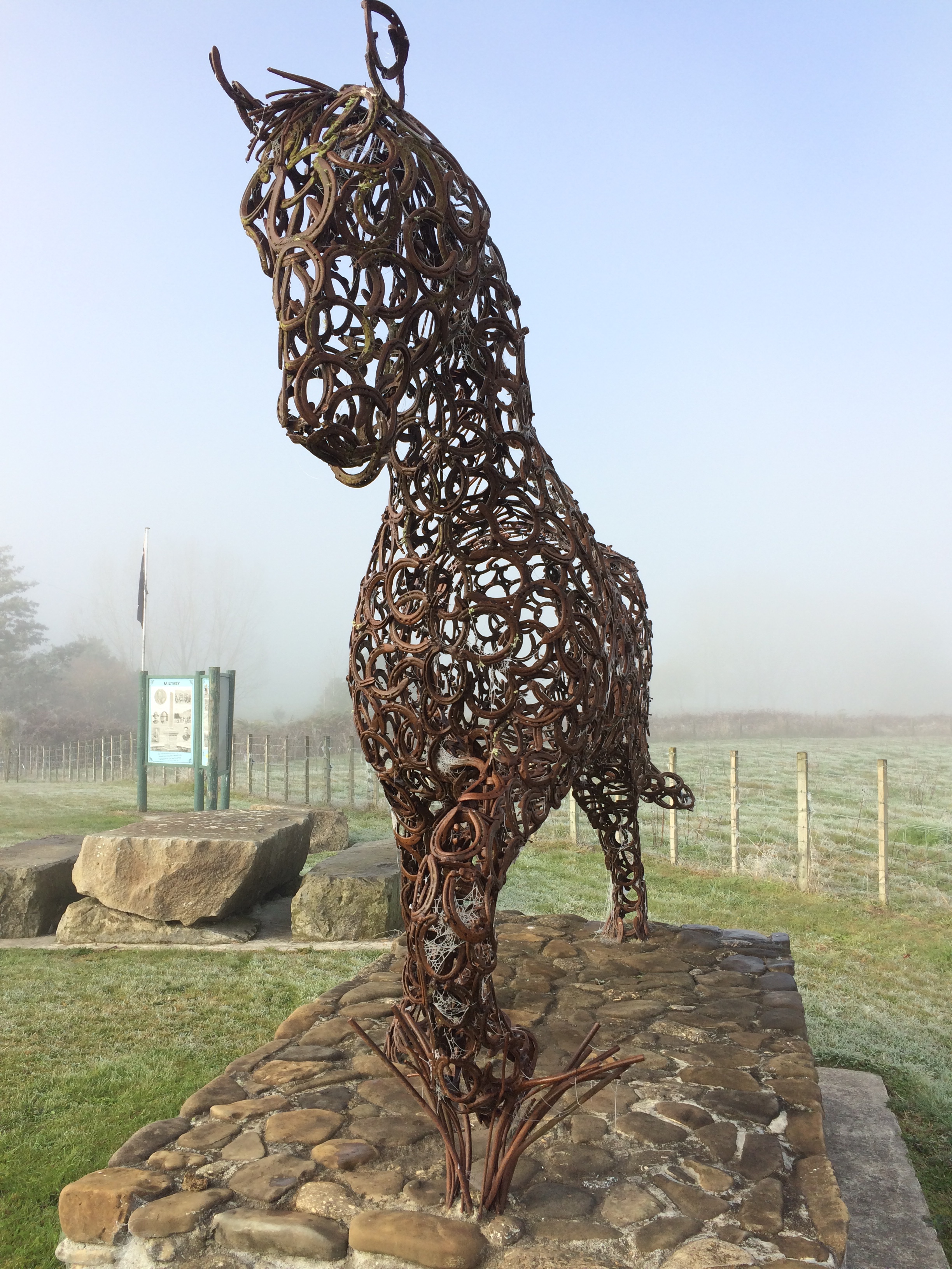
The memorial reserve kept giving; there was more of that pragmatic country poetry:

That little “verse” refers to this spectacular creation, made entirely of used horse shoes:
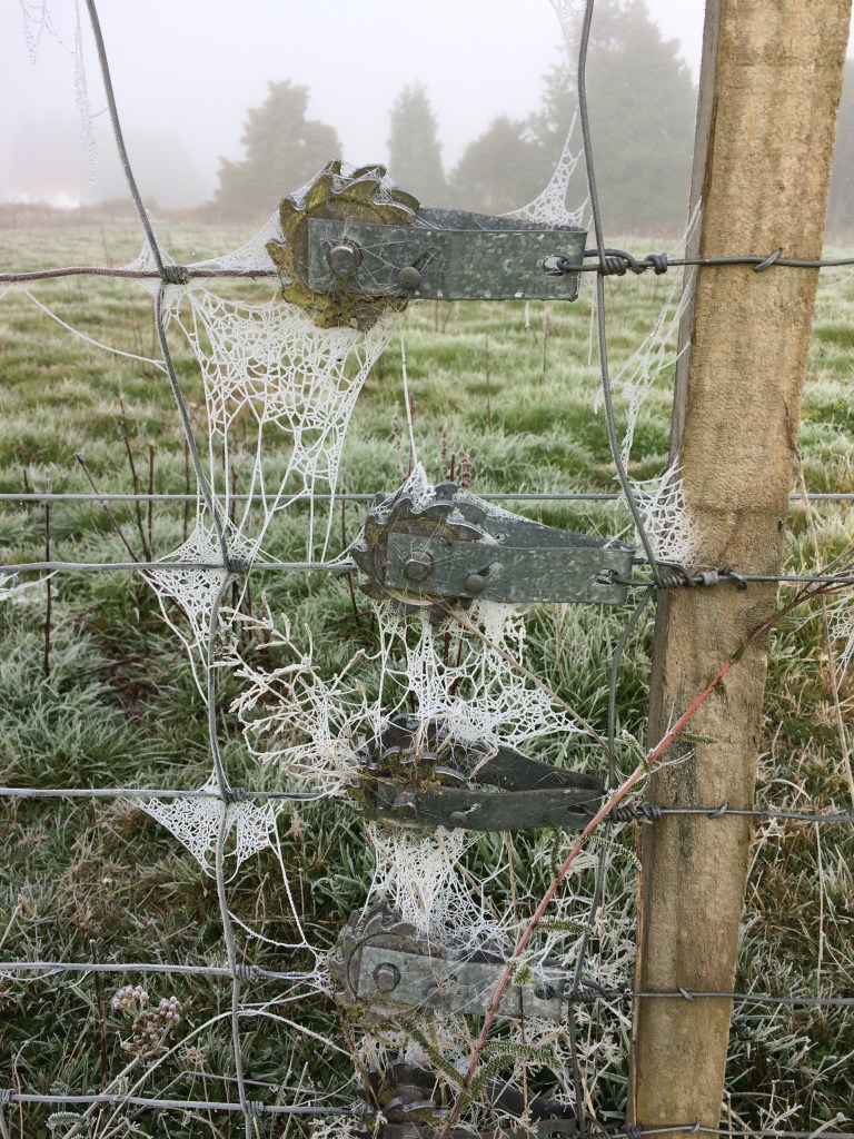
It was time to go. It was still early and the frost was still on the ground, and I was getting cold.
As I headed off alongside the Retaruke River, the sun slowly came out, drawing clouds of steamy mist off the warming hills:
The gravel road along the river valley made for peaceful day’s travelling. I was struck, as I often am in places like this, by the contrast between, on one hand, the carefully-machined road corridor, lined with introduced grasses and deciduous trees, and, on the other, the wild native bush and rugged hills bearing down on it from every side.

Deep drifts of colourful autumn leaves filled the verges:

I stopped for a selfie in a sign-post mirror at a blind corner:

The mist lifted and another sunny autumn day deepened. A lot of the roadside trees had only just begun to change colour, much less lose their leaves:

There are always things to see and think about as you plod along a back-country road. For example, unlike tar-seal roads I’ve walked, which have with more traffic and higher speed limits, there wasn’t a lot of road kill. But coming around a gravelly corner was a familiar smell, then the huddled shape: a billy goat. With his red-brown coat, he lay indolently posed as if in a delicious abandonment to sleep, cast aside, but uncaring. Finding his way slowly back into the earth.
The road hugs the deepening gorge of the Retaruke River. Pines crowd down from the steepest country; it was probably cleared and put into grass with backbreaking effort a hundred years ago, and now it’s back under trees. A lot of the plantations on this steep country aren’t even sown to be harvested, Roger had told me – their owners are paid to plant them as carbon sinks.

But plenty of native bush remains, and probably always will on the very toughest, steepest hills:

Machinery can cut roads across long papa cliff-faces, sure. But if you ever stop clearing the constant rock-fall, it’ll eventually blot out just about any road.

It’s such a pleasure to follow a long country road, on your own, from sun-up to sun-down. It made me feel like an antipodean Tom Sawyer, heading for the Kiwi Mississippi. The road went on and on, deeper and deeper into the far reaches of the land.
I was footsore but the liquid, lucent early twilight took my mind off that.
Finally, just on dark, I reached the end of the road: a dot on the map called Whakahoro. Like Kaitieke, this was once a thriving Pākehā community – even a significant river port – and before that, an important Māori one. Now there’s only one large farming and tourism operation, Blue Duck Station, complete with tours, accommodation, activities and a cafe; and a DOC campsite, including a bunkhouse made from the old Whakahoro School.
That was where I bedded down for the night, enjoying the sight of the same native timbers, high-tiered windows and steep-pitched roof as the primary school I went to (Horoeka in southern Hawke’s Bay. It’s defunct now too, similarly deprived of children by urban drift, the conglomeration of farms and the planting of pines).
I couldn’t see it in the dark, but a hundred or so metres away rumbled the Whanganui, fabled river, footsteps of a mountain, and living person under both lore and law. I could almost feel its enormous presence in the black, back-country night. By the bunkhouse, an information panel amplifies the voice of the tangata whenua, the people of this land for hundreds of years before anyone who looks like me walked on it. They still own a lot of this territory (though nowhere near as much as they are entitled to) and are still deeply connected to it. They’ve suffered huge losses and been under immense pressure; but they’ve never left. As they say:
The river flows from the mountains to the sea.
I am the river, and the river is me.
I like being reminded of this, by panels like these, erected by the tangata whenua to say, Hey. We still exist. This was once all ours, and in a real sense it still is.

A panel like this is an act of living memory. It’s like when you go to Berlin and thread your way along coloured paving stones showing where the wall ran, and you find here and there a sculpture or plaque quietly pin-pointing where someone was shot to death, trying to scramble to freedom. You look around you at the laughing tourists, the desk-saddened office workers, and feel the line between history and the present dissolving. With Faulkner, you feel the past is not dead – it is not even past.
This land we walk over on routes such as Te Araroa belongs to people in different ways: to the public, councils, private landowners, humanity. But it’s always owned in another, deeper sense: it’s always, pre-eminently, the territory of the first people to inhabit it. That can’t be remembered too much, I feel. The land under our feet was taken from these people by force or deceit, and they’ve never had proper restitution. As Pākehā, we should know whose land was taken so that we, not much more than a century later, find ourselves walking on it, living on it, building our homes on it.

Later, I’d come across another panel which said the Whanganui tangata whenua are Ngāti Hāua to the north, Ngāti Ruru toward the river, and Ngāti Uenuku and Ngāti Patutokotoko to the east.
We should know these names.
It was a privilege and pleasure to lie down to sleep on their land, beside their magnificent awa in the old school house under the massive, starlit sky.
Thanks for reading! In my next post I’ll continue blogging this seven-day, 150km journey from Tongariro to Pipiriki on the Whanganui River. Earlier posts, right back to the start of this trip at Cape Rēinga, are above.
A note on dates: This post was written in July 2020, after I walked this section in late May-early June 2020. I’ve given nominal publication dates to this and all Te Araroa posts so that the journey displays in the correct order. The first section was walked in Jan, 2017 and sections have been walked and blogged roughly every six months since.
