
I put my kayak on the car roof and drove three hours north from our home in Wellington to Whanganui, and then another two up the river road to Pipiriki.
You need a kayak for at least part of the previous section of the Te Araroa trail, upriver from Pipiriki, because the riverbanks are trackless wilderness, impassable on foot. But you can actually road-walk or cycle this section, down the river road, if you want. I chose not to, as I’ve got my own kayak and thought it would be more fun afloat.
Pipiriki is an orderly little village at the edge of one of the country’s most untamed places. It’s the last settlement you can reach by road, heading upriver, before the Whanganui National Park becomes accessible by river only.
This was where, in June 2020 I finished my previous stint on Te Araroa, bumping my kayak tiredly against Pipiriki’s little wharf (you can see the post on that stint, and all the previous stints, by clicking on the “home” button at the top of this post and scrolling down).
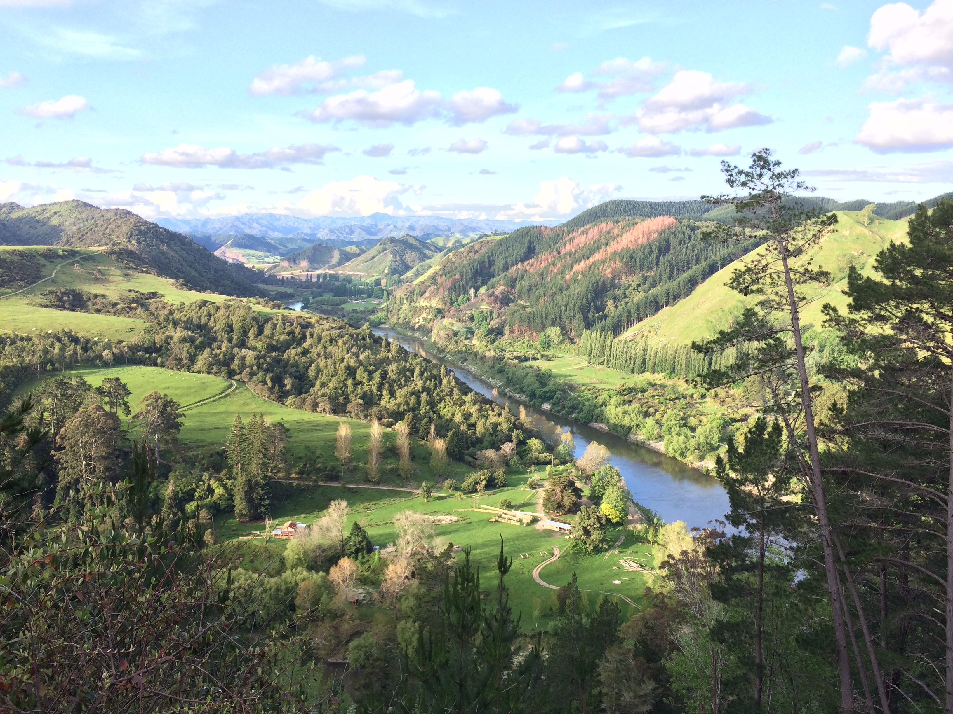
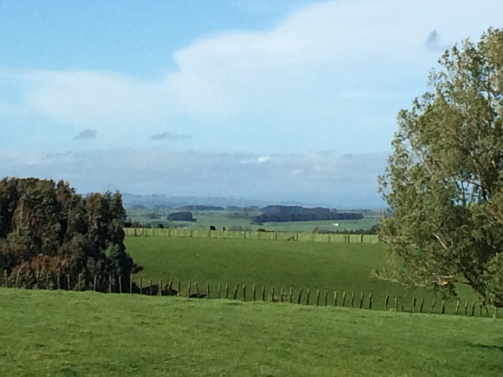
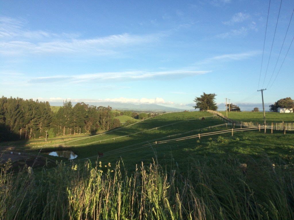
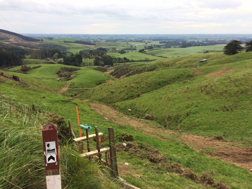
Now, in November 2020, I was returning to that little wharf surrounded by wilderness. On the way, I came to the top of a bluff and this stunning view. I’d be kayaking this very stretch in a couple of days.

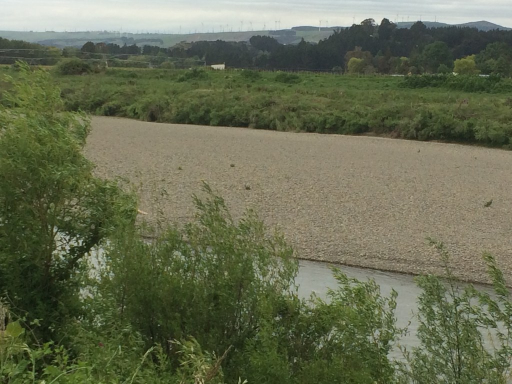
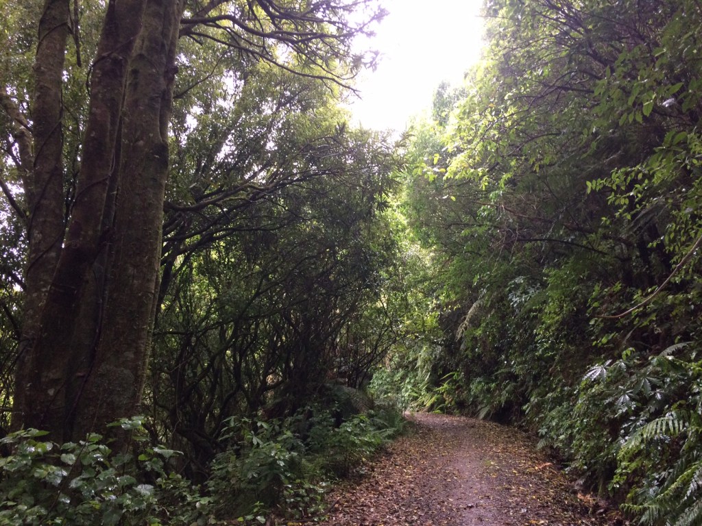
It was good watching the river unfurl beside me as I drove, quiet in its channel. There’s plenty of farmland around here, but for long stretches all you can see is regenerating bush:
I stayed overnight in a cabin at the Pipiriki campground. Checking in, I had my first inkling of what became this Te Araroa stint’s theme – whānau: family – when I apologised to the proprietor, Josephine, for arriving almost on dark.
“All good,” she said, smiling around a mouthful as she walked into the reception area from her adjoining home, “I was just finishing dinner with my moko [grandchildren].”
She showed me around and told me to make myself at home. Later, she told me her connections in Pipiriki go deep. For me and hundreds of other tourists every year, the watchful little village in the shadow of the forest’s edge is a jumping-off point for adventures. But I was realising that for the locals, Pipiriki and the other settlements along the Whanganui are much more: home, roots, identity, mana (spiritual power, prestige, authority), freedom – but maybe most of all, whānau.
And it was whānau that I found floating up, again and again on this trip, to the surface of my walking, paddling, wandering mind.
But that was still to come. For now, after Josephine went back in to her moko, I stowed my pack on a bunk, boiled the billy and sat on the cabin’s deck watching the light fade over the stately, rain-soaked bush, softening into black above the river:

Birds stereophonically farewelled the light and then a great quietness spread out from all those millions of trees without people or roads among them, without asphalt or steel or fluorescent tubes or anything at all that didn’t follow its own, ancient ways. I felt my heart-rate slow.
It was good to be back in Pipiriki, and back on the trail.
Day 70: Pipiriki to Rivertime Lodge, just south of Atene (46 km)
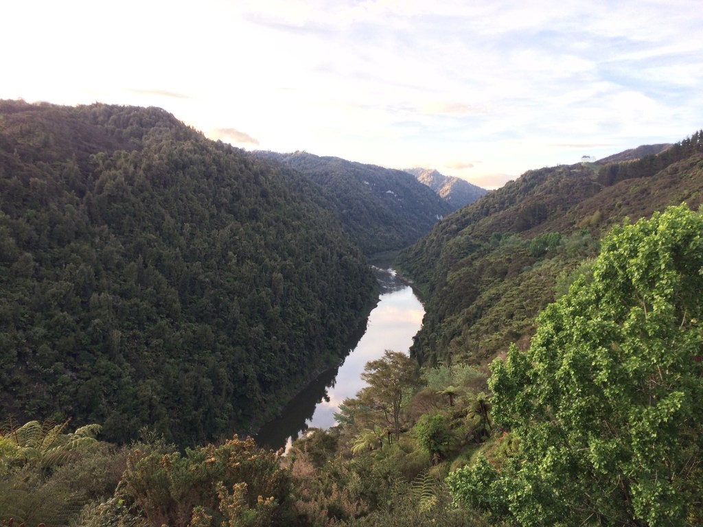
I took my kayak down to the river, then drove back up to the campground. I’d arranged with Josephine to leave my car there for safekeeping. It was an easy ten-minute stroll back down to the river. The view downstream was inviting, but also, in the way of wilderness, a little intimidating:

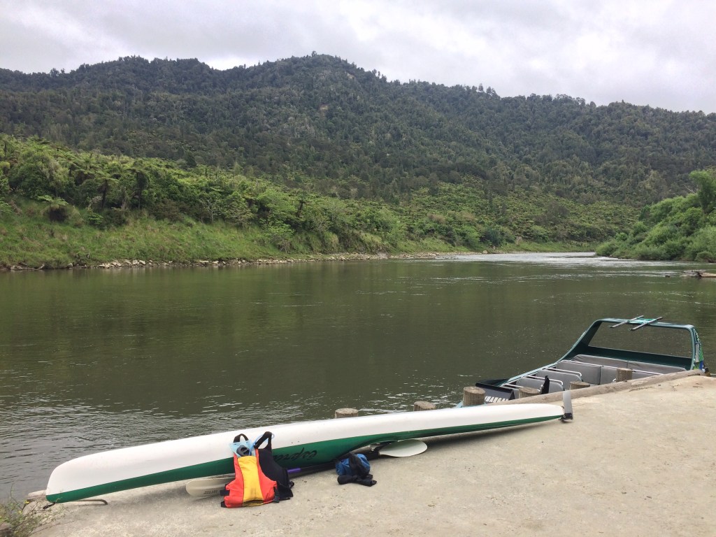
Because I was using my own kayak, and it’s built for speed rather than storage, I was travelling extra light. I’d booked a bed that night at a place called Rivertime Lodge, almost exactly halfway between Pipiriki and Whanganui city, making sure it provided bedding and a kitchen. So all I needed to carry was a change of clothes in a small drybag, my paddling gear, a thermos and a bit of food. And to get there by nightfall – 46kms in a day was doable, but there’d be no time to waste. Not unless I wanted to curl up that night with river gravel for a mattress, a spray-skirt for a blanket and a lifejacket for a pillow. Here’s the ship, fully provisioned:
I loaded up and pushed off. I felt the current grab me. I was back out on the big stream.
Being spring there was still plenty of water in the river and I slipped along easily. Pipiriki marks the end, mostly, of the national park part of the river. But it’s still mostly native bush along the river and as I glided down toward the sea, James Taylor’s song was in my mind:
Isn’t it a lovely ride?…
Nobody knows how we got
To the top of the hill.
But since we’re on our way down,
We might as well enjoy the ride...
Sliding down, gliding down,
Try not to try too hard,
It’s just a lovely ride.
On my GPS, I watched famous place-names like Rānana (London) and Hiruhārama come and go. That last one means Jerusalem, and it was once a place of pilgrimage for me.
In the nineties my parents shouted me a trip on the river for my 21st birthday – I was on an anti-possessions kick at the time, so preferred an experiential gift to a yard glass or wristwatch. It was midsummer and it was a delicious, balmy four days down from Taumarunui to Pipiriki. I gave the kayak back to the operator and hitched down the then-gravel road to Hiruhārama. It wasn’t the famous convent that drew me, back then. I’d come to see one of the last residences of a famous Kiwi poet.
James K. Baxter lived at Hiruhārama in the late 1960s and early 70s. His poetry and aspects of his life and death meant a lot to me, growing up. Still do, I’ll admit. (I say admit, because Baxter has recently had a significant fall from grace. I already knew, by the time this disgrace was exposed, that he was not really a heroic figure. Not that any heroes are “real” – heroism’s pretty flaky, as a concept, I think. Still, witnessing his fall deeply affected me.)
Anyway back in 1994, I couldn’t let the chance pass to see the site of his famous commune, where he’d written some of his best poetry and done some of his most powerful campaigning for a more just society.
Now, in 2021, I decided not to stop, but I did pull over to the riverbank for a while. I looked up through that deep green bush toward the convent’s red spire and the small crowd of weatherboard houses, toward the sinuous road between them and the river, and remembered that first visit, 25 years ago or so.
I remembered walking up the dusty gravel path from the road into the village proper and asking guidance at, I think, the church. I explained I wanted to visit any places in the village that had anything to do with Baxter. Someone gave me some directions and said just to go ahead and look around – no one would mind, as long as I was respectful. This was ancestral Māori land and a living, breathing, working village, a pā, not a museum or a memorial. That was the firm but gentle message.
My first stop, nonetheless, was the boulder that serves as Baxter’s headstone. It says in Māori when he was born and died, with the Māori name he went by at that time:
HEMI
JAMES KEIR BAXTER
I WHĀNAU 1928
I MATE 1973
Baxter was one of the first Pākehā (European) New Zealanders to say, with any kind of widespread impact, that Pākehā must listen to Māori wisdom and knowledge, about things like society, family, justice and sustainable coexistence with nature; about everything, really. He used to say that if we didn’t, our little nation-building project, founded as it was on violent land theft by Pākehā from Māori, was doomed.
I wholeheartedly agree. Of course, that type of thinking was well-developed at places Jerusalem-Hiruhārama, long before Baxter ever got there, and it has endured and deepened long after he left, and you can still feel it in the air.
But back in the early 90s I was more sentimental and star-struck, and I spent some time at the poet-prophet’s grave. It nestled, I seem to remember, in a green and leafy nook. Then I went up steps through bush (the same ones Baxter “thumped up” in the poem ‘Tomcat’, I remember imagining) to the house Baxter had his commune in. It was an old villa with a tumble-down, but gracious feel. A young woman was there – it’s a long time ago but I think her name was Te Aroha: “the love”. She showed me around the house, saying family of hers had known Baxter. She was not effusive about him, but acknowledged his contribution.
What she was passionate about was Māori self-determination, and the righting of historical wrongs. There is no peace, she knew, without justice. She was studying law at university, and her goal was to work on the Waitangi Tribunal process of addressing colonial land theft and other damage, and enacting restitution. Her eyes glowed as she told me about it.
She had books and notes spread out on the kitchen table, I remember, so I didn’t stay long. With self-contained poise, she wished me well on my journey.
I went back down the jungly steps to the main part of the village. It was getting late, but I didn’t know where to stay. Somehow I was offered a bed in a spare room by one of the locals, a quiet Māori man. The room was his son’s but he was away in the city, he said. I was grateful and a little embarrassed by such undemonstrative generosity.
Over dinner – mashed potatoes, boiled peas and curried sausages, I think – he didn’t have much to say about Baxter, or anything. I tried to talk to him about dispossession, the revitalisation of Māori language, land rights, the nuns, the hippies, even poetry, but he kept his thoughts to himself. After we washed up in silence he announced he was going to bed early, so I did too. I was pretty tired after four days on the river, anyway.
About 2am I was woken up by his son, who’d returned to the village unexpectedly to find a young Pākehā dude in his bed.
He took it with good grace, and I grabbed my backpack and spent the rest of the night on the sofa.
The next morning they gave me some breakfast and then I hitch-hiked home to Dannevirke via Raetihi, feeling like Baxter himself, who’d often hitched up and down the river road.
It had been a strange, moving little pilgrimage.
Now I was back, but below the pā, the road and the memories, on the river. It was tempting to tie up my little boat and revisit the site of that special interlude. But you can’t step in the same river twice, and now I’d rather listen to Māori poets singing their own songs.
And the river is very long, and I had to keep moving. Further down, I found a quiet beach and stopped for lunch.

The first time I first clambered into a kayak when I was about 11, something about the whole thing just entranced me. A little boat, all for me, and under my exclusive control. It was a powerful taste of freedom. No roads, no traffic, no rules. The way you and the boat become almost one thing – how you balance it with your hips, how your every movement is transmitted to it and, through it, to the water. How the water holds you up and lets you find your way. How you can, with a few hard strokes, send yourself scudding, like a stone that skips itself.
It felt a bit like flying. I could go wherever I wanted, turn and weave as often, as languidly or as extravagantly as I liked. Most of all, I loved the feeling of stroking forward hard then resting the paddle on my lap and letting the momentum carry me on and on, stock still, yet moving. Drawing a long, languid “V” on the silky surface, marking the skin of the world for a moment. In a river, the sensation is even better because the living, thriving current is both a thing that flings you, and a thing you’re part of. You can just sit there, soaking up the green scenes, the wide luminous bends, and above it all, a ribbon of sky unrolling.

Somewhere around Ātene (Athens) I locked eyes with a large, antlered deer. It was standing stock-still in the shadow of the forest’s edge, just above the glassy river. It stood there staring at me as I glided by, a few metres from it. Too late to move, its only hope a perfect stillness. And it worked: I glided on.
A pig, possibly wild, kept pace with me a while, jogging along the bank. And later there was a young deer, not much more than a fawn, grazing with a few goats. As I glided near, the goats saw me and kept grazing, uninterested; but then the deer looked up and nearly fell into the water, it startled so hard. A second later it had disappeared up the near-vertical bank.
Ātene seemed to have a certain contained energy to it. I seemed to be moving around it for a long time, very slowly closer then slowly further away. From my topographical map I saw why: beside the settlement there’s an almost perfectly circular depression in the earth, with a ring of hills enclosing it. it’s an old meander of the river, cut off and drained when the river, countless years ago, forced a shortcut through a rock wall.
I stopped for a rest just south of there, clambering up a silent bank in the middle of what felt like the quietest forest in the world, no one there but me and the deer, pigs and goats.

The late afternoon sun was beguiling and I nearly fell asleep. But I still had a way to go, so I dragged myself back into the muddy saddle. It wasn’t really all that hard, when the scenes beckoning me downriver were so idyllic:

My destination for the day, Rivertime Lodge, is just south of Ātene. As I got close I slowed to a crawl, examining every bend and shingle bank. I didn’t know if the lodge would have any signage visible from the river, and in my late-afternoon, sore-shouldered, sun-dazed state, I was worried I’d miss it. It would be easy to just glide by, and then I might end up stuck on the river with no tent, no sleeping bag and no way to cook my dehydrated pasta.
I saw a guy in a back-pack sprayer picking his way through the steep, scrubby pasture on the bank, using his long wand to delicately administer death to weeds, and called out for directions to the lodge; “another 400 metres,” he reckoned. I poked along a bit further and pulled over at a likely-looking bay, but a scramble up the bank revealed nothing. So I climbed right up to the river road and walked along until I found a mailbox; the number told me I still had a couple of hundred metres to go. I clambered back down and re-launched, and around the next bend could see a house through the trees – that had to be it. I pulled my kayak out of the reach of floodwater, tied it to a tree and found a path that lead up through a terraced flower garden to the lodge.
On the sunny back deck I met my host, Frances, and her pup, Piripono.

While I sorted out the payment on my phone, we got talking. Frances was a warm and gentle person who had recently moved “home” to run the lodge. She spoke quietly of what it meant to her to be back on the land of her ancestors.
Family, was the gist of it – the blood-tie that binds.
She also told me about her pup’s name. “It means faithful,” she said. “He’ll be a good mate to me. I was trying to think of a name and I thought about Bolt, or Lightning. But then I thought, no: what is he, to me? So then I thought: Piripono.”
Day 71: Rivertime Lodge (Atene) to Whanganui City (43km)
I had a good sleep in the comfy little cabin with its en suite and river-facing deck. In the morning I cooked my breakfast in the camp kitchen, with its window overlooking cows having theirs in a sun-dappled paddock.

Then I untied the kayak, loaded my scant possessions and launched back out into the flow.
It was marvellous to float along in that broad, old river, with bush and birds and farms gliding by.
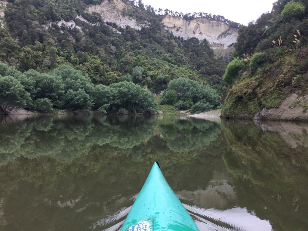
At times there were little swift rapids to urge me on, but as the day lengthened the river broadened and deepened and I began to feel the momentum go out of the water. I’d checked the tide and thought I’d have little, if any, time paddling against it, and the forecast indicated little headwind. But as the going still got harder and harder, I realised the real issue was that I was now very close to sea level. The river was hardly moving. I slogged through it, chopping at the water with my twin-bladed paddle like a climber swinging ice-axes.
I stopped for lunch and a cup of coffee on a muddy beach in the middle of nowhere. The bluff I’d stopped at for the photo at the beginning of this post towered above me, covered in bush. At my back, more wild ridges. In between, the old, deep, hard-driving river. I was alone in a huge landscape.
Further on I passed the first riverside suburbs of the city of Whanganui. Now I was really struggling – two 40km-plus days of kayaking taking a toll. I stopped for another brew on a mudbank.

Before leaving Wellington I’d I worked out on the map the closest affordable accommodation to both the river, and the continuation of Te Araroa. The trail turns from the river to the south at the suburb of Durie Hill, and right at that point is “Hikurangi StayPlace”, a hostel mentioned in the Te Araroa trail notes, including the line: “can help collect/store canoes/kayaks for those coming all the way down the river.”
I hauled the kayak out up the riverbank where Anzac Parade meets the James McGregor Memorial Park and considered my options. It would be an awkward 500 metre walk to the hostel, in my wetsuit slippers with my kayak on my shoulder. I could probably have sorted out something in advance, but it’s better not to be too rigid in your planning when you’re at the mercy of currents, tides and your own energy. I’d thought: I’ll get to Whanganui and see what happens. Now here I was, cold, bedraggled, bone-weary and hungry. I rang the Hikurangi’s front desk, said I was a Te Araroa hiker/paddler, and explained the situation. The proprietor barely turned a hair before generously agreeing to come and get me.
“Have you got a roof-rack?” I asked.
“No, but it’ll be fine. See you in five.”
He pulled up in his car, lashed the kayak on the roof of his quite nice car with a rope he had in the boot, and five minutes later we were pulling in to the “StayPlace”.

That sweeping driveway leads into large grounds which might once have been park-like, but now feel dramatically overgrown, as if the hostel is being slowly drawn back into the bush which once lined the entire river.
My host showed me where I could stash the kayak out of sight behind a garage, and we went in for check-in.
Inside the main doors a wide timber staircase curved grandly down. The whole place had a faded grandeur to it, as well as something equally faded, but sadder, that I couldn’t put my finger on. But it was shelter, a private room was only $50 (actually I think it was less because he gave me a Te Araroa discount), I’d done 80-odd km in two days, and it would very much do.
The proprietor showed me to my room, which had a shared bathroom alongside. I quickly realised the StayPlace’s history: it had been an aged-care facility. Many of its original fittings were intact, so I felt a bit like I was squatting in a rest home, and the residents would soon return to demand their narrow beds. Or that time had speeded up, and I’d reached my own final, straitened home. It was a little ghostly. But it was also endearingly odd.

My room was just big enough for a single bed, a small wooden desk with a straight-backed chair, a hand-basin and a closet. There was a barred window which opened slightly, giving a view of a damp courtyard, cracked concrete veined with moss, exuberant vegetation creeping closer.
I lay on the bed and looked at the high ceiling. Mobility rails were screwed above the bed at the head and side, and a kind of hospital-grade vinyl buffer ran around it. Everything spoke to me, in that slightly overtired and overwrought moment, of broken dreams. How many elderly folk had died in this very bed, I wondered. Had any loved ones held their hand as they slipped away? It didn’t feel like it.
I shook off these gloomy ideas, hung up my wet gear and went to investigate the shared kitchen. My loose plan was to go from there to the nearby Four Square, get lots of carb-rich food and come back here to cook. I wasn’t very enthused about this plan, though, my whole body aching from the long paddle. Maybe someone in the communal areas would have a better idea.
On the way to the kitchen I passed a few residents, all older men, all apparently alone. A silver-bearded, hard-eyed guy unlocking the door of a room half-turned to stare at me, then saluted with an opened can of extra strong European lager, several more clanking in a plastic bag on his wrist. “Evening, chief.” The tone indicated polite reserve, but no invitation to chat.
A whiff of booze and loneliness came from one or two of the other rooms I passed. But there was also faint laughter, a trace of banter, tinny music.
There were two more men in the kitchen and dining area. Both wore high-viz and workboots. They were preparing meals in stolid silence. A third man came charging in, somewhat middle-aged, gaunt but vibrating with desperate strength, his eyes wide and nostrils flaring, a large kitchen knife gripped in one fist. He slammed open the fridge door and rummaged through a plastic bin with a name scrawled on it in marker pen – his own name, presumably, although the knife might have suggested otherwise. The other two ignored him and he didn’t seem to register anyone’s presence. Keen not to catch his eye, I turned my gaze and saw the notice board. Pizza delivery flyers were stapled to it. I grabbed one, went back to my room and rang the number.
After dinner I had a shower in the heavily hand-railed bathroom – complete with a sort of a crane for lowering people into the bath – then went to bed. I thought I’d have trouble getting to sleep in the slightly haunted atmosphere. But the amount of pizza I’d eaten and the distance I’d paddled put paid to that.
Day 72: Rest / logistics day (0km)
The next day was not particularly restful, and I actually covered about 200km by car and bus, but at least I had a day off walking or paddling.
The main item on the agenda was retrieving my car from Pipiriki. The Te Araroa trail notes mentioned the possibility of a lift up the River Road with the mail van, so I rang the number and was told I’d be picked up from the Hikurangi at 7am.
When I walked down the StayPlace’s broad front steps at 7am the postie, Valerie, was already waiting in her big silver people mover, loaded up with letters, parcels, newspapers and junk mail. Also in the back seat was Valerie’s sleepy granddaughter, who greeted me with a tired wave and promptly fell asleep.
As we drove upriver Valerie and I exchanged our stories. A South African immigrant, she and her husband had had the River Road contract for a while now, and she enjoyed it.
“It’s the people,” she said. “You get to know them. They appreciate the service – it’s important to them. We drop off just about anything you could want.”
She liked the way the families and the land were so linked. “All the families up this road, they’ve been here for generation after generation.”
All the post boxes were sited in such a way that she could pull off the road and put the mail in without leaving her seat. She had everything on the back seat placed so she could twist in her seat and grab whatever she needed:
“These guys get the Chronicle, and the free paper, and I’ll give them these brochures as well. I know the dad here likes a read.”
Whenever she could, she glanced in the rear-vision mirror at her sleeping grandie.
At Pipiriki my car was waiting safe and sound. I took off fairly quickly, wanting to explore a bit on the way back down to Whanganui.
At Matahiwi I stopped to have a look at the old Kawana flour mill, built in 1854 to mill wheat grown by local Māori. It’s been beautifully restored, along with the nearby miller’s cottage.
Not far away is the Matahiwi Gallery and Café, housed in a former primary school. This impressive replica steam-boat is out the front.

It was used in filming, primarily on the Whanganui River, of Vincent Ward’s 2005 NZ-British war drama River Queen, which starred Cliff Curtis, Temuera Morrison, Samantha Morton, Kiefer Sutherland and Stephen Rea. The boat is a hell of an artefact, a monument to the efforts of all those who try to tell compelling stories of the colonial violence inflicted on Māori.
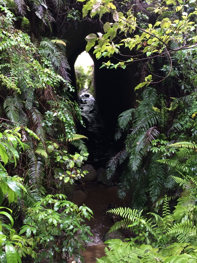
Further down the road I stopped at a sign indicating a five-minute walk to the Tunnel Culvert. It’s a key-hole shaped passage under the river road, set in thick bush, and the way all that green reacts to the sudden shaft of light is rather lovely.
Back in Whanganui I pondered what to do with the afternoon. I had plans of carrying my kayak from the Hikurangi StayPlace back down to the river and paddling the remaining five-or-so kilometres out to the river mouth. It just appealed to me, out of a sense of completeness and, I don’t know, poetry, to have kayaked the entire navigable part of the river, from Taumarunui all the way to the Tasman Sea. But how would I get the kayak back to the Hikurangi?
I drove out to Castlecliff Beach, which is where I would come ashore after passing the rivermouth breakwater known as North Mole (the official end of the Mountains to the Sea cycle route). The receptionist at a campground there agreed to look after my kayak while I bussed back into town to get the car. It was all theoretically possible. But the appeal started to fade. The day was waning, the weather wasn’t great, I was still feeling pretty broken from my long paddle, I was close to missing the outgoing tide, and it all began to seem a bit hare-brained, especially considering I had to walk 33kms the next day.
I canned the idea and went down to a reserve at the river’s edge for a last look out through the mouth of the mighty Whanganui, into the everlasting sea I’d been journeying towards on Te Araroa for the last long while (since the trail left it in south Auckland, in a way). This straight-shooting sign was there. Somehow, it summed up the bone-weary, disillusioned feel of that over-ambitious, time-wasting afternoon:

I went back to the Hikurangi Stay Place. On the way I picked up fish and chips and resupplied at Pak n’ Save for the next few days – noodles, biltong, peanut butter, crackers and oats.
Day 73: Whanganui City to Koitiata (33km)
I breakfasted in the dark and was soon out on the riverside path. Across the water, the famous Waimarie riverboat shone in the soft light. Waimarie: peaceful water.

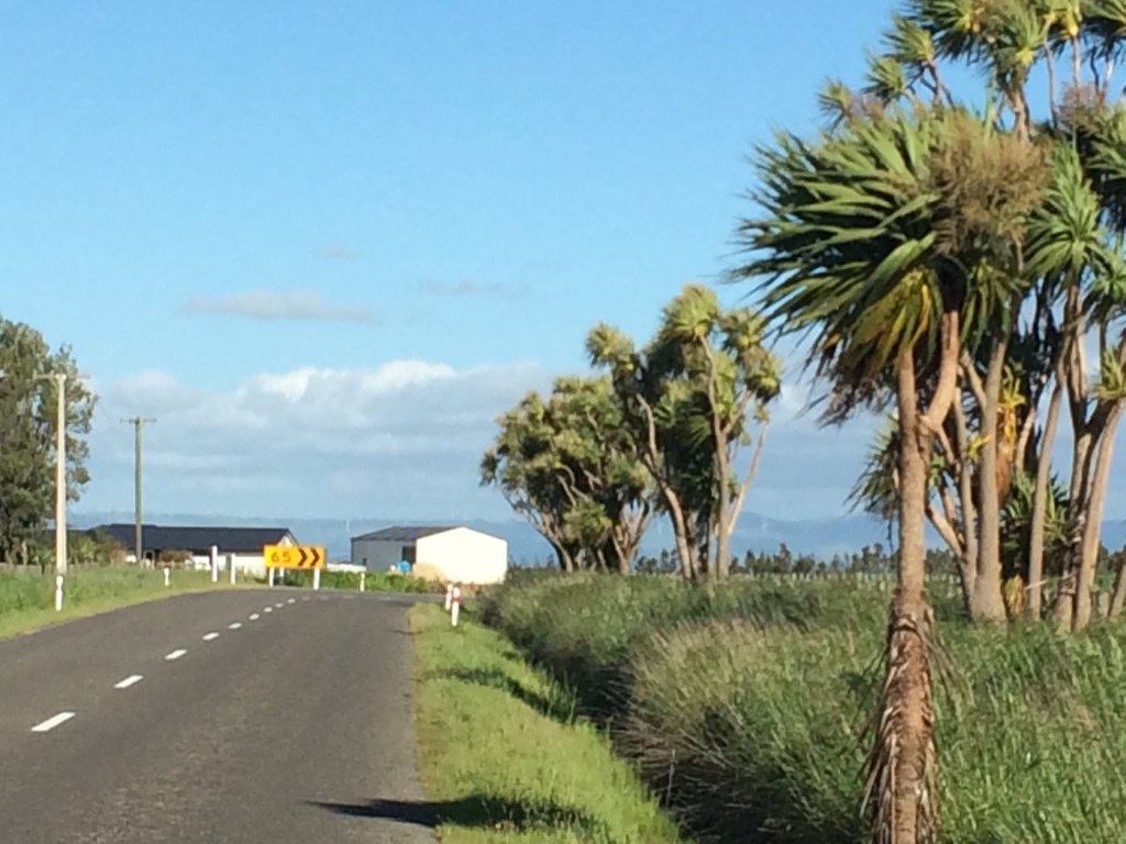
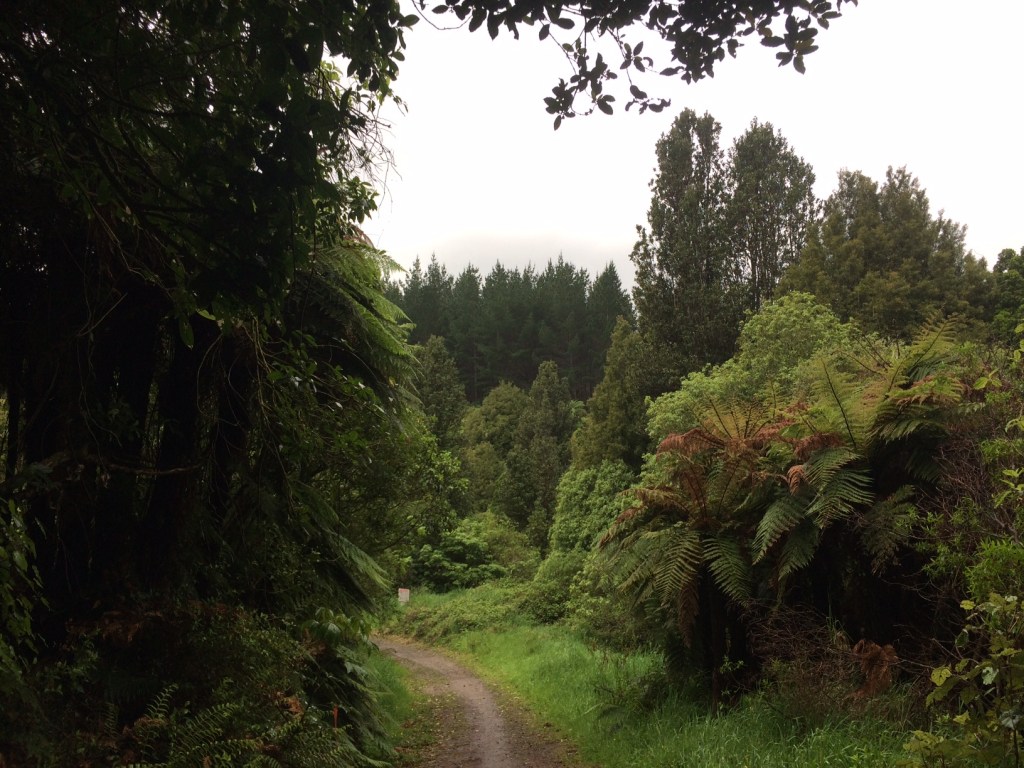
After a short jaunt along the river, the Te Araroa route provides a few options for getting the hell out of town, including the famous Durie Hill elevator (now operated by NZ’s number one popstar-slash-civic-values-advocate, Anthonie Tonnon). But I decided on the direct approach of Portal Street: a portal between city and country. In no time I was out in the big green desert of NZ’s favourite monocultures, grass and pine. Still, it has its wide-open, tumbleweedy sort of charms:

It’s a long, dull slog along the poetically-named No. 2 Line, a flat, 14km, tar-sealed, dead-straight shot all the way to Fordell, a crossroads in the verdant wastes. This kind of stretch isn’t particularly romantic, sure, but most of Te Araroa isn’t like this – they only send you down a road when absolutely necessary, and even then they try and make them minor roads. This one was quite busy though, and at this early hour I had a steady stream of commuters hammering past, which was awkward with the narrow verge. You couldn’t relax, often having to sidle off into a steep ditch to give oncoming traffic plenty of space. I kept count of the cars at one point to pass the time and soon got to over a hundred – just those coming toward me. And there’s nowhere, really, to take a break – even when you’re having a cuppa, those clanking, fuming death-machines thunder by.

Tramping the length of NZ has its dull, ordinary and even painful moments, of course – what doesn’t? Avoiding an on-coming ute, I slipped over in a ditch, slopping mud and slime up my legs and grazing my hand. A passing schoolkid on a bike saw the whole thing and her eyes widened as she slowed. “You OK?” It was kind. I brushed myself off and smiled, but inside I was a bit dark. It’s all part of it though. As the gurus say, if you spend all day kicking the earth, sometimes it’s going to kick you back.
And you just have to find the joy in the trail, no matter what kind of section it is. Just the pleasure of advancing along the long spine of the land, step by step. Of just being literally on the road, Kerouac-style, with only your vital needs on your back, the past behind, the future ahead. Of the purist form of travel in the world: Shank’s Pony. And there’s always sights to see: the changing colour of the sky, the contours of the farms, the fabric of the tar seal, the denizens of the paddocks:
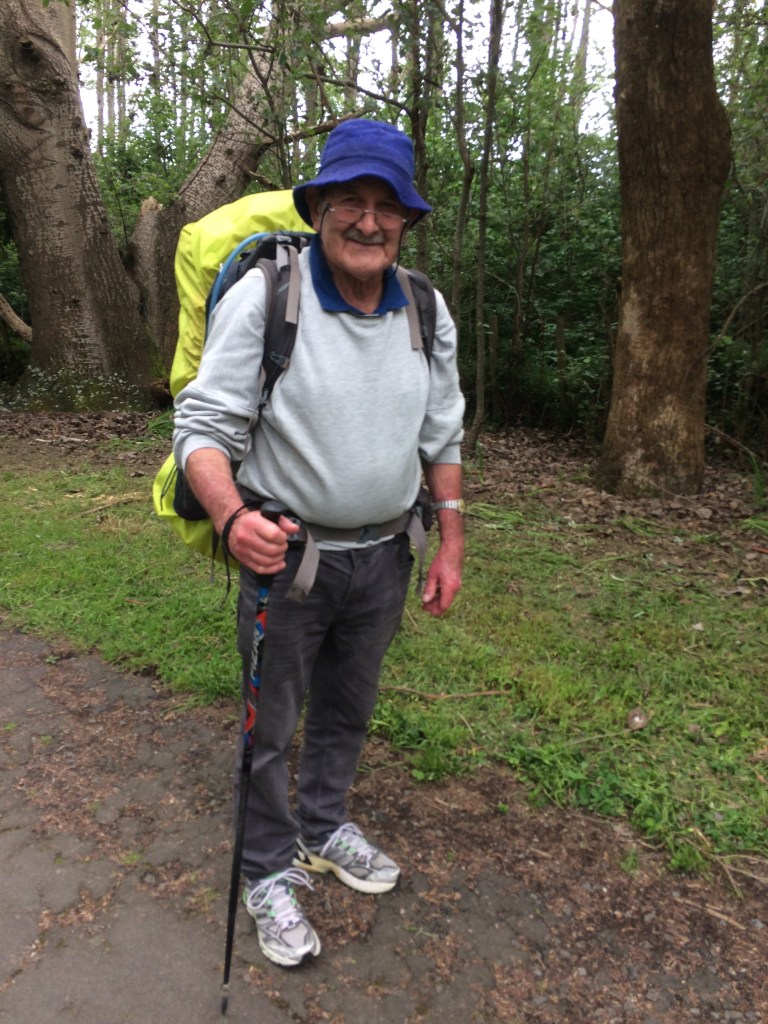
It was just after taking this shot that I met a couple of through-hikers, Kiwi guys doing the whole trail in one hit. This was early November, 2020 so they’d got away from Cape Rēinga in late September, I think. One was a newly graduated teacher who had to be at his first job by late January, so they were trying to smash out the whole of Te Araroa in four months. His mate was a builder who’d needed a holiday. Rather than rushed or hassled, though, they seemed singularly relaxed and cheerful, taking whatever the trail threw at them.
We chatted for a while as we walked, and I noticed, not for the first time, the easy, ground-covering way through-hikers walk. They don’t pound at the road with the poles and feet, they just swing along, knowing that no matter how hard you walk you can only go so far in a day, and that there are many more days to come. Then they stopped for a break. I’d just had one, so we parted, smiling, knowing we’d likely cross paths further on.
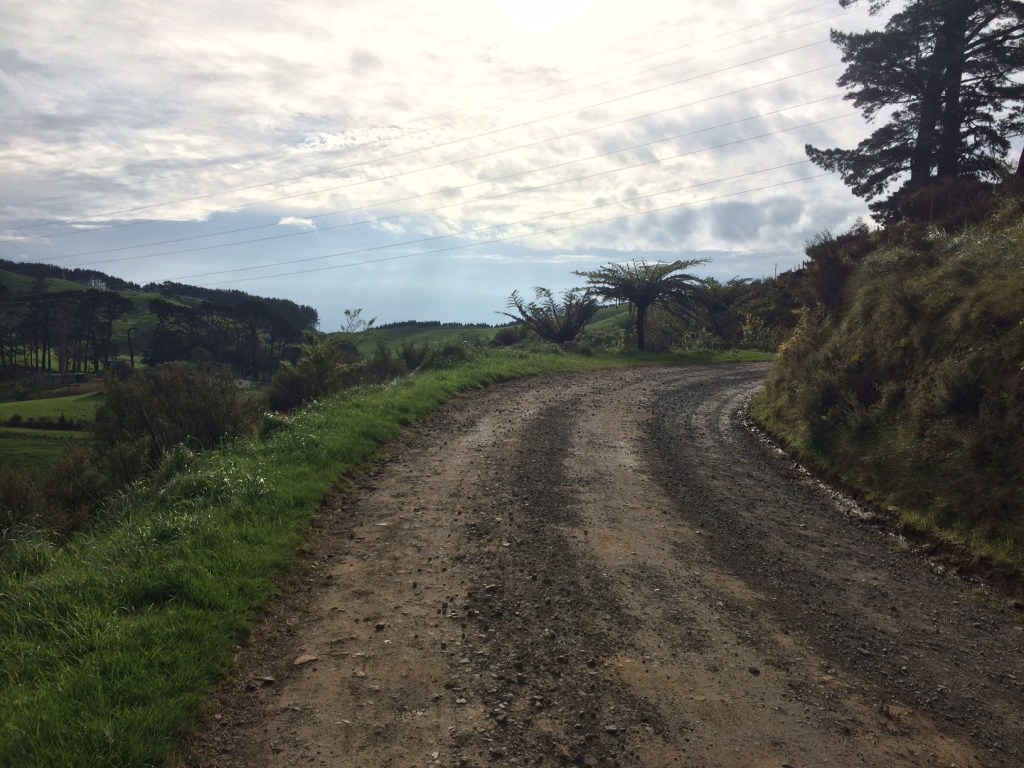
At Fordell you turn right – west – onto Warrengate Road, another four kms of rolling rural monochrome. But again, it has its beauty – the manicured contours, the dozing sheep, the neat little homes plopped in paddocks:

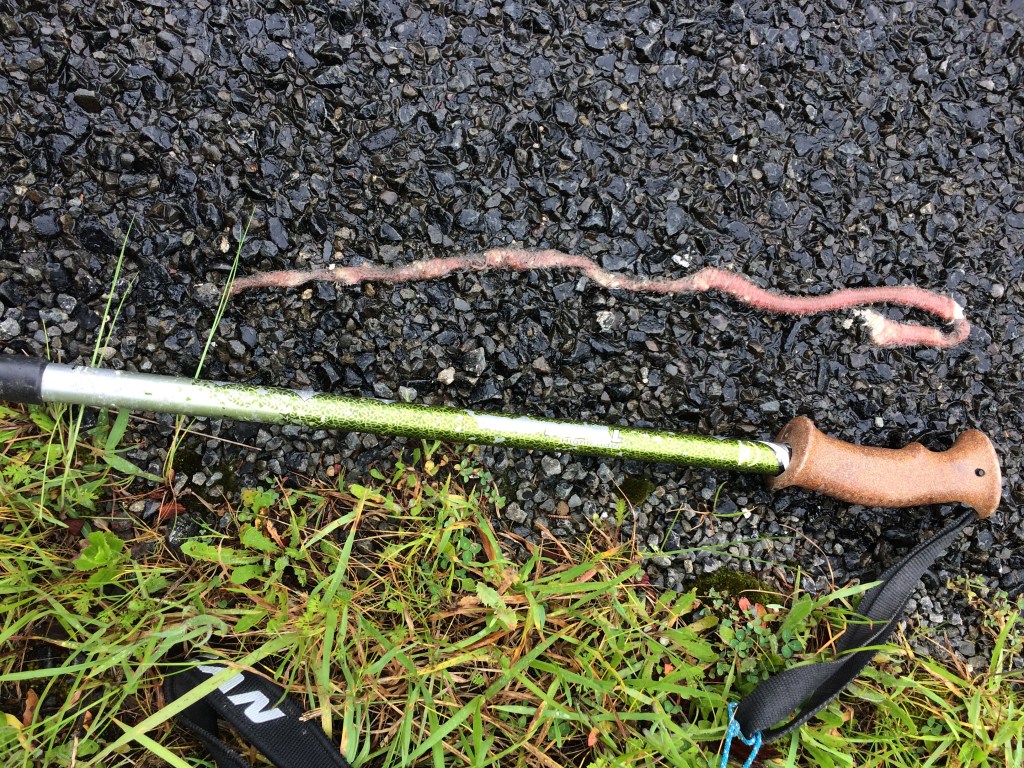
Also I found what I presume was a native earthworm, semi-squashed but still half the length of a walking pole, and nearly as thick:
Rain came and went, but you just pull on your coat and plough through. No such thing as bad weather, they say, only bad gear. And my gear was OK. And I liked the steam rising off the fresh-ploughed earth:
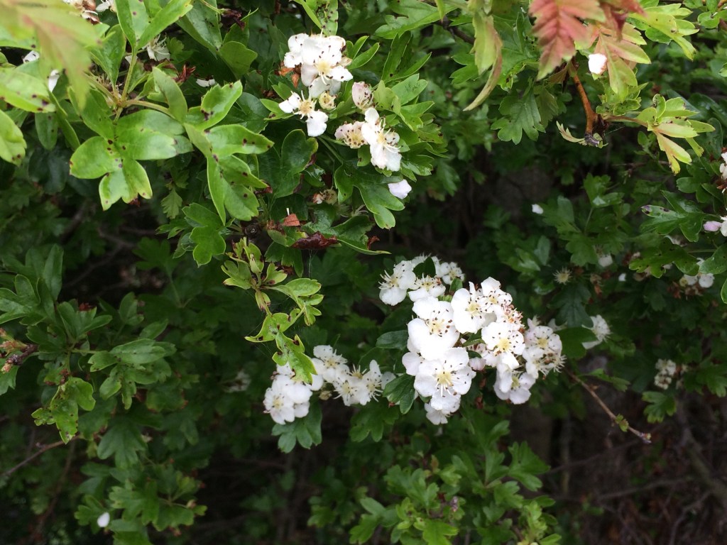
Another good thing was it was early spring, so there was lots of delicious-smelling blossom brightening up the verges:
You turn left then, back to the south, for a rare, short stint along the main highway. Trucks and buses and utes roar by like they’re fleeing Armageddon and it’s all quite hectic, but there’s room on the verge and it’s only three km. And even in the bitumen wasteland there are still flashes of beauty:

Just after the Whangaehu River Bridge you turn right down the Whangaehu Beach Road, a long and lonely stretch of increasingly sandy country. I was looking forward to seeing the sea again, having not been beside it on Te Araroa since I left Manukau Harbour, hundreds of kilometres back. My feet were killing me after all that tar seal but everything felt better when I crested a sand hill and there it was:

The teacher and the builder caught up – we’d passed each other a couple of times, during road-side breaks. We walked on together, hustling a bit now since we knew, from the trail notes, we had to make the mouth of the Turakina River within a couple of hours of low tide, a window which would soon close. I was pretty had it by this point but it was still a joy to be back on the long, dark, west coast sands, with the breakers rolling in. A few km went by in a salty, footsore daze and then behold, the Turakina estuary.
I always like these frontier moments on the trail – some sort of atavistic memory, maybe. A challenging barrier to cross. On this side, the howling wastes; on the other, shelter, warmth, security. But this one was a little daunting. How swift, exactly, was that current? How deep was the channel? But hesitating only made it deepen. And there was no one to ask, no way to know if it was crossable, except to pull off our boots and wade in.
It was not much more than knee deep, it turned out, and not particularly swift. And the chill and the salt were soothing on my battered feet. On the other side, we found our way through the dunes to the campsite in the small seaside village of Koitiata (AKA Turakina Beach). It was just visible through the flax and toetoe as we got closer:

We pitched our tents and swapped trail yarns for a while in the cooking shelter over dinner. The other two were full of stories and fairly bright-eyed, trail-hardened after five weeks or so of constant walking. But it was my first day back on the trail, not counting the kayaking. So I was soft as butter and exhausted as a tail pipe, and after briefly ackowledging the sunset I passed out like a semi-squashed native earthworm in my tent.
Day 74: Rest day (0km)
On this leg of Te Araroa, Koitiata was the only chance I’d get to have a rest day somewhere truly picturesque, and truly off the beaten track. Plus I was truly sapped: I still hadn’t recovered from all that kayaking, let alone 33km walking hard roads and harder sand – all in all, a hell of a way to kick off a multi-day tramp. It’s funny though, justifying this to myself as I blog reminds me of the slight battle I had at the time to accept the decision. Part of it is the trail just gets under your skin and starts calling you on: “Another few kms, you know you want to, Bluff is waiting…” And part of it is the enduring clouds of the Protestant work ethic and Catholic guilt, which can make the noble art of idling seem decadent, even sinful. But who cares if I took a day off? Who did I need to impress? I was on holiday. I’m walking the trail purely cos I want to, and I could’ve camped at Koitiata for 10 days if I chose.
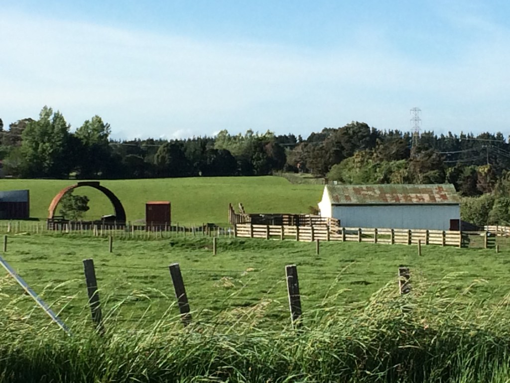
Silly faux-moral hangovers resolved, I had a sleep-in and a lazy breakfast in the camp’s cooking shelter, reading my novel (I pack light, but always pack some fiction – the extra weight is well worth it). Then a good chat to one of the long-term residents of the campsite. He’s a teacher and lives with his partner in a massive house bus. They each had Rav-4s to get to work, and a couple of big dogs. He was full of cheery story-telling.
That theme of family was prominent among the stories. He’d saved his twin brother’s life with a stem cell transplant; he had nursed both parents through long and painful deaths. Then, worn out, he’d hit the road.
Now he was relief teaching up and down the coast, staying in little campsites like this. He had an air about him of relishing the living of life firmly on his own terms, and simply, and freely. His partner appeared with the dogs; their easy banter spoke of another kind of family love.
I went exploring and found these two huge whale vertebra that had washed up here years before.

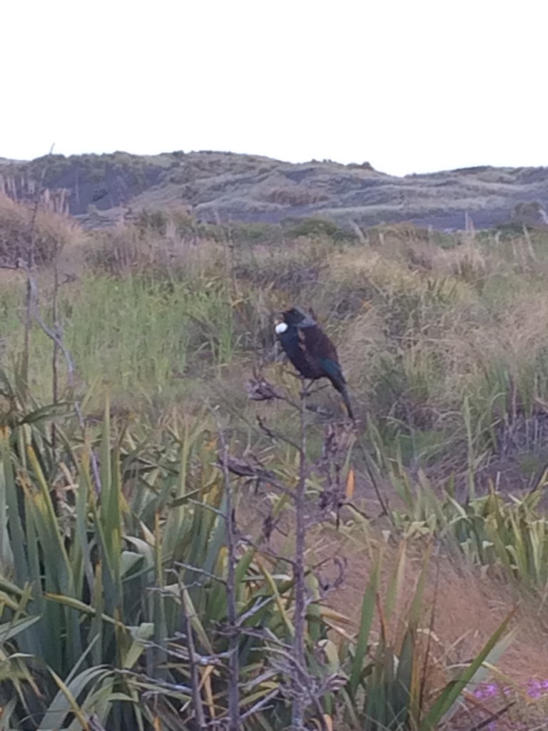
The dunes were a quiet wilderness, complete with tūī feeding on the flax. This one seemed to sit and wait while I got a photo.
I walked down a boggy path through the dunes to the beach.
(Note to TA walkers: if you’re continuing from the campsite, this track is tempting as it’s south-tending, but it’s so boggy you’re probably better taking the one that goes slightly back north past the whale bones, briefly toward the river-mouth then onto the beach. It’s quicker and dryer.)
Once I made the beach, it was bliss to saunter along in bare feet, no back-pack, just a towel and a book, a bottle of water and a snack.
I read for a while, leaning against a storm-ground log and enjoying the wide, salty wildness.

Then I had a bracing swim in the sun-washed waves, and strolled back past the whale bones to the campsite. Near my tent there was a raised wooden platform with cell phone signal, and a great view of the sun setting over the Tasman:

I was back in my tent not long after – the next day would be another long one.
Day 75: Koitiata to Bulls (29km)
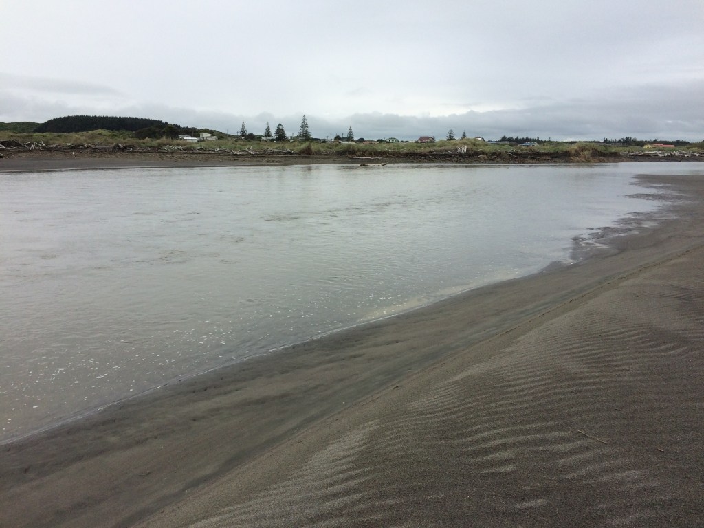
I was on the beach soon after dawn. It was a joy to be striding along while the sky, sand and sea lightened. I love these ribbed patterns outgoing tides often leave.

As the sun rose the palette warmed.

At one point a noise warned of a vehicle thrumming closer behind me. As it neared I heard the revs slow and turned to see a big dude on a red quad bike. His shaggy black hair was billowing, he wore rugby shorts, a singlet and a warm grin, and had fishing gear stacked on the rack behind him. As he came abreast he yelled:
“Ow, you’re keen mate!”
I grinned back but before I could respond he accelerated away, free hand out in a huge thumbs up, shouting into his slipstream:
“Go hard broooooooo!”
I love a long walk on an empty beach and this was vintage stuff: a huge sky, a swathe of sea and a sweep of sand, strewn with massive logs, a thousand seagulls and little old me.
I was relishing it but my feet still hurt badly from those 33 kms, which was a little disconcerting. Normally on Te Araroa stints, sore feet don’t trouble me like that, or if they do a rest day fixes them. Either I was getting soft, or I needed some new tramping boots. Every rest stop, I let the poor battered things breathe a bit of sea air.

Part of the reason I’d got started early was to make the most of the firm footing provided by the low tide, and at first I zoomed along. But it wasn’t long before I began to get forced up into softer and softer sand. Soon I was picking my way between driftwood trunks.

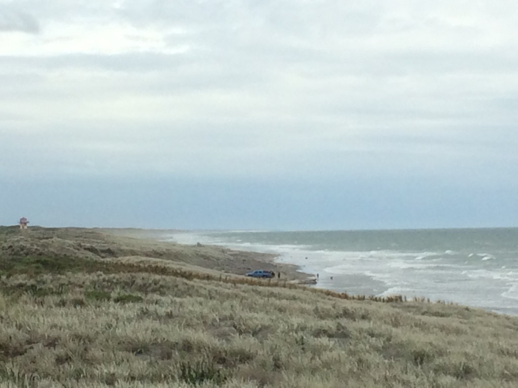
Still, it was a good, if hard13kms down that magnificent beach before I had to turn inland. There was supposed to be a marker by a stream bed but after floundering around a while in the dunes I was buggered if I could find one. The trail notes went on to say: “If you get to the fire lookout you have gone too far by about 1.5km, go back, do not enter the bomb range.” Keen not to get blown up, I found a high point on the dunes and looked south. Ah, there she blew, the fire lookout, with some fishers putting out a long-line nearby. Mum, dad, kids and some cousins by the looks. Family again (fire tower in the background):
From the same high point it was satisfying to look north and see the vast scope of the land I’d covered, on foot and by paddle, to get here. Beyond the long crescent of stormy beach, those faint hills on the horizon suggested to me all the choppy wilderness between Whanganui and the volcanic plateau, and beyond them up to Waikato and the King Country.

But it was time to head inland again. I turned away from the sea with a bit of a heavy heart, knowing it would be a couple of hundred tough kilometres before I’d be walking Te Araroa beside it again. More floundering followed as I tried to find the forestry road Te Araroa uses through the Santoft Forest, but eventually I lumbered out onto it. The antiseptic hush of the industrially straight rows of plantation pine was a bit of a let-down after the manic jumble of the beach. But the trail is the trial, and on I went. Soon it led me out of the pines and onto farmland.
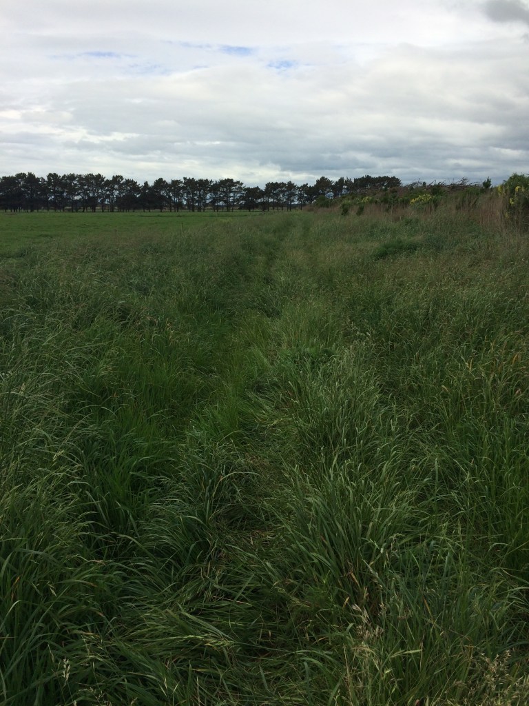
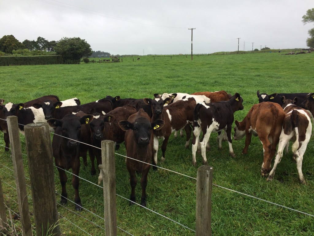
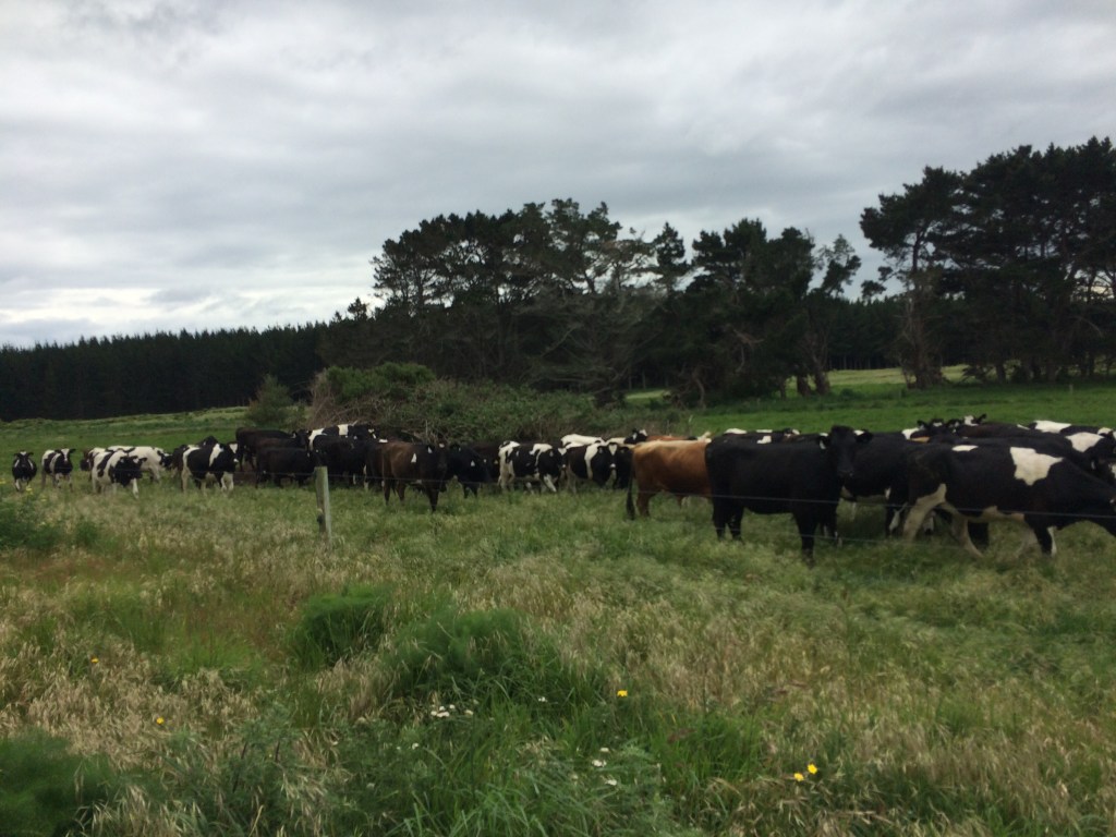
For a kilometre or so, an intensely staring mob of hungry cattle followed me, trotting and even full-on running, piling into each other, keeping pace, desperate not to be at the back of the mob in case I started tossing hay-bales. It was funny and a little unnerving – a mob that big, moving at speed, makes a panting, rumbling, bone-shaking sound that is quite something. And they’re all staring straight at you, no doubt wondering if you’re carrying anything edible. Or if you are. No, they’re vegetarian… so maybe they’re trying to work out if you’re vegetarian, and if not, plotting how to get through that wire fence and persuade you at hoof-point of the merits of a plant-based diet.
Then came Raumai Road, a very long, very hot stretch of back-country tar seal. Man, that bit was hard work. The sun was out, there was no shade, my feet were murdering me, and the heat was bouncing back from the tar seal in glassy waves. The road was dead straight and all you could do was plod along. I’m not normally one for selfies but it was so hot I clipped the shade-wings onto my cap, and frankly, they were too magnificent not to record.

That road was flat and straight, a lethal, gun-barrel straightness you can only fully grasp by walking it. Normally there are points up ahead to work towards for motivation and relief: interesting trees, curves in the trail, the brow of a hill. But here, it all looked pretty much the same. So it was just shoulder your pack, grit your teeth and plug away. A long time seems to go by; you check your map; you’ve done a kilometre. You lower your head and grind on.
I don’t want to overstate the hardship – as mentioned before, every bit of trail has its particular character and charm.
The wind got up a bit and provided some relief, whining a ghostly music in the powerlines, and making the tī kouka (cabbage) trees rattle and clack.

The spring sky loured atmospherically above the old man pines, the powerlines and the artificially-stimulated green of the paddocks. This bit of trail’s charm was, I decided, a sort of industrial-gothic.

On and on went the road. I toppled down in the long grass and watched the clouds form a face, ringed by seed-heads. I fell asleep.

When I woke up the road was still there. On and on I walked. Locals pounded by, mainly in large, expensive-looking utes. They were all in a hurry and they didn’t seem particularly friendly. Bloody pedestrian townies, I imagined them thinking. Why wouldya walk when ya can drive a bloody big shiny high-powered UTE? Bloody hippies. But this was probably unfair because the first locals I actually met were lovely.
I’d rung ahead to book a night at a homestay mentioned in the Te Araroa trail notes, at Jo Gallen’s on Brandon Hall Rd, on the outskirts of Bulls. I’d said I’d be getting in around 6pm but it was becoming clear it would be quite a bit later. I rang and Jo said that was no problem, and that she and her partner likely wouldn’t see me till the morning anyway, as they were out for the evening. “But it’s no worries, the kids’ll look after ya. I’ve trained them up”.
It began raining hard, great heavy sheets of wind-driven rain, lashing right into my face. I pulled down the shade sails, put on my coat, hoisted the hood, leaned into the rain and ploughed on. I felt like an unfit, footsore Shackleton.
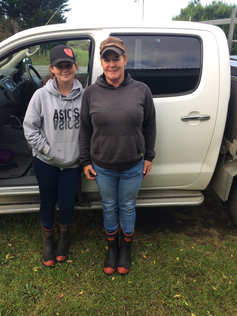
Soon after Raumai Rd turns into Parewanui Rd I was churning painfully along when I saw a small four-wheel-drive zip past in the opposite direction. It chucked a nimble U-turn and pulled up alongside. A gumbooted teenager got out. “Are you staying at the Gallens?” It was Jo’s eldest daughter. Tasked with checking me in, she’d got worried when 6pm came and went, and come to get me. She shrugged off my thanks as she stowed my pack in the boot. “Don’t wanna be out here any longer than ya have to, do ya?”
The Gallens have built a cute, comfy little hut in a paddock beside the house, especially for Te Araroa hikers. Jo’s three capable, cheery young adults showed me to the hut, a shower, a beer, and barbecued steak and chips for dinner. It was really the most amazing, gentle hospitality and I actually felt a tear in the corner of my road-weary eye. After dinner, I fell asleep in the little tramping hut trying to watch the All Blacks-France test on my phone.
Day 76: Bulls to Fielding (about 28km)
In the morning I met Jo, who was as kind and down-to-earth as her kids. She was about to leave for work and, it being in the right direction, agreed drop me off where her daughter had picked me up. (I’m pig-headed about not skimping a single metre of the trail.) As I got out of their ute I felt quite mean about my ruminations the long afternoon before, unfriendly locals glaring from their Hiluxes, all that. These locals were all generosity, work ethic and good humour. They took a pic of me for their Te Araroa Tramper Photo Wall of Fame, and I got one in return. This tight-knit family are dead-set, trail-magic champions.
I slogged the 4km into the centre of Bulls. Having to catch up some of the previous day’s goal made me feel a bit like I was running behind, before the day had even begun. I tried to shrug the feeling off, but the fact was, I had a long way to go in the next two days, and some fairly tricky logistical decisions to make.
This stint on the trail would be the closest in the entire 3000km+ journey that I would get to my hometown, Dannevirke, to my own roots in this land I was walking the length of. My folks live there, and my elder brother was staying, and they’d offered to pick me up, take me back to “Dannevegas” for a bed for the night, and drop me back on the trail the next morning. They were also keen to walk a stretch or two of the trail with me, if we could fit it in.
Apart from it being great to see them and all that, it did feel apt. Walking Te Araroa, for me, is partly about reconnecting with NZ, after spending nearly 20 years away, and what could be more reconnecting than sharing the actual trail with your own actual kin, and staying a night under your own actual ancestral roof?
But on the other hand, one of the main things I love about the trail is the solitude – that rare chance to be alone, or relatively alone, while immersed in nature. Normally, everything in life seems to militate against solitude – it’s quite hard to just get right away from people and plunge into non-human nature, all on your own. It’s a kind of enjoyable spell, which I find the trail casts on me – a rhythm, a daze, a kind of hypnosis by active movement, distance and nature. Would a family catch-up break the spell? Did that really matter?
I thought about it at the Mothered Goose Café at the central crossroads in Bulls, over a colossal breakfast and quad-shot flat white. But there’s nothing like walking for thinking, so I was soon back out on the road.
It was re-orienting, walking across the bridge over the Rangitikei River. It’s a sensation I’ve often had on Te Araroa: a place I’ve driven through a thousand times snaps into strange, high-definition focus, simply because this time I’m on foot. The bridge is a bottle-neck on the country’s main state highway; trucks roar and the whole structure vibrates as they brake for the 50km/h zone of Bulls’ main street. But there’s also a powerful river, close to the coast, draining a massive hinterland. It’s steely blue in the deep parts, white and seething in the rocky narrows. There’s shingle, mud, willows. A living natural feature of Bulls that I’d never before noticed. I don’t think I even knew that river was the Rangitikei, till that moment. I mean I always knew of the river, often kayaked it; just not really registered that you cross it to enter Bulls from the south. Never looked up it, from this point, towards the mountains, nor down it towards the sea.
Over the river, you scuttle across the howling murder-trap of the State Highway and into Wightman Road. This name, along with those industrially green paddocks with their ram-rod fences, sparked some unkind thoughts about what colonisation (“the White Man Road”) has done to the land, not just here but all over the world. The relationship to the land is extractive, a means to acquire wealth – you tame it, skin it, pull what you can from it. Walking through these landscapes, I sometimes feel this extractive attitude has pulled the soul out of it, the community, the sense of it being a living system of which humans are really just one small part, instead of the overlord. That there’s no community, only shiny, over-powered machines. That the land seems stilled, uniform and strapped down, all the juice sucked from it.
Of course, you’re just passing through, even if on foot, so you don’t see the clubs, the schools, the blood-ties, the history.
And of course, I grew up in a place sort of like this. And I’m another wight-man, another member of that invasive species. It was wilder and hillier, sure, the country I grew up on east of Dannevirke; more native bush, more unfarmable gullies and peaks, fewer fertile flats. The same fertilised green, though, the same straight fences and people always in a hurry, nobody seeming to linger, always measuring, always extracting. But there were also plenty of people like the Gallens, like that dude on the quad giving me the thumbs up on the beach – ordinary people looking after each other and making their way in the world, by tending the land, by being part of the land. There was community. And I’m sure there is out here, too.
There were signs of spring everywhere. I saw these little guys scurrying to get away from me down a weed-choked drain, probably also choked with nitrogen:

It was cute but kind of sad, too – the ducklings dived for safety under the water as I passed, but that water didn’t look very safe. When they came up, their heads were encased in green slime.
There’s much air force activity around here too, with the nearby Ōhakea base, which only encouraged these thoughts – straight lines, discipline, force, might is right. Danger: keep clear.

Probably sounds like a bunch of sentimental or politicised hooey to some people, but the thing is, you’re out there walking, alone with your thoughts, and stuff leaps out at you in a new way. Because you’re walking a long way and carrying all your needs on your back, and because you’ll be sleeping that night on the ground with nothing between you and the stars but stretched nylon, you’re in tune with your environment in a fairly unusual way. You could get to your destination in 30 minutes if you drove like a normal person, but you choose not to, so it will take all day. What a delirious squandering of time and energy! You’re “tramping”, but it’s not normal tramping – it’s not birds and trees and rivers, it’s pylons, highly-engineered tar seal, no. 8 wire, irrigators, ruler-straight ditches, cowshit, money, extractive industry. It’s a bit of a weird experience.

And yet. As I turned down Hurst, Wilson and Ngaio roads, I saw that something remains in the land, despite all the above. The land is the land and it has an energy to it that might survive just about any human interference. (I guess we’ll find that out.) The curves of the land beyond the road; its different colours and textures; the way it falls and rises, layering itself with trees and sky.
Then something else appeared. For the first time from the trail, I could see the Ruahine Range, the one I grew up looking at – that was from the other side, the east coast, and now I was looking from the west, but I still recognised it. That long, rolling, softly jagging shadow.

It told me I was walking directly now toward the land I grew up on, just on the other side of that range. It moved me in an unexpected way. I hadn’t realised this would appeal to me as much, but it made sense: in a way, for the first time Te Araroa was taking me home. Or to a version of home.
I stopped at Mt Lees Reserve, where there’s a historic homestead and a free campground with drinking water and a toilet. I thought about staying: there was a lovely patch of bush, the first I’d seen for quite a while, with a loop track. But I decided to push on – I felt I hadn’t done enough distance that day to really merit a break, and it would make the logistics of meeting up with my family much easier if I got to Fielding that night.
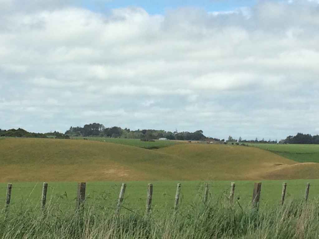
As I moved towards Mount Biggs School along Mount Stewart-Halcomb Road, I reflected on these names. It’s the Manawatū heartland, a huge flat farming area, and yet there’s these two “mountains”. But, I realised, it did actually feel like a high point – without my realising it, the route had gradually brought me up from the river onto a kind of ridge, the fertile land falling away on every side. Walking along this windy high-road, I could look far up into the blue distance in the north, until the land dissolved and it was like a glimpse of infinity. Some might say this is boring country to tramp, but to me it began to take on a certain power.
The wind whistled like a train right down that ridge, making the tī kouka trees ripple and clatter. They were in their early summer bloom and the subtle fragrance of their clouds of small, white-and-yellow blossom drifted across the road on that powerful westerly.

Being immersed in the energy of that westerly reminded me of a particular joy of walking Te Araroa, or walking a long way anywhere, even on a day of hard slog: simply being unsheltered all day, simply marinating yourself in the elements. Being acutely aware of the weather, the wind direction, its changing intensity and feel. Being involved in the world, part of it, instead of interacting with it through a screen or a windscreen. To paraphrase Maurice Sendak (In The Night Kitchen):
I’m in the wind, and the wind’s in me.
Knowing exactly what the weather is doing, from moment to moment, knowing it in your body, in the pressure on your back or chest, in your hurried or curtailed stride, in the squinting or relaxing of your eyes.
Certainly more than you do hermetically sealed in a car or bus, or yomping on foot down a concrete canyon, the wind turned into a confused welter, as chopped up and funnelled as the asphalt under your feet.
In the sun the paddocks gleamed, each blade of grass a vibrant, shining green. The way they stream in the wind. In the distance, a brightness off the unseen sea.

The road had turned more southerly now and in the distance I could see the Tararua Range, the Ruahine’s southern continuation, and the white dots of its high wind farms.
I passed Mt Biggs School and the road became a long, cambered curve that dropped into a corridor of native bush, studded with the rich yellow of kōwhai trees.

The road swung briefly northward and I was walking straight toward a peak I recognised, Wharite, the southern end of the Ruahines. I could clearly see where the land dropped down into the storied break in the mountains, the Manawatū Gorge – in Māori, Te Āpiti. This place has been special for many people for many centuries and it was a special place in my childhood, too. Driving the forty-five minutes into the small town of Dannevirke from our somewhat remote farm was itself a bit of an event. But if you carried on heading west and south for another half an hour, you found yourself passing right through the heart of the high, wild ranges, which always seemed a bit like the gates to the world. And sure enough, you passed through those gates, and you reached the Big Smoke: the legendary Mecca of Palmerston North, with such wonders as Pizza Hut and traffic lights.
Now, back walking across the Manawatū plains, I could see Wharite, dropping down to the gorge, and then where the hills began to rise again, through the wind farms, into the Tararua Range. On the left, where I grew up; on the right, where this trail was taking me.

I hadn’t clicked how good this would feel, how it would tie together several things that I like about this Te Araroa journey, things that make it so meaningful to me. Of course it helped that I was swinging along in a good rhythm finally, the sun was shining and the wind was mostly at my back, the grass was streaming and gleaming in the wind, there were bright purple spring flowers in the verges and everything felt right with the world. I even began to feel more benign toward the local traffic – where I’d felt dark at people for not returning my wave, now I began to cut them some slack. I’d thought them grim-faced, ignoring me, but now I realised it could just be them wearing their concentration faces on what was a reasonably challenging, narrow bit of road. It would be disconcerting to come across a walker coming the other way, with little room for error. Also, I reflected, friendliness generates friendliness: it was true that if I made the effort to make eye contact and smile, rather than just do a desultory little one-finger-raise with my hiking pole, I’d more often than not get a wave and a smile in return.
Walking toward Te Āpiti, it began to feel more and more right that my folks would come and pick me up once I got to Palmy, half a day’s walk beyond tonight’s destination, Fielding. And join me for a bit of the trail while they were at it. It began to feel like an opportunity too good to miss.
I walked along and took in all the beauty around me – not just nature, but human-made, too. The way the farm buildings and the interventions on the land become part of something bigger, something more deeply interleaved. The curve of a shed beside the verticals of the fence-posts, the sun on the wooden rails, the rusty iron roof, the bush beyond with a pylon among it, the wheaten colour of the grass-heads, the paddock grass licked flat by the wind: everything.
I treasure this feeling that comes on the trail sometimes, usually in the late afternoon when the light is gaining that magical quality photographers love and when I’m slightly delirious with effort and depletion. Roland Barthes described it as “everything speaks to me” and that’s what it’s like – like all your senses are singing.
A motorcyclist comes toward me, totally in black on a red bike, black helmet with red trim. He brakes for the corner, right beside me and in that exact moment through his clear visor we catch each other’s eye. He gives me the slightest of nods, twists the throttle and vanishes into distance.
Meanwhile, clouds, sky and a ploughed paddock by the road provide new shades to absorb. The wind-sculpted white above the square and silver buildings, the hot blue.

Contrast with a hint of similarity is often the thing – here it’s the lumpy clods of the paddock, below the softer clods of the clouds.
In times like that, I have to force myself to stop taking photos, or I’ll never get anywhere. The day was waning and I plodded on. Things entered a new, familiar phase. The last couple of hours of a long day on the trail are the hardest, especially if it’s a rare day of road-tramping, like this one. I was really tired, I’d come a long way, and I still had a long way to go until I could eat, rehydrate, lie down and switch off. But there’s no button to push, no instant solution. You hurt, you want to stop, but you just can’t. No one’s coming to make it easier.
And you’re not in the bush, so you can’t just find a flat spot by a stream and camp. All the land around you is private. Sure, the owner might let you camp but how would you find them to ask? The house might be miles away. You might find it and they’re not even the owner – a lot of land belongs to big corporations now, not necessarily the people that live on it and work it.
You could camp on the verge, maybe, but even if you could find a flat bit would you really want to? Cars howling by; visible and vulnerable to anyone who took exception to your staying the night there? What about water?
(All of which adds to the slightly queasy, alienating feeling that road-walk days can generate. The road is a littoral space, not quite private, not quite public. Tramping it, I sometimes feel the slightest little glimmer of what it might feel like to be homeless: never having a place you’re really welcome to lay your head.)
You just have to go on.
Finally, way down Sandon Rd and onto Ranfurly Rd, the farms began to give way to lifestyle blocks. I was on the outskirts of Fielding. I liked the way the electric fences moulded to the flow of the land.
And beyond the electric tapes, there it was again – my dear old Ruahine Range, with Wharite as its full stop (or maybe comma), dropping down into the range I’d be walking up in a few days, the Tararua. I love how, on a long walk, you seem to be able to compel whole chunks of terrain like this. It feels like you’re dragging them towards you, footstep by footstep. Mohammed summoning the mountain.

Finally I crested a hill, aching in every fibre, and there it was: Fielding. Even though I’d only come from Bulls, and only been trekking along tar seal and through farm land, there was still the thrill of emerging from a kind of wilderness into civilisation, walking up and over the dividing line, the boundary between head-torches and light switches, stream-water and tap-water, easy chairs and leaning on a tree. When I was a kid and we drove into Dannevirke from the farm, there was a sign marking the town limits and we’d gleefully yell it out as we drove up and across it: “B, b, b, b, b… BOUNDARY!” A bit dorky maybe but hey, I was eight or something. Anyway this felt a bit like that.

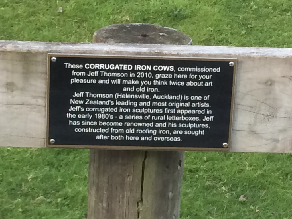
In the thinning, but still golden, dreamy evening light I came across this unexpected art installation by well-known NZ sculptor, Jeff Thomson.
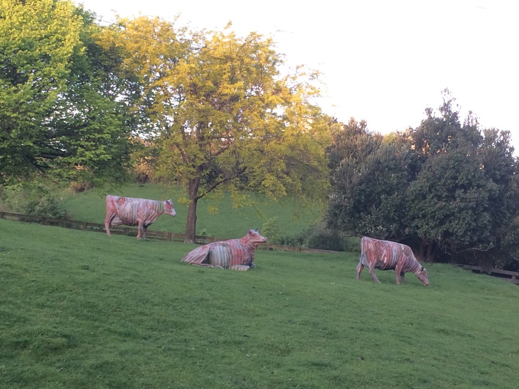
I was road-dazed, everything was speaking to me, everything was linked. Seeing these cows, by this particular artist, felt like something you couldn’t make up. When I was a kid, Thomson was one of the first artists I ever knew of – possibly the first time I’d understood the concept of “artist”. He makes all kinds of wonderful work out of corrugated roofing iron, a quintessentially Kiwi building material. He has a beautiful old HQ Holden covered in it in the national museum, Te Papa. My elder brother was into him when we were kids; we used to see his work on the side of the road as we drove up past Tirau or somewhere (in our own HQ Holden) and everyone would look out for it. The whole experience of looking for art from the car window seemed special, strange, anointed. I was struck by how this guy made art out of any old thing he found lying around in his little old Kiwi life. The beauty in the everyday. You could do that. It was revelatory, and now here it was, in a paddock by the trail.
I enjoyed the wee plaque. The prescriptiveness of it: “these cows WILL make you think. So there. Or else.”
On I stumbled, into Fielding proper. I slid down for a rest against a fence on an empty section. Some kids went by in a lowered Cortina or similar, bass thumping. One held an RTD toward me out the open window: “That dude looks like he needs a drink. What a drink, dude?” I smiled and declined. It would have been the last straw: I would have keeled over and slept right there.
There is only one designated campsite in in Fielding and it was clear on the other side of town, a good 4 kms off the trail. I hauled myself up and plugged away at those last, persistent ks of this long day that refused to die.
I wanted to click my tramping boots muddily together three times and be instantly drifting off in my little tent. But no. Still those ks resisted. I was halfway there and seriously running out of puff. I paused and tapped my pole three times against my left boot, mumbling to myself in the deserted small-town dusk.
“There’s no place like a bit of horizontal earth you’re officially allowed to lie down on. There’s no place…”
A high-powered white car pulled over. A young man leaned out the opened passenger door: “You going to the campground? Want a lift?”
Trail magic, I thought later, finally drifting off in my tent on the hard ground.
Day 77: Fielding to Palmerston North riverside path (about 25km)
In the morning I had to do those 4 kms again to get back on the trail, but I swung along through Fielding’s waking-up streets at a good clip. Soon I was out of town, across the Oroua River bridge and onto Campbell Rd, which runs parallel with the busy main road but spares you a lot of the hectic traffic.
Closer and closer came the Ruahine Range, and Wharite with its trademark TV aerial.
This next shot is taken from under a tree, where I flopped down for a rest in the shade. It was only late spring but the day was heating up, and road tramping with a heavy pack, as discussed earlier, can be brutal.

Soon after I was crossing the railway line and blessedly onto green paddocks and farm tracks again. Then came a couple of clean, wild-looking little creeks. Scenes like this are welcome respite from whooping semi-trailers and the hard pounding your feet take on harsh volcanic chip rolled into tar. I appreciate these unglamorous, but interestingly overgrown little detours off the main drags the trail takes you to, but which you’d otherwise never lay eyes on.

I was gunning for the little village of Bunnythorpe by lunchtime and made it. I raided a dairy and sat down under another tree on the grassy verge. It was strange arriving on foot in this little village, which I’d driven into so often – drop a gear, go through at 50km/h in two minutes, quickly chop back up to 100 and you’re gone. But now I had spent a whole morning getting here, watching it take shape ahead, step by step. I looked around as I ate and drank, getting a whole new slant on the place. Then on, and an encounter with this shady character:

This was in an attractive, atmospheric little right-of-way across some paddocks just out of Bunnythorpe. (The trail notes mention Stoney Creek Road, Sangsters Rd and farmland and farm driveways through to Roberts Line and Railway Rd). This guy came right up to me, stamping his foot, glaring at me. I knew enough from growing up on a sheep farm to not turn my back, and sidled away, eyeballing him right back and lifting up my hiking poles like horns. Seeming to decide I wasn’t worth the effort (or just that I was even nuttier than he was), he let me go. Later that day on the trail I was to meet someone who asked me how the encounter went – apparently this sheep is locally famous for bunting unwary walkers in the bum and sending them flying.
There were also lovely old trees and wandering chooks:

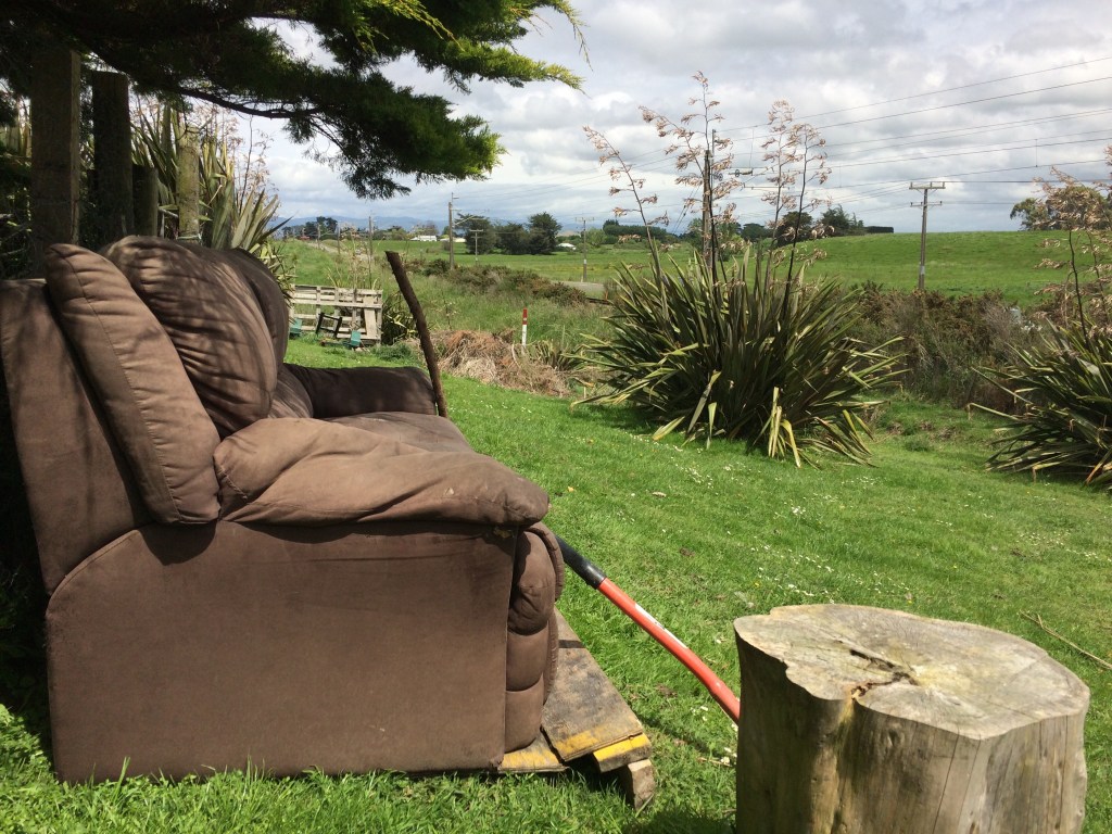
And even a complementary couch, complete with chopping block – hopefully not for the chooks or the bolshie sheep:
Crossing the next section something happened which seems a whacky coincidence at first glance – I ran into a guy I’d been texting only that morning about possible accommodation in Palmerston North. Out of all the vastness of the 3000km trail, there he was: Brian, in orange high-viz.
“You must be Caleb,” he said in greeting. This country really is an enchantingly wee village sometimes.
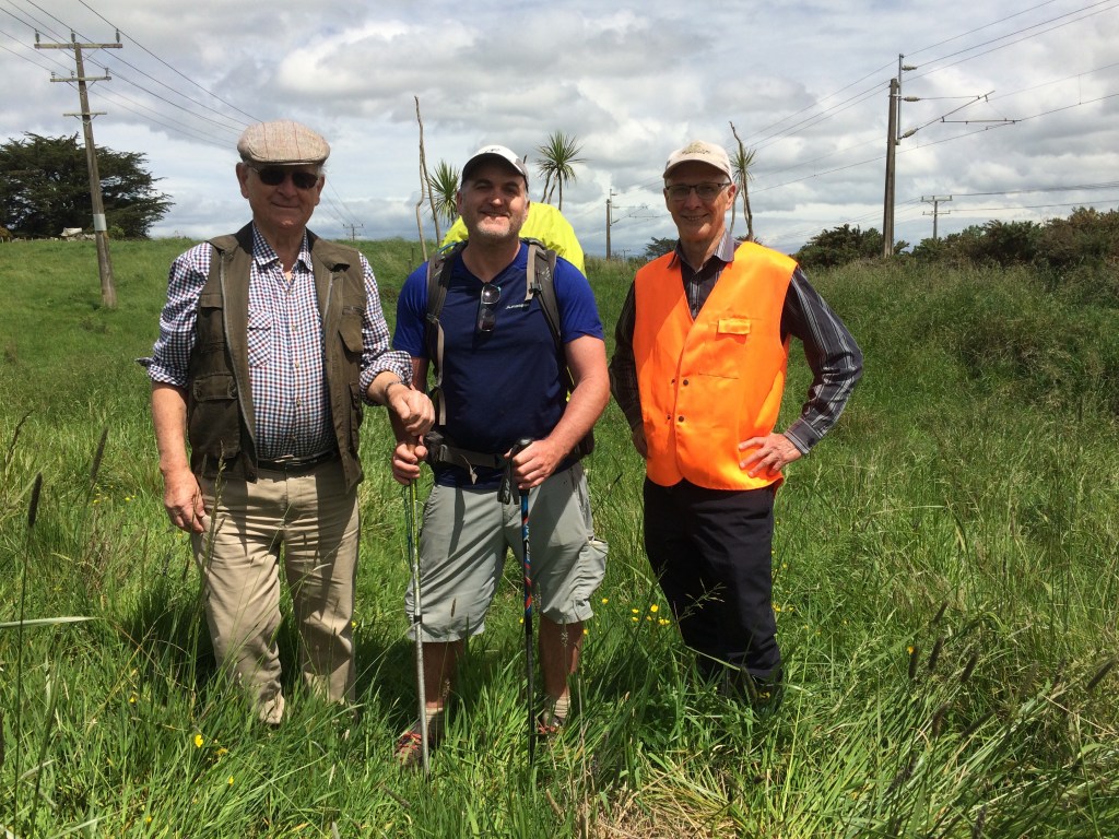
He and his wife Paula run the Te Araroa homestay, which is just off the trail in Palmerston North, my destination that day. I’d only that morning texted him to cancel, as I’d decided to stay with my folks in Dannevirke instead. Now here he was, large as life.
It turned out he’s a Te Araroa Manawatū trustee (the trust that manages the trail is organised into regional entities), and he was there to look over work on the trail with a local volunteer (on the left in the pic above). This man, whose name I noted but have lost, had done a lot of hard physical work improving the trail through the Tararua Range. It was quite special, to tramp right up to a couple of the thousands of keen, generous Kiwis who’ve made the dream of a New Zealand-long trail come true.
We had a laugh and a chat, and Brian told me about the sheep. Then on I carried on into the wide green yonder.

As I went I reflected on how ingenious it is, the way the Te Araroa trust has stitched together bush trails, unmarked wilderness, forestry routes, minor roads and farm tracks, stiles, foot bridges and right-of-ways, poles and markers to create this mesmerising thread down the heart of the country.

On and on that thread called me, with its beguiling black chevron stickers and its iconic silhouettes of a tī kouka (cabbage) tree. And in the distance I could see the mighty Tararua range, which I knew would be one of the highlights of the entire journey so far, growing closer.

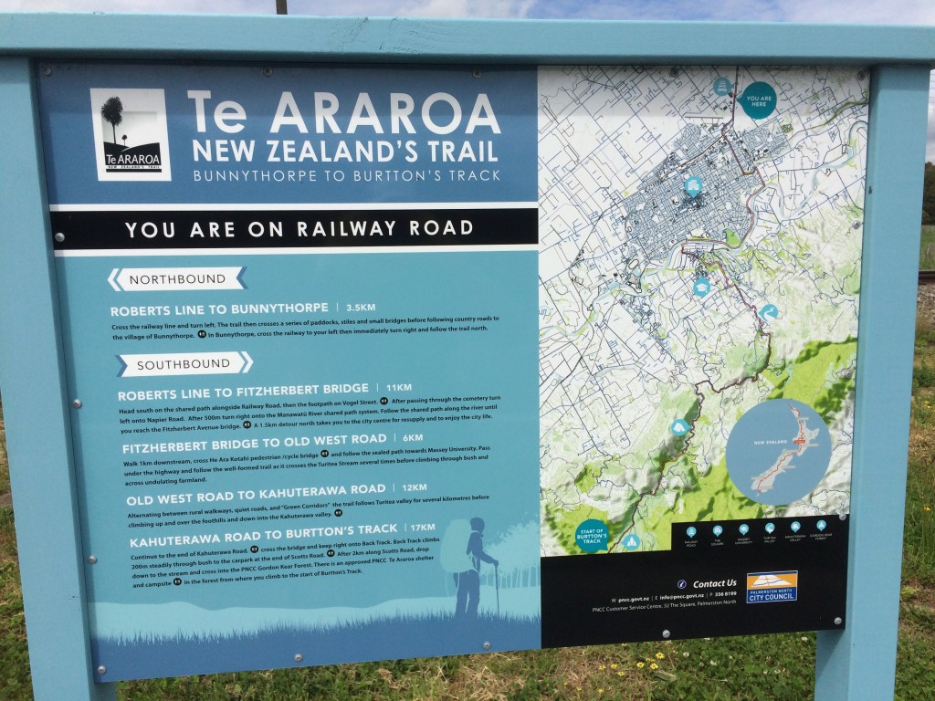
One of the interesting features of this nation-long thread is passing through different territorial authorities. It’s another little buzz of progress: “Oh, I’ve officially left Whanganui’s patch, now I’m in the Manawatū” or whatever. But also, just seeing what each of them has done with the presence of the trail on their turf. Often they give insights into the landscape, the stories behind the Māori and Pākehā names, the pre- and post-colonial history. And sometimes a glance where you are, where you’ve been, and what’s ahead. Here’s an example of the great work Manawatū has done with its trail infrastructure:
The shared bike/walk pathway along Railway Rd was a bit of a trudge but I was getting close to my rendezvous with Mum and Dad, at the Roslyn shops on the western edge of “Palmy” (just showing my local-boy credentials there). I flopped down for a rest under a tree, just opposite the end of the airport runway, and watched the big birds come in.

I entered Palmy on Vogel Street, and there were Mum and Dad, cheering and brandishing coffee and pastries at me through the car window. Thus fortified I marched on; Dad hopped out to walk a stretch with me and Mum drove ahead to meet us. The trail took us down to the historic cemetery, and through it to Napier Rd. That was an unusual little trail experience, walking with my Dad along among the peaceful pioneering dead, with their stories of hardship and determination.
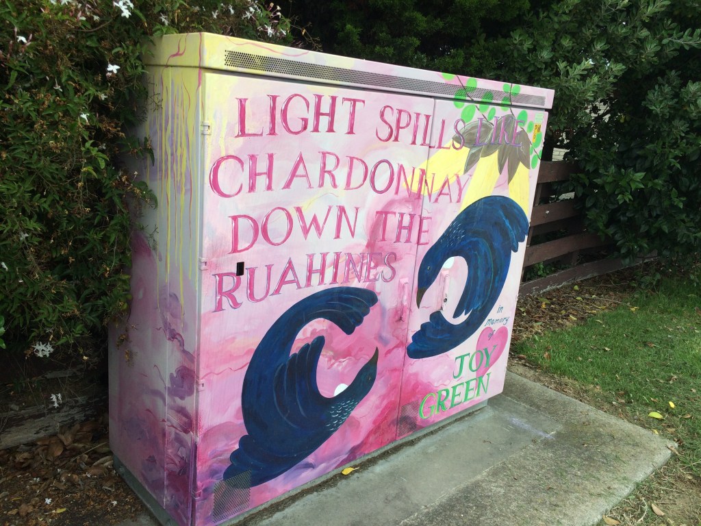
Mum walked back to meet us along Napier Rd and we passed this gem, a substation decorated with a tribute to my own dear Ruahines, which I’d been eyeing nostalgically from the trail the last couple of days.
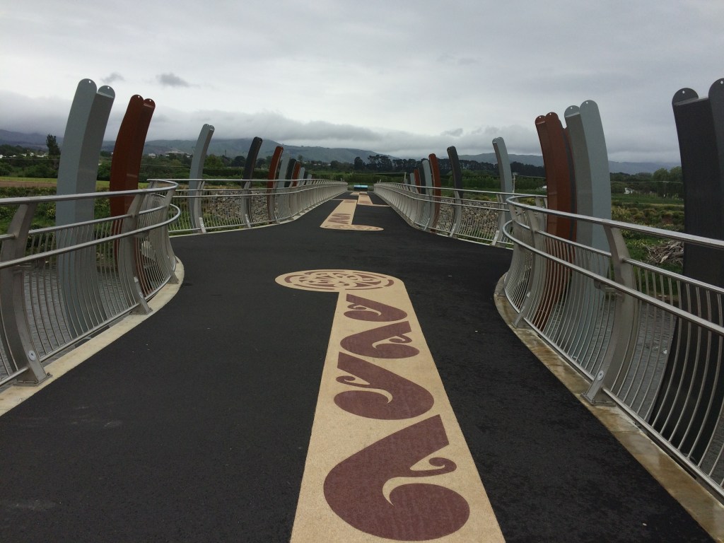
Then we were onto a shared walkway down to the river, initially heading east beside the Gasworks Drain. At the river it turns south and becomes He Ara Kotahi, Palmerston North’s new flagship riverside walking and biking path. It’s an absolute jewel, with a section of “glow path” (with glowing sand that absorbs UV light during the day and releases it at night), boardwalks, shelters, seating, viewing platforms, plantings, sculptures and info panels about all the rich history along here.
One of them, for example, was designed by the local Rangitāne iwi, and is in a pattern inspired by the border of a cloak. It symbolises protection of the land, the idea of the inhabitants “laying their cloak over the land” rather than stripping all the goodness from it. It also sums up how this route was a major pathway long before Europeans got here.
Mum went back to get the car again. Dad and I wandered along in hectares of lush green lawns, stop banks and bush, the river shining dully beside us in the overcast evening. Dad had a go with my pack and looked impressively comfortable, like he could’ve kept straight on to Bluff.
Further off to the east glimpses of the windy, wild Tararuas insinuated themselves, complete with those ubiquitous windfarms. A reminder of the tougher terrain soon to come.
Mum parked up and walked back and we had a good few kms together, the three of us in the deepening evening. Mum, too, looked very much at home on the Long Pathway. It was special to be accompanied by my folks on this Te Araroa project, which I’ve been doing mostly solo since 2017. Now here I was walking the length of New Zealand with the two people who’ve backed me to the hilt since I was born, at the trail’s nearest point to where I was born. It felt good.
Also, with my energy flagging and my feet throbbing, these two legends kept me fuelled with thermoses of hot coffee, strawberries and chocolate. We eventually knocked off at the Fitzherbert Bridge, and then another special thing: a brief detour off the trail, 30 minutes’ drive over the range, and I was in the town most familiar to me – dear old Dannevegas.
Day 78: Palmerston North to Kahuterawa Rd (17.5km)
In the morning I got a lift back to the trail with my older brother Matt, who was then working in Palmy. He walked with me and carried my pack for a while too, and that was special as well.
Then I was off again on my own, and heading south. Here’s a last look north, toward the Fitzherbert Bridge and the Ruahines, and beyond them, Dannevirke, our old farm, the past, my childhood, and… well, Janet Frame says it best:
the lost sound of the rain
… the sun, the voices of the dead, and all else that has gone.

As mentioned, the best bit of the new He Ara Kotahi riverside path, for me, is the way it acknowledges and honours the original people of this territory, the tangata whenua, and their history. The highlight is the foot- and cycle bridge:
Over it I went. Once across, I felt a change: now I was really off the Manawatū flats, over the river, and heading upward into the rugged range that had been beckoning me the last few days.
The trail passes between some of Massey University’s agricultural and science buildings, passes under Tennant Drive alongside Turitea Stream, and enters a patch of bush called Bledisloe Park. There’s a steep climb up bush terraces and then a good view over the university.
I was really struggling by now, with fatigue and sore, blistered feet. This was close to the most tired and sore I’d been on the whole 1000+km journey so far, and the worst blisters. I wasn’t sure if it was a general lack of fitness, the fact I’d started this stint with a 80+km paddle and a 30+km road walk, or if I was just getting old. Also my shoes were pretty had it. I bought them right beside the trail from a MacPac in Silverdale, north Auckland, when my previous boots died (I’d bought them in Kaitaia, after my very first pair of Te Araroa boots were killed by Ninety Mile Beach). Now they, too, were on their last legs (so to speak). This, I resolved, would be their last day on the trail. I band-aided up my feet, pulled on my knackered shoes, and struggled on.
I followed the trail through parks, bush reserves, over stiles, across farmland and under Old West Road. Covid is a constant presence, even out here.
Then it mostly follows a riverside planting scheme alongside the Turitea Stream – peaceful stretches of riverbank, with lots of young native trees and toetoe poking up through the long grass.
Harakeke (flax) did its quiet rattling in the cool spring wind, which was turning southerly: right in my face. It was turning into a tough old afternoon, but the scenery made up for it, and I was slowly finding my mojo again. The latest bit of doctoring I’d done on my feet seemed to be working.
When the going is tough like this I find it important to soak up the beauty of it all. What a privilege it is to be out here at all, to have the luxury to spend day after day out walking. Finding tranquil rest spots like this helps – made just for you, they seem, hidden away from the rest of the world.

The trail then follows Ngahere Park Road, past a turn off to Palmy’s water reservoirs. Ngahere means forest and it’s an apt name – the gravel road soon turns into a bush track:
It’s a narrow sliver of bush at this stage, with farmland and pine plantations on every side. I was looking forward to getting away from pines and paddocks into the real ngahere, coming up in the days ahead. But for now the dark green of the pines kept poking up above that olivey, shadowy, tangled exuberance of the proper bush:
Soon I was onto a gravel road again, and it was time to give these diligent buggers another rest:
Farmland in places like this, out on the edge of ranges and bush reserves, does have a pleasing wildness of its own – as if the bush is just biding its time to come bursting back, when we all disappear. I liked the abandoned truck in the foreground of this, with a stream of returning bush overflowing the gully behind – a reminder that our extractive obsessions might become just an eddy in the planetary river.

I was on Greens Road now, and enjoying its many greens. Other rewards were its swooping cambers, and the ponga ferns that graced its bends, and the late afternoon light opening up to the west, as I ground slowly up toward a highpoint.
It was very quiet out there – no people, no traffic. That was until a huge thundering sounded behind me and built in intensity until young guy on a highly modified dirt bike came roaring past, helmetless, in shorts, gumboots and a Swandri.
Finally I reached the high point. To a sound track of the young guy thrashing the kickstart on his bike somewhere over the brow, revving the engine, then cursing bitterly as it died again, I drank in the view I’d earned. It the first view clear out to the coast I’d had since leaving it several days before, at the Santoft Forest. That familiar satisfaction: I crossed all that, that great plain, on my own two (half-hobbled) feet.
In the distance, you can see the gleam of the Tasman Sea around Himitangi and Foxton Beach.

That stile took me down over undulating paddocks to a scrub-choked gully, and the last enduring image on my retina from this stint on the trail: spring blossom exuberant among quiet shades of mānuka and ponga. And below the blossom, a little bridge someone has taken the time to build for for trail walkers. I crossed with gratitude.

Across that small bridge and up the other side I was out onto Greens Rd just before the intersection with Kahuterawa Rd, and there was my friend Chris, waiting to pick me up. His generosity in coming to get me and put me up for the night reminded me of another, crucial kind of whānau: our oldest friends.
After a restorative night with Chris and family, just off the trail near Massey, I took an Intercity bus north again to get my car and kayak from the generous protection of the Hikurangi StayPlace in Whanganui. Then I drove back to Wellington and my own small and perfectly formed family of two. And that was that, another trail stint in the memory banks.
It wasn’t a classically beautiful or wild section, but it made up for that with its oddball charms, and all the time and space it gave me to ponder, or just hobble along in often-painful, yet usually restful blankness.
Tune in soon for the next instalment – a short one, through the Tararua foothills proper, from Kahuterawa Rd to Makahika Outdoor Pursuits Centre, just east of Levin.
You can also read earlier instalments – from the very beginning at Cape Rēinga if you like – by hitting the “home” button to return to the top of this blog.
Ngā manaakitanga, every good wish. And thanks for reading!

Hey mate, what’s the password?
>
LikeLike
Got rid of password lock mate. Thanks for reading.
LikeLike