
“All good there, mate?” asked the big man in the bush shirt, narrowing his eyes at me out the ute window. Three equally well-built road-workers peered at me from the back seat, eyeing my Goretex leggings, telescopic hiking poles and flouro-yellow pack liner. Fair enough – I must have looked a bit suspicious, fossicking through the long grass outside their depot.
“Yep thanks – I’m doing the Te Araroa trail, and I just wanted to find the exact spot I got to last time, so I don’t skip any,” I explained. He looked a bit nonplussed, then his stubbled face cleared.
“Ah yip, that length-of-New Zealand thing? Awesome. Have a good one then bro.”
As the ute crunched off down the gravel of Greens Rd, 15kms south-east of Palmerston North, I found it. The very spot I reached on my last stint on the trail, back in November 2020:

Back then, I’d kayaked down the remaining bit of the Whanganui River (Pipiriki to Whanganui city), walked across the Manawatū plains to Palmy, then up into the Tararua foothills. I got as far as this unassuming bit of Turitea farmland, before I ran out of puff. Luckily, an old friend, Chris, lives nearby. He picked me up and helped me on my way home.
(To see that and the rest of my Te Araroa journey, hit “home” at the top of this post).
Now it was June, 2021, and I was back on the trail. I drove up from Wellington, stayed a night with Chris again, and he dropped me back at Greens Rd on his way to work.
Day 79: Greens Rd, Turitea to Moturimu Whare, Gordon Kear Forest – 16km
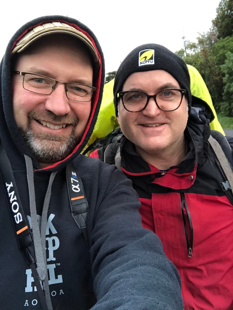
Before I set off, Chris took this shot of us. I’m on the right, all kitted up for an early-winter morning back on the trail.
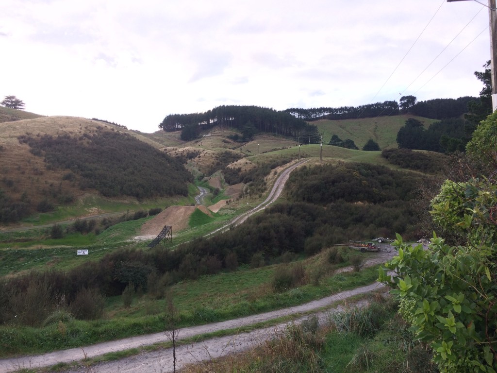
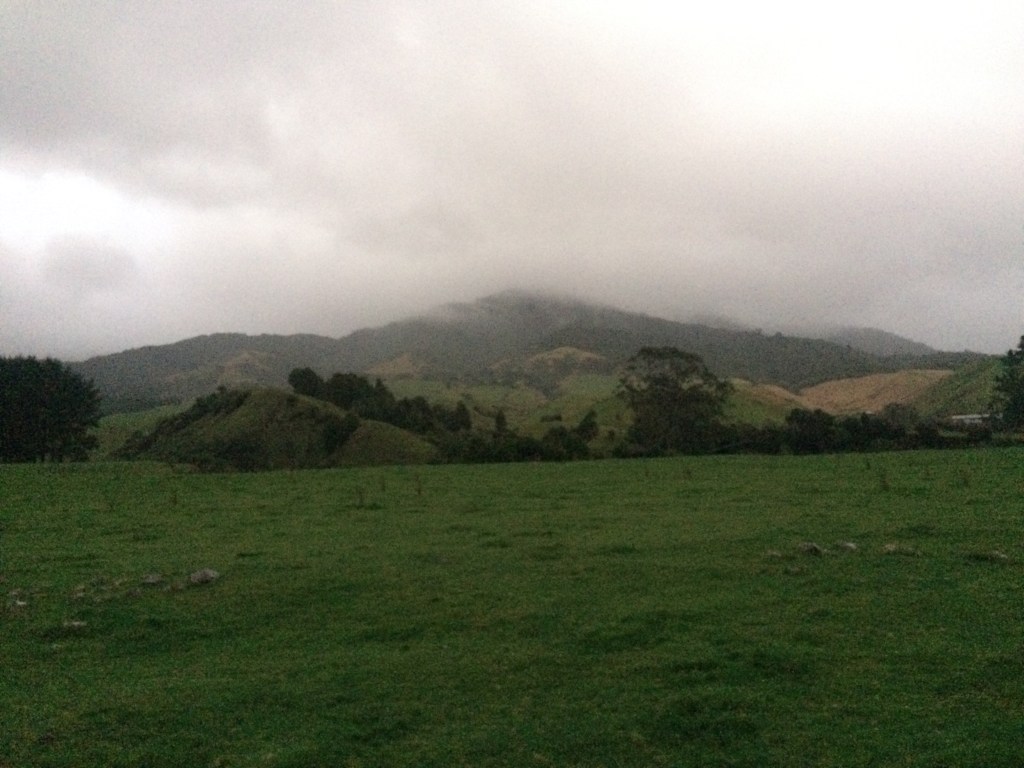
Here’s the view to the south, back the way I’d come – the last kilometre or so went down this hillside, from the pines on the skyline, past the mountain-bike ramp and up onto Greens Road.
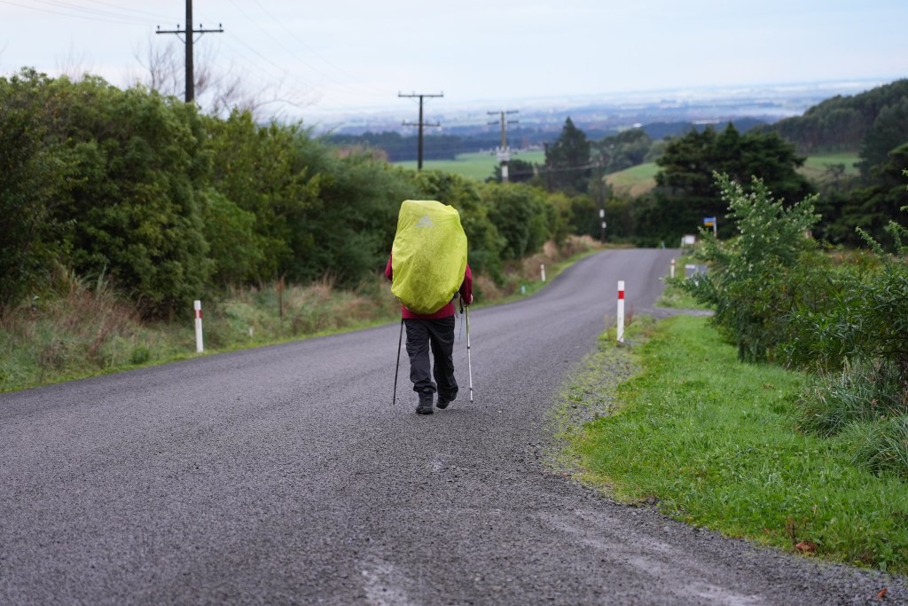
And here’s the way ahead – this shot also courtesy of Chris.
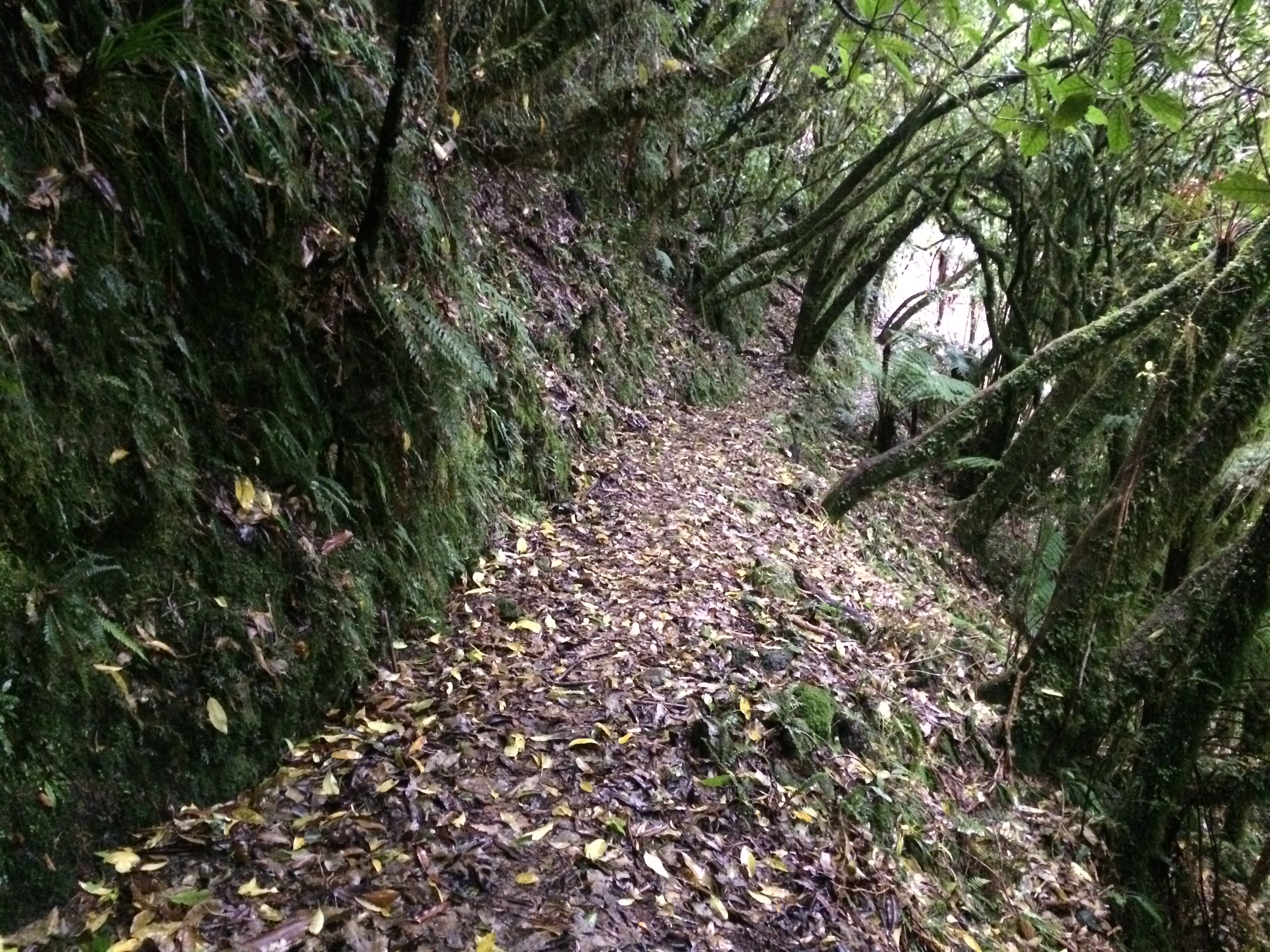
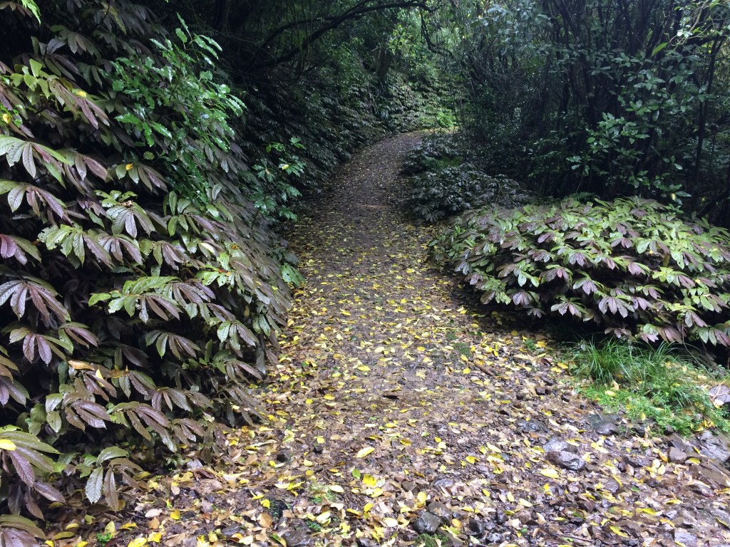
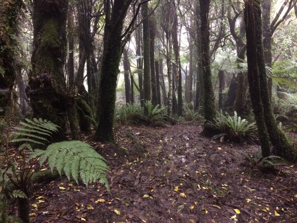
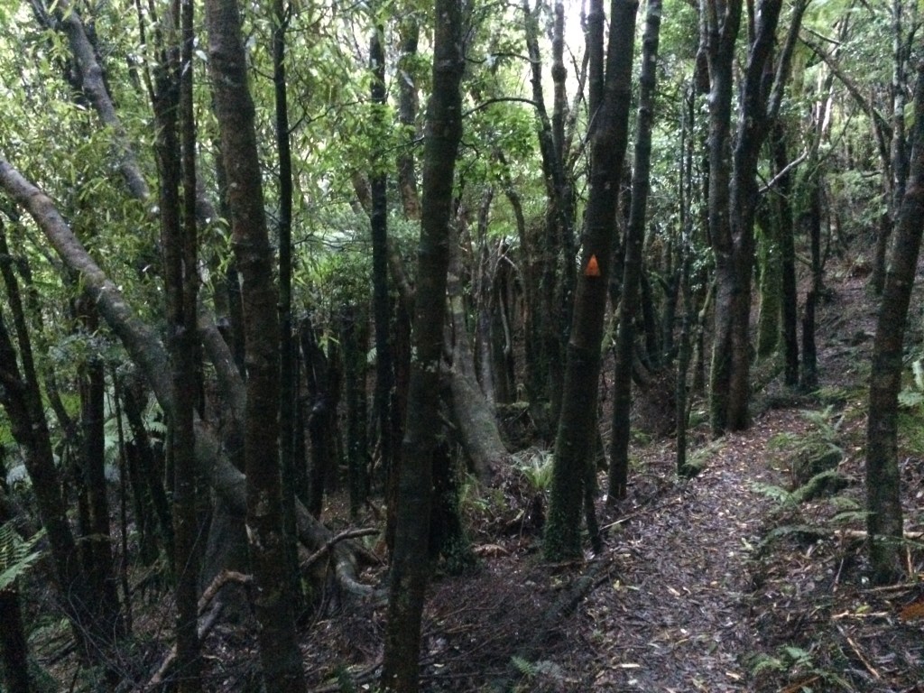
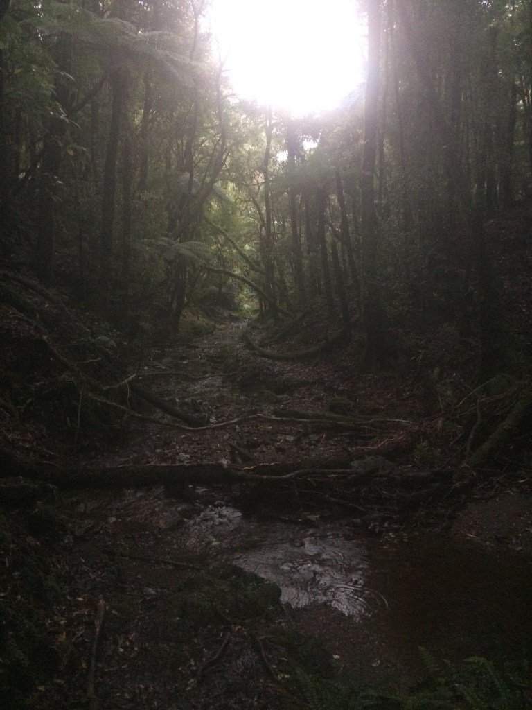
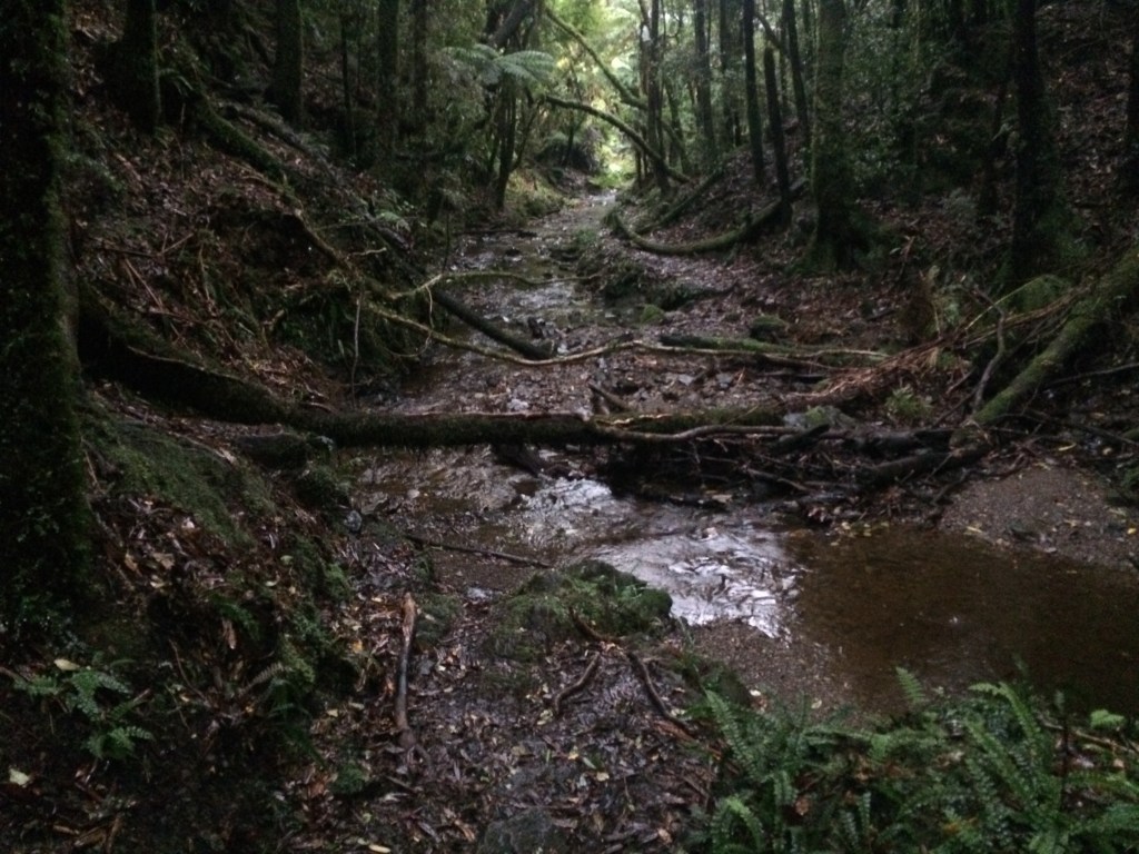
From Greens Rd the trail turns into Kahuterawa Rd, which narrows as it heads deeper into the bush. After five or six km it reaches Arapuke Park, a mountain-biking Mecca, I gather. I crossed Black Bridge and headed up onto the Back Track. I liked this moody section, lined with luxuriant foliage.
After a few kms of steady climbing there’s an inviting lookout, towards distant hills. There’s a memorial seat there, which Chris had told me about – the memorial plaque is to his uncle Maurice.
The Te Araroa trail’s te reo Māori name has a big meaning – the long pathway – but it sure passes through a small world. I enjoyed a restful moment gazing out at it from Uncle Maurice’s seat:

Further on there’s another leafy, quiet bush section. After a few months with no tramping, it was so good to be back in the great green heaven.

The highlight of this section was a sign announcing I was now halfway to Bluff.

NOBO is trail-speak for north-bound; SOBO, south-bound. (Most people go south-north but a few hardy contrarians choose to walk uphill, haha.) I liked the pic of the weary but jubliant through-trampers, sweaty shirts drying in the sun, “1500km” or something spelled out in stones on the picnic table:
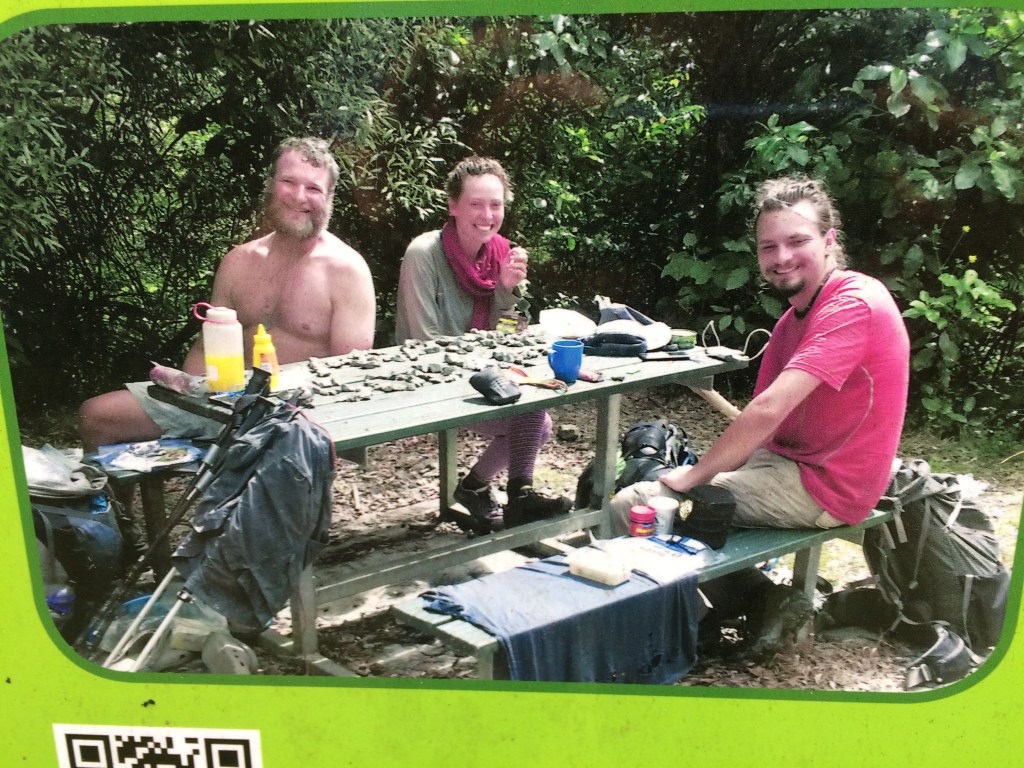
It was much chillier than in this pic when I was here – many through-trampers would be here in hot sunshine, having left Cape Rēinga in early November in order to make it down through the Southern Alps well before winter. But it was still a fittingly peaceful, scenic place to think about all those 1500-or-so-kilometres I’d done since early 2017, and all the 1500-or-so I will do by… well, who knows. Whenever.
My actual total at this point was about 50kms less than 1500km (the Hunua Range south of Auckland was closed when I got there, due to Kauri dieback. I’ll go back and fill it in sometime.) But I still felt a sense of occasion.

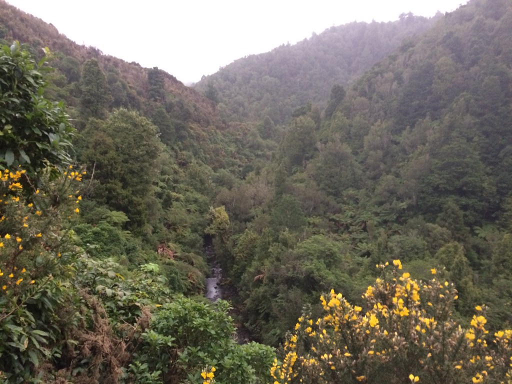
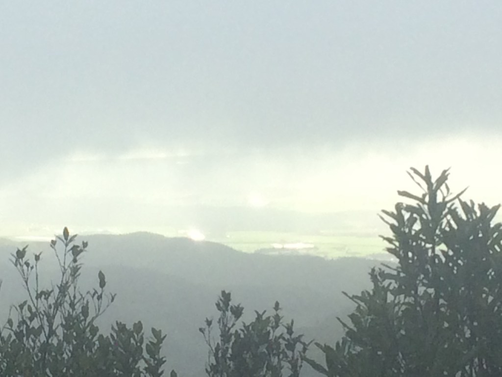
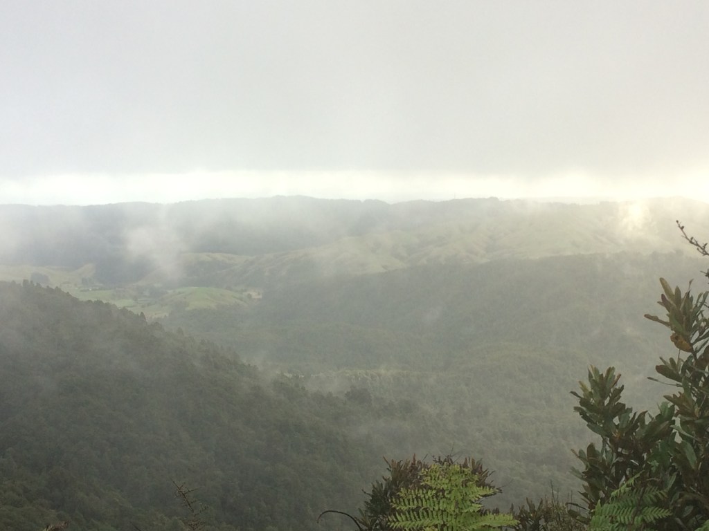
From a high point soon after that, I got a glimpse of those flat, boring plains I’d slogged across from the coast south of Whangaui. They looked a lot better in the blue distance, with some wild green between me and them:

Here’s a close up. Looking at it made me remember that those monotonous plains weren’t all bad. They had a wide-open, windy charm, some good people, and a sense of distance, space, possibility. Still, it was satisfying to be up in the ranges at last, looking back on them.

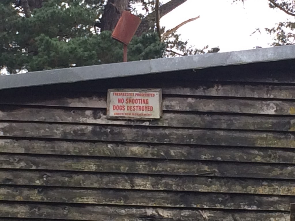
It was around then that the trail leaves Arapuke and the Back Track and goes down the gravel Scotts Road for 2km. The signs of life on this hill-country road were a bit more in-your-face than down on the plain. I guess when your land borders thousands of hectares of prime hunting land, you might have to be quite direct:
This old stock-loading ramp was built between two stumps, now bursting, in slow motion, back to life. It seemed emblematic of the area. The blurred border between the artificial and the wild:

The trail takes you over a stile to pass a locked gate into the Gordon Kear Forest, a pine plantation owned by the Palmerston North City Council. You follow a forestry road over the Kahuterawa Stream and arrive at this unique shelter and campsite – the Moturimu Whare:

It was built especially for Te Araroa walkers and is a real treat. It has a cooking bench, a sleeping platform and some plastic chairs. The traditional Māori design and decoration and the broad doorway give it an open, welcoming feel. I got water from the nearby stream, brewed a cup and sat watching the early winter twilight deepen over those miles of pines.
An info panel explained that the whare honours the original name of the area, given long before Pākehā (European settlers) ever set foot here: Moturimu, the island of rimu (one of NZ’s most stately native trees). In the tumbling, variegated jungle of the Tararua Range, this area was once distinguished by an extensive stand of mighty rimu.
Distinguished, yet also condemned. Graceful and weeping-willow like in its juvenile form, huge and straight when mature, the rimu is a treasure of the forest. But to the settlers, it only looked like cash. Its timber was the best of all the native trees for building houses and furniture, and we couldn’t get enough, especially in the population boom after World War II. Moturimu became the site of a large logging operation, complete with a village for the workers.
Now Moturimu has no rimu at all. Instead, surrounded by pasture on one side and untouched bush on the other, we’ve turned it into an island of pine.
Still, it’s a pleasant enough place to spend a night and I enjoyed having it all to myself. A perk of tramping in winter.
Day 80: Moturimu Whare to Tokomaru Shelter – 14.5km
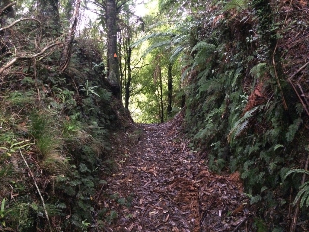
The day kicked off with three kilometres uphill through the pines along the gravelled “Toko Corner Road”, a forestry route. At the top was a picnic table and a stile, and a sign marking re-entry into the Tararua Forest Park. I climbed over and away from the ghosts of ten thousand dead rimu, back into the wild.
This was the beginning of Burtton’s Track, a route with a fascinating history, of which I’d find out more later. For now I just relished being back in proper, mature bush for the first time on this section of the trail. In fact, it was the first serious bush since I left the Whanganui River, well over 100km north.
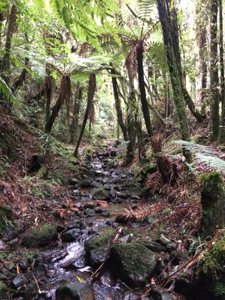
Below is either No. 1 or No. 2 Stream – Kiwis can be quite prosaic about naming things, can’t we?
After an hour or so mostly descending, I reached the Tokomaru River, wide and quiet in its deep valley.

Orange markers showed the way across, then it was upstream a while to a clearing just off the river. This is the former site of a whare built by a settler named Jim Burtton, in 1908. Here’s a photo of it, from an info panel in the clearing. It’s impressive, when you consider Burtton felled, milled and nailed up every one of those wooden tiles and wall boards, alone on the wild block he spent much of his life trying to clear and farm.

But what’s really impressive is the tale of Burtton’s death. When he bought this block, it had no vehicle access from the nearest road, Tokomaru Valley Road, and therefore no way to get his wool and meat to market, nor to get in supplies. But the council agreed to let him build his own cart track. So that’s what he did – alone, with pick-axe and spade, on top of all the backbreaking work clearing the ancient bush off his steep valley block, not to mention the farming itself, Burtton hacked a roughly twelve-kilometre track wide enough to drive a bullock dray out from the end of his farm. He continually improved and maintained it, clearing slips and chopping through collapsed cuttings, for 33 years – until 1941.
One late summer evening that year, he was coming home across the suspension bridge he’d built across the Tokomaru River near his whare. The timber he’d split and the ropes he’d rigged had served him all those years, but now they broke, dropping Burtton eight metres onto rocks.
Battered, his leg broken, he crawled out of the riverbed back to the whare and fed his dogs. He was in mortal danger, but it was no reason to stop looking after his only dependents, his companions.
Then he dragged himself the six kilometres from the whare out to civilisation for help. For his life he went, along the track he’d cut with his own hands from the unforgiving bush. It took him all night to reach the Tokomaru Valley Road and alert his nearest neighbours. Who knows what he endured, pulling himself over the ground in the darkness, remembering as he went each hard-won cutting, each drayload, each carefully benched corner, camber and climb.
He died the next evening in Palmerston North hospital.
I thought about all this over a cup of tea in the clearing he crawled away from that night, my back against a ponga that was probably not even a seed in the ground back then. Then I got up to follow this singular man’s last journey.

Did he love the bush he crawled through that last night? Or did he curse it as a callous invader he’d spent his life trying to uproot, and which now clogged his path to safety? Possibly, I thought, a bit of both.

The six kilometres from the whare to the road took Jim Burtton 12 hours; it took me about 90 minutes. As I walked, I imagined him crawling along the same ground. Blacking out from pain, waking up in the mud, carrying on, never beaten while his heart still pumped. The care he took in building the track is still evident, despite the effects of time and weather. For me, it was still a fairly tough, hilly slog, even walking upright. Let alone having to do it on your belly, with an excruciating injury.
What motivated him, all through his final, slow, agonising crawl?
Maybe it was the track itself, the work he’d put in to access all that wonderful isolation. An embodiment of his decision to live so far beyond the pale there wasn’t even a road, until he damn well built one.
And his unwavering committment to that decision, decade after decade, alone with his stock, his dogs, the hills, the trees, and the quiet river that eventually did him in.

Just before the road end I reached a high point and a view out into the rough country Jim Burtton tried, and failed, to tame.
But failure, I was thinking, isn’t necessarily a bad thing. Even a strong, capable, Barry Crump-type bushman like Burtton was ultimately let down by gear failure – a bridge he built, with all his skill and strength, failed. He fell.
And we all fall, even the strongest, the most resilient, the ones least inclined to weep or talk about our feelings, the “manliest” men, the most successful people, even those most sure of themselves. Especially those most sure of themselves. To fall, to have your bridge collapse under you, is human.
And what do you do, when you fall on the rocks because your knots failed? You get up. You look after those who depend on you. And you do whatever you have to to get help – no matter how self-sufficient you are. You try, one last time before it’s all over, to connect.
I chewed almonds and biltong and comtemplated these things in the light drizzle.

Not long after that I reached the Tokomaru Shelter, another place provided especially for Te Araroa walkers (though anyone can use it). It’s a plain little tin shed with a packed earth floor, a wooden table and chair in one corner and a raised sleeping platform in another; but it felt palatial in that lonely place.
Over noodles and biltong I entertained myself reading comments in the hut book (also provided by the Te Araroa trust):
“Woke to a rat trying to nibble my bum hole – cheeky bastard didn’t even buy me a drink first.”
“Lovely shelter. Glow worms along stream behind.”
“All those slips along Burtton’s Track were caused by the immense weight of Jim Burtton’s balls when he dragged himself out along it with a BROKEN LEG.”
Then I heard a scrabbling and saw a silky movement, and looked up straight into the black eyes of a rat, emerging from the gap between the corrugated iron and a corner post. We contemplated each other for a long moment. Its long nose twitched, whiskers and sleek fur silvery in the candlelight. I made a movement toward my camera and it vanished.
I crawled into my bag but was sleep was elusive: the rat and, by the sound of it, several of its dearest mates had begun a party in the wall cavity right beside me. I put in some earplugs and, to distract myself, began making up a song. I got a couple of stanzas into it before drifting off:
The Ballad of Jim Burtton’s Balls
Well we’re the children of the urban drift
Living shelved in cities like reams of paper;
But I sing of one who’s heart would lift
To get bush-choked miles from his nearest neighbour.
So keep your crumbling inter-webs and robot hacks
Your munted motorways, your interest rates and malls
And let’s toast Jim Burtton, who made himself a track
That withstood all weights, except for that
Of his own tremendous balls.
Day 81: Tokomaru Shelter to Makahika Outdoor Pursuits Centre – 18.5 km
The morning was rainy and cold but I soon warmed up with some fast crunching along a few kilometres of gravel. The trail goes along Tokomaru Valley Road and then south into Mangahao Rd, through bush and pines. Then it passes a couple of reservoirs and dams, giant sheets of silent water and concrete; they feed the nearby Mangahao hydroelectric power station.
The trail turns its back on all that, though, into rich, thick bush. This is the Mangahao-Makahika Track:

After the morning’s rain the sun came out briefly and the bush did that shining, glittery thing, every leaf washed and lit.
It’s an everyday experience on the trail, leaving a road or farmland via a rough track that pulls you into forest, submerges you in the purity and abundance of the wild. But it never fails to enthrall me.
Maybe it was extra-poignant this time, after being so immersed in Jim Burtton’s life-long, ultimately failed project to subdue the bush, and then the gravel road up to the acres of deadened water above antiseptic concrete walls, and the wisp of creek they left, anaemic below the dam… all that habitual taming that we do, that reflex, consumerist subduing. Now I was back in the indifferent, lucent, primeval tangle. And it was delicious.

There are some mighty, mature rimu, and then three tributaries of the Blackwood Stream. Here’s one of them, where I filled up my water bottles – there’d be no more water till I had crossed the small peak ahead of me and come down the other side, a good four hours’ walk.

The stream, according to the trail notes, is named for the predominance in the area of black beech (tawhairauriki). I was intrigued – what would a Kiwi black forest look like?
Following the track up from the stream, I found the answer: it looks marvellously dark.
The trunks, the canopy, the mulch of fallen leaves on the forest floor, even the light – everything in there had a charged, living darkness to it. I liked it a lot.
The trail winds up onto the 671-metre highpoint of the Makahika Ridge, that lush bush keeping it from being too much of a slog.

The rain came and went all morning, but it was a still day, and the water droplets lay intricately on leaves, twigs and spider webs.

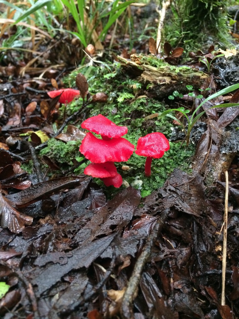
There are often small delights beside the trail:
Finally I reached the top. The trail notes promised fine views of the Horowhenua and Manawatū, right out to the coast, but I wasn’t holding out much hope with all the low cloud I’d been walking through. And the views weren’t vintage, as it turned out, but they weren’t terrible either:
I liked the way the sun lit up the sea, making it wink and glow below the moody clouds.

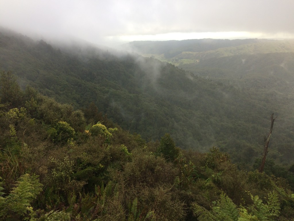
The clouds lifted long enough to show me where I was walking. Sure it wasn’t the heart of the Tararuas, sure it was more like foothill tramping, but they’re still pretty undomesticated:
I went on from the Horowhenua Lookout to Archey’s Lookout, slightly down the south-western side of the Makahika Ridge, and just as I popped out of the bush onto the clearing the cloud lifted a little more:
The low cloud blocked the promised views of the South Island, Kāpiti Island and the Makahika Valley, but the moody winter light picked out all the water on the plain. Sea, pond, dam, lake or river, they all responded eagerly to the meagre sun:

But it was growing more meagre by the minute and I still had a long way to go. Back down into the bush I plunged. It was a 350m descent and I got straight into the headlong, exhilarating rhythm you can attain on a decent downhill track. It bottomed out after an hour or so and then took me along the Makahika Stream’s myriad channels, tributaries and branches. Overhead, the waning sun occasionally poked through:
I had been warned to be careful of a possible sudden rise in stream levels here, because of the rainy weather and the fact you spend more time in the stream than out of it. But for the most part it was just a matter of splashing onward, my new boots and old gaiters keeping my socks pretty dry.
The track in this area follows a defunct timber-felling project’s tram line. At times, I could sense the original engineering, now swamped in exuberant bush.

There’s a campsite at the bush’s edge but I wanted to get to Makahika Outdoor Pursuits Centre before dark. My plan was to stay there and get some up-to-the-minute weather advice from the centre’s owners, John and Sally Duxfield, who I’d spoken to while planning for this leg. The issue was that the three or four following days of the trail are along the most exposed, dangerous section of Te Araroa in the North Island, and one of the most weather-affected parts of the entire trail: the Pukematawai-Mt Crawford ridge in the remote heart of the Tararua Ranges.
John, a former airforce pilot and very experienced outdoorsman, had warned me that with winter coming on that ridge could easily be fatal in the wrong conditions, and that I should prepare myself for having to pull the plug at Makahika. But I was hoping the forecast might have improved – I had no cellphone coverage so couldn’t check, but John had told me he’d look it up and talk me through the permutations.
So on I forged, following a poled route along farmland. Across the paddocks, the lower slopes of the Tararua main ridges loomed, inviting and threatening at the same time. That low, heavy cloud didn’t bode well. I’d planned for a 11-day jaunt on the trail, and booked time off work to allow for that, but it was beginning to look like the three days I’d just had would be all I’d be allowed.
There was final wade of the Makahika Stream, with two sharp-horned cattle beasts trotting up to watch me cross. I eyed them and they eyed me, and only sheared away when I stumbled up the bank towards them, their eyes blank and baleful in the torch light. Then it was a two-kilometre crunch along gravel in the dark to the OPC.
I knocked on John and Sally’s door; they live at the centre’s entrance. John looked me up and down.
“Bit wet, eh?” I was drenched and cold; I’d re-waterporofed my faithful old coat, but I was realising it wasn’t really up to it anymore.
“Nah, I’m all right,” I lied.
I didn’t want him to think I was not well-equipped for early winter in the upcoming alpine section, and advise me to postpone. I’d been hanging out for a prolonged bit of solitude on the trail, to put some serious miles under my feet, to get out into the proper, empty wild. The three days I’d done so far had barely begun to scratch the itch. I’d done tonnes of planning and logistics to get here – organising shift-swaps at work, leaving my car at Chris’s house outside Palmy, planning for getting back to it after finishing, how to carry 11 days worth of food and the right gear – I really didn’t want to postpone.
I looked at John hopefully. “So what do you think about the weather?”
He smiled. “Tell you what, get yourself set up in one of the dorms, have a hot shower. Then come back up here and we’ll have a look.”
There was no one else at the centre; I had it all to myself, the big communal room lined with bunk-rooms, the commercial kitchen, ablution block and comfy lounge.
I walked back up the drive to John and Sally’s and he sat me in front of the log fire with a cup of tea and opened his laptop. He looked up several different specialist weather websites, showing me how the wind, rain and cold would affect the mostly exposed, tussocky tops I would be following.
I listened, feeling more and more pessimistic. John sat back and looked at me.
“The three main weather dangers in the mountains are wind, wet and cold. I always say, if you’ve got as many as two out of three, you’ll normally be OK, as long as you make good decisions. But at the most exposed times on this route, on these days, you’re going to have all three dangers. On top of that, visibility will be very low. You’ll need everything to go right, or you’ll be in a survival situation.”
I nodded. I could see the writing on the wall. John said he wasn’t going to tell me what to do, but I could tell he thought I’d be taking a foolish risk to go on.
He told me there looked to be a weather window opening the next week. I’d stil have time to complete my planned section before having to go back to work.
So that’s what I decided. The next morning I spent recovering and writing in the empty communal room at Makahika, watcing the rain sluice down the big windows. In the afternoon the sun came out and I helped some of the centre workers clean out a shed; John had asked one of them to give me a lift back into Levin on his way home that afternoon.
John, Sally and the centre workers are a very generous and knowledgeable bunch; Te Araroa trampers are lucky the trail passes by their fantastic place.
The worker dropped me at the Intercity stop in Levin and I bussed up to Palmy. Looking out the bus window at the great green range sliding by, the few kilometres I’d walked and all the ones I’d planned to walk, I felt the disappointment wash over me. I’d spent a lot of time and energy planning this trip, and I just wanted to be out alone in the bush, no matter what the weather. Even if I’d had to hunker down a few days, lying in a sleeping bag listening to the wind and rain batter the outside of a high mountain hut seemed lovely. But I’m sure it would have actually been pretty cold and grim; and if I had twisted an ankle or got lost in the fog and not made it to that hut, and not been able to find a spot flat and sheltered enough to put up my tent, it might have been fatal.
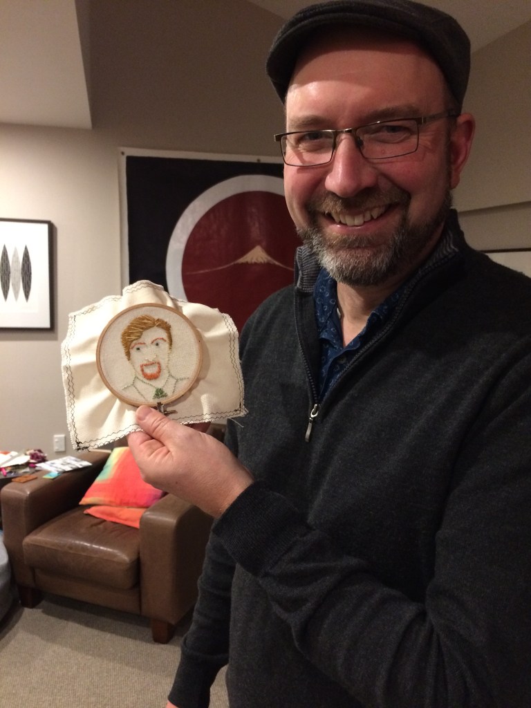
Chris picked me up from the bus stop and I spent another night with him and his family. Their kindness and easy banter cheered me up, as did Chris’s first attempt at embroidery. They’re a crafty, creative bunch, Chris’s family, and he was inspired to have a go when his daughter Olivia came home with it for homework. He chose a portrait of Murray off Flight of the Conchords, partly because Murray is Chris’s surname. So here they are, Murray by Murray:
The next day I drove home and waited for the weather to clear. I used the time to buy a new, storm-proof coat and a some more merino base layers. Early the following week I rang John at Makahika for another weather conversation. My opening gambit: I thought the weather window, though narrower, was still there and the trip was still possible, if I hustled. He listened, then perused his weather pages, giving his considered, thoughtful commentary. I waited, feeling my heart sink. John paused, then pulled the trigger.
“You could go,” he said. “It might be OK. But there’s a solid chance it wouldn’t. And even if you made it, would it be worth it? You’d slog up there, but there’d be no view, and the whole time I think you’d have your heart in your mouth. A voice on your shoulder saying Caleb, you shouldn’t be here.”
I knew there was really only one choice. I’d have another go in a few months when the weather had improved and I could enjoy it as a tramp, not as a boundary-pushing survival exercise.
And that was that: 45 km, some memorable scenery and experiences, and a reminder that whatever outdoor plans we make, nature’s the boss. Especially in winter, and especially above the bushline.
Thanks for reading! More posts will be up soon, with the next stint on the trail – Ōtaki to Wellington, and Makahika to Ōtaki Forks. If you want to read my previous Te Araroa adventures, hit “home” at the top of this blog.
Cheers, ngā mihi, and hasta pronto.

2 thoughts on “On winter sun, failure and building your own road: Palmerston North to Makahika (near Levin), Te Araroa trail days 79-81, kms 1471-1517”