
Day 31 – rest day in Waipu: 0 kms.
Zero kms… not walking can be so, so good. Even with a hangover.
Day 32 – Wenderholm to Silverdale: 18km (including initial backtracking).
I collected my car from the driveway in Mangawhai – dropping off a bottle of wine to the kind driveway-owner – and headed south for an hour or so. I parked at Waiwera beach; my car would be safer there for a couple of weeks than in even-quieter Wenderholm. Then I walked about 2 kms back to the boat ramp I’d canoed to, so as not to cheat on the full Te Araroa experience.
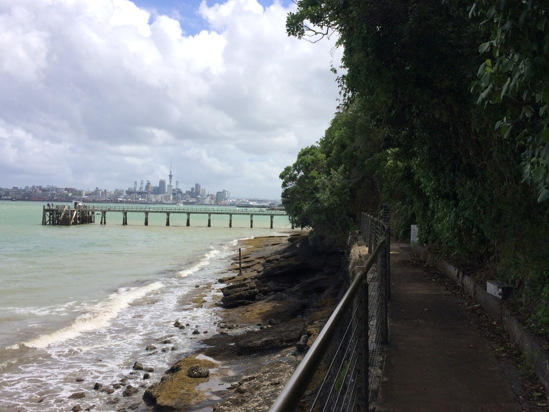
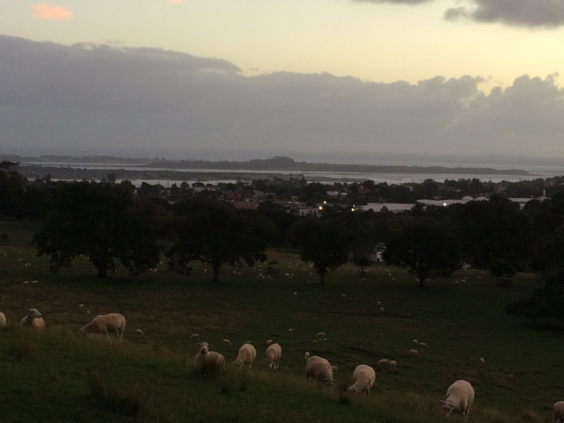
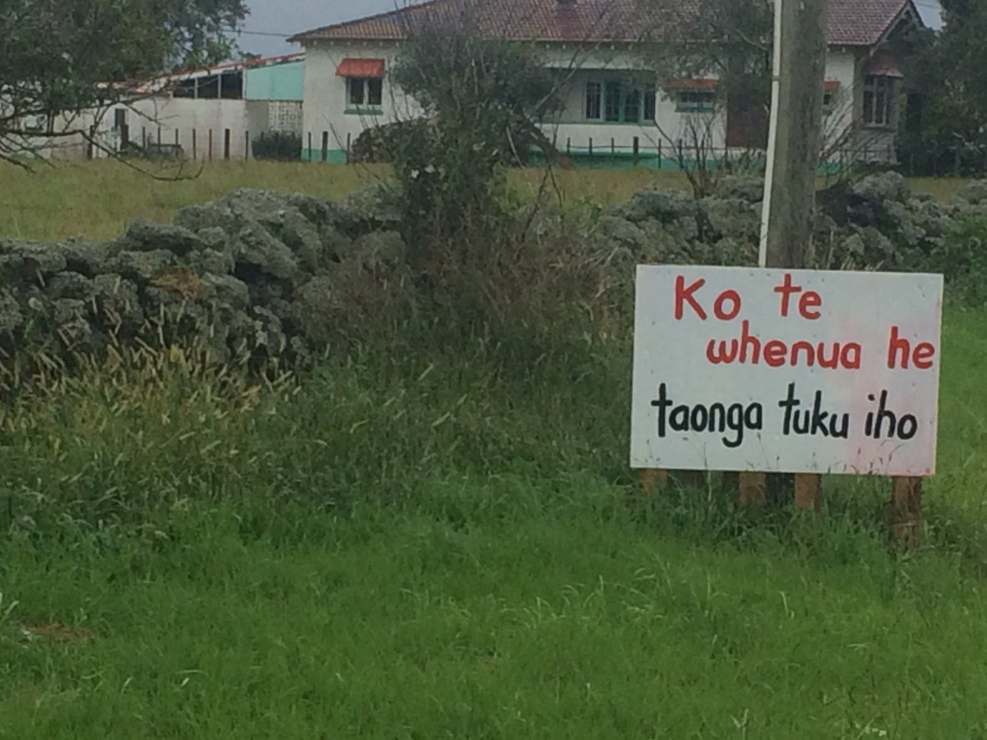
The walk from there back to Waiwera goes over a bluff whose rich Māori history owes a lot to its strategic and sensational views up and down the coast:

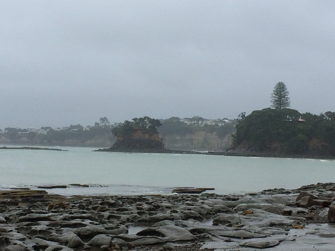
The low tide allowed a pleasant stretch around the headlands to Hatfield’s Beach and then Orewa, hopping over rocks, pools and secluded sandy stretches.
The trail follows lovely long Orewa beach, past the kite-surfers and campers, to a bridge over the Orewa River. Here, dozens of teenagers giggled, strutted and clambered on wharf piles and bridge railings, somersaulting down to carpet-bomb the evening water.
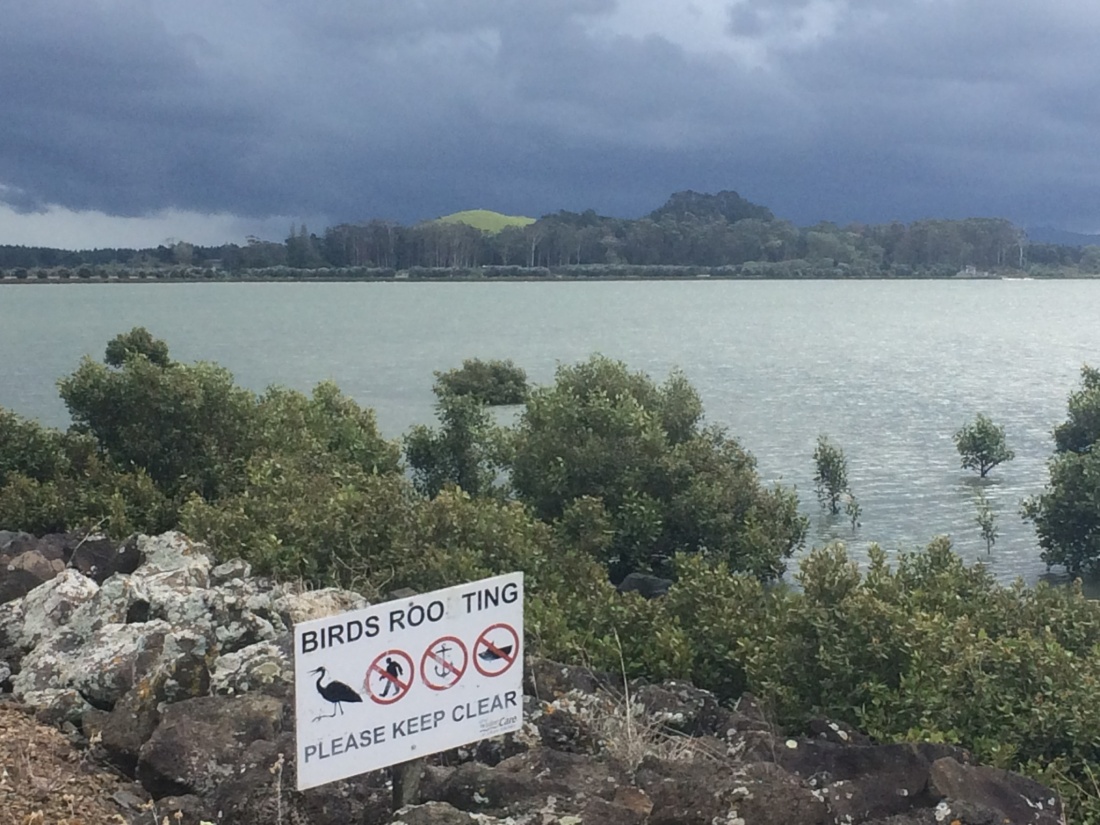
A pathway hugs the estuary all the way round to the Silverdale shops, where I branched off a km or so to a B&B on Whangaparaoa Rd. They kindly let me camp on the lawn for five bucks. I ate my noodles and drank my liquorice tea overlooking the Weiti River, whose mouth I planned to wade the next day at low tide.
Day 33 – Silverdale to Long Bay: about 23km, including detour.
The next morning I stopped at the Silverdale Macpac, which the trail passes, for some new tramping shoes. My old ones were giving my joints more of a beating than was strictly necessary.
The salesman understood what I needed, having dreamed himself of doing Te Araroa. “I’d do it in reverse, though,” he said. “I’m a North Shore boy, so the whole way up I’d have the extra pull of heading home.”
It was a quick stop, because I was trying to reach the Weiti river mouth at Okura by early afternoon; the trail notes made it clear that dead-low tide was the only time it was wadeable. Missing the tide would mean a long detour.
I pounded along, relieved and restored by my new tyres, blasting through the kilometres.
Most of the way down to Okura is tar seal, until lovely little Stillwater, with its perfect name.
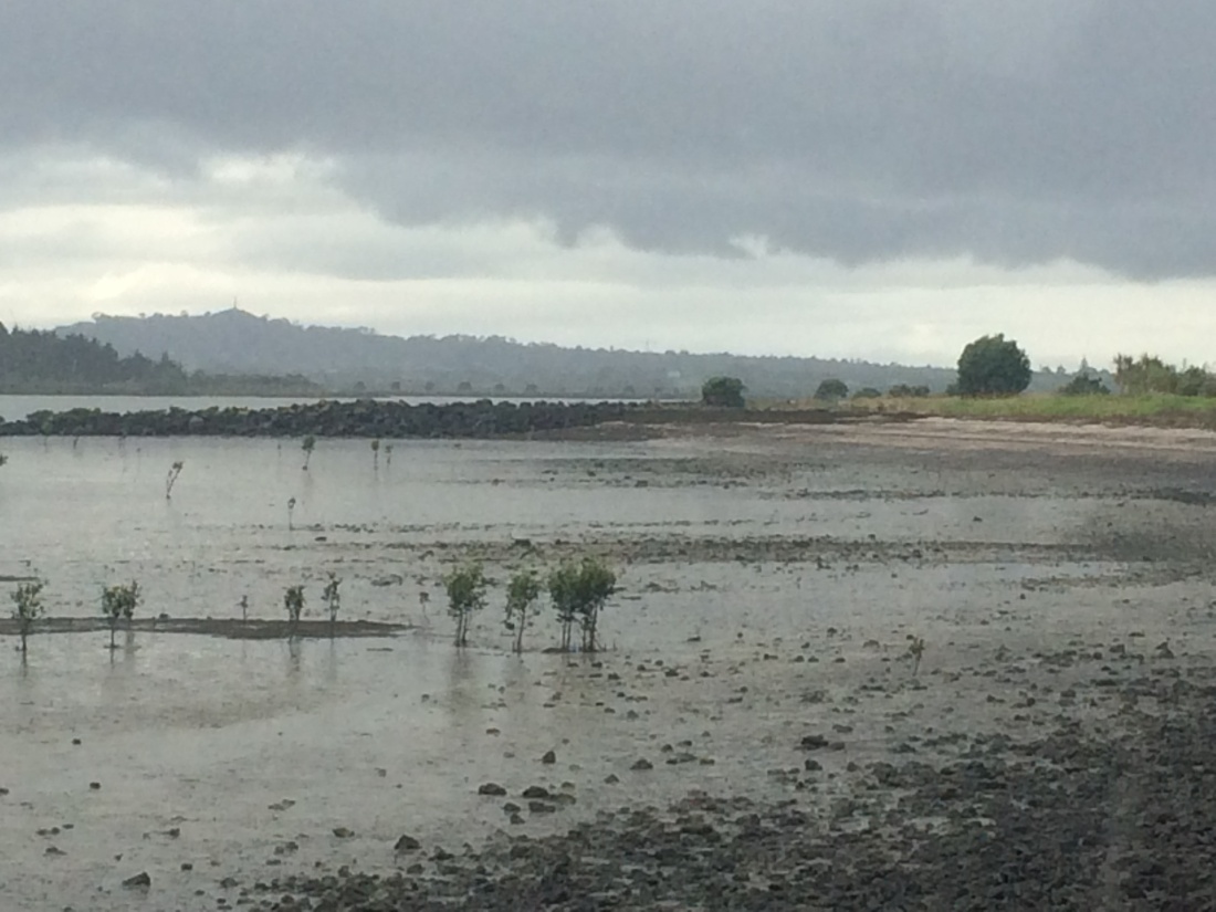
After that you hit DOC’s Okura Bush Walkway, a gentle track through bush and coastal grasslands out to the mouth. At low tide you can cut across the sandy flats to Dacre Cottage, isolated on a point. It’s a historic site, but I didn’t have time to explore – the tide was rising. I’d done my best to make it, but just couldn’t flick those kilometres under me fast enough.
I double-plastic-bagged everything in my pack, walked out onto the sandy spit and tried to wade accross.
The rocks on the other side were only four or five metres away, and from there it would be a short scramble up a headland, then an easy amble along a grassy coast. Not making those few metres would mean a three-kilometre detour upriver to a shallower spot.
The tide was streaming in, a strong, buffeting force against me.
At its lowest point, the trail notes say, the channel is only hip deep; but I was up to my neck, feeling my pack lift and bob. I’d unclipped the waist strap and loosened the shoulders; I considered using it as a float, and kicking across.
But I couldn’t guarantee it would keep its buoyancy; what if it sank like a stone, and I lost everything?
It’s a quite wild, lonely piece of coast, especially on a dull day. There was nobody around, no houses; if I disappeared under the water, no-one would know.
I hesitated, feeling the tide shoving past, the water dark and swirling. It felt dangerous, the kind of situation where people push ahead when they shouldn’t.
I backed out and surrendered; it wasn’t worth it. Up river I found a crossing I could manage, to the end of Okura River Road. I still had to go in up to my neck, but I got there.
I spread my wet gear on rocks and had some lunch, then trudged around the long, tar-seal detour to Long Bay.
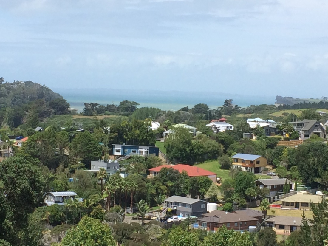
I realised I was in the burbs. From places which are really little satellite towns of Auckland, like Orewa and Stillwater, I was in the North Shore proper: manicured lawns, bus stops, quiet streets that smelled of DIY and money.
It’s an odd feeling, to find yourself tramping, bedraggled and smelly, through such a domesticated place, so soon after crossing a forest and wading a desolate river. But quite satisfying, too.
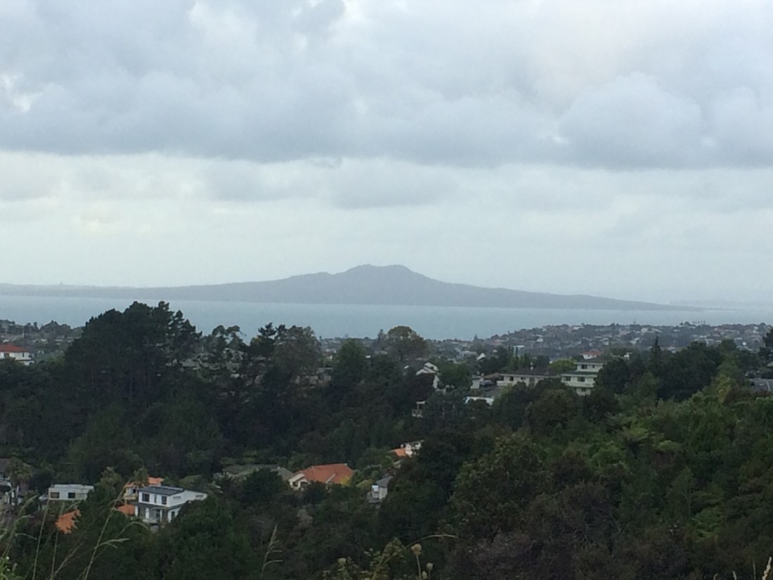
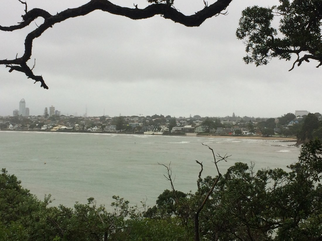
In the suburb of Torbay Heights, I got my first view on the trail of an icon of Auckland, city of volcanic cones – Rangitoto Island:
By the time I got to Long Bay it was nearly dark; I got a bus down to the nearest campground, at Takapuna Beach, and pitched my little tent.
Day 34 – Long Bay to Takapuna Beach: 15km.
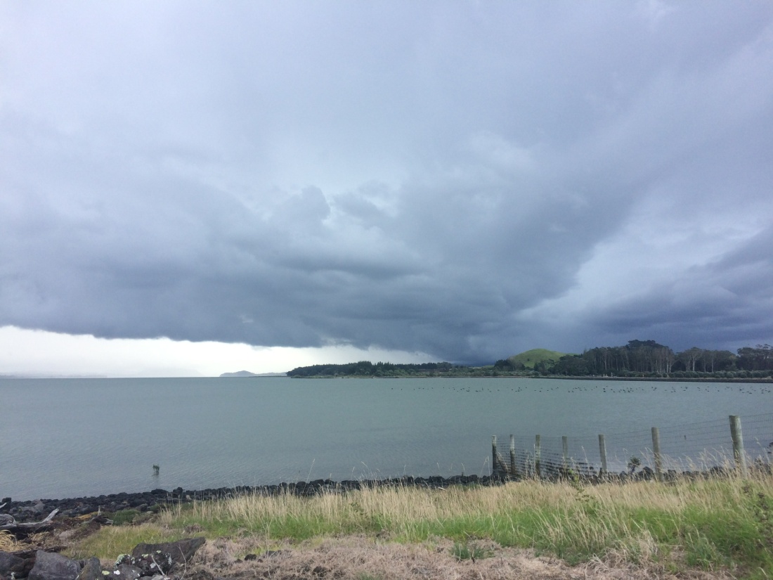
The next day a big storm was forecast; people were packing up and leaving the campground, but I thought my rugged tent would survive. I packed lunch, scroggin, water and wet-weather gear, booked a second night, and got a bus back up to where I’d got to the night before.
I’d waited for low tide, so it was an enjoyable afternoon following the beaches and rocky skirts of headlands down past some of the most exclusive suburbs in New Zealand – bays called Brown, Murray, Rothesay, Mairangi, Campbell, Castor and Milford.
Again, I enjoyed that evocative contrast between wilderness and civilisation. You’re trundling along metres below mansions worth several millions, a block from crowds milling in malls and throbbing traffic; but you’re all alone in the most wind-washed, purest of places.
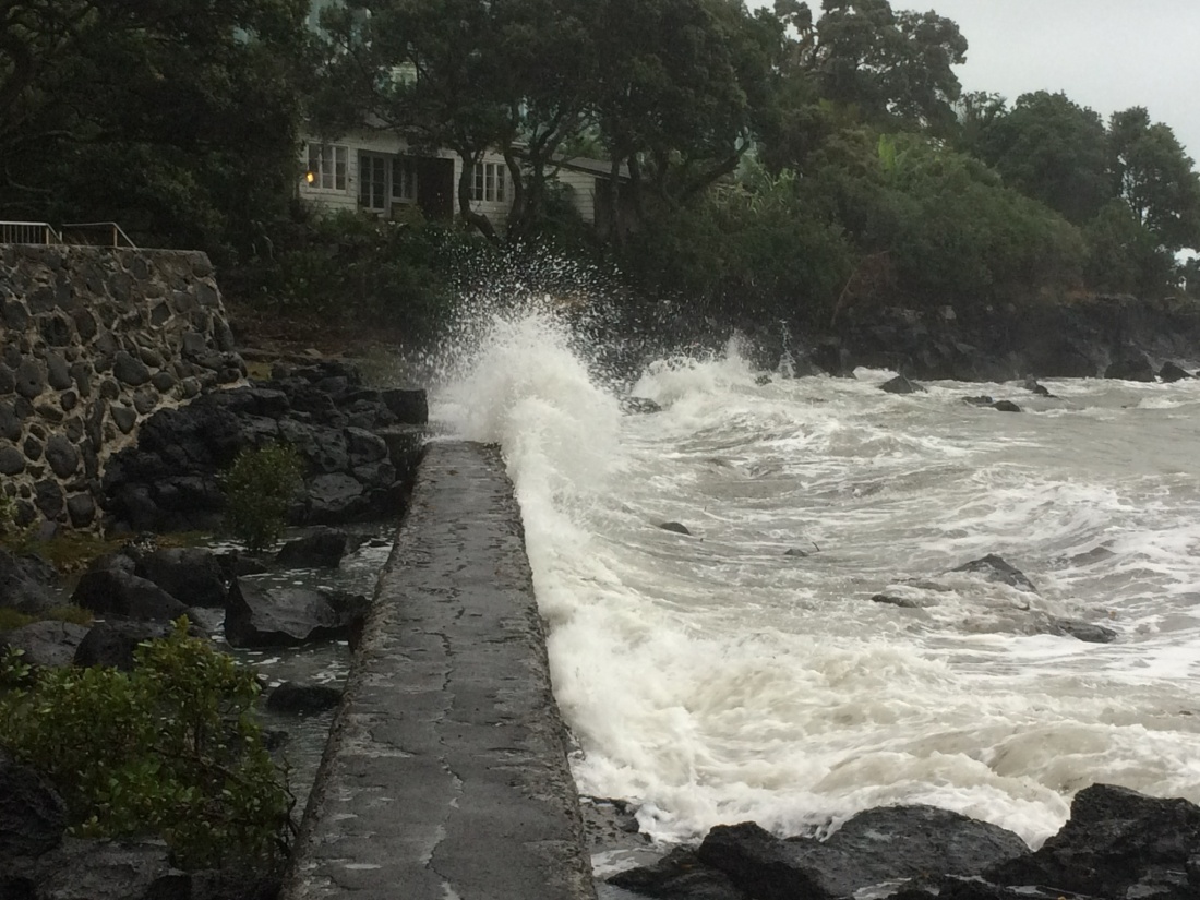
Sometimes, civilisation intervened to, arguably, improve the wilderness. There’s a seawall, which doubles as a causeway, very enjoyable to bowl along. Its artificial surface melds, by design or weather-beating, into the rocks around it:
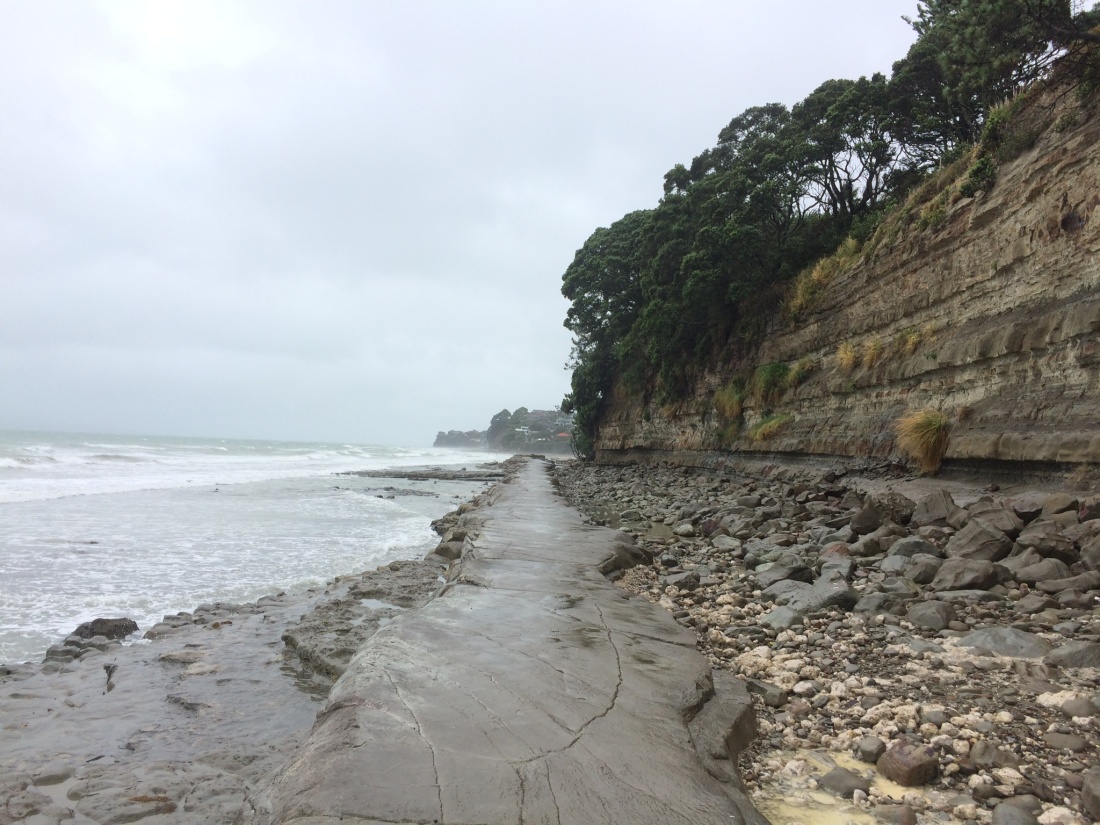
Elsewhere, the causeways are completely natural, shelves of rock that hug the cliffs, handy steps of harder sediment.
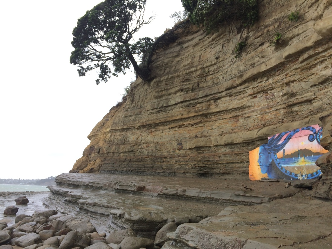
Someone’s used one of these to decorate a stratified cliff. It’s slowly being eaten by the sea, which is indifferent to the high price of its mouthfuls:
Sometimes you get a glimpse of the gated, armour-plated palaces on top of the crumbling cliffs, which their owners try to hold in place with elaborate geotechnical feats; just one of those engineering marvels would buy a whole house in the provinces.
Below, the sea finds its way into the rock despite them, and nibbles away darkly at their pricey foundations:

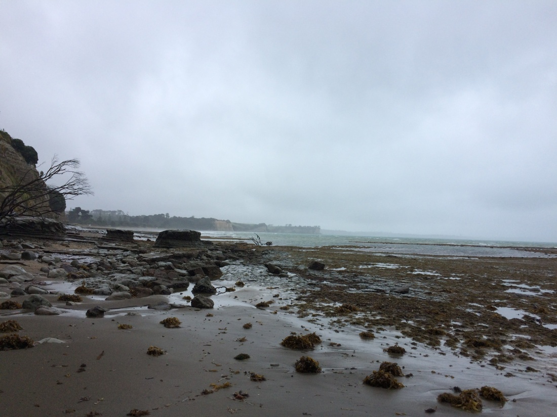
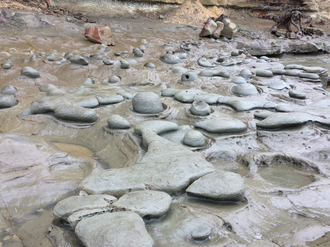
Along the shore there’s endless variation, natural carvings, pools, grottoes and bubbles of rock, mud, sand and water.
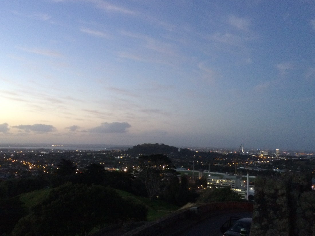
After a few hours the tide came in and I had to do the last couple of bays via clifftop walks, parks, the odd street, a pleasant route which Te Araroa has carefully sign-posted. From a headland covered in pōhutukawa that groaned in the northerly, I got my first glimpse on-trail of the glass towers of central Auckland:
It was satisfying to watch the city reveal itself as I crept closer, step by step, just as a mountain or stretch of coast does when you’re doing a more conventional tramp.
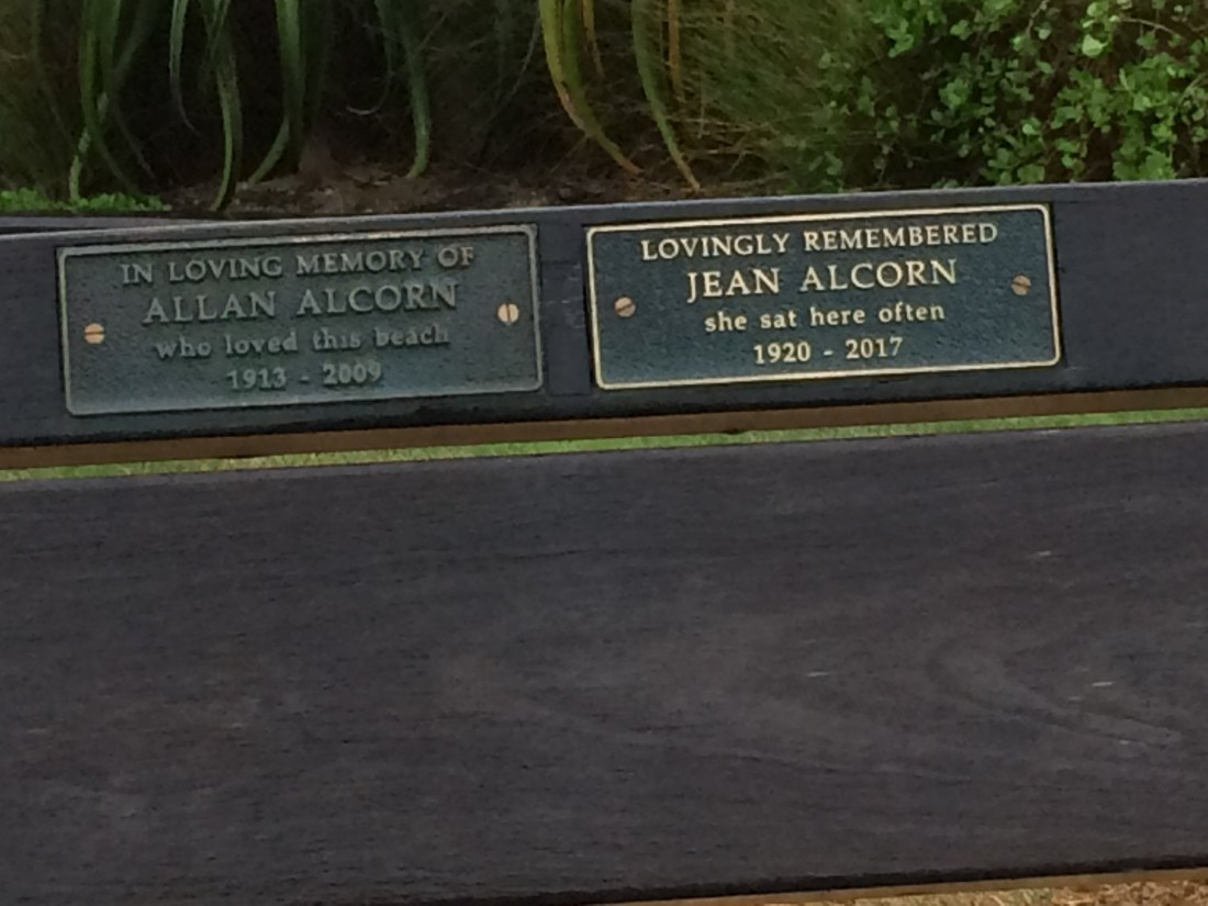
Another thing I like on urban coastal walks is all the memorial benches, on quiet beaches, headlands and pathways all over the country. “So and so loved this view,” the plaques say, or: “She sat here often.”
Walking by, or stopping for a rest, I imagine the people remembered in the plaques are nearby me somehow, hovering or taking root, benign and slightly wistful.
Further on the storm began to really brew; there was a king tide, the seawall-causeway narrowed, and the waves shattered onto me, sometimes. I met a man coming the other way, with a collie on a lead; “what’s it like ahead?” he asked. I said I thought he’d better carry her through the next bit.
Finally I was back at my little orange tent, which stood rock-like in the gale.
I enjoyed my two nights at the Takapuna Holiday Park; it’s an unlikely sliver of egalitarian paradise in one of the most expensive neighbourhoods in the country.
Somehow, this couple of hundred metres of beach-side land has held out against the encroaching hordes of ravenous estate agents.
Surrounded by exclusive schools, mansions, suits, scents and cars, a rag-tag bunch of backpackers, families and retirees in jandals and cargo pants battened down the hatches.
Day 35. Takapuna Beach to Onehunga – 21km.
In the morning the storm was over and the scoured sky was a pulsating blue. Before setting off I had a swim in the cold, clean-feeling bay; I learned later you shouldn’t really do that in Auckland after a storm, but it was delicious.
I had to wade most of Takapuna Beach, normally a golden arc. Further on, some of those estate agents appeared to do a deal near the high-tide line, crowded with flotsam:
Cheltenham beach was a sunny haven, backdropped by that symmetrical explosion-remnant, Rangitoto, and strewn with storm-tossed kelp and sunbathing yuppies.


(Does anyone still say “yuppies”? Maybe I should say “townies” instead, in honour of a Kāpiti friend of mine who says, of Wellington: “I don’t like ‘town’. Problem with town is, too many bloody townies.”)
I made my way around North Head, atmospherically riddled with old fortifications, tunnels and wartime gun emplacements. There I got my first close-up, on-trail glimpse of the Sky Tower needling the clouds.
I had lunch in dreamy, funky, old-world Devonport, then ferried across to that spiky CBD. True to my rule of doing all waterways under my own steam, I’d come back later to kayak it; but for logistical reasons I had to crack on for now.
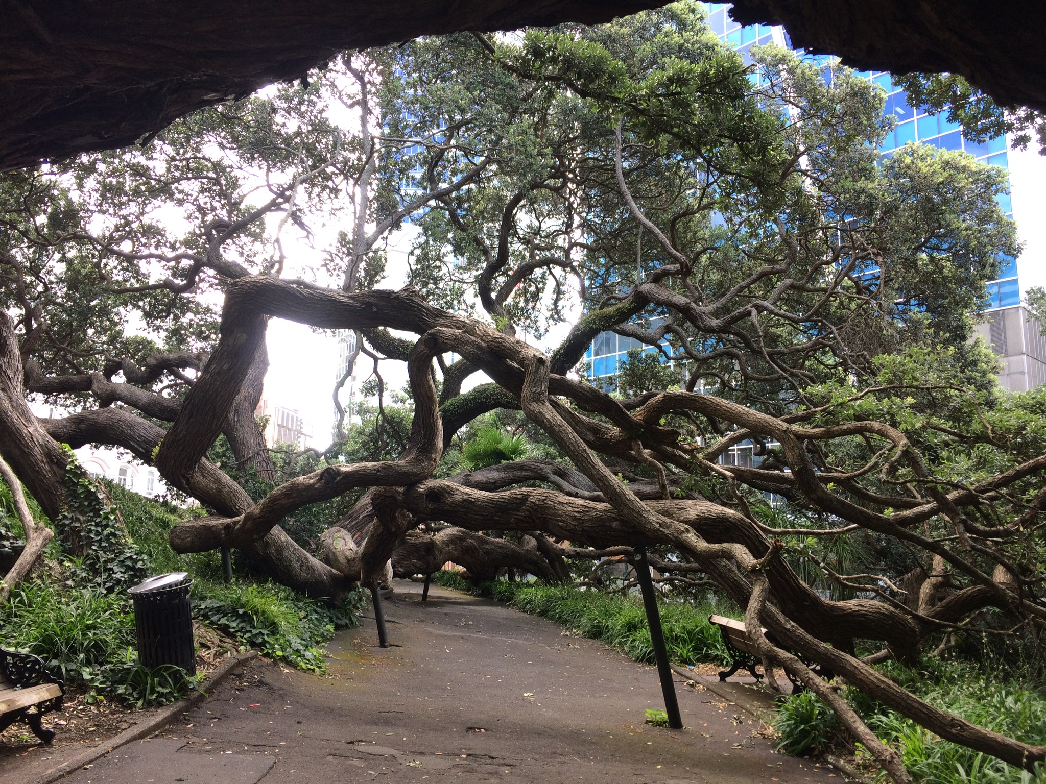
I made a brief detour up Queen St, just to know what it’s like to tramp up one of the grittiest of urban pathways; then followed the trail up past the university into the domain. On the way, more scenes of nature having its rough, passionate way with glass, concrete and steel:
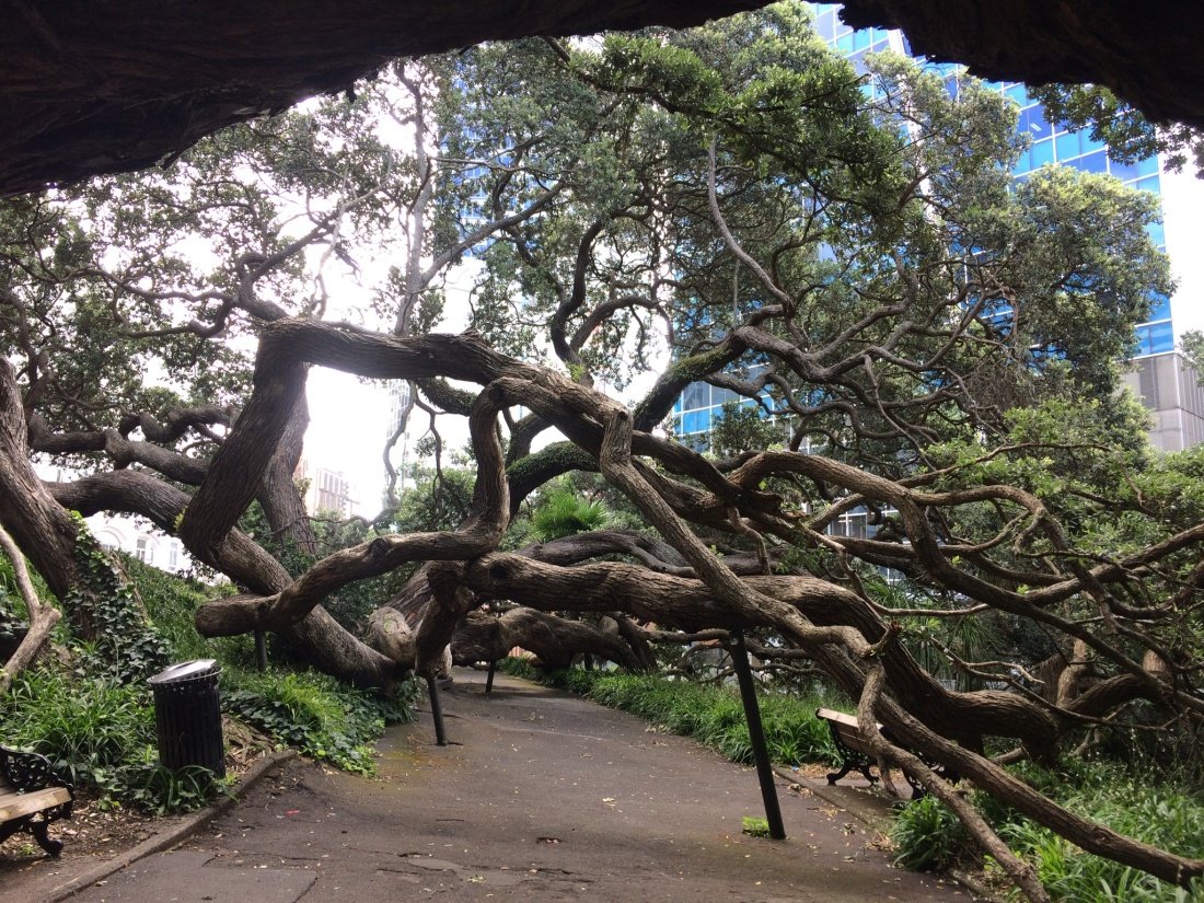
Beyond the university and the museum, the Wintergarden, somewhere that hitherto only existed for me in a Tiny Ruins song. It was sweet and mysterious, like the song, and a couple were getting their wedding photos. “Congratulations!” said the passing tourists. And there was this thirsty or trumpeting guy:

You go past a cricket field, and the hospital, and the prison, and a couple of famous, very posh schools; then straight up Mt Eden, an old volcano (like most other hills in Auckland).
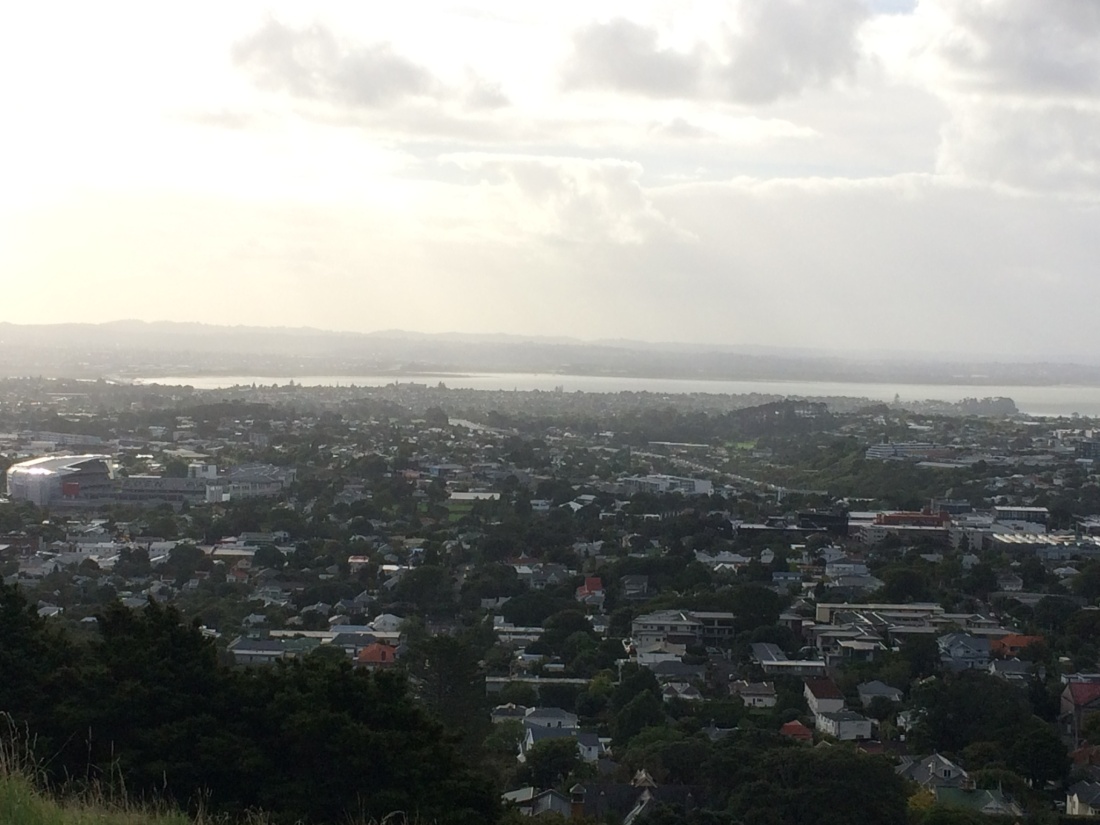
When you breathlessly reach the top of this legendary mound, there are views back along the north shore, where you’ve walked for two days, and across the huge, sprawling belly of Auckland. There it is, greedily and cheerfully taking up a whole peninsula, big-bellied Auckland with its untold lovers:
That, as you probably know, is a reference to the excellent Māori name for Auckland, surely one of the most poetic, yet political names in the world: Tāmaki Makaurau – often translated as Tāmaki, the spouse desired by a hundred lovers.
It was called it that, apparently, because the fertile volcanic peninsular is so richly blessed with weather, soil, fish, shellfish and plants, and so strategically located – narrow enough to drag a canoe across, allowing access by water to territory in all directions. Everyone desired Tāmaki.
Today, every woman, man and their chocolate lab is still in love with Auckland, and wants a piece – house prices are insane and tourists thunder through. And fair enough – it’s spectacularly beautiful in parts, and has a subtropical energy that is sometimes joyous, sometimes a bit demented.
There’s no doubt it’s a mighty, magical city. But when you look down on that slender isthmus, it seems to quiver a little under the pressure of so many embracing arms; as though Tāmaki is in danger of being loved to death.
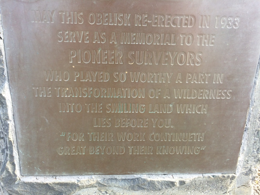
This plaque, one of many on the summit, seemed to offer a clue to where it all started to go wrong between Tāmaki and his myriad, voracious lovers:
The trail takes you on through serene, costly Epsom and into Cornwall Park, along avenues of native trees and up to the summit of Maungakiekie – One Tree Hill.
As the sun went down I looked down over the grazing sheep (who seemed oblivious to being a living cliche) to Onehunga and Māngere Mountain, where I’d be walking tomorrow. And there was Manukau harbour, the other side of the isthmus – I’d reached the Tasman, after leaving the Pacific late that morning.
On top of Maungakiekie the night-time Tāmaki emerged, even more compelling, a vivid sea of lights and hopes.
Some Te Araroa walkers skip Auckland, saying nothing could interest them less than a boring yomp along suburban streets and sterile motorways; but, far from boring, I found it a uniquely satisfying tramping experience.
First, because Te Araroa trust have designed an elegant route through the most charming, pedestrian-friendly parts, so it’s urban in a quirky, multi-textured way, rather than a grimly industrial one.
Secondly, because walking for hours through a city reveals it in unexpected ways – how it lies along its hills, ignores or conforms to them, how it washes over the terrain, yet how it can never completely dwarf or overcome it.
I walked on down Maungakiekie, past the clump of young native trees on the summit, planted to replace an invading, justly extirpated pine. Then I was into Onehunga: gateway to Manukau, and the trail south.
Another joy of urban tramping is the availability, when you’ve had enough, of Uber. Soon I was at my mate Dan’s place in Blockhouse Bay, footsore, scenery-dazzled and in powerful need of beer and a bloody good catch-up.
Day 36 – Onehunga to Puhinui: 25kms.
In the morning another Uber had me back in Onehunga and on the shores of the mighty Manukau. I crossed the old Māngere bridge, now mainly used by fishers and cyclists, and headed around the coastal track to Ambury Park, a working farm with spectacular harbour views.
Rain hammered down while I was on the way but the sun came out just as I stopped for lunch, at a shelter made partly of volcanic stones, right on the water’s edge.
Māngere Mountain, just behind the park, erupted massively quite recently (in geological time), so there are cool lava caves and formations roundabout.
Two German tourists happened by, hopping from rock to lava rock along the water’s edge, as I was boiling the billy for a coffee. “Do you know anywhere we can camp that has a shower?” they asked. Maybe the farm park? They have a campsite. “Yeah, but there is no shower,” they said. “We just got off a plane from Germany, and came straight here; we really need a shower.”
Auckland airport is only a few minutes drive away from the suburb of Māngere Bridge; 747s levered themselves into the sun-showery sky over Māngere mountain every few minutes.
Later, I thought I should have told them to just jump in the harbour; it looked pristine. It wasn’t always that way, though. Auckland’s main waste water plant is right on its edge, near Ambury farm, and it used to completely desecrate the harbour. Recently, it’s cleaned up its act in a huge way. The transformation is incredible, to judge from old photos on the information panels along the track.
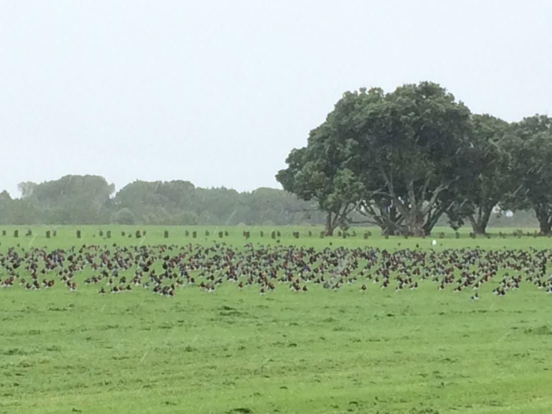
Manukau harbour is one of the world’s top sites for spotting certain migratory wading birds: bar-tailed godwits, lesser knots, whimbrels, sandpipers, pied oystercatchers, pied stilts and wrybills. Vast flocks of them fly literally from the other side of the world, within the Arctic circle, every year to spend summer eating shell fish on the Manukau’s immense tidal flats. The grassy parks on the way to Ambury are a favourite resting spot for them when the tide’s in:
Around the other side of the Māngere peninsula, thousands of birds roost among the mangroves. “Civilisation”, the legacy of those brave surveyors honoured in the plaque above, completely stuffed this place, for generations – the shellfish died, the birds didn’t come, and local Māori had their food source, their identity and their community badly damaged. So it’s really heartening to see how thorough the restoration has apparently been.
Below: Leave the poor, love-sick birds in peace!
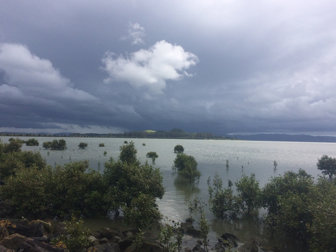
The apocalyptic sky seemed to converge on Puketutu island, the small forested idyll just off the coast from the water works:
But there was light at the end of the tunnel – out at the harbour entrance, where the Waitākere range broods over the Tasman:
I took a lot of photos through here, because a) it was really beautiful and b) it would be my last coastal walking on Te Araroa for a thousand kms or so. The trail heads inland from here and doesn’t return to the coast until down around Wellington somewhere, I think. I’m sure it will go through some incredible scenery, but I really love coastal tramping.
I sat on this Manukau harbour beach and thought that the next time I sat on a beach while walking Te Araroa might be years away, at the pace I’m going (about 500km a year).
Looking back over the ground I’d covered, I saw the still, sheeny waters of the harbour; to my left, the wooded hill of Puketutu Island; to my right, the double-round hump of Māngere Mountain; and, way in the distance, the peak of Maungakiekie – One Tree Hill, with its plinth, presiding over the landscape. I was right there, at the foot of that plinth, only the night before, and since then I’d come nearly 30km under my own steam.
I like seeing, in this kind of scene, how landscape predates us, out-punches us, overpowers us and takes precedence over us, often in an understated, gentle way. For example, Māngere for me, until now, was just the name of a suburb. Now, looking at that mountain, I see it as the site of a primeval explosion, full of energy and natural forces.
And Maungakiekie beyond that, how it dominates the landscape – and yet it, too, has become “just” a suburb, One Tree Hill. How we reduce the landscape, the geography and the planet to our human dimensions, but how it resists, how this harbour fought back after the sewage works and all the damage we did to it, how the Māori from here stood up for it, to help it recover.
After leaving the harbour, you go through the Otuataua Stonefields, a heritage site where Māori once stacked sun-warmed stones to warm their kūmara crops. The piled stones remain. Today the most striking remnants, to me, are the many signs denoting an ongoing protest over land rights. An information panel says tangata whenua are in danger of being squeezed out of their rightful territory by greedy developers, and that historic land-theft in the area has never been recognised, much less recompensed. The more things change…
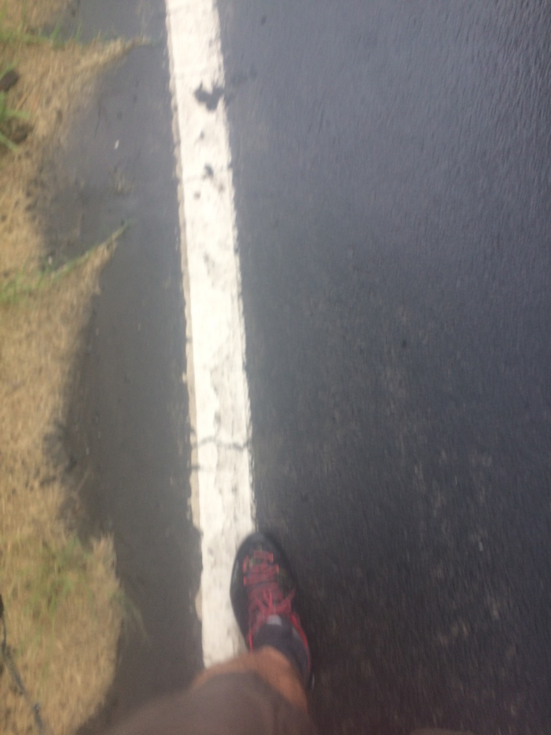
After that it’s a long schlepp along tar seal roads in the back country around the country’s busiest airport. It rained, the odd car roared by, huge planes rose and sank through the mists. I put my head down, clicked into the familiar feeling of the land slipping by, and followed the white line.
It was another unique, urban tramping experience, to move with my sedate but deliberate rhythm through the frenetic airport precinct, with its fast-food factories, warehouses, industrial sites and highly-focussed, hunched drivers zooming toward pick-ups, drop-offs or distant lands.
A bridge took me over broad, brown Pukaki Creek, which, at low tide, is no more than a thin silver ribbon along a muddy central groove.
On the other side, a viewing area; people park up to plane-spot, or to wait for loved ones, or eat McDonald’s before heading into town. While I rested under a nearby tree, one of those steel behemoths lumbered up into the sky directly over the viewing area, and trumpeted off, stately, immense, certain.
Less stately, but still serene, I, too, trundled on in the drizzly twilight. A few kilometres later, good mate Dan turned up. More perks of urban tramping: generous collection from the trail-end, the same bed for a few nights, and not having to cart all your stuff.
Beer-time.
Day 37 – Puhinui Creek to Brookby: about 21km
Dan had a day off and was joining me for the day’s journey. His partner Amber dropped us off back at Puhinui and we followed a path beside the creek, which Te Araroa trust has cunningly used to take walkers west-to-east across one of Auckland’s biggest industrial areas.
At first the trail passes through a reserve and is lined with bush; it feels like proper tramping, beside a silvery stream and big native trees.
Then it enters the industrial area around Wiri and its banks become much more imprinted with humans’ funny ways, ranging from manicured lawns, to introduced trees, to Rainbow’s End in the distance. Puhinui creek: I feel your pain, but you soldier on, tinkling, as you always have. I hope you always will.
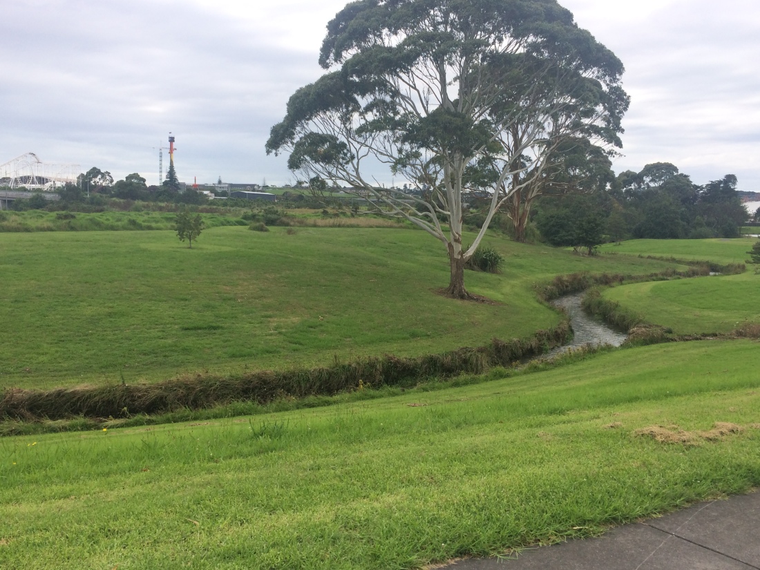
It’s quite cool following a natural feature through a suburban semi-wasteland; despite all the hydraulic engineering, fuel tanks, a prison, flood protection, channelling, streets, subdivisions, factories, warehouses, playgrounds and concrete paths, the stream just wends its determined way, the only really wild thing anywhere to be seen.
At times it disappears under all that enveloping, anaesthetising concrete; you pass a few barb-wired compounds, a cul de sac or two, a traffic light, a thoroughfare; only to see it reborn a bit further along, holding no grudge, its silvery tinkling undiminished.
It was great to have human company, too; we tramped along, chattering.
There was one other wild thing in view: Matukutūreia, AKA McLaughlin’s Mountain. It has been vandalised by a quarry, but it’s still mostly there, covered in grass and a bit of scrub. I love the casual way these low volcanic mounds keep appearing as you tramp through Auckland, around the corner of a building or beyond an on-ramp: We’re still here, they murmur in their knowing, bluff-shouldered voices, despite your concrete, your quarrying, your surveyors, your endless cars.
The creek track brings you out, after nearly 10kms, at Tōtara Park, after a short stretch of the very lovely Auckland Botanic Gardens.
Then it’s suburban streets through the outskirts of Manurewa for a while, before, all of a sudden: countryside.
Six days after entering Auckland’s northern limits at Waiwera, I’d reached the other side of Tāmaki’s kingly sprawl.
There are views of the Hunua Ranges as you slog along the frenetic Alfriston and Brookby roads, further and further out into the quiet paddocks.
Cars and trucks hurtled by, and Doctor Dan took a professional interest in the high-tide drifts of scattered road-kill.
I was flagging by the time we reached Brookby; it had been six days, and 114kms, since I’d had a day off.
Brookby turned out to be a place of compelling quietness, with a primary school, a riding club and a drowsing crossroads.
Dan’s missus Amber collected us there. Beer o’clock. O urban tramping, you are so under-rated.
