
“People like Paul and himself, with their pianos and violins, are here on this earth, the earth of South Africa, on the shakiest of pretexts… the ground beneath his feet is soaked with blood and the vast backward depth of history rings with shouts of anger.” – JM Coetzee, Youth
“…Any sensible person knows grief is a long-term project. I refuse to rush. The pain that is thrust upon us let no man slow or speed or fix.” – Max Porter, Grief is the Thing with Feathers
Sipping a mussel from its shell and staring at Mission Bay through a sun-laced pōhutukawa, the young doctor seemed lost for words.
Then: “This,” he said thoughtfully, “is not shit.”
I’d just spent some of day 38, supposedly a rest day, kayaking across Waitematā harbour with the eloquent Dr. Dan, a mate who generously hosted me for the three days I spent crossing Auckland proper.
Apart from it being a spectacular stretch of water, the point of the Waitematā paddle was to stick to my plan of travelling every metre of the whole, long, lovely length of Aotearoa, under my own steam.
For logistical reasons I’d ferried from Auckland’s north shore to its CBD a few days previously; now I had time to come back and fill in the gap (only a k or so each way).
We hired a tandem boat from Ferg’s Kayaks at Okahu Bay and a chirpy guide took us across to Devonport beach. The Harbour Bridge loomed above; a gentle but strong swell rolled in from the Pacific, blending with the wakes of ferries, speedboats and cargo ships.
On the way back we visited Judges Bay, which is as close as small boats are allowed to the ferry dock in the CBD. Then we meandered through Hobson Bay (salvaging a storm-blown spinnaker en route).
Afterward, Dan and I walked around to Mission Bay to sit among the pōhutukawa branches on the verandah of the Belgian cafe, with the breeze, beers, mussels and frites; and lo, it was not even slightly shit.
Later we visited the Viaduct, and Dan showed me a famous ocean-going yacht that’s moored there, all incognito and elegant – the Ngataki. She’s the star of a classic of New Zealand sailing, writing and adventuring, South Sea Vagabonds (1939). This was a special moment for me (not least because Dan has a family connection to her). Her first skipper, Johnny Wray, was a lover of the sea’s “cleared attics” rather than the bewitching wrinkles of the land. But I feel sure Johnny, who built this incredibly resilient and lovely craft with his own hands and sailed her through storms, oceans and love affairs, would approve of the concept of Te Araroa.

Day 39 – Brookby to Clevedon: 8km
I made up for a not-completely-restful rest day by only doing 8 clicks. Mainly because, to return to the trail, I first had to get back from Blockhouse Bay (Dan’s house) to Brookby (the point I reached before my day off). This involved a long trip by foot, bus, train and Uber; much easier, and quicker, said than done.
From Brookby it’s a short road trek to some paddocks. Then you have a steep climb up Kimpton’s Track onto a low range, covered mostly in pines. From the top, there’s a satisfying view north of massive, sprawling Auckland, which I had just walked across on my two feet.

To the south and east, the Coromandel Peninsula across the Hauraki Gulf. Here’s that view, beyond the estuary of the Wairoa River (where Johnny Wray once moored Ngataki for a winter of repairs):

More to the north and east, Waiheke Island, with its olives, wine and mansions, and the Coromandel looming beyond.

On the other side of the summit was the lovely Clevedon scenic reserve, where I passed walkers and joggers heading up for their evening constitutional.
Clevedon itself is a charming little place with a few cafes and shops, and a down-to-earth pub. There, two generous mates and several cold beers waited: more joys of semi-urban tramping. I stayed the night with them in Papakura.
Day 40 – Mercer to Rangiriri: 25 km
(Note: from this point on, my distance totals in the titles of blog posts will be slightly out of synch with the Te Araroa website, for a while, because I had to skip a section – as outlined below).
The next section, which is 60km and takes about three days, contains what should be a spectacular final curtain to the Auckland leg of Te Araroa: the Hunua Ranges. Unfortunately I had to defer this pleasure, because the Hunua tracks have been closed to trampers for repairs since a huge storm in March, 2017.
Now, I’ve heard on the trail grapevine you can ignore the signs at the trail head and tramp it anyway, and that the authorities are just using the excuse of the storm damage to get on, undisturbed, with other tasks like trapping or pest-poisoning. But that may be totally untrue and, as I’ve said before, Te Araroa depends on goodwill and a certain amount of playing by the rules. The whole thing could collapse if too many people ignore things like the occasional trail closure.
So I left the Hunua for another day – it’ll keep. I got a bus from Papakura to Mercer, just beyond the closed section; this remnant of a town is the gateway to a completely new region of Te Araroa (and of the country): The Waikato/King Country.
My aim was to do 45kms of it, which would take my total for the trail so far to 700kms, allowing for skipping the Hunua.
Incidentally, getting to Mercer by public transport is now a lot harder than it used to be. Buses no longer stop there, there’s no train station, and hitching through the south Auckland sprawl could take forever. So I bought a bus ticket to nearby Pokeno, and was resigned to walking or hitching the 8 kilometre difference; but the driver kindly agreed to pull over at Mercer and let me off there.
“Doing the big walk, eh?”, he’d said when I came aboard with my pack and poles. “Good on ya.”
From the motorway service station and restaurant complex that historic Mercer has been basically reduced to, the Whangamarino Redoubt Track leads walkers up into the hills above the Waikato River, New Zealand’s longest.
Here are my first views on Te Araroa of this mighty, storied, much-loved and much-abused awa – first, looking south, i.e., upriver:
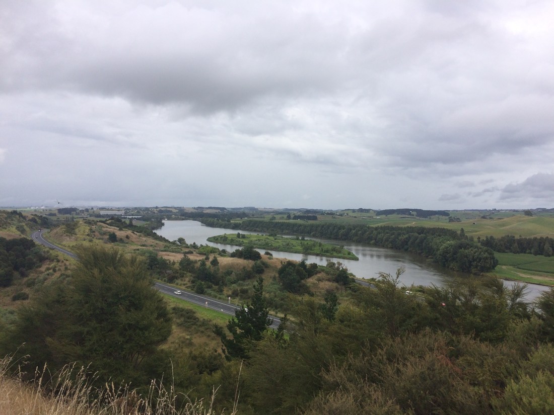
And below, looking northward (down river), towards where the Waikato eventually meets the sea:

This long, broad, aloof-yet-personable river will keep me company for the next 80 ks as I journey up toward the North Island high country.
The gloomy skies were apt because, soon after, I came to the first evidence of why this river, and its eponymous region, are such significant keys for anyone wanting to unlock the real, violent story of modern New Zealand.
It’s a sad story, and a brutal one. I’ll digress briefly to re-tell it, in my words, because what’s the point of walking the length of the country if you don’t get confronted and illuminated by the truth of the place and its stories?
I mean the stories we don’t have time to see, much less consider, when we blast by on the motorway at 100 kilometres an hour.
One of the things that makes this country special is that in 1840, The Treaty of Waitangi was signed between Māori and colonising British. Some people, mainly descendants of the colonisers, find it embarrassing, for some reason, and think it unworthy of a national day, which they wish was simpler, more triumphant. But I think it’s actually pretty special that our country was founded on an agreement – a pact between two people, to share a land. Almost like a marriage.
And it’s also special that it’s not a simple day, because since when were life, and community, and human beings, simple?
Anyway by the 1860s the settler numbers had swelled, and more were coming all the time, and they wanted what arriving people always want – more land. From ever-growing Auckland, they eyed the fertile Māori stronghold to the south, the Waikato. Māori leaders there felt that hot gaze, and wisely anticipated trouble; they fortified their villages, armed their warriors.
The colonisers, wilfully or not, misinterpreted this as aggression, and built a massive, military road – now Auckland’s Great South Road – right up to the edge of Waikato Māori’s sovereign territory. This road ended right where I was walking, near Mercer.
Waikato Māori, apparently, saw this in the spirit with which it was intended – as a threat; a show of “might is right”. The Māori didn’t think might was right; they thought right was right, and wrong was wrong, and agreements to share a land should be honoured.
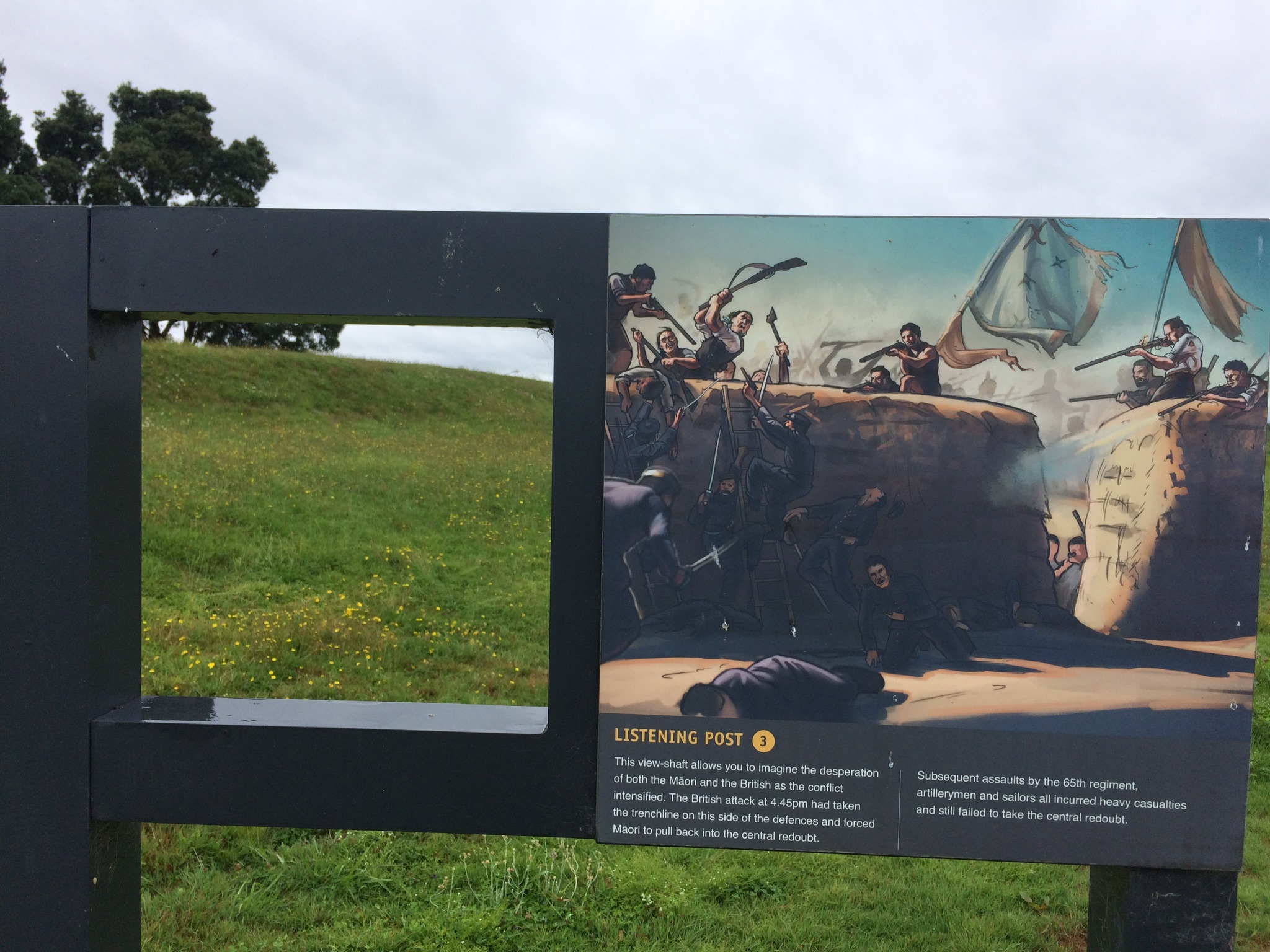
There were skirmishes. British soldiers in red coats and with the latest military gear responded by shelling a Māori village on a ridge called Meremere, which you can see through this viewfinder, erected on the very ridge they fired from:

From the information panel, I learned the deadly shells came from long-range, 40-pounder Armstrong cannon the British lugged up this hill – a hill treasured for many centuries before that as a peaceful food-gathering site.
In the river below, the British had the purpose-built, 300-ton, iron-clad warship Pioneer, and other gunboats; their shells came down hard and thick on Meremere.
The Māori fought hard. But eventually, the settlers shelled them into submission; then took their land. This was repeated around the Waikato, and in different ways, around Aotearoa.
I was impressed at how this place and its story have been preserved, at the good attempts at “making memory”, at honouring the past to learn from it, and acknowledge the pain and loss inflicted. But also sad at how little this story is known, how little taught in schools, how little discussed. How we cringe away from it, instead of facing up to it. At how much more familiar Kiwis are with our exploits and losses in wars on the other side of the world, than we are with the drama, meanness, cruelty and tragedy that we did to each other, right here, in places like Whangamarino.
Beyond the redoubt, the track finally reaches the river, a peaceful sight after all that sadness:

It’s beautiful, but it has been shelled too – by agricultural and urban pollution, deforestation, and introduced pests. Sitting staring at it, I was jolted when several half-metre giant Koi carp loomed out of the shimmery depths:
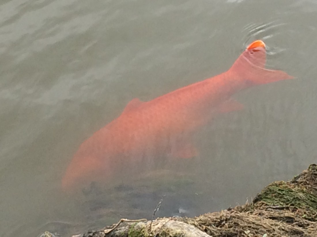
These look like huge goldfish, of course, but they’re actually one of the most devastating invasive fish in the world. Like another kind of “red coat”, they eat everything in sight, including the native species that have always called the Waikato home.
They roll on their backs to tug at weed and search for prey, surfacing slowly like great glowing monsters. One poked its powerful nose above the surface and seemed to eye me, cold, alien, indifferent.
But golden marauders notwithstanding, the riverside pathway is really beautiful:
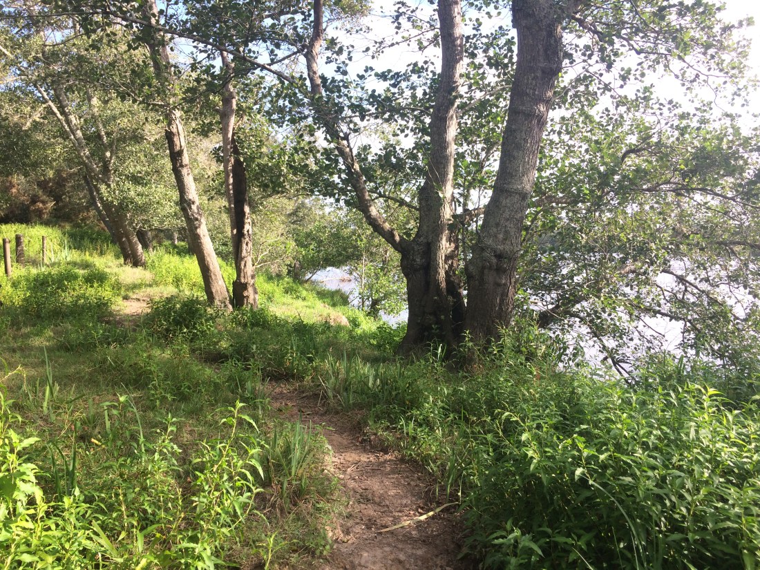
It meanders along the bank, beside cornfields, paddocks, and through sun-dappled bush. For all this beauty, credit where it’s due:

I’d struck a perfect summer day for river-bank wandering, and it was bliss to bowl along in the muggy sunlight.

The riverbank is bayou-like, lush and fruitful. The trail leaves the state highway behind; its howl and hammer fades away, replaced by silence, water-slosh, the cicadas’ ecstatic, sexual yodelling.
Sometimes, though, a forlorn sort of civilisation pops its head out. Is there anything as desolate as an empty, silent drag strip?

Further down, huge swathes of river:

The occasional headland lets you drink in the scale of it:

The track isn’t always obvious. Soon after I took that photo, there’s a swamp which, the trail notes say, you can cross on a 30-metre boardwalk. But the track petered out before the swamp edge. I cast around, up and down; backtracked, crossed fences, but no board walk could I find. Eventually, resigned to slopping slowly through the swamp, I set off, prodding gingerly forward with my poles into all that soggy lushness.
But almost straightaway there was a “plink” – my pole-tip had hit the boardwalk, invisible under the smothering swamp-grass.
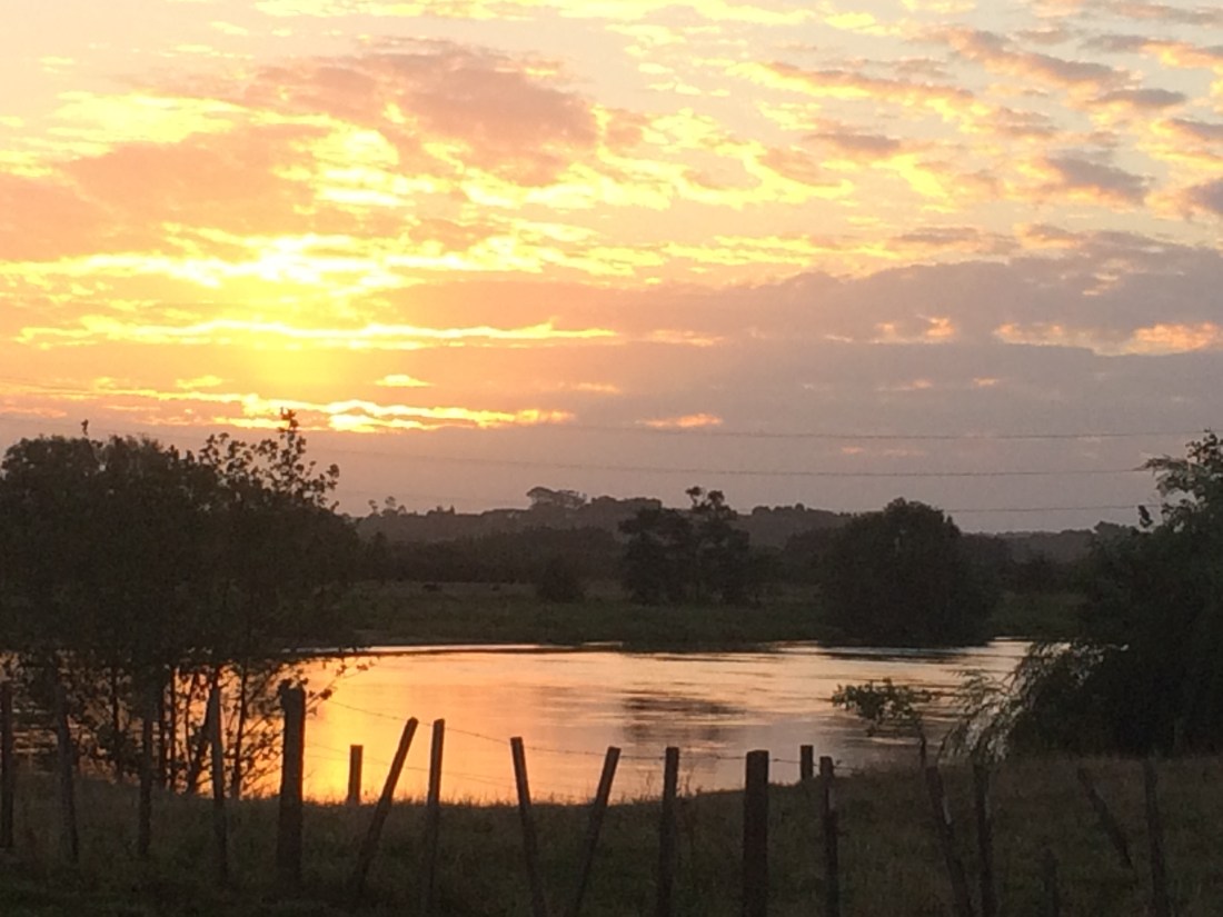
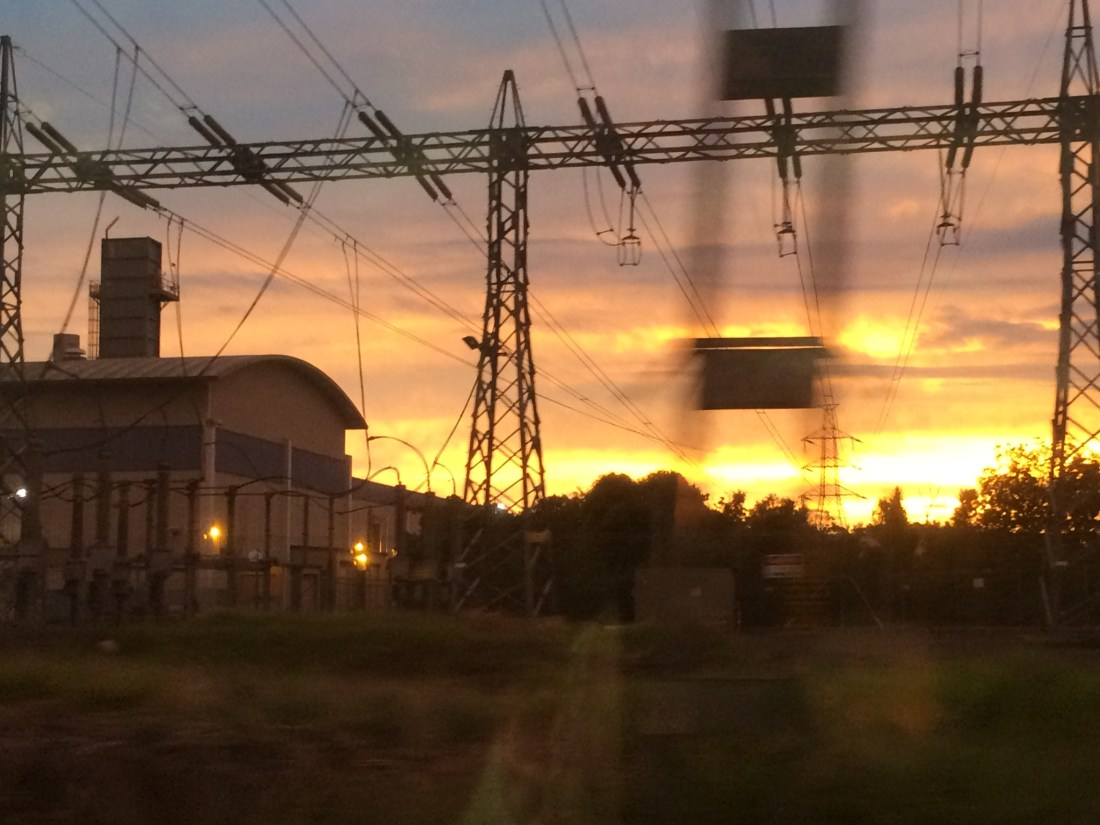
Then it’s a long, tired 8.5kms along the stop bank into Rangiriri. On the way, the sunset:
After that faded, it was time for some of my favoured moonlit tramping. Here, with the stop bank a straight and even path, there was no danger of getting lost, so I switched off my head-torch and padded along in the night.
I’d rung ahead to Cathy Miller, who runs the Rangiriri pie shop, guest house and camp site. I’d be getting in late, after dark. Could I camp anyway? “Sure – I’m away, but just go through the gate behind the house and pick a spot.”
Rangiriri was deserted and silent. I pitched my tent in the moonlight, and had a sleepy feed and a liquorice tea, watching the trees across the paddock sweep and sway in the starry breeze. Then I crawled inside and slept.
Day 41 – Rangiriri to Huntly: 17km.
Rangiriri is one of the most moving and significant places in New Zealand’s history; though I’d be surprised if even one in 10 Kiwis would be able to say what happened there. Me included, before I visited on Te Araroa.
So in the morning, after one of Cathy’s sensational pies, I took some time to explore.
It’s the site one of the bloodiest battles ever fought in New Zealand, between the invading British, and Māori people trying to stay on their land, in their community.
What happened was this (as detailed in the NZ History website): on November 20, 1863, British army and navy forces attacked the Māori position at Rangiriri.
It was the last line of defence of the Kīngitanga, a Waikato based land rights movement under King Tāwhiao. Having shelled the Kīngitanga forces out of Meremere, a day’s walk down river (where I paused en route to Rangiriri), the British sailed their gunboats up to Rangiriri to pound its ingenious defences.
Then they charged on foot, again and again. The battle was intensely fierce: the stakes were high on both sides.
The Māori warriors held out a long time; finally they succumbed, in controversial circumstances. 37 British fighters died, and some 50 Māori; many more were wounded. 183 Māori warriors were exiled and imprisoned on Kawau Island, north of Auckland; their land was taken, and their community links shattered.
(Earlier on this leg of my tramp, I’d climbed a hilly, remote track named after the Northland warrior who later helped them escape; it’s described in a blog post below).
A line in the NZ History site’s account of the battle sums up the truth of what happened at Rangiriri – people getting violently shoved off their rightful territory by others, who considered themselves superior:
“Settler William Morgan wrote in his journal that it was ‘extremely annoying, in fact it is galling, to think of our losing so many fine officers and men by such savages as those we had a sight of yesterday.’”
Despite the sadness and brutality of what happened, it was special to see the efforts in this small town to tell the truth about the past. There are two historic sites: Te Wheoro’s Redoubt, and the main Rangiriri Redoubt.
The signage and information panels at the two sites pull no punches. They use words like invasion, even detail a war crime – fleeing Māori, including women with children, being shot in the back by British marksmen as they tried to escape across this lake:

From Rangiriri village, with its genteel pub, museum and cafe, you have to walk up a gravel road and a hill to the remains of Te Wheoro’s Redoubt to find out this stark detail; potshots at desperate, displaced backs.
It took me by surprise. Most of the rest of the language on signs, leaflets and websites around Rangiriri is a bit dry and military: engagements, positions, falling back and moving forward, as if it was a big tactical game. But these words were more concrete, and got through to me: bullets in fleeing backs.
There’s a photo of the Māori leader the redoubt is named after – a Ngāti Naho chief who initially tried to work with the Crown, for his people’s sake; only to later become a leading critic of what he saw as racist government policies.
Standing on the site of his fighting pā, looking around at his people’s land and then into his sad, thoughtful eyes is a powerful experience. This is a man who personally experienced the pain of the failures and flaws of the Treaty of Waitangi, but who never gave up striving to make the pact work, for everyone’s good:
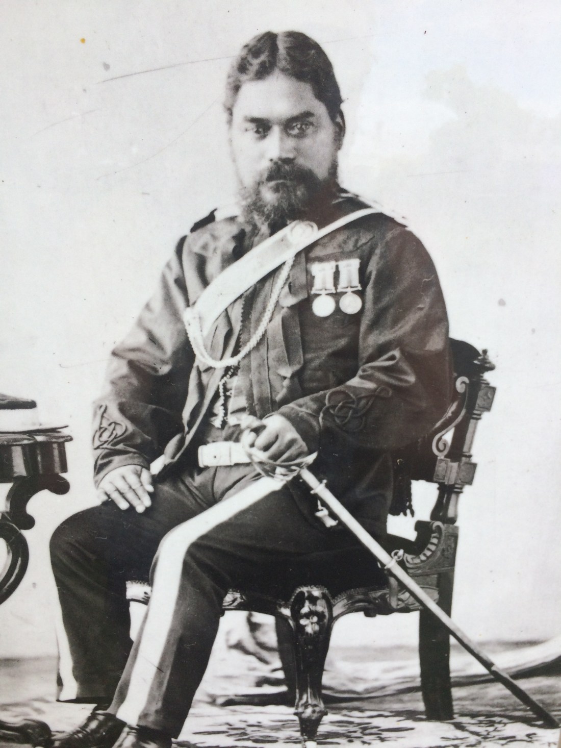
“It was a long time ago, move on, move on” – that’s a mantra you often hear when this topic comes up in New Zealand. But to me, Te Wheoro’s eyes in this photo seem to say: how can you move on, when “it” was done to you, to your people? How can we all move on, when this country still doesn’t really acknowledge, collectively, the wrongs that were done?

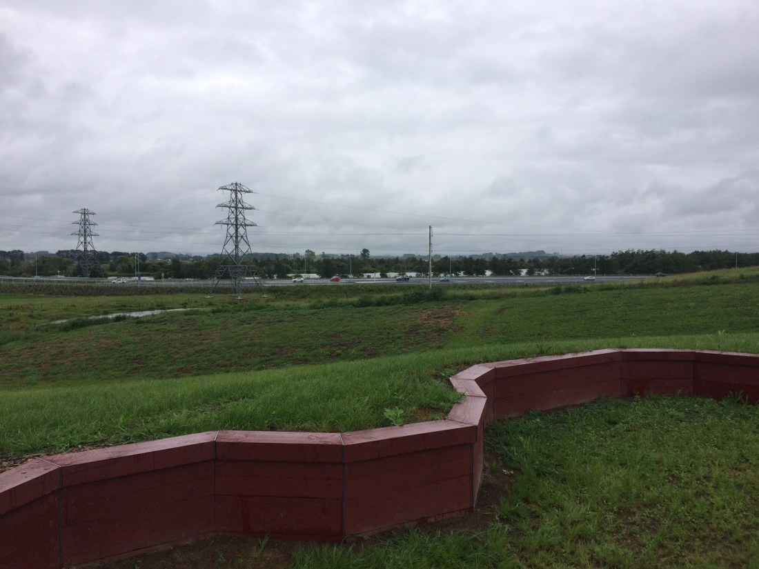
Down the road at the main Rangiriri Redoubt, a newly built, interactive memorial lets you feel the grim intensity of the battle, with information panels and view finders:

There are thoughtfully reconstructed fortifications and landscaping that let you imagine the scene in 1863. Instead of that line of traffic below the trench-line, I pictured steel gunboats:
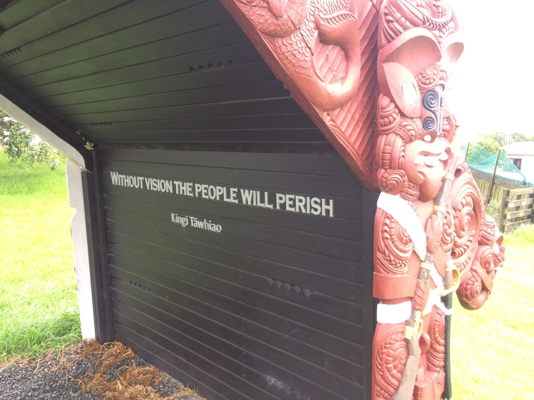
And there’s a message for every New Zealander from King Tāwhiao, who was defeated here, but who kept standing up for justice for years afterward in the King Country:
Outside the cemetery, there’s another excellent information panel; but it seemed symbolic that the letters toward the bottom are distorting and sliding off. As if it represented the ground of memory under our feet turning slippery, eroding away; as if an acid rain of forgetfulness is eating at our foundations, which are composed of words – the words of an agreement to jointly build a country.

Another provoking thing about Rangiriri is the way the traffic floods past. It’s right on State Highway 1, a river of concrete, a symbol of the “civilising” forces in whose name explosives rained down on this place.
Thousands of people stream by on every day; how many stop? How many know what this sleepy river-bend represents? Maybe that’s what Rangiriri is most evocative of, in the end: oblivion, forgetting, numbly “moving on”.
Somehow, I think, we’ve got to find a way process this stuff better, as a country. It’s all there, gnawing at us; we just don’t like to think or talk about it.
For me, Rangiriri was the most powerful, impacting stop of the whole, nearly 700-kilometre journey so far.
But now I, too, had to “move on” – with my feet, at least.
From Rangiriri the Te Araroa trail takes you over the Waikato River and along the stop bank on the other side. You’re bound to meet some curious locals:

That guy was pretty shy, but later, some of his older relatives were much more forward. “Oi!” this tough-looking chick seemed to demand. “What’s in the backpack, city boy?”
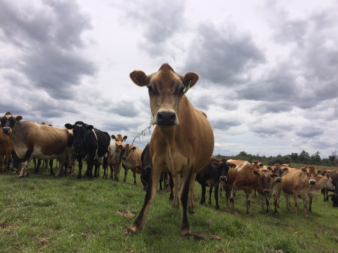
The trail is very pastoral along here – cows, pasture, farmhouses and crops:

The river glides along through it all, hushed, muscular, serene:
There’s a golf course, Māori land, horses, and finally the famous orange stacks of the Huntly power station.
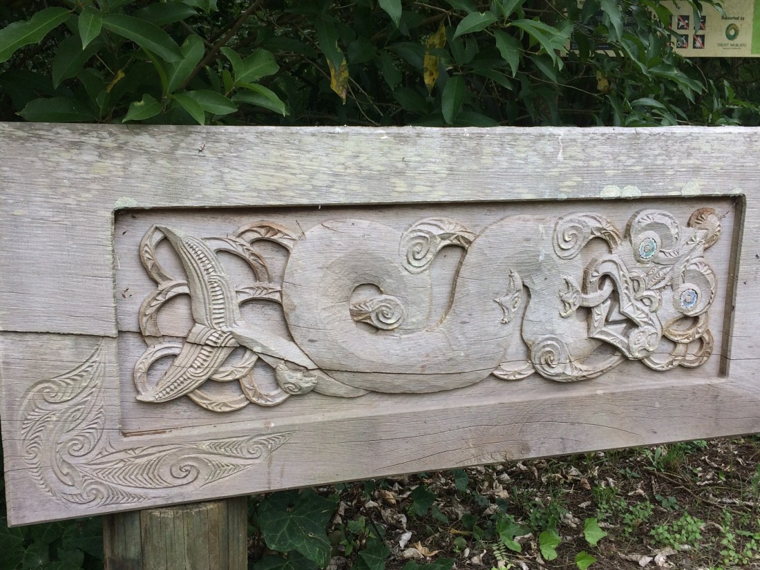
Nearby, signage for the Te Araroa trail talks of the Waikato iwi whose land you walk through, and the mythical taniwha, water creatures who inhabit the river and interact in endlessly surprising ways with humans. There’s also an exhortation to trampers, which sums up what that day on the trail had been like for me, especially the start of it, in Rangiriri:
Kia tūpato kia pai tō hikoi – Walk the path in safety
Me te titiro whānui, kia koa – Enjoy and learn
Ki ngā taonga – kei mua i a koe – From your surroundings.
In Huntly I crossed over the river on the rail bridge and stuck my thumb out on State Highway 1.
A tradesman picked me up and took me into Manurewa, where I got a train, then a bus north to Waiwera, where I’d left my car. On the way, I got a wave and a smile through the train window from my old Te Araroa friends Māngere Mountain, and the Manukau harbour:
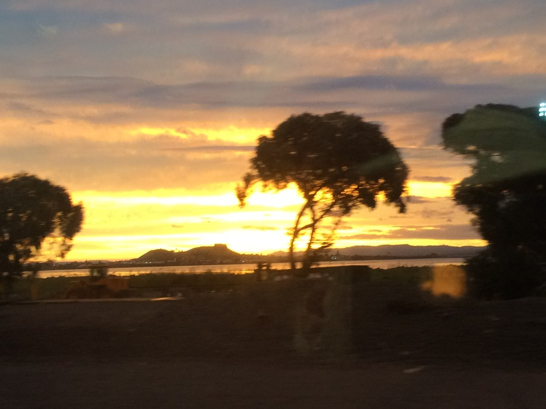
Beyond the industrial zones and the vibrating veins of the big city, I saw the glow of the wider world I’d walked through for the last few weeks, and the months before that.
It will keep glowing as I head back to normal life, sustaining me until it’s time to hit the trail again. That will be in a few months, when there’ll be another instalment of the Te Araroa section of this blog. Thanks for reading!
(If you haven’t already – see the rest of the journey below).
