Day 22 – Rest day: 0 kms.
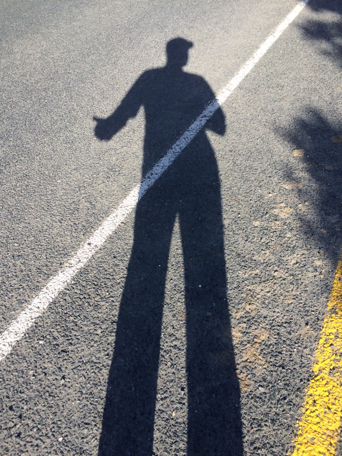
In the morning, after hiking well over 100kms, it was utterly delicious to be able to laze around, read a while, get up when I felt like it; and even more delicious to have breakfast like this:
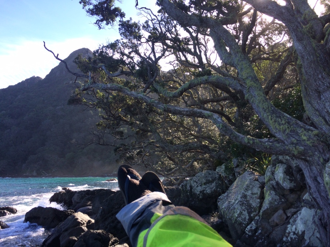
Lying there in the sun, I sipped coffee, munched crackers with peanut butter, and felt the boulder under me shake as the big waves hit it.
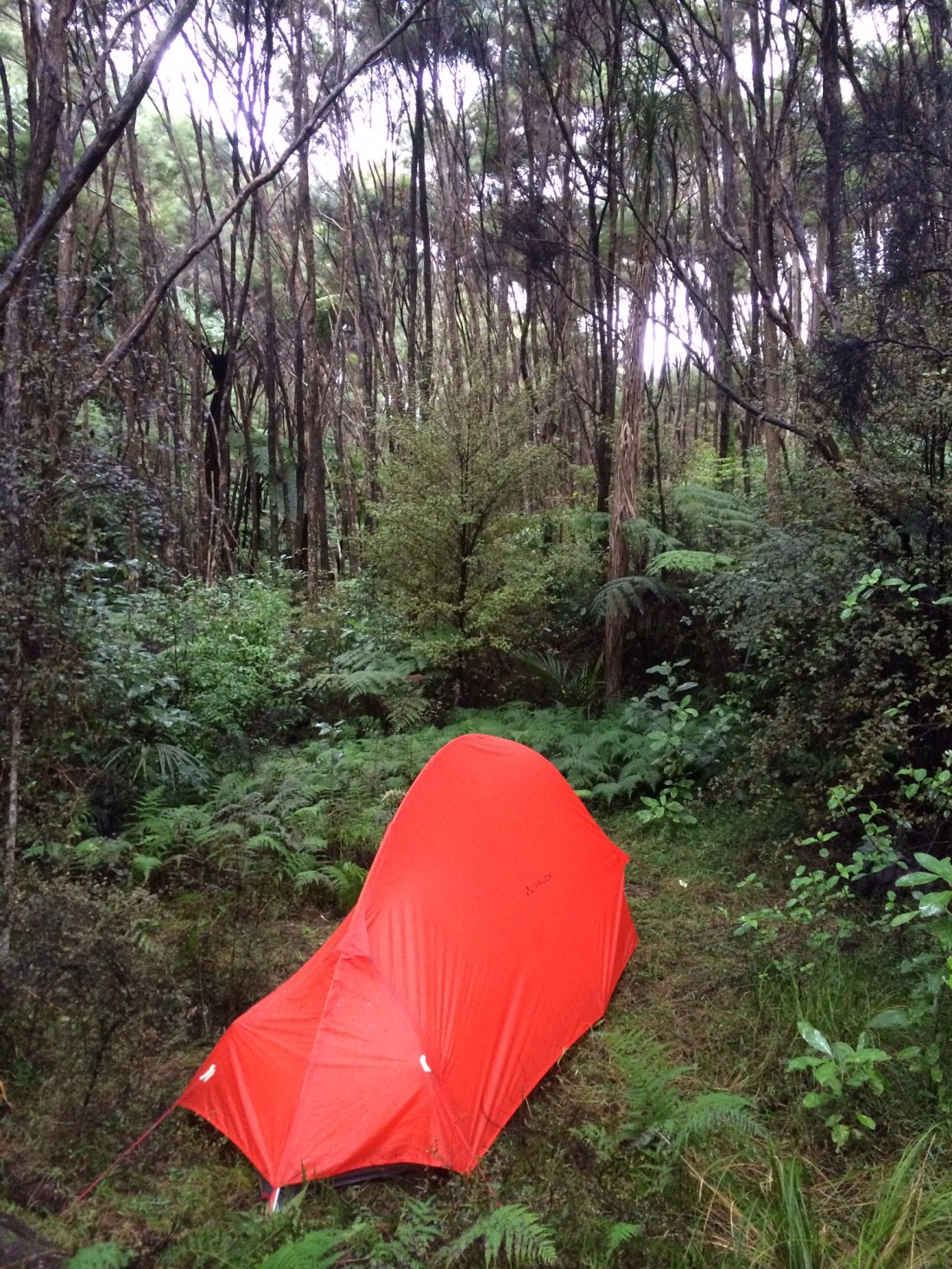
Note the rugby socks and stylish windproof leggings from Warehouse – despite the “Winterless North” nickname, it got down to just below zero that night. I was fine in my tent, though I did wake up at one point just before dawn and put on my raincoat – it was the only thing I had left to bolster my sleeping bag.
The teen fishers went home after lunch and I had Peach Cove to myself. It’s a very peaceful spot, perfect for a rest day.
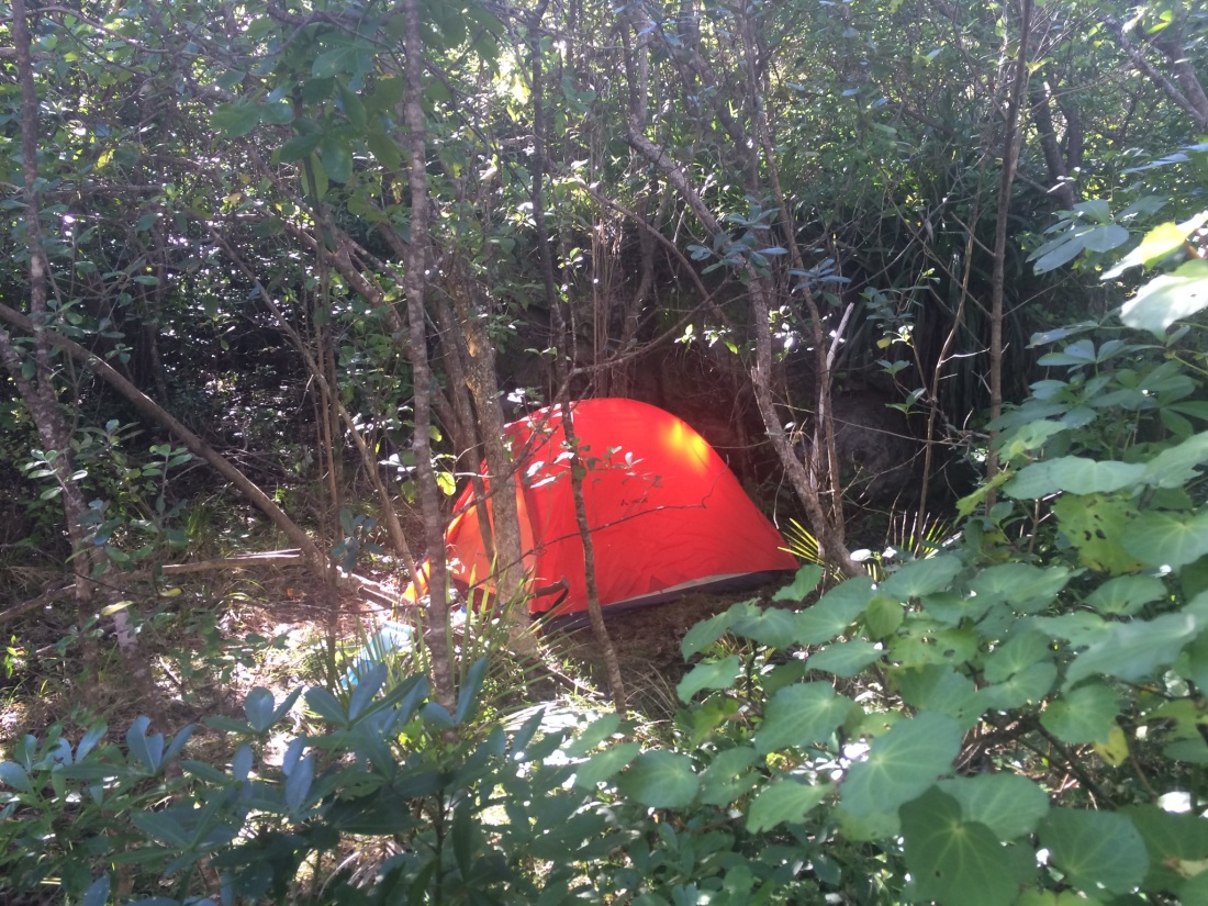
I liked my little sunlit glade.
Day 23 – Peach Cove to Mackenzie Bay: about 7km.
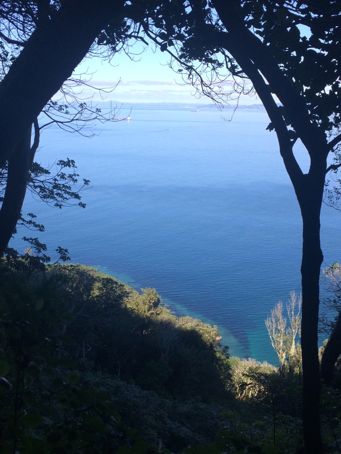
The thousand steps were a lot harder, of course, going back up; but the pain was lessened by the views down through bands of sun and shadow:
I was aiming for Reotahi Bay, where I’d arranged to paddle a kayak across the harbour to Marsden Point the next day; but I fell about 5kms short – the views are just too distracting:
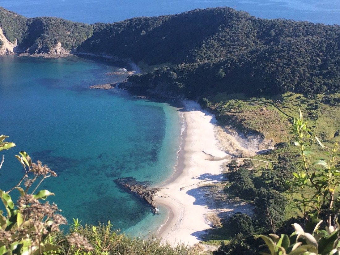
As always, some of the most beguiling vistas are back the way you’ve come. It’s so satisfying to see the huge sculpted immovable swathes of land, that you’ve picked your way obstinately over:
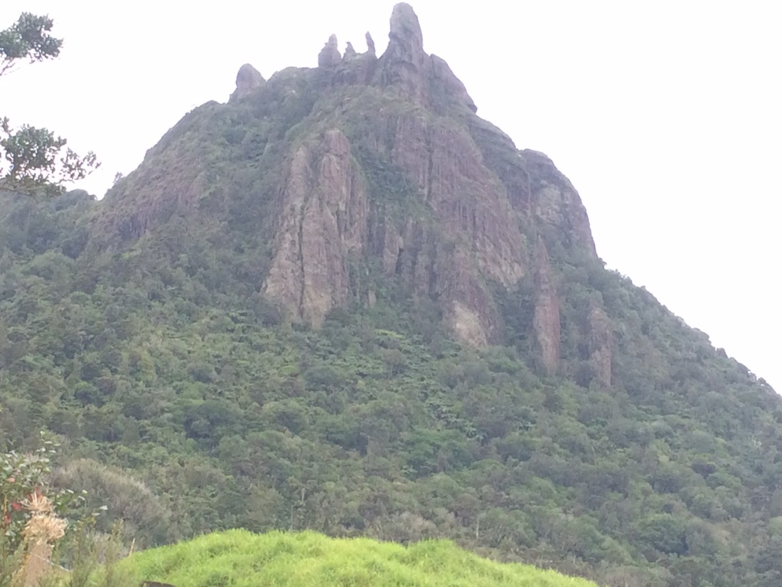
One of the most striking sights appears across a paddock of lilies and toetoe. It’s Mt Manaia, full of legends, history and mauri, with its brooding, taniwha-like, sculptural forms:
Finally I made it to Dougie’s place, Appin Cottage; it was a paltry 7kms, but the campsite overlooked the major international shipping lane I would be paddling in the morning.
Dougie is an artist and aficionado of Celtic lore, as well as a purveyor of hospitality to trampers; we sat up in front of his log fire with a Laphroig. Then I went to sleep in the bamboo grove, lulled, strange as it sounds, by the electric, brassy-bass hum of the refinery.
Day 24 – McKenzie Bay to Waipu (Tip Rd): about 21kms.
I’d arranged by phone to meet Peter, my kayak-contact, at 10am on Reotahi beach. Peter’s one of several boatmen listed in the Te Araroa trail notes who can ferry walkers across the 1.5km mouth of the Whangarei harbour for about $20. Otherwise you’d spend a day or more on a huge back-track north and east into Whangarei; crossing the mouth means you can carry straight on south.
But, as mentioned in an earlier post, my aim is to go the whole length of NZ under my own steam – so where water crossings are called for, I’ll kayak.
So I asked Peter if he’d mind just taking my pack across, while I paddled behind; he agreed with benign amusement.
My mate Nick from Waipu lent me his fishing kayak, and arranged to leave it on a pontoon at the Marsden Point marina, near his work. (It would have been a 2-hour return drive for him to drop if off on the Reotahi side, so that was out of the question).
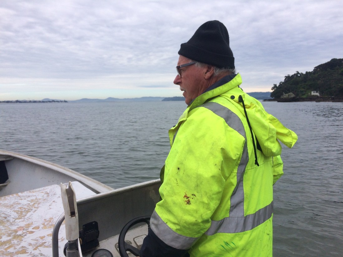
I was on the beach at 10am; Peter had said to phone him when I got there. “Look up toward Mt Aubrey,” he said on the phone. I saw a figure on a balcony waving. “Come up for a cuppa.”
Peter works at the port over the water from his home at Reotahi; but he moonlights as a log-catcher. If a log falls into the harbour while being loaded, it quickly becomes a significant shipping hazard. “It’s only a narrow bit of water,” he said, “but the tidal currents are huge.”
A tonne or two of spear-like timber, just below the surface, can wreck anything. So the call goes to Peter, or a mate with whom he shares a 24/7 roster; he jumps in his boat and zooms after the errant, lethal log.
He snares it, and tows it back to be re-loaded.
In between that, and his regular job, he ferries across walkers. “There were hundreds last summer,” he said.
The crossing is notoriously treacherous, Peter told me. A lot of port or refinery workers commuted in tinnies or kayaks, and he’d had to rescue a few that had come to grief. “It’s a long drive around through Whangarei, so sometimes they try and shoot across, when they really shouldn’t.”
In his time there’d been a few lucky escapes, and some deaths.
He saw me looking nervous. “You’ll be right,” he grinned. “It’s a perfect morning for it.”
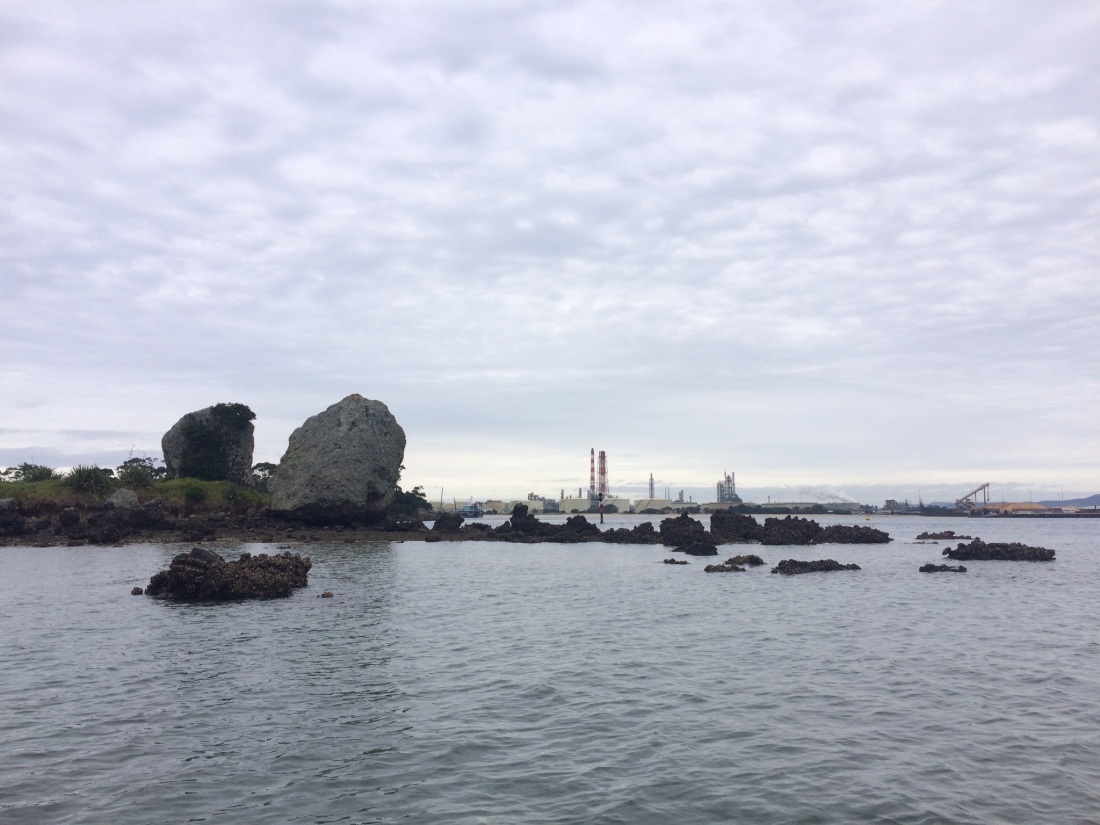
After the tea we climbed aboard and launched; Peter threw in a speedy lap of nearby Motukaroro Island, where several seals lazed. The waters around it teem, he said; its a marine reserve.
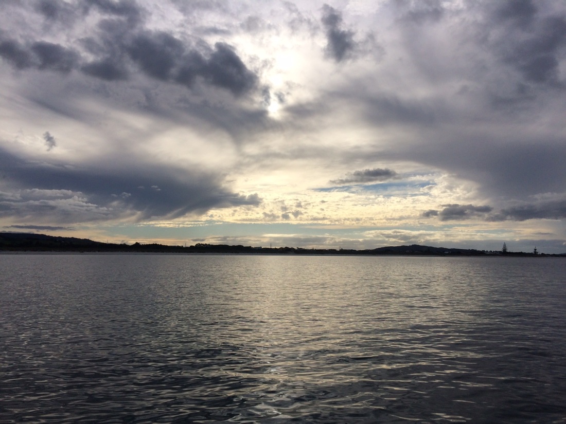
The refinery loomed over the water beyond the island, droning its quiet industrial hymns to the indifferent sky.
We reached the pontoon using the map Nick had sketched for me; dumped my pack, grabbed the kayak, stowed it, and were off back to Reotahi.
Drawing up to the beach Peter dropped my lurid orange coracle overboard, helped me scramble down, and sent me off with a smile and a wave. Peter’s The Man.
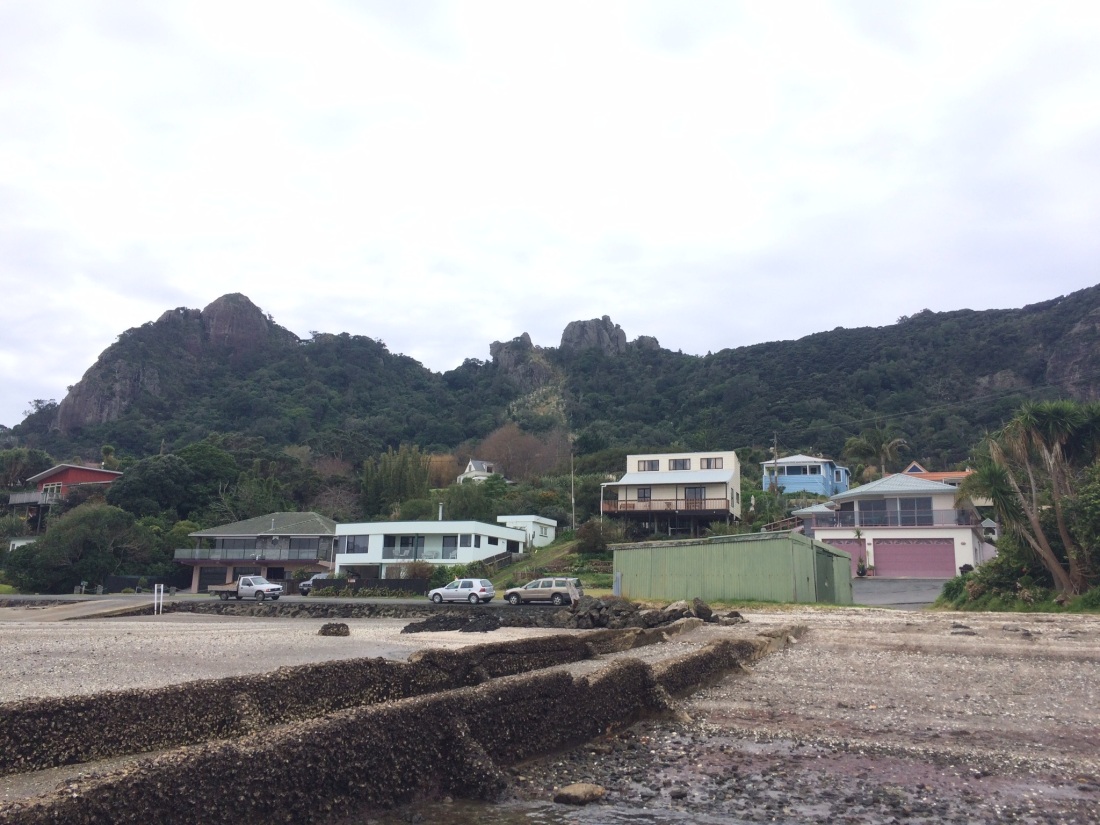
Looking back I could see the ridge-line line I’d walked over Te Whara and Matariki, with Peach Cove on the other side; closer was the bulk of Mt Aubrey, with Reotahi village by the water:
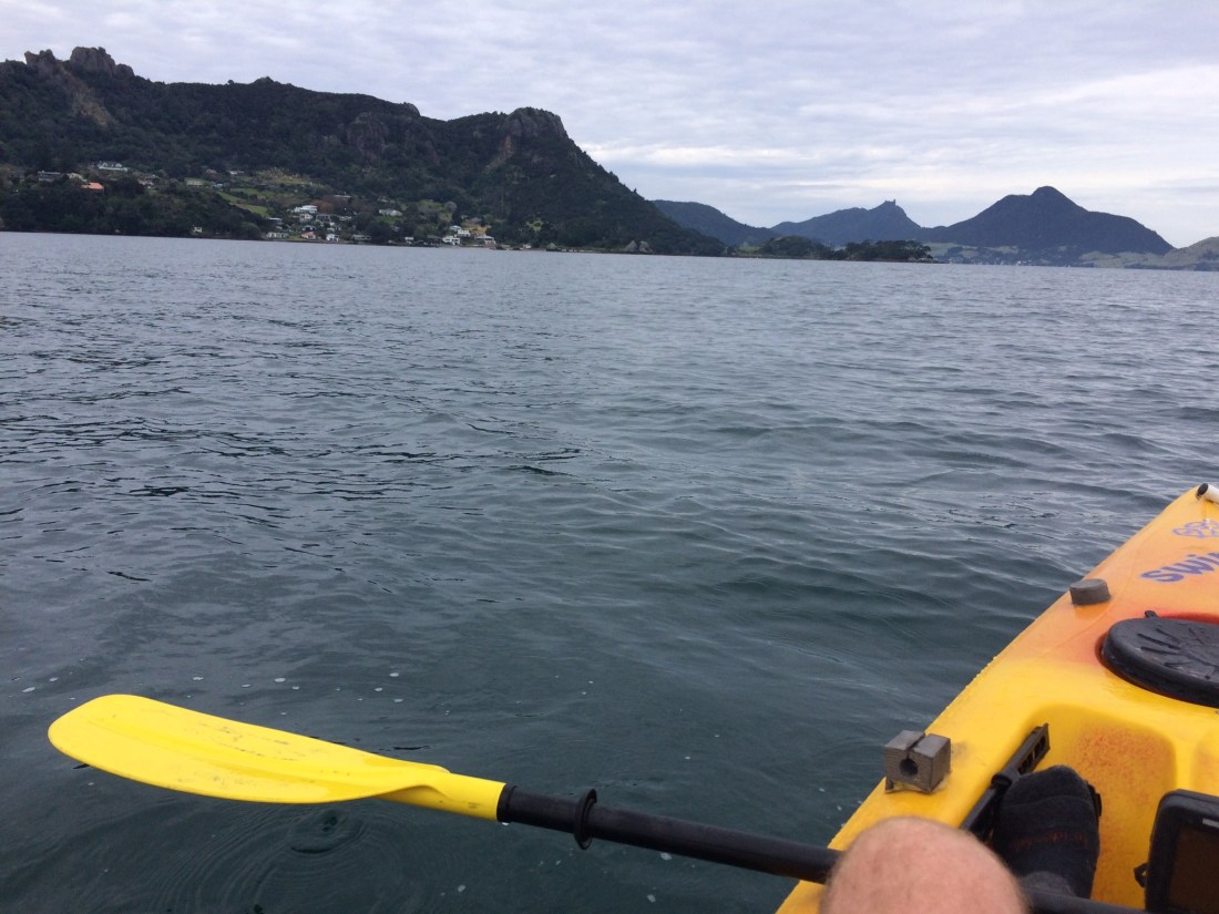
In less than half an hour I was paddling up to the Marsden marina; I had a few minutes rest, watching my footprints dry and thinking travelling thoughts. Then Nick turned up with a hot pie. Nick is also The Man.
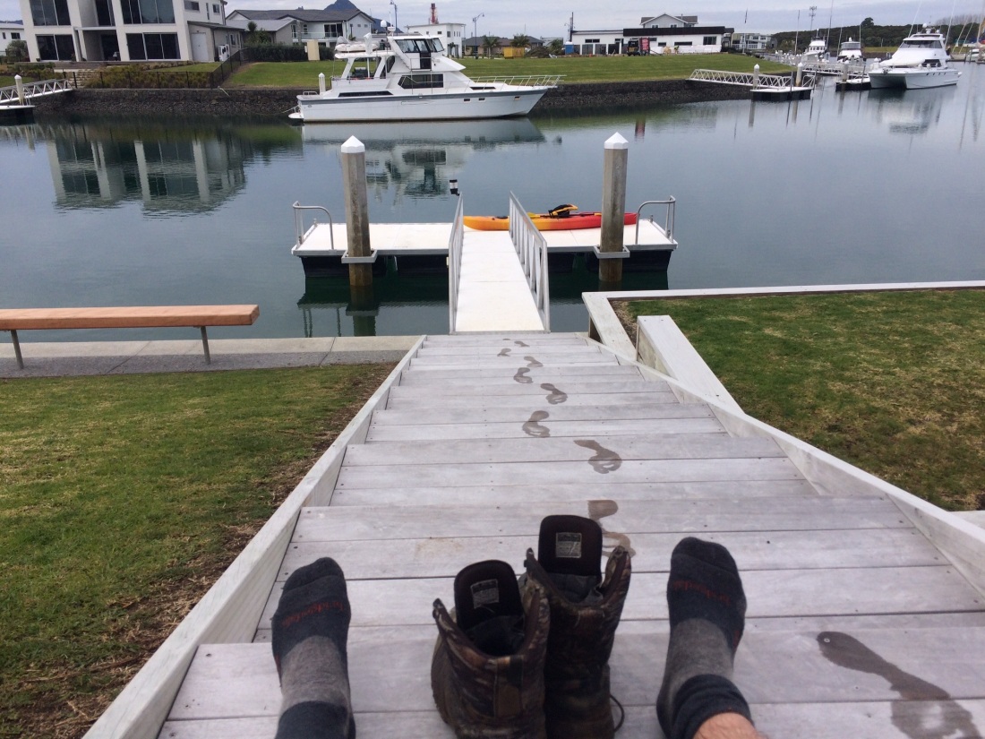
Nick dropped me at the Marsden Point beach, where the ferry would have dropped me had I not kayaked.
I wasn’t skimping any of the Te Araroa route, mind, because the distance I crossed is actually greater than the ferry route. (I’m a bit nerdy about not skimping.)
A little way down the beach you duck under the huge, gullet-like pipeline that takes the refinery’s products on and off the docked ships. Then you set off along the long, creamy crescent of crunchy shells and crisp sand that is Bream Bay.
I had 20 kms to go to get to Nick’s house in Waipu, where I’d stay that night; the crossing had used up a lot of time, so I had to get a wriggle on.
It was a good feeling to put my head down, put my legs in gear and charge off down the sand, a small human engine.
I stopped at one point, though, to phone ahead and arrange another river crossing.
10kms down the beach is the Ruakaka River; you can wade it at low tide, but I was going to be there when it was high.
The trip notes mention Simon, who can hire kayaks to trampers for the crossing.
When he met me at the mouth, I told him an idea I’d had on the way: instead of walking the 6kms down the beach from Ruakaka to the road into Waipu, could I rent the kayak for a bit longer?
Normally he wouldn’t, he said – if something went wrong, he’d be liable. But I told him I own a kayak, go out on Wellington harbour a lot, carried a personal locator beacon and phone, and am famously prudent; after a while he agreed.
And so it was I saved 6kms of shoe leather, and soaked up great views back up to the heads, and marinaded myself in wintry, pewter hues.
We arranged Simon would pick me up from Tip Road, where the trail leaves the beach and heads into Waipu. Soon I was paddling peacefully south, parallel to the breakers, past the Uretiti DOC campsite; it made a great change from foot-slogging.
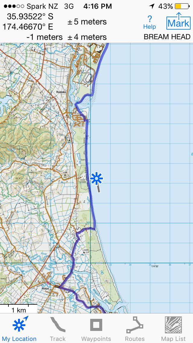
This is how it looked on my GPS – the purple line of the Te Araroa route, the Ruakaka racecourse and river mouth at the top, Tip Rd into Waipu at the bottom, me under the blue, starry shadow of the satellite:
Simon was there as promised; I paid, he gave me back my pack, I gave him his kayak. Perfect. Simon is the also The Man.
Good old mate Nick was waiting for me there too, with Ruby the dog. After she had a go at the three-legged land-speed record on the beach, we were back at their house and into a frosty beer or seven.
Day 25 – Waipu (Tip Rd) to Cove Rd, near Bream Tail: 24km
Just after dawn, on his way to work, Nick dropped me back at the end of Tip Road. By late morning I was through Waipu, and up on the Brynderwyn Range, looking down over the sweep of Bream Bay toward Marsden Point:
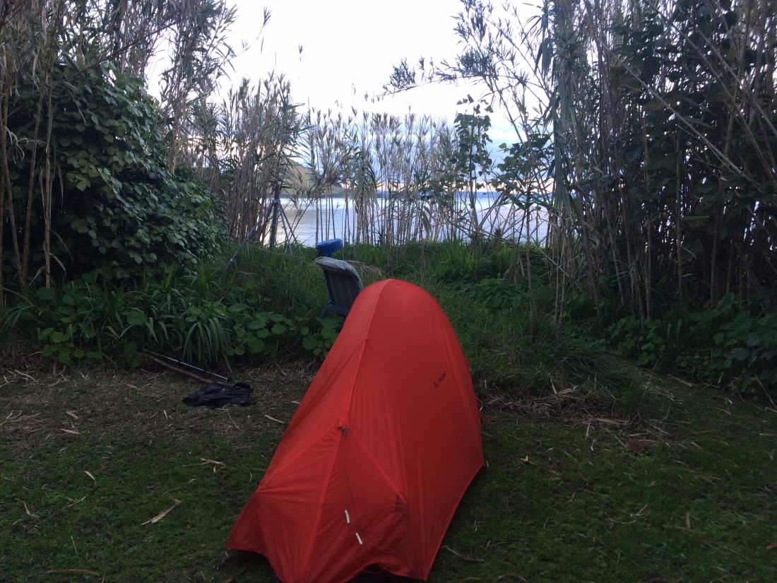
In the evening, I made camp in a quiet patch of young manuka near Cove Rd. Their slender tops swayed with a composed, mesmerising grace in the easterly that built all night.
Day 26 – Bream Tail to Pacific Rd, south of Mangawhai Heads: 21 kms
This was my last day on the trail for that trip. I was aiming for 21 kms, which would give me a total for the trail of 461km, and 300km for this mid-winter stint.
It was still fairly sheltered as I set off from my campsite and then up Bream Tail Rd. But near the top of its gradual incline you are nearly overlooking the sea, and any weather coming off it – and today there was plenty. A storm wrecking roads and houses further south was more benign here in the balmy north, but the wind and horizontal rain still shrieked in my ears, threatened to tear my woollen hat off, and sent me staggering sideways at times.
The trail takes you through paddocks and then a section of mature bush, complete with some of those whale-like kauri, serenely unmoved in the face of the storm.
Then you pop out onto the Mangawhai Walkway, a clifftop track with fantastic views. One of the pleasures of a long tramp is the way the outlook suddenly, radically changes. It happens just as you feel as if you’ve been walking past a landscape for so long, it has seeped into you through your boots.
I’d spent the last four or five days looking at Bream Bay, the Hen and Chickens islands, and the Whangarei Heads, from just about every possible angle; but now I’d made my way over the Brynderwyn range, and a whole new tranche of terrain was thrown open:
The Mangawhai harbour is too wide to wade and I doubted I’d get anyone to hire me a kayak on such a rough day; so there was nothing for it but to trek around through the townships of Mangawhai Heads and Mangawhai, and over several bridges. This adds about 5 kms, but is worth it for the outstanding burger shops you walk right past.
Finally you’re through the towns and back on a gravel road; it had rained on and off all day and the name of the road didn’t augur well: Black Swamp Rd. But soon enough I was in a sheltering pine forest, and on my last km or so of walking for this trip.
I found a sheltered campsite near the beach, but away from both the protected birds that nest in the dunes here and the fenced-off pines.
Freedom camping is a hot-button issue in NZ, but sometimes it has to be done on Te Araroa, because of the way the logistics of the trail unfold. I plan to avoid it, unless I’ll be in DOC estate, where you can generally camp where you like. But sometimes there’s no alternative: it’s getting late, there’s no traffic for hitching and no public transport to get to accomodation in town. But if there is no specific area set aside, it can feel like you’re going to get yelled at by someone, ordered to move on at 2am.
You just have to be a bit delicate about it, and sensible, and hope for the best. Of course you leave no trace when you pack up – you take your rubbish, dig a very discreet toilet pit if you have to, light no fires, etc.
In the morning the storm, and this section of my tramp, was over.
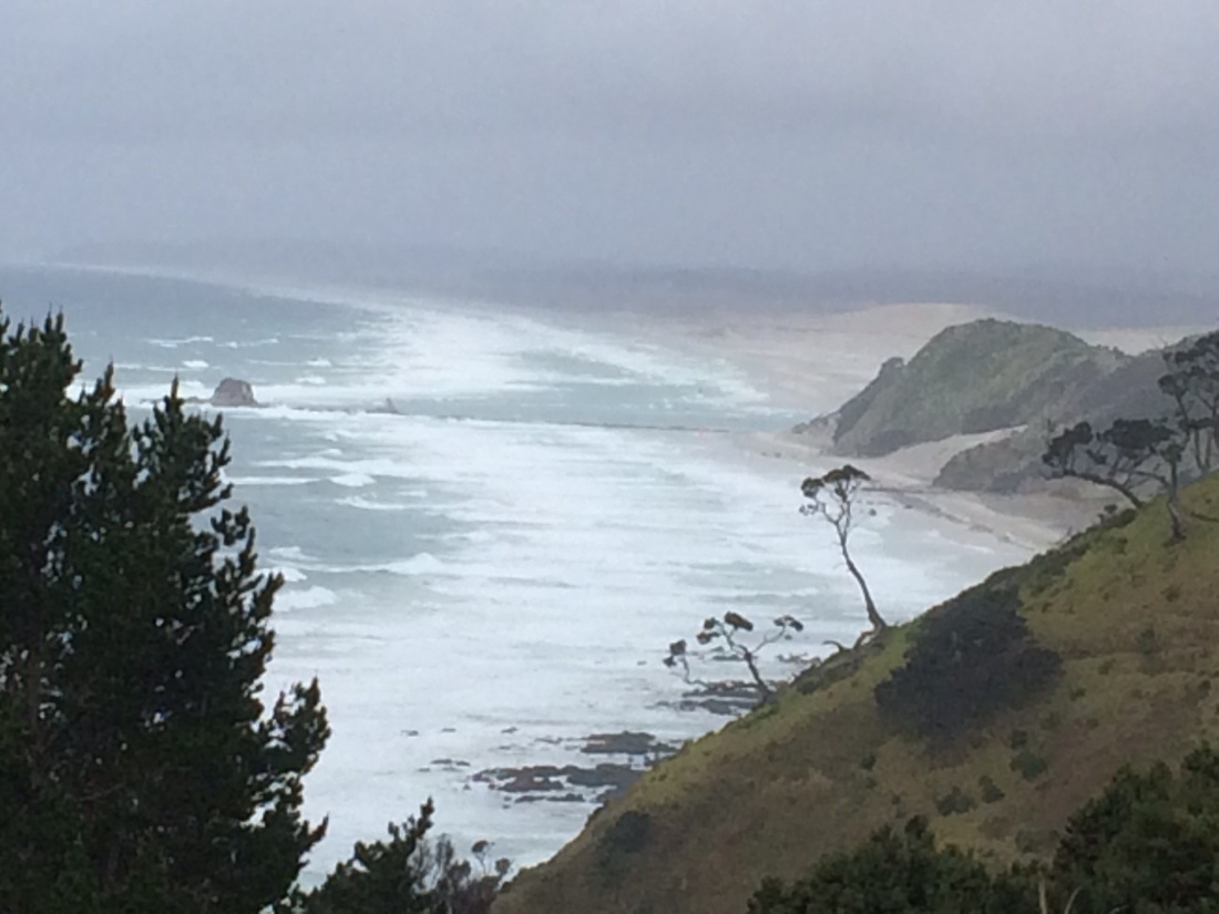
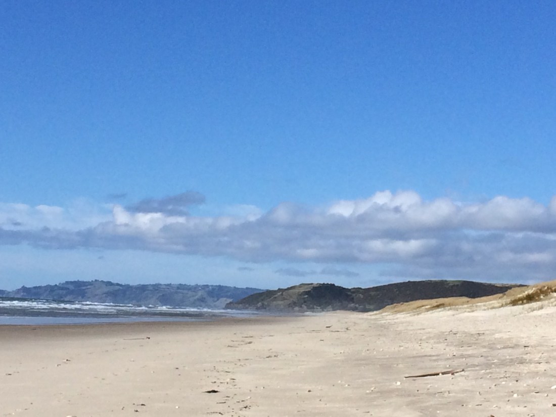
I went for a swim, had breakfast in the dunes, and spent the morning enjoying the glorious golden views up and down the beach.
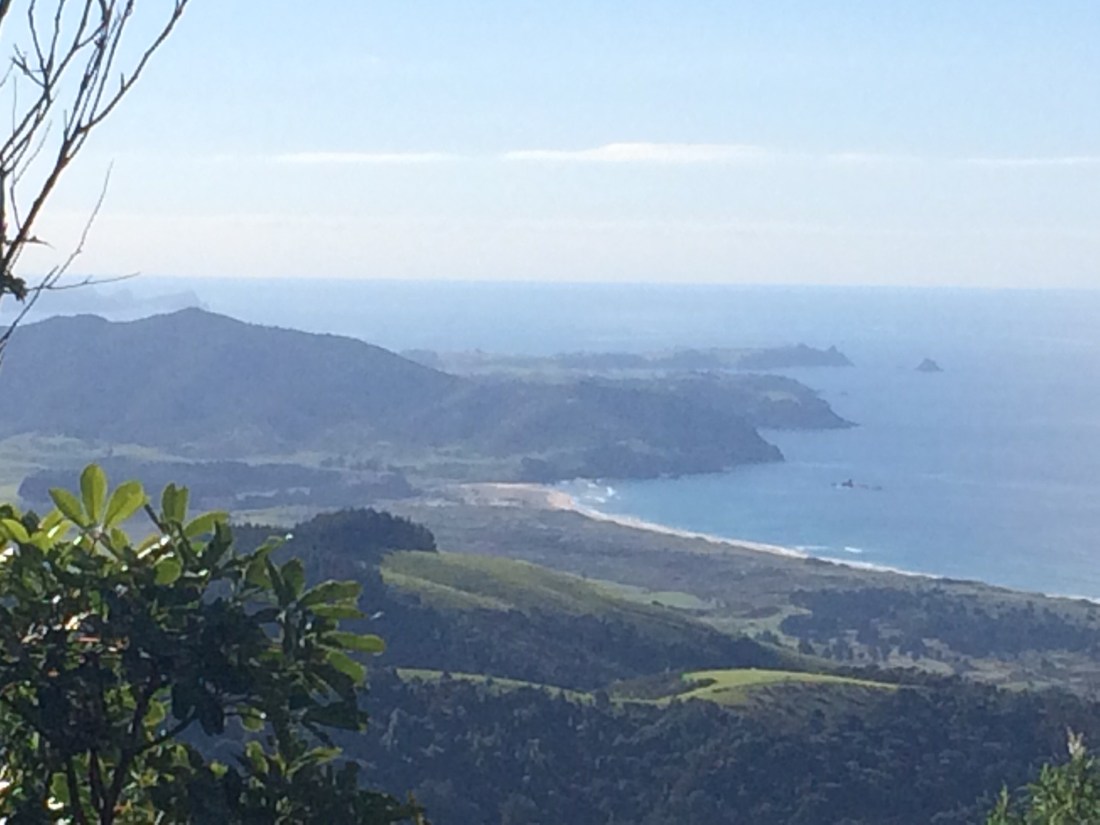
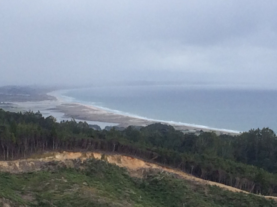
This is where I’d been – looking North to Mangawhai Head, the Brynderwyn Range, and Whangarei Heads and Marsden Point beyond:
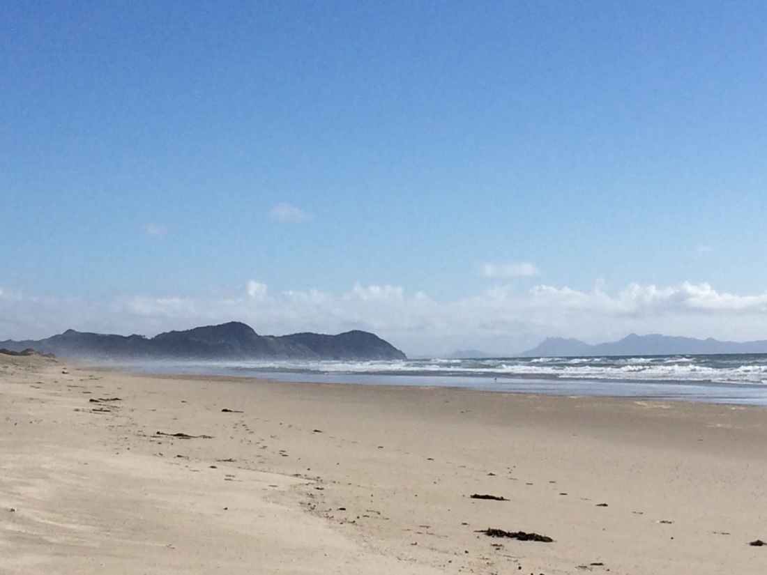
And this is where I was going, on my next Te Araroa instalment – south to Te Arai Head, and Pakiri beach beyond that:
After lunch I packed up, walked out to the main road and hitched back to Nick’s in Waipu, where I’d left my car. A three-week, three-hundred kilometre section of Te Araroa was in the bag.