

When you’re out in the hallucinatory beauty of the Kiwi back country, sharing it with other people can be both hellish and heavenly.
I touched on this tension at the beginning of my previous post, which deals with the first five days of this 13-day, 268-kilometre section of the Te Araroa trail. This post covers the following eight days.
I’ve been doing the full trail in short bursts when I get time off work (meaning the entire, 3000-kilometre journey down the length of NZ will likely take me at least six years). Until now, these two-week bursts have been lovely and lonely.
But this time, by chance, the timing of my walk coincided with the point on the trail that dozens of Te Araroa through-walkers had reached. These are a disparate bunch of about 1000 characters, many from overseas, who walk the mostly off-road trail from Cape Rēinga to Bluff in one hit, only taking the odd rest day. Most of them leave Cape Rēinga around November each year, and reach Bluff by March, or thereabouts. So a fair few of them were in the King Country/ central plateau area of the North Island when I was there, in early December, 2018.
And as well as these intriguing strangers, I shared a few days on this particular stint with a couple of people already dear to me.
All in all, it altered the experience, mostly for the better – after all, according to a proverb which has been described as New Zealand’s most famous*, people are the most important thing.
Since January, 2017 I’ve covered just over 1100 kilometres of Te Araroa (in Māori: “the long pathway”). Here’s an account of the most recent bit.
Day 54: Near Piropiro to Mystery Creek (both on the Timber Trail)
(about 20 kms)
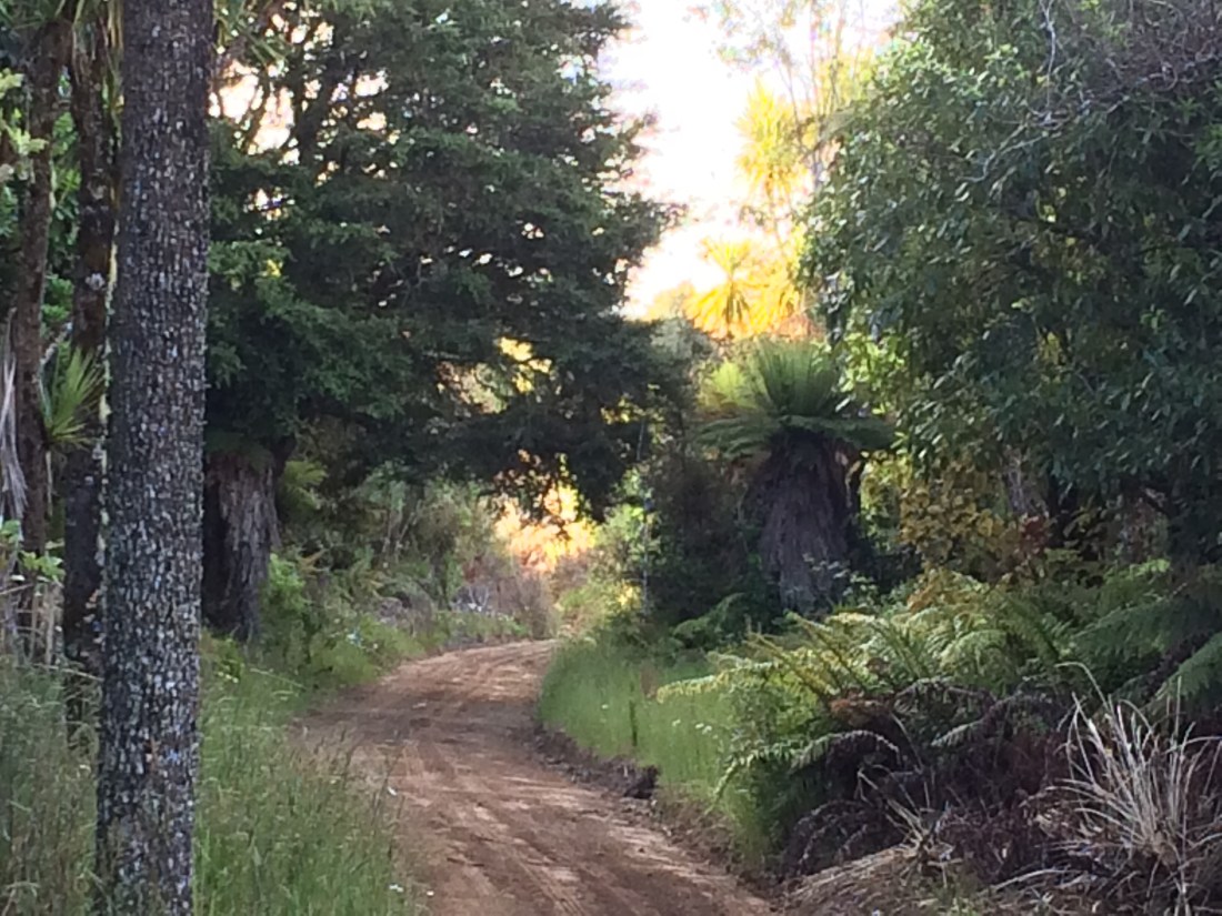
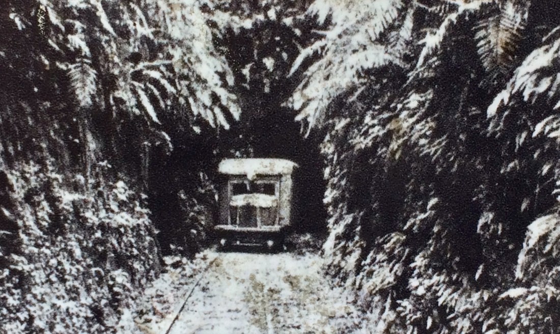
I woke up in my tent on a river flat near Piropiro, nearly halfway along the Timber Trail. (That’s a cycling and walking path along old logging routes in the Pureora Forest, between Te Kūiti and Taumarunui).
After porridge, coffee and a swim in the cool, clean stream, I got away early and enjoyed the gentle rise and fall of the old rail line through to Piropiro. This whole range used to swarm with mills, camps and settlements; the information panels are full of engaging stories such as the locomotive brakeman who had to fight off a huge, wild boar that kept attacking the train, until it ran him over (the boar).
Here’s one of the many mills from which the rails radiated:

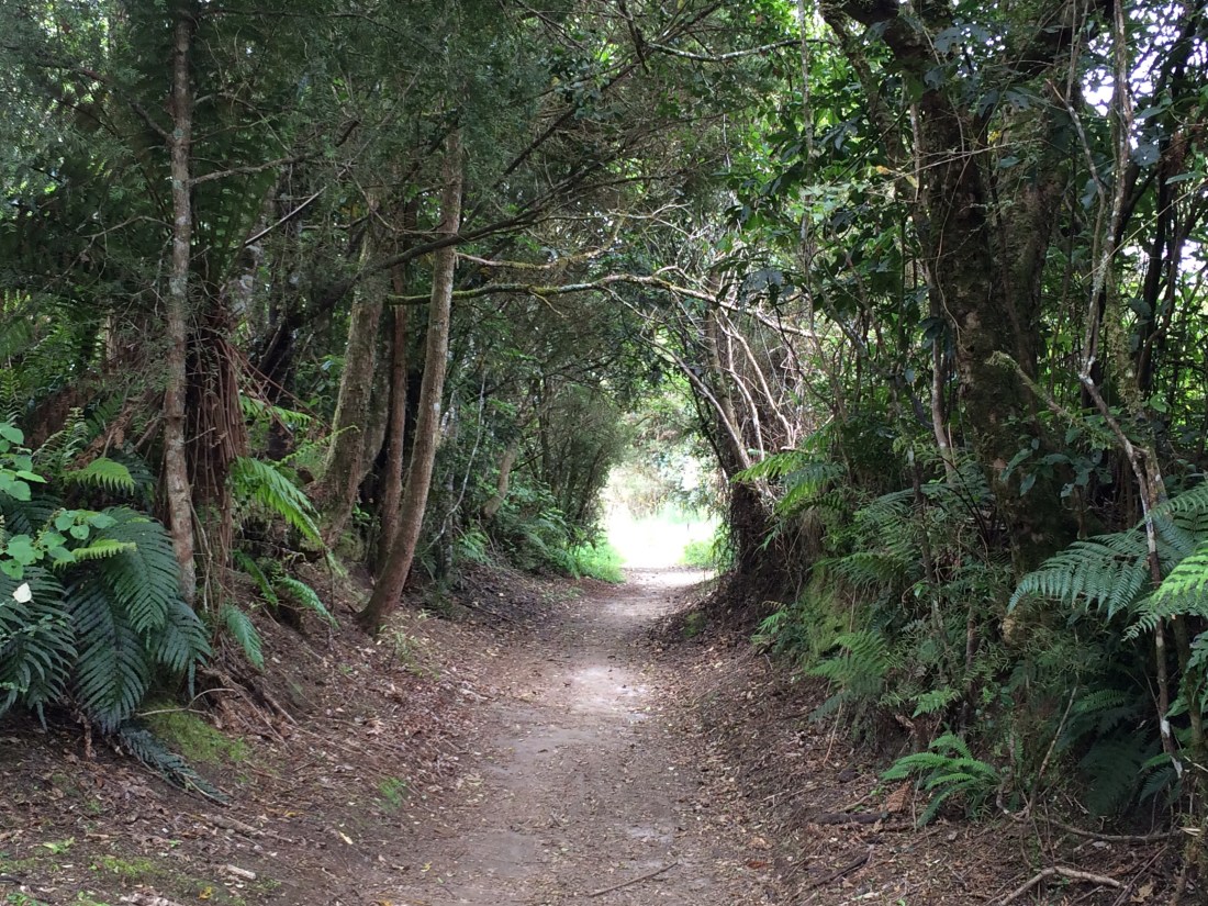
The trail is mostly wide and smooth, and it’s lovely bowling along in the soft, green light.
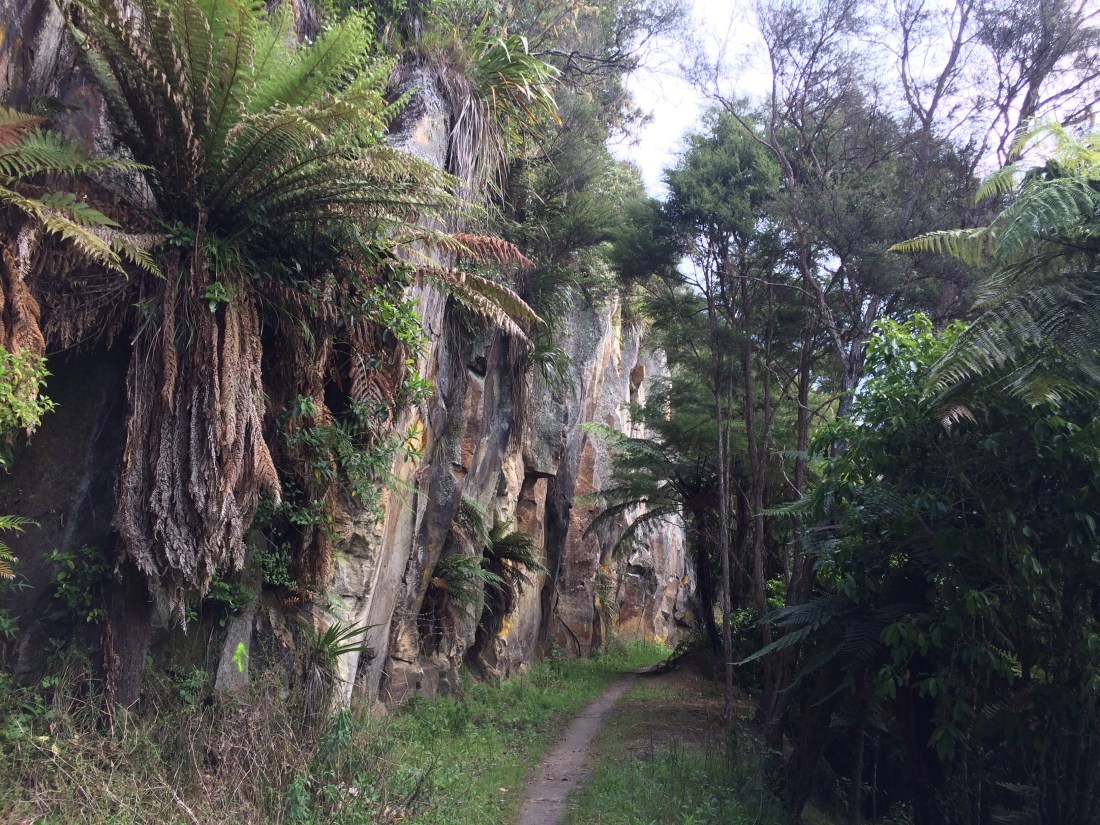
Some of the engineering feats are pretty impressive, considering all this rock and mountainside was carved without modern machinery:

I liked the story of Haware the Giant, outlined on another of the excellent information panels. Haware was a relisher of wilderness, a communer with birds and valleys:

I soon passed Piropiro, roughly the midpoint of the 85-kilometre timber trail. There’s a campsite, probably full of through-hikers, and a flash lodge, no doubt full of lycra-clad mountain bikers. I assiduously avoided them all.
I found a stream, filled up my water bottle and boiled the billy. Have I mentioned how much I love breaks, when tramping? They remind me of a nice moment on a James Taylor live album, when he tells the crowd: “We’re gonna take a break after this song. Ah yes, the break; we do love the break. I know we rehearsed it; it’s pretty good. It’s tight.”
Soon after that the trail heads up a steepish ridge into a stretch of old-growth bush, relatively unscathed by the timber trade. It was still and golden and leafy up there.
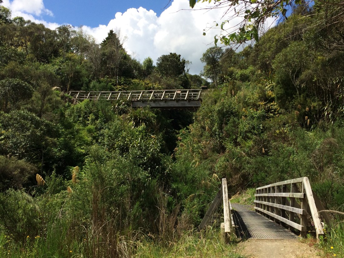
I liked the info panel beside another of the magnificent new suspension bridges, this one over the Maramataha Stream:

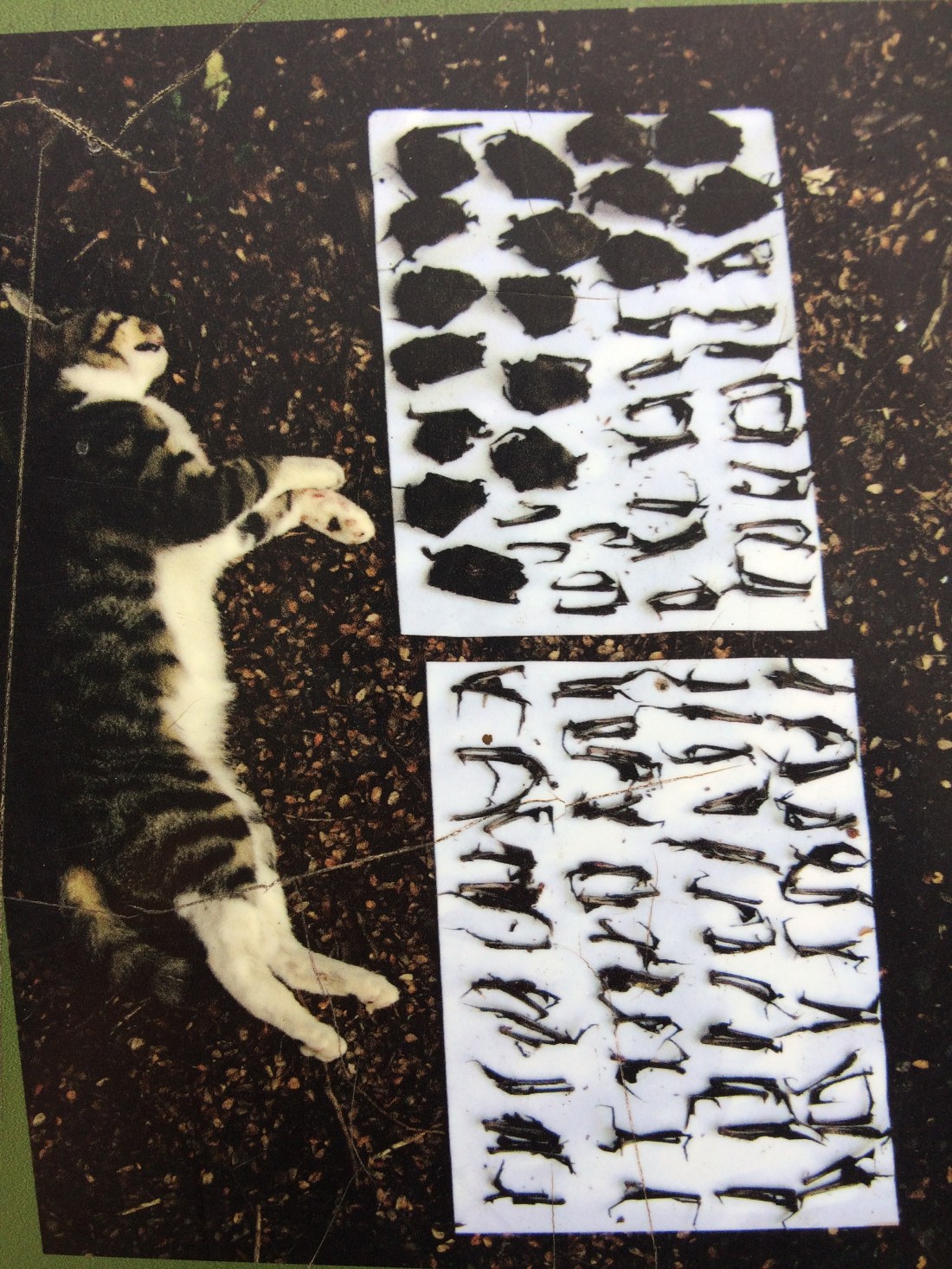
They can be gritty as well as poetic, though, these info panels – this one also talked about the plight of the long- and short-tailed native bat, our only native mammal, and how they get repeatedly nailed by introduced pests / pets. This feral moggy (possibly housetrained at some point), personally accounted for all the dead bats beside it, before it was finally accounted for itself:
Another thing I loved was the scent of the tī kōuka, the cabbage tree, which flower in early summer and smell like jasmine, except even more delicious. They feature on the Te Araroa logo, too:

As the warm afternoon lengthened, the bush, damp from yesterday’s showers, steamed in the hot sun. With the moist heat, the rich, brown soil and the fragrant, subtropical exuberance, it felt nearer Tonga than Taumarunui:
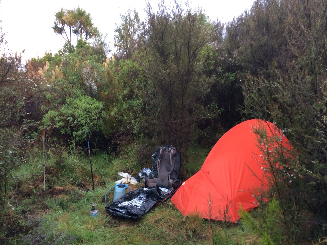
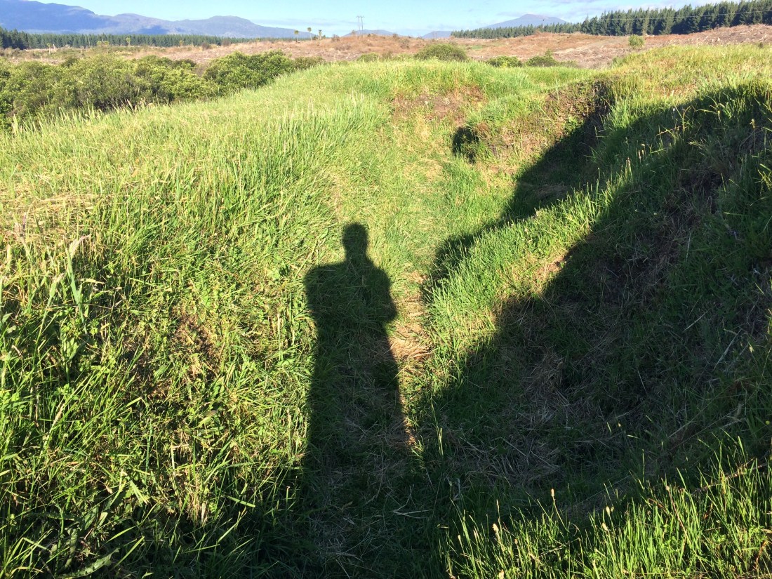
It was getting dark. Near a stream called Mystery Creek, high on a bushy plateau, I found a campsite. It was just big enough for a single tent, deep in the scrub about 50 metres off the track. I wanted a rest day the next day, having covered over 90 kilometres in the four days since my last day off. Many walkers have a much more rigorous rhythm, but I was on holiday, and still getting used to the trail, and damn it, I wanted to chill out in the bush a while. And I wanted to be alone, out of sight of the track, away from those tricky people, so I could think, write, read and just be a while, let the busy year drift through my mind, let it percolate, let it all go.
I should note the Te Araroa trail notes recommend Timber Trail walkers camp in certain designated spots, presumably to reduce the environmental impact. This was not one of them, but camping is not forbidden there. It’s important to respect camping guidelines, but I think there’s also room for people to get off the beaten track, as long as you leave no trace.
The ground in the clearing was rumpled and rucked where pigs had been, looking for grubs and roots. I stamped down the wrinkles, slashed back the blackberry and found it perfect. There was even a just-right-sized manuka sapling to lean against, and watch the light fade while I ate my noodles.
As I was setting up I heard laughter. I went to investigate; just over the bridge, it turned out, was a designated campsite, complete with long-drop and shelter. No problem – it was far enough away that I could still enjoy my solitary spot. And I got to meet more through-hikers.
(These, if you aren’t up on the distance-trekking lingo, are people who do a multi-month hike in one go, without more than the odd rest day. America’s Appalachian or Pacific Crest trails are examples of through-hiked trails. Te Araroa has, in recent years, become a popular new addition to the international circuit of these long trails. About 1000 through-hikers a year tackle Te Araroa, while many thousands more do bits of it – like me).
Now I’d had the odd chat to through-hikers on this leg of the journey, but not really connected with any – we were always on a mission to get somewhere, or I was too tired, or too much in my own little world. But this time, they were just chilling in the gentle evening, and I was in no rush either, so we sat on the warm ground and yarned a while.
There were two bearded dudes from Quebec, old friends, long-haired and amused by life; one of them was named, romantically enough, after a Knight of the Round Table. The third member of their little party was a blonde American. She was slim, short and had a tough-but-gentle look. Her long hair stood up in a fantastic, pretty snarl, flaring behind her like a wild banner declaring: There’s more to life than good grooming. It looked cool. She didn’t appear to care how it looked.
They were all young, tanned and extremely fit after weeks on the trail, a little jaded by the constant effort, but mostly having a total blast. They were chatting about their day, what they’d seen; they, too, had decided to stop here because of the creek. (You don’t camp, generally, without a water source.) “I scrambled down the bank to fill up our bottles,” the American said. The French-accented Knight grinned. “Yeah,” he said, “it is why we let ‘er ‘ike with us. Cos she ees a good scramble-er.” Everyone smiled.
I wished them well and went back to my tent. I sat outside in the long, still dusk, relishing the thought of a day off tomorrow.
I’d established a new, personal tradition on this leg of Te Araroa – a nightly haiku or two, last thing in my tent, as a way to maintain my fairly recently acquired writing habit. Here’s one from that night:
Maramataha
As gold-tinged darkness
falls, a clearing – just my size –
under the moon’s edge.
Day 55: Mystery Creek (0 kms)
Through-hikers call these “zero days”, because that’s how many kilometres you do. It was bliss to sleep in, read a while in my sleeping bag, have a leisurely breakfast and another cup of coffee.
When I went over to use the campsite long-drop, the trio from last night had gone. But there were two more Quebecois, a couple, having a rest; they’d come from Piropiro that morning. They were open-faced, tanned and relaxed. We chatted about our journeys, and found we had a similar philosophy – hiking at your own pace, not rushing, often hiking until late because you’d slept in, not worrying about that or about having the best gear. Listening to your body, starting and stopping each day when it was ready. The magic space you get into on the trail, and take back with you into the world.
Talk got onto photos, sharing the journey with friends back home. I told them about my blog, and they recognised the title. “Oh, a Kiwi guy up north told us about it, I think!” said the woman. “We met him on the trail, he was doing it in sections, like you. And he invited us to stay with him – he lives near Whangārei. We were talking about blogs and he showed us yours. I remember that you were going to take six years to finish the trail!” That’s me, I said. “You should mention him in your next post,” she said. “His name’s Nigel.” Kia ora Nige, and cheers.
After they left I had a look in the campsite’s little wooden shelter. There was a bit of graffiti inside. This was the best one, and, as a bonus, is pretty much a found haiku:
Today I met on
the trail a beautiful
Italian woman!
– Declan.
Scrubbed clean
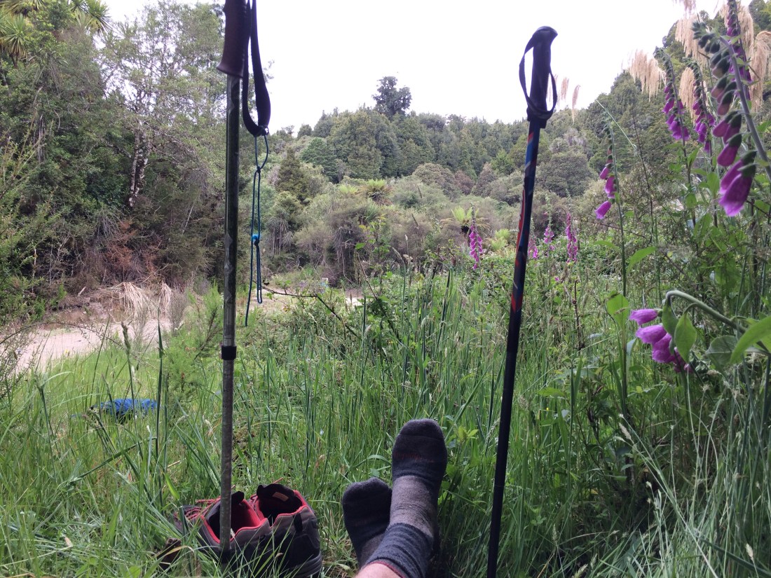
Then I went for a swim in Mystery Creek – how could I not, with a name like that? It was hard work, though, narrow and rocky as it was, and choked with blackberry and cutty grass. But I forced my way along until I found a pool just big enough to dunk myself, three times, in the mysterious waters.
Back in my campsite I had lunch and liquorice tea, propped up on my manuka in the sun, and carried on with my RH Morrieson novel.
I enjoyed hearing, just out of sight, the occasional voices of trampers on the track, or the hum of tyres; then the bridge would clank as the bikes went over, or plink under hiking poles. I was tucked away from the traffic in this perfect clearing, quiet and alone. I thought of the Kev Carmody song, Droving Woman:
Eventually the children will move to the east
But I couldn’t stand the bustle of even a quiet city street
I’ll stay in the scrub here where my heart really beats…
As the day lengthened a storm brewed, until thunder and lightning banged and crackled around the hills. I was on a light-filled table top, wild with regrowth: manuka scrub, fragrant tī kōuka, horoeka, blackberry. The fuzzy air was thick, charged, and rain began to come and go. When it got too heavy I’d go inside my little tent, which stood up to the storm, impervious. When it cleared I’d go back outside, sit on a plastic bag on the steaming grass and carry on with RH.
It was a perfect spot to just stop, to let the world and the trail keep turning, to lie down on the earth and read and listen to the clouds rumble, ring and mutter. One huge lightning rod of a tree stood up near the bridge – a kahikatea, maybe. (It survived unsmitten.) When I had to take refuge, white flashes lit up the gloom inside my perfect shelter with its taut, orange skin.
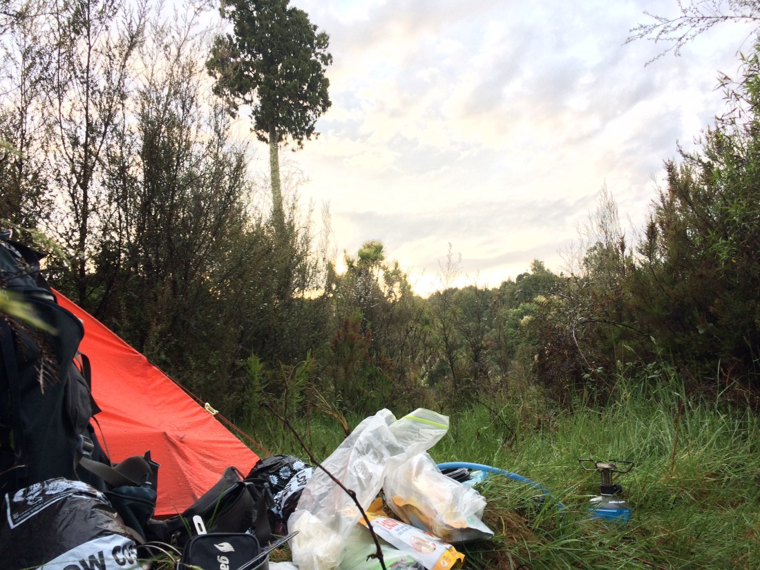
Outside, the air was rich with the scent of damp earth, and the starlike flowers on the scrub, and the creamy tī kōuka bouquets. Inside, the steady pock-pock of the rain on the good strong nylon skin above me.
It was a great rest day.
Zero day haiku
In Mystery Creek
at last, a pool big enough
to go right under.
Day 56: Mystery Creek to Ongarue (17 kms)
I got away early and didn’t stop for quite a few kms, until I came to the little wooden shelter at No. 10 camp. There a cheery, bright-eyed Kiwi woman in her early 20s had spent the night. She said it had been great, apart from the odd mouse in the ceiling. The best bit of “graffiti” was this one, she said, and I had to agree:

She had just graduated from uni and was doing Te Araroa while she decided what to do next. She was the only Kiwi through-hiker I met, although I’m told there are more every year.
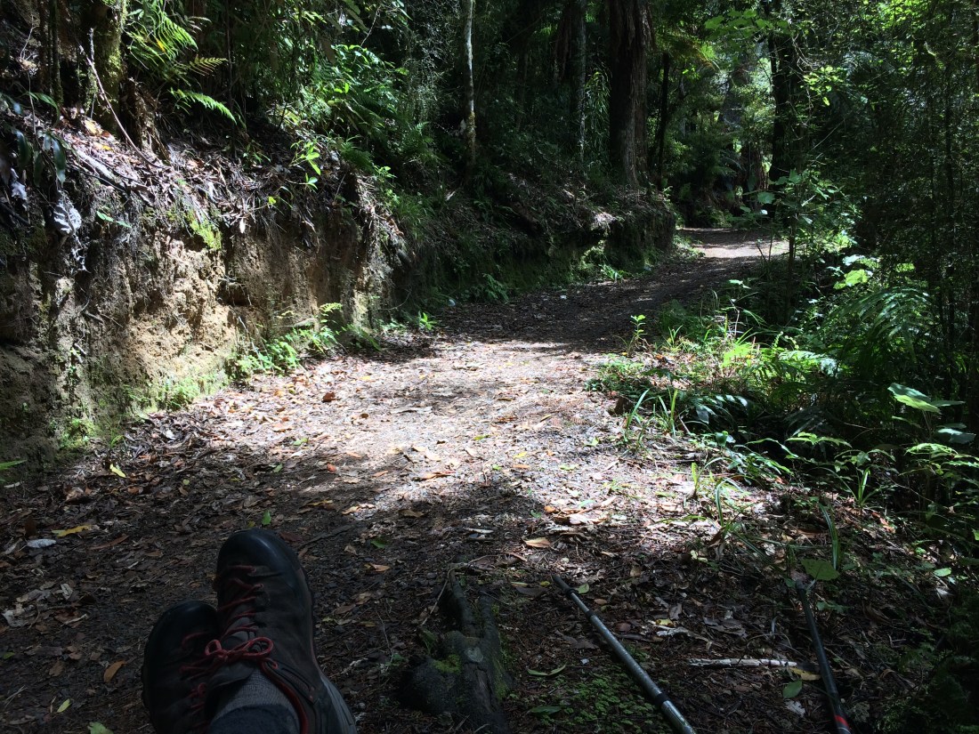
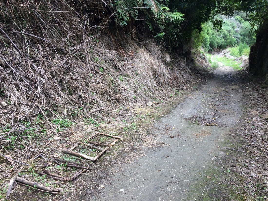
There was a lot of timber-industry detritus along that section, giving it a slightly haunted air:

One panel showed a whole village, with muddy streets of simple wooden houses, in a flat area where there is now nothing but a couple of hectares of young scrub. Others described the outings into Ongarue and Taumarunui for the pictures or to play rugby:

These next two photos are about a century apart, and show this bit of bush, first, when it was being rapaciously exploited, and now when it has been left relatively to its own devices. I quite like how it’s not that different – as if our predations would not, finally, be all that significant, if we were to just vanish in come sort of The Quiet Earth apocalypse. That might be too hopeful, though. Here it is… Then:
And now:

Further on the land opens out into views down towards Ongarue. Three through-hikers were taking a break in the sun. An American guy had a sun-reflecting brolly which, he reckoned, was a light-weight substitute for sun cream and a rain coat. He’d know, having already completed the Appalachian Trail:

Another highlight of this section is the Ongarue Spiral, an engineering marvel which allows trains to make big, fast height gains by spiralling around over themselves. In recent years a preservation effort has restored the spiral, and the Timber Trail follows it. Here’s the “now” shot:
And here’s much the same view, in 1923:

Below the spiral is a lovely section at the foot of cliffs, glowing in the storm-inflected afternoon sun:
Around here is where Te Araroa walkers start to hit the significant milestone of 1000 kilometres, a third of the way to Bluff. It wasn’t 1000 yet for me, since I skipped the Hunua Ranges (south of Auckland), which have been closed since March 2017 due to storm damage – I’ll go back and do them whenever they re-open. My 1000 would happen the next day, on the road to Taumarunui. But there were a couple of makeshift commemorations of the feat along this section:
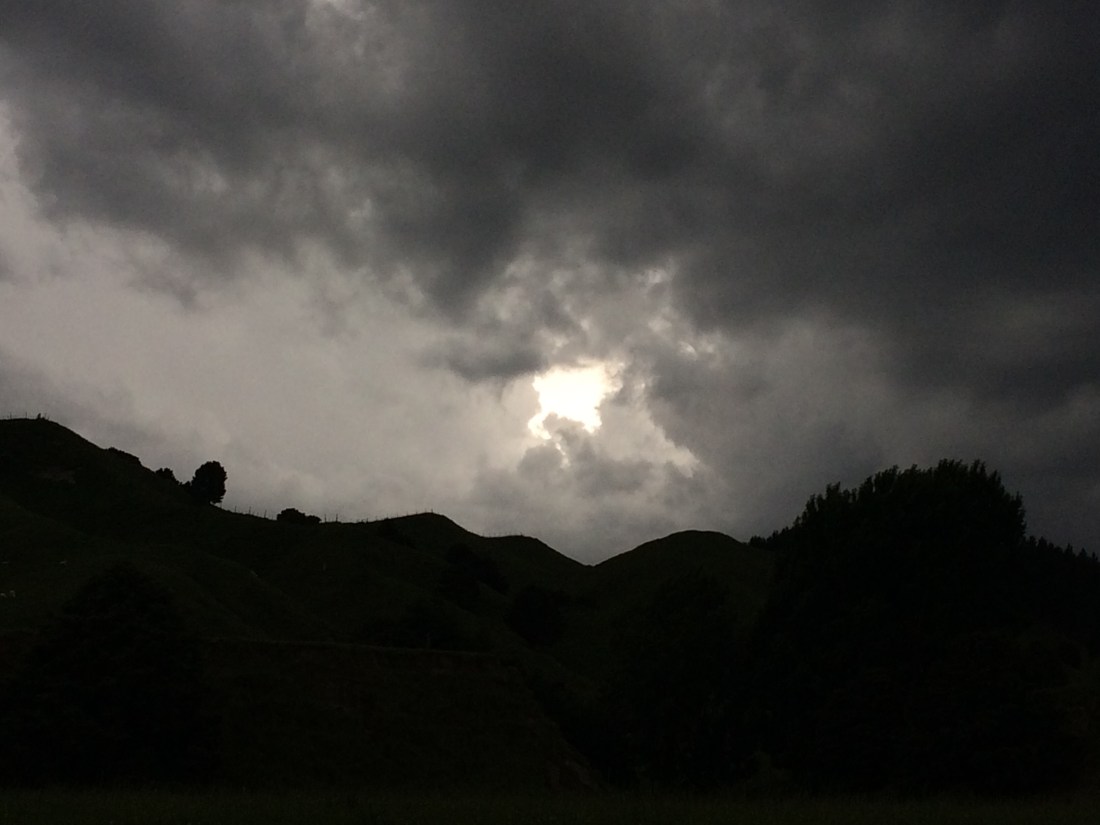
The thunder storm brewed and the sky darkened, eventually splitting like a black, apocalyptic plum. Rain sluiced down. I trudged on. Only about 15 minutes later the sluicing stopped and a small opening grew in the clouds, as if Sauron’s angry eye was peering down to inspect the water-blasted world:
The rain was soon back though, and settled in hard and heavy for the night.
Te Araroa Trust has built a campsite beside the river in Ongarue, and it was there I stopped to camp. There’s a little shelter with running water, and about a dozen through-hikers congregated there to cook dinner on their portable stoves and catch up with each other’s journeys. It was fun listening to their stories and banter, but I felt odd, uncomfortable.
Back in my tent I reflected on this a while; hadn’t I looked forward to meeting the hiker tribe, these kindred spirits, these fellow travellers? Why did I feel excluded, somehow unsettled in their company?
I realised I’d expected to be part of their little mobile community, “the bubble” as they call it (a bubble is a group of individual hikers who start the trail at the same time, and end up bumping into each other, leaving each other behind and catching each other up for the whole length of the trail). But I wasn’t part of it, mainly because, as a section hiker I wasn’t on the same, four-month journey as them; I hadn’t shared the continuity of common campsites, in-jokes, jargon, nicknames, experiences.
Also, I realised, my discomfort was probably due to nothing more than that I’d had a bit too much company on this leg of the trail. People are great, and through-hikers are especially cool, but I just needed more solitude.
I felt better back in my tent, listening to the rain on the nylon. It’s very possible to feel less alone when you are actually alone.
Two Ongarue haiku
Listening to them
laugh, tease, tell trail stories:
loneliness like rain.
Sometimes tribes are like
town lights seen from a night ridge –
better from outside.
Day 57: Ongarue to Taumarunui (26 kms)
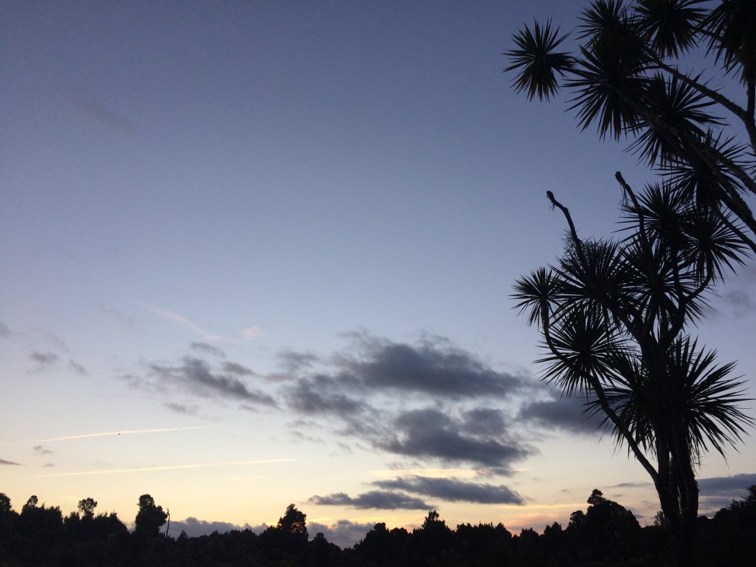
In the morning the sun had returned and it was a lovely climate for a longish road slog into Taumarunui. Here’s the view from my tent:
The route is along a gravelled back road, through little Māori settlements and farmland, so its another of those times that road walking is not nearly as bad as people make out. And there are sweet little vignettes like this – horse, shack, graves, hill, mist:

Still, there’s a certain monotony that sets in when you’re walking all day, k after k along a long road. I broke it up with leisurely phone conversations, first to my brother and his family, and then my girlfriend. Cell phone signal is often a bit of a luxury on Te Araroa, so I made the most of it, and it made the time pass.
And I finally hit my thousand ks from Cape Rēinga – one third of the journey done. Fittingly, I reached the milestone around here, where love, apparently, makes the land go around:

I celebrated with a Trumpet and a Magnum for lunch at a little souvenir store in the same area (which wasn’t the middle of nowhere, but you could see it from there). The shop sold lumps of ancient swamp kauri and twee T-shirts (twee shirts?) alongside the coffee and ice creams; it was just right.
Late in the afternoon I made it into Taumarunui, where I pitched my tent at the town campground, despite my earlier feelings of being peopled-out. But in a town you usually can’t just camp wherever you like; respect sometimes means accepting that solitude is quite rare, and hard-earned.
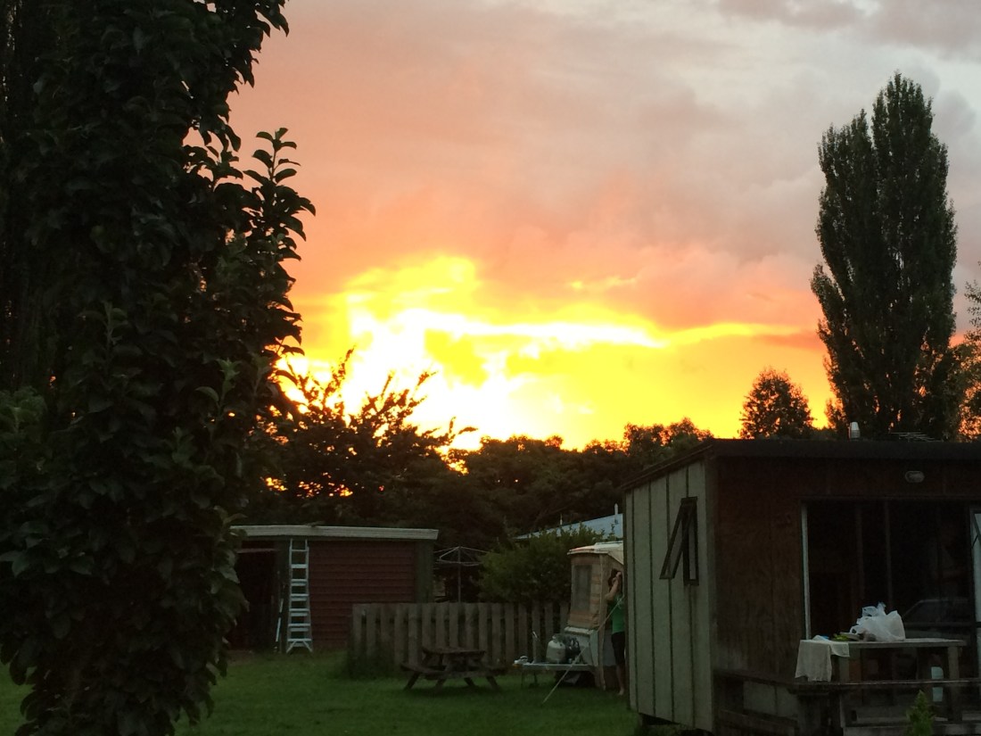
I got a burger and some bubbly to celebrate being one third of the way to Bluff. At the campground beside the Whanganui River, the dying thunderstorm stained the evening sky.
Two Ongarue to Taumarunui Haiku
From the Spirits’ Leap
to Love Farm is a million
steps. I’ve felt them all.
As mist lifts the horse
browses; bush, gravestones and sun.
Death isn’t so bad.
Day 58: Taumarunui to Whakapapa River, near Owhango (29 kms)
I headed out of Taumarunui over the Whanganui River. I’d be roughly following this storied waterway over the next few days, up towards its source on the upper slopes of Mt Tongariro; in a day or two, I’d cross a much different version of it – nearly narrow enough to jump. And later on, on a future section of Te Araroa, I’ll canoe down it – all the way to the sea.

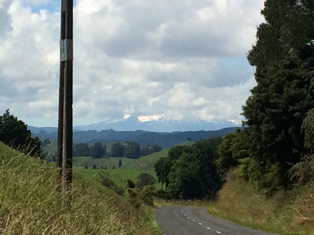
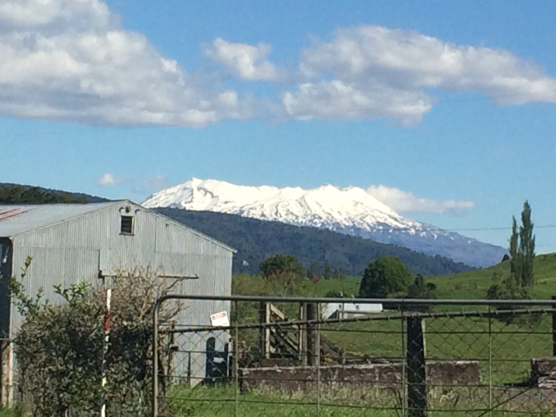
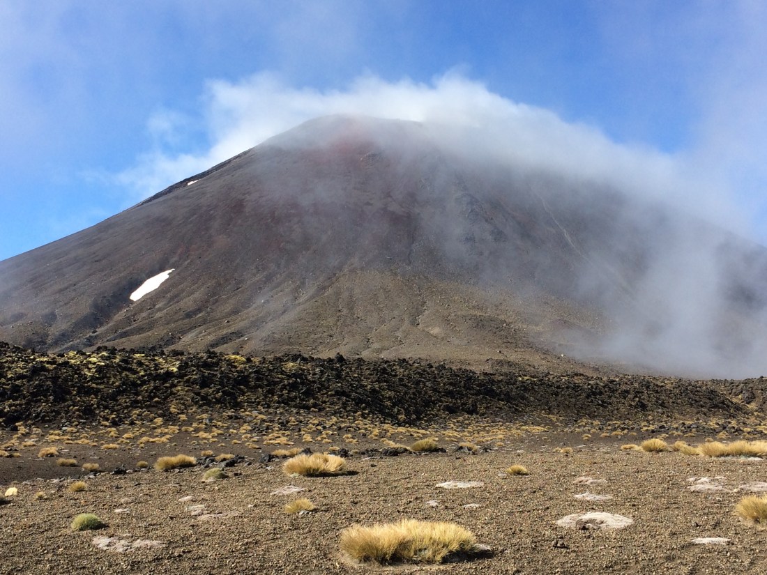
Ruapehu soon cropped up again, seeming to beckon me on – this 13-day stint on Te Araroa would end right next to these snowy flanks:
I passed a school pool where holidaying kids shrieked and bombed. I stopped to chat to their mum, leaning on the fence. “I think youse are awesome,” she grinned, gesturing at my pack and poles. She lives by this remote road, has grown used to watching us go plinking by. As we yakked, a through-hiker went steaming past, encompassing the pool, the kids and us with one curt nod, without breaking stride. “He’s on a mission,” observed the mum.
Further on, this guy was also on a mission, rearing up behind a fence:
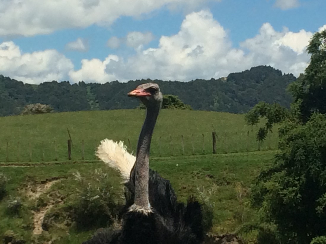
I found him compelling, and stopped for photos. But then he puffed up and began to crouch, sway, and thump his wings on the ground, and I became acutely conscious that the top-most wire barely reached his belly. One leap of those prodigious legs and he could wrap an enormous clawed fist around my throat.
I beat it. Later, other hikers told me the same thing happened to them, and one googled it, and it turns out it was a mating dance. I still feel more intimidated than flattered.
I marched on; the heat was really building and it was a long, hard road slog, albeit through very pretty farmland. The only way to get through it was keep moving. I wanted to camp among the cool trees of the Tongariro Forest at the far end of it – not have to spend the night on a road verge.
Road-walking is a particular pleasure: the pleasant beat of your feet on the hard drum of the road, the passing ripples of the land, the stillness of the hinterland.
The road-kill: a dead goat grinning; a poleaxed possum; a single, intact wing, emerging untainted from a smudge in the dust, flapping, as if the road itself might fly.
I came around a corner and saw a tall figure stretched out in the shade of a big tōtara. Under the baseball cap, thick blonde ponytail and gold-mirrored aviator shades I recognised a through-hiker I’d briefly met before, a tall, athletic eastern European in her early 30s. I’ll call her Daria.
It was too hot to walk, really, so we hung out in the shade and had a good long chat. We discovered we had a shared approach to hiking Te Araroa: walk every metre. “I mean, I respect everyone’s way,” said Daria. “Hike your own hike, and all that. But some people are hitch-hiking this bit, for example, because they think it’s boring, and look at it! I love it. This is beautiful, rugged Kiwi countryside.”
And it was – a winding, looping gravel road through typical back-country farms, with weather-beaten wool-sheds, steep green faces and undulating ridges, tipped with bush. “This is part of it,” Daria went on. “I’m not gonna say, oh no, I’ll only do the prettiest bits, or only the easy bits… Why should hiking a whole country be easy?
“The thing is, I enjoy, most of all, the actual walking. I enjoy every single step, being in motion, walking all day. I get the impression some TA hikers just sort of suffer the actual walking, and what they really enjoy is getting to each day’s destination, and the dream of getting to Bluff. That’s cool – everyone is different.
“But when I meet people who are doing every single metre and not hitching or bussing any of it, I feel something like: ah yes, these are my people.”
Just not stopping
After a long rest we were both ready to set off again, and soon fell into step. “Feel free to take off if I slow you down,” I said, but the pace seemed to work for both of us. I was grateful: Daria’s thoughtful, positive company and trail fitness would help me through this gruelling day. We yarned away peaceably as we tramped along the dusty, switch-backing road, up and up into the green emptiness.
She had travelled all her adult life, working in any old job – hospitality, mainly – and saving for new adventures. One day on a trip she discovered camping, liked it, and then in the Scottish highlands fell in love with long-distance hiking. She began combining the two, went further and further, and began to relish pushing herself. “One day, I did 70 kilometres… it was a little crazy. I just kept going and going.”
She began to dream, she said, “of getting on a path and just not stopping… just walking on and on, day after day.” At that stage, she didn’t know multi-month routes such as Te Araroa and the Appalachian Trail existed. “I was planning an overland route from Scotland to Portugal.” But she would have had to wait until the northern summer, and she wanted it now, that feeling of just not stopping. Idly googling, she found Te Araroa. “I booked my flight right then.”
She found she was a natural. She had been on the trail for six weeks when I met her, and not taken a single rest day; she’d quickly fallen into the habit of breaking camp before dawn and hitting the trail at first light. “Then I can do 30 or so kilometres, get to where I’m going by 2pm and have a lazy afternoon, and it’s like a day off. Then in the morning I just carry on.”
Open-hearted and personable, she had made plenty of friends along the way, but mostly hiked alone – most people found her rhythm too much. “I get to know a group of hikers, then I tend to leave them behind. I just like to keep moving.” Thirty kilometres is an easy day for Daria; 40 a solid one; 50 a satisfying push. She was flying down the island, eating it up, bouncing over mountains. She walked with an effortless, casual gait and a perpetual smile. There was something peaceful about her, like a person who has found her way to be.
We finally reached the top of a hill we’d been working our way up for, it seemed, most of the afternoon. Ruapehu rewarded us, shining up suddenly from behind one of those ubiquitous wool-sheds:
I was out of water and really struggling; we’d passed no houses or streams for a while, and the heat was sapping. Daria generously gave me half of hers.
Later we both went dry, and then we finally found a house. The owner was chopping wood; she led us through her lovely garden and filled our bottles from a hose. She brushed aside our thanks – she was a horse trekker, and knew what the hospitality of strangers could mean. She was getting ready to ride across Patagonia.
Owhango was drawing near. “I hope they have a dairy,” Daria said, “so I can get my ginger beer and ice-cream.” These had become her trail tradition on passing dairies; the combination sounded marvellous. I started thinking a lot about that dairy.
But it was a Sunday, and the few shops were shut. It was a bitter blow in that heat. But we shrugged, trudged on, and got out of that baking sun at last and into the cool bush. Then we were at the edge of the Whakapapa River, at a golden, grassy, tree-lined campsite. I was utterly shattered; it had taken all my concentration and will to keep up with the light-stepping, long-striding Daria. “A swim would be nice,” I muttered, but the river seemed a long way below the campsite. It was all too hard. “I’ll check it out,” she said, and disappeared.
I plummeted down in the grass like a shot donkey, put my feet up on a seat, and tried to breathe normally. Some time passed. Then she came skipping, literally skipping, back across the grass – 29 kilometres in a day was at the far edge of my range, but she had barely felt it. She plopped down in the grass, grinning. “You OK?” She had jogged down a couple of tracks and found one that reached to the river. “It’s a bit cold,” she said.
Revived from the swim, I got my tent up, hobbling around embarrassingly. Daria whistled and sang, and was cooking dinner outside her tent before I’d finished pegging mine.
Over dinner, she confided her intense walking regime was posing refuelling challenges: “I am eating like a wood-cutter.” She showed me the big tin of tuna and packet of pasta (“serves 4-5”) she was busy downing. “I just can’t get enough. I burn through whatever. It’s OK – after a shop, I just have a heavy pack for a few days.” She favoured high-energy foods, and didn’t worry too much about their weight – olive oil, yoghurt, cheese, fish, peanut butter.
We watched the stars come out and chatted about life, love, friendship, family and walking. She was full of enthusiasm and good energy; I was exhausted, but chatting to her was reviving. When we said goodnight, she said she might see me at breakfast time. But when I got up in the morning – not at sparrow-chirp, but not late either – there was no sign of Daria the Distance-Cutter.
Two Taumarunui to Owhango Haiku
Roadkill
Not horrible, nor
tragic. Just a shadow – a
road, a leg, a wing.
Daria
Life skips in your lope,
you’ve tripped the wild current, you
bounce over mountains.
Day 59: Whakapapa River (near Owhango) to Waione Stream (on 42 Traverse) (21 kms)
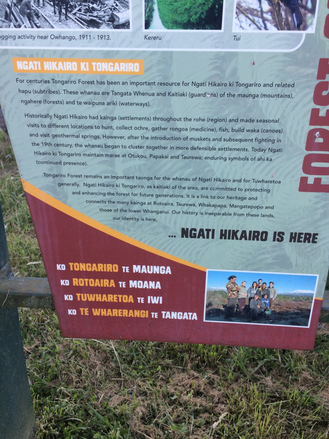
Before I left the campsite I read the info panel, because the final line had caught my eye: “Ngati Hikairo is here.” Everywhere you go on Te Araroa, you’re walking on Māori land. And despite the disguised or explicit violence of colonisation, the original people of that land – the tangata whenua, in this case Ngati Hikairo – are there, present, woven into its fabric. When it comes down to it, we walk Te Araroa as guests.
After the sign is a bridge over the Whakapapa River. Then you’re on the 42 Traverse, a track through a rugged expanse of bush between Taumarunui and National Park. It’s said to be named after the original title of this stretch of bush, State Forest 42 (now called the Tongariro Forest). The Traverse is used by mountain bikers, trampers, hunters, quad-bikers and four-wheel-drivers (although the latter were banned while I was there – something to do with track conditions). Much of it is nominally drivable, but there’s a long, very muddy, pedestrian- and bike-only section toward the end of the Te Araroa route, which deviates off the main one.
One of the salient features for me was seeing the headwaters of the Whanganui. Having kayaked it years ago, from Taumarunui to Pipiriki, I’m familiar with its downriver breadth and power; so it was fascinating to see that here, it’s barely more than a rocky creek:

Having emerged from the flanks of Mt Tongariro (which I’d be crossing in a couple of days), the Whanganui stands out here for the monolithic patience with which it has nagged its way, during millennia, right through steep hills:

Other highlights of the day were insect-related. First, what seemed to be a mason bee, which I watched haul a large spider, the size of a 50-cent piece, right across the track – at that point, as wide as a road. The spider seemed to be alive, but barely; I wondered if it had been injected with some paralysing agent, as mason bees do. The bee was intent, ruthless. Its strength and energy were compelling. When I got too close, taking photos, it dropped its prey a moment and buzzed me angrily – afraid of nothing. I thought of the Baxter poem where a mason bee tells the poet to “bugger off”; his musings “won’t put an end to death”.

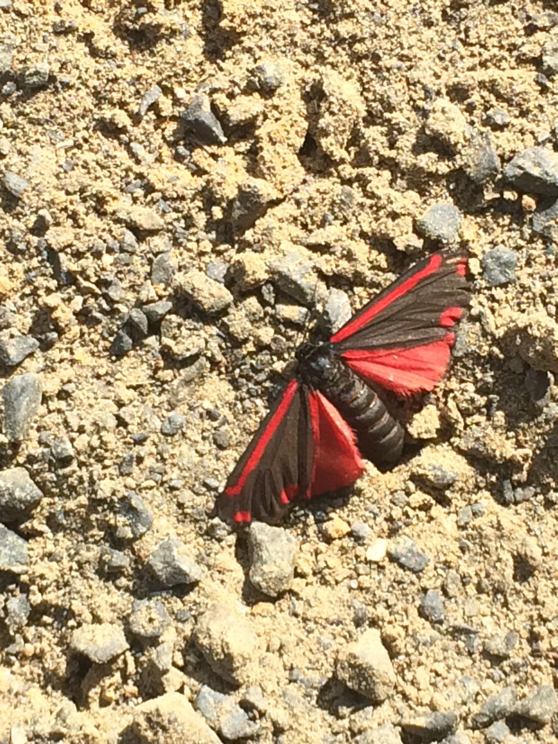
Then there was this vivid-winged mountain dweller, not in much better shape than the spider – I don’t know why. I don’t think I’ve seen his or her ilk before:
Mt Tongariro began to appear through the trees. It was fun and a little daunting to reflect that I’d be crossing that broad back in a couple of days.

Daria had planned to cross the whole forest, all 40km or so, that day – I bet she did, too. Why not? But after 20-odd kms I’d had quite enough, thank you, and found this prime bit of real estate just off the track, by the Waione Stream – a tributary of the Whanganui.

I was wading into the stream for a swim, eyeing a lovely deep pool under a cliff when a sleek shape came nosing, torpedo-like, out of the shadows. My heart jumped and I moved back; a granddaddy eel lived there, and seemed to be warning me off. He glided back to his cave when I retreated, and I had a quick rinse in the shadows, instead.
Then it was bliss to lie back beside the silvery, trickling stream, eat noodles, drink tea, and enjoy what would probably be my final wild campsite on this section.
Three Whakapapa to Waione Haiku
Creek-shark, patrolling
your home’s dark sparkle: I cede
to your black-toothed grin.
Blue bee drags spider
corpse across road. A good shock,
such relentlessness.
Slow, constant, hard, a
desire blind to time, that’s how
a river splits hills.
Day 60: Waione Stream (on 42 Traverse) to Tongariro Holiday Park (on State Highway 47) (15 kms)
In the morning I enjoyed a leisurely breakfast – I didn’t have a long day planned. And you can’t rush your porridge and coffee in such a lovely spot, beside the eel-pool, in the windy, tangy, toetoe-coloured sunshine:

There was a now-familiar sensation that, although I was about to get up and walk on, this spot on the bank of the Waione Stream would stay exactly the same, with its silver-grey, sun-warmed stones, its gold-streaming toetoe, its dark-rising eel, its melodic, shining water.
Being in the bush for days on end impresses this feeling on me: these scenes exist whether I, or anyone, is there to see them. The mountains and bush and rivers run on, endless, just themselves, forever.
Tongariro drew closer all day, and by afternoon was joined by the perfect volcanic cone of Ngāuruhoe:

For a long while the track formed a tunnel through low scrub and thick stands of toetoe, its fronds bowed with fat plumes. Sometimes, the golden plumes lay on the track, giving me a fright – they looked like small, fallen animals.
Towards evening I came out of a scrubby wasteland into the sunny, neatly preserved remains of an important battle site – Te Porere, the last redoubt of the Māori rebel, guerrilla warrior and religious leader, Te Kooti Arikirangi Te Turuku. It’s also significant for being one of the last battles of the New Zealand Wars. This is a period of history which gets glossed over in the everyday life of this country, but which you can’t skirt around on Te Araroa: the track takes you right up to the trenches.

Not that you should actually enter the upper of the two redoubts: The traditional owners of this territory regard it as a wahi tapu – sacred site, and a sign asks you not to go into or onto the trenches. It marks the graves of many of Te Kooti’s faithful warriors, including women, who died in that final, unequal 1869 battle with Crown soldiers and their Māori allies. The Crown used heavy cannon and 500 soldiers; Te Kooti had a fraction of those, and no cannon. In total, 41 people were killed.
As the redoubt was being overrun, Te Kooti escaped into the wild forest I’d just walked through. He had part of his left hand blown off, but was never captured.
Without diminishing his own violent acts, I think the living monument of the redoubt recognises Te Kooti as a formidable resistance leader, whose actions occurred in the context of the violent occupation of his country. It’s still rare in NZ to find such thoughtful efforts to acknowledge the darker chapters in our shared story. Ignoring the past is no way to heal it.
I felt uneasy when I saw several Te Araroa hikers had pitched their tents on the manicured lawn beside the upper redoubt. There was no sign banning it, and, in general, you can camp in publicly owned bush; but it didn’t feel right.
I rested a while. I took in the sombre landscape around the site of Te Kooti’s final stand, which is also one of the sites, if not the site, where the whole colossal trauma of the New Zealand Wars finally sputtered to a close – but not a resolution. I chatted to the hikers, none of whom had been born or grown up here. I wish I’d said something to them about their camping; I don’t know why I didn’t.
I moved on. I know they meant no disrespect, but I think the site represents too much hurt and loss for it to be a good place to sleep.
Further down is the lower redoubt; here you are allowed to walk right in and get a trench-eye view of this hard Kiwi story:
Just below the lower redoubt, the track crosses a narrow stream on a short footbridge. It took me a moment to realise this is the Whanganui River, the longest navigable river in the country; I’m used to seeing it broad and brown, not shallow and sparkling. Nearly 290 kilometres downstream, at its mouth, it boils and seethes and rears up, sometimes, to swallow streets. Here, I was only a few kilometres from its source – a spring high on Mt Tongariro, just out of sight beyond some pines.
The track then meets State Highway 47. Two kilometres on is the Tongariro Holiday Park. Normally I avoid holiday parks, preferring to find a wild, solitary spot to marinade myself in; but in places as special and as popular as this National Park, you’ve got to be extra careful to avoid camping where you’re not welcome. You’ve also got to watch out for the water – most streams are toxic from volcanic runoff.
Regardless of the campground’s slightly sanitised surroundings, and all the pesky people, this was my last night in a tent on this section of Te Araroa. I lay down on the old, welcoming earth one more time.
Waione Stream to Te Porere Redoubt Haiku
Toetoe bush, you sing
Streaming in the warm wind: “let’s
live, here, now. Let’s be.”
Day 61: Tongariro Holiday Park (on SH 47) to Tongariro Crossing northern end (Ketetahi Rd, off SH 46) (8 kms)
It was an easy amble from the campground to the beginning of the Tongariro Crossing (or its end, depending) and I had all day to do it. I had booked a shuttle to pick me up at 5.30pm and take me around the mountain to National Park township, where I would spend the night. In the morning, my girlfriend was coming up by bus from Wellington, and the next day we’d do the crossing from the southern side, ending up at the point I was walking to today. And that would complete this stint on Te Araroa.
From the south is the way most people do the crossing, and the way DOC recommends, as you end up with less of a vertical climb, get better views and don’t have to wade against the horde. (Regarded by many as one of the world’s best alpine day tramps, the Tongariro Crossing groans under the weight of its popularity).
Regardless, Te Araroa goes against the flow, because that’s the way most Te Araroa walkers travel – north to south, Cape Rēinga to Bluff.
But if Johnny Cash could sing to June Carter: “for you I’d even try to turn the tide”, then I, for the first time in more than 1000 kilometres, could turn north.
It was a bit of a monotonous, busy tar-seal road, so I listened to a novel on national radio awhile. But then I decided to put my phone away and fully tune in to my surrounds – this was my last little taste of such solitude in such nature for a while.
A dark-eyed woman on a quad bike roared by; she wore camo pants, gumboots, a bush shirt and a beanie, and her dark hair streamed out behind. Her eyes were fierce, her face was strong, elegant and determined. She leaned hard on the handlebars and zipped expertly into a driveway; she looked like she meant business – the best kind of business.
Mt Tongariro loomed directly above me now, huge and tawny, like some kind of massive animal sleeping. The steam drifting slowly from vents and craters on high ridges looked like its breath, hanging in winter morning sun (though this mid-December morning was anything but wintry).
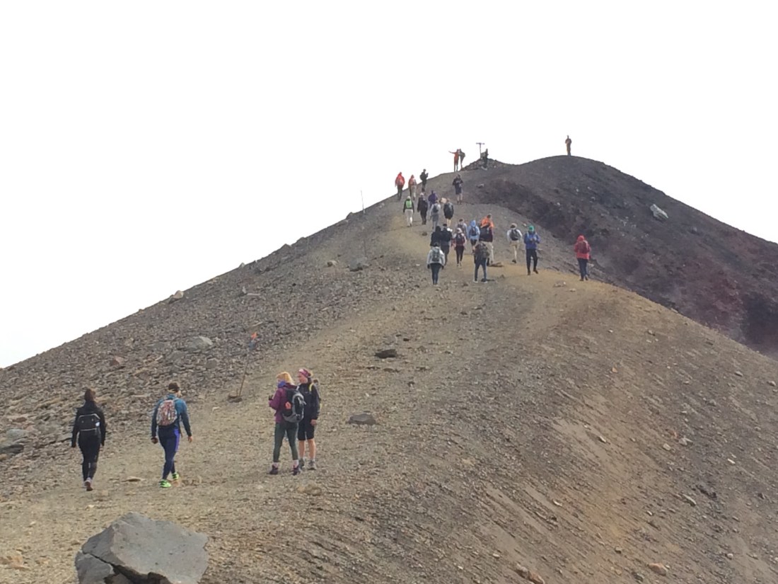
Finally I reached the Ketetahi Road, a one-kilometre route up to the start (or end) of the Tongariro Crossing, and got my first taste of the scale of the industry that has sprung up around the famous alpine stroll. Banks of tour buses waited, a huge car park, and no-parking flags lined the road; it was like a guard of honour, I decided, leading me to my goal.
At the end of the road, a crowd fresh off the mountain hobbled and milled, flushed and excited; they high-fived, took selfies, flopped down, scarfed chocolate, slept and canoodled on the dusty grass beside the gravel pick-up area. Shuttle buses came and went. Before long I, too, was shuttling back to civilisation. The wilderness looked weird, out there behind the plexiglass.

In National Park, I checked into a backpackers and headed next door for a burger. I felt good: I was watching the cricket over a beer; I’d done nearly 250kms; tomorrow was a rest day; I was about to do the most famous one-day walk in the land. But none of those was the main reason I was smiling, sitting there watching the Test match fizzle out.
The best thing about tomorrow, despite all my outbursts on here about the sweetness of solitude, was that I’d see a particular face again.
Home-stretch haiku
Mountain in cold sun:
a big tawny dog, steaming
after a hard run.

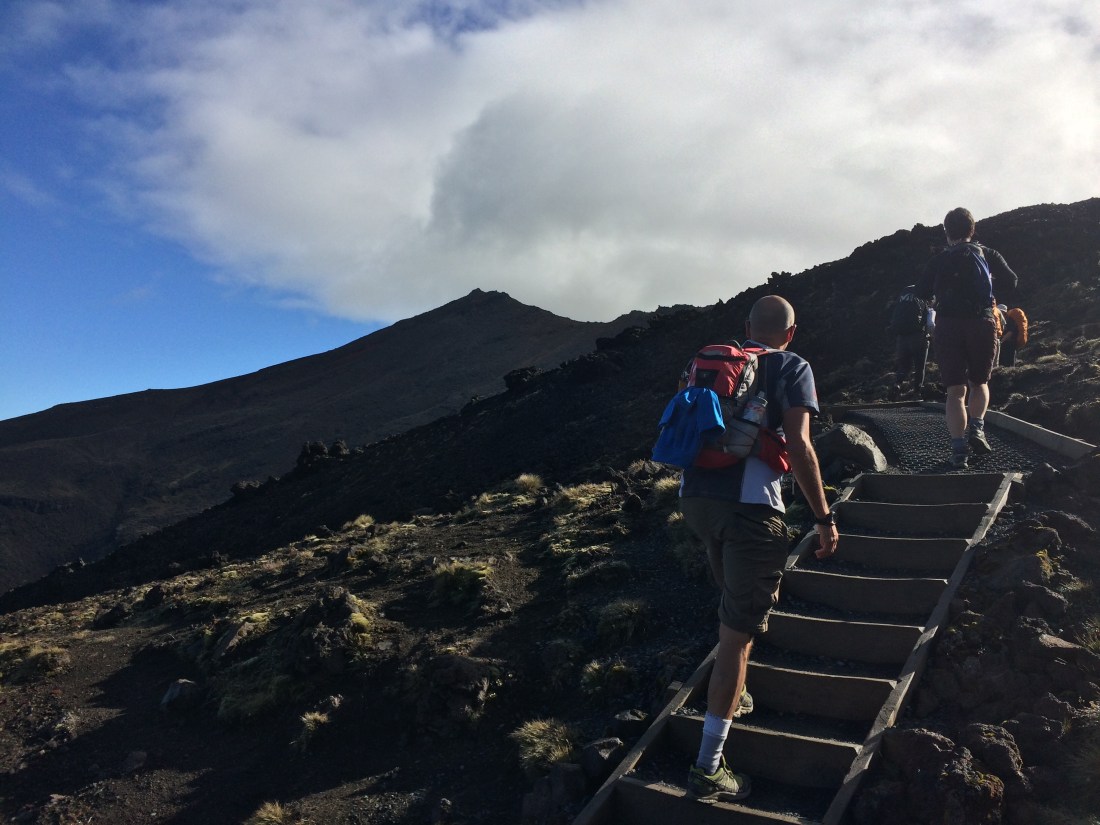
Day 62: Tongariro Crossing (19.4km)
Giving ourselves the maximum time to enjoy a walk we’ve been hearing people rave about for years meant rising at 5.30am. By six, we were on the first shuttle bus to the start of the Crossing, 15 minutes drive out of National Park village, at a lonely, lava-blasted place called Mangatepopo.
Shuttle after shuttle pulled up, sending a wave of dust and walkers up the track. We set off after them: just us, the mountains, and a thousand or so other rubber-neckers.
I realised this would be the perfect way to finish this post, and the previous one, which deal with my most recent 268kms on Te Araroa. I’d reflected a lot, during those 13 days, on the tension between solitude and company. Now, after nearly a fortnight mostly alone in the wilderness, I would share this most spectacular of wild places with a) thousands of people I didn’t know, and b) one person I’m lucky enough to be getting to know better all the time.
Initially I wondered if the crossing would live up to the hype, and whether the experience of it would be diminished by sharing it with so many others.
The answers are: yes, because there are very good reasons for the hype; and no, because there’s really nothing that can diminish this place:
That’s Mt Ngāuruhoe, AKA Mt Doom from The Lord of the Rings, seen from near the top of the Mangatepopo Valley. Before long you’re passing Soda Springs at the head of the valley and on to the so-called Devil’s Staircase, a steep grind up to the South Crater. Here you can see the lunar beauty people often mention when describing this walk:

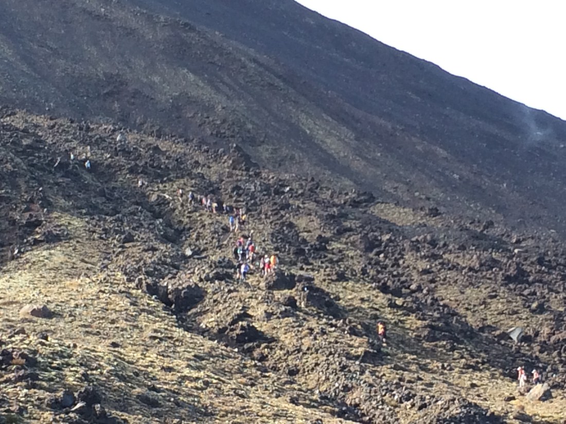
On the other side of the crater is another steep push up to the top of the Red Crater. The stairs stop after a while and it’s quite a scramble; this was probably the toughest part of the day. You need shoes with decent grip, and walking poles help. We saw people in jeans and street shoes, but that’s probably tempting the mountain to teach you a lesson.
Soon after is the highest point of the crossing (1886m, or 6188 ft), from which you can look down into Red Crater; it steams away gently, but there are enough shards of smashed mountain to remind you that you’re standing on shaky ground. This is also Te Araroa’s highest point in the North Island.
Near here is a poled route to the actual summit (1978m), but we decided not to make the long day any tougher. (Also, iwi ask people not to stand on the very tops of these mountains, which they consider sacred).
Also near here is where we started to meet Te Araroa through-hikers coming the other way, admirable purists maintaining their north-south flow, popping over Tongariro on their way to Bluff. They were immediately recognisable because of their larger packs, their hiking poles, their beards and tangled hair, and by a warm flicker in their eyes that said: this steep, stunning scene is just the latest among many I’ve lately crossed, and I have many more to go. (And probably something less polite, about having to wade through herds of day-trippers.)
The crossing’s highest point is exhilarating – you can see across a mighty sweep of rugged, tussocky foothills, down a length of Desert Road and out to the Kaimanawa Range. People stood up there making thrilled, shouty video calls and taking selfies, and there are little steam-vents beside the track where you can warm your hands. It was pretty cold and exposed, even on a decently sunny day in the middle of summer.
Just over the highest point is a quite steep slope of loose scree. A lot of people were skidding and swearing on the thick, volcanic rubble. “It doesn’t mention this bloody thing anywhere on the website!” said a pink-faced man sitting on a rock halfway down, prodding his phone while his family stood around, arms folded, morose.
The shuttle driver had told us the crossing’s most common injury is a turned ankle on this slope. A poster on the door in one of the long drops warned that in peak season, two walkers a week are rescued from the crossing; a fair few of those would be from this little section. But if you’re reasonably fit, have done a bit of back-country hiking, have decent gear (especially footwear) and don’t rush it, you should be fine.
I doubt you need to be told if you’ve got this far, but just in case: let this be the moment to point out that this is a potentially dangerous alpine environment and you’re very exposed if the weather turns bad, which it can in a heartbeat. Please prepare accordingly, and see the DOC brochure for more info.
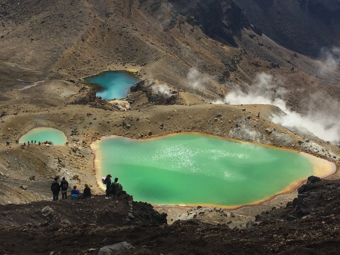
As you get further down, the footing gets easier and you can focus on the striking sight of the Emerald Lakes. Note in the foreground a bit of that slippery scree:

We picked our way toward the largest lake, sat against an antediluvian boulder in the sun and boiled the billy for coffee and noodles. We watched the excited crowd float in and out of the clouds of steam, and the wind scuff the bright water. It was strange being in such an pure place with so many people, and uncomfortable at times. You have to ascend the steep parts in a slow-moving file, wait to overtake slow traffic, or pull to the side when you’re the slow traffic, and some road-hog is almost butting your backpack.
But in another way, it actually added to the experience – hearing kids’ excited commentary, seeing couples’ eyes shine, watching older trampers or those who seemed unused to the outdoors grinning with satisfaction at their achievement in simply being in such a place:
And despite the crowds, there’s always a direction you can look where any amount of “poor, bare, forked animals as thou art” simply disappear into the immensity:

There’s another steepish climb past the Central Crater and up to Blue Lake, an expanse of quiet water as still as a held breath. Then you skirt below the rim of the North Crater, and before you know it, you’re heading down. At this point I’m sure we were not alone in thinking: ah, it’s pretty much over, that was easier than I thought.
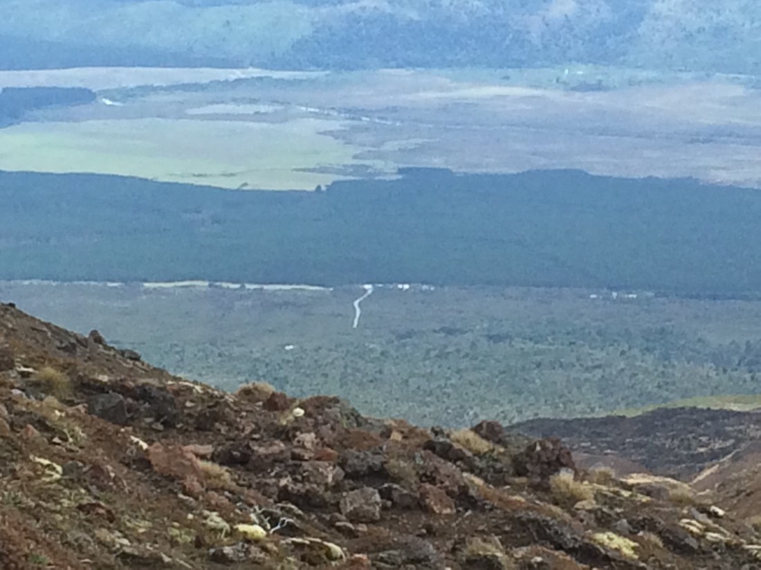
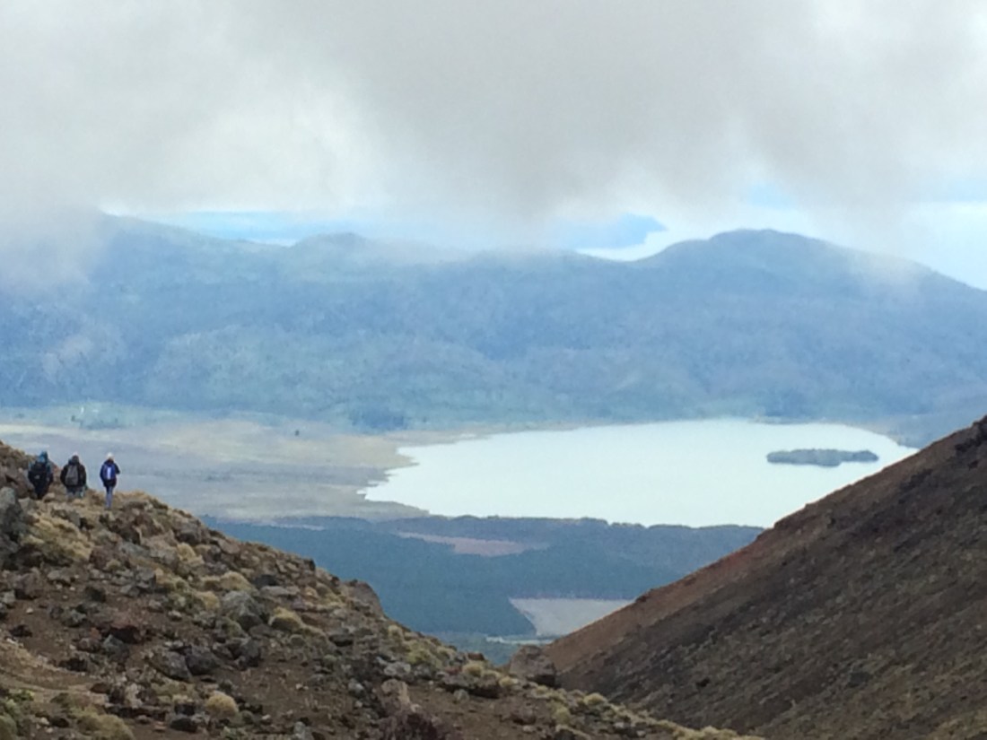
But have some scroggin and strap in, because the downhill is actually harder than the way up, in some ways – you’re tired, and it goes on and on, for a good three hours. At least the views are sensational. Here’s Lake Rotoaira and Motuopuhi Island, with a scrap of Lake Taupō beyond:
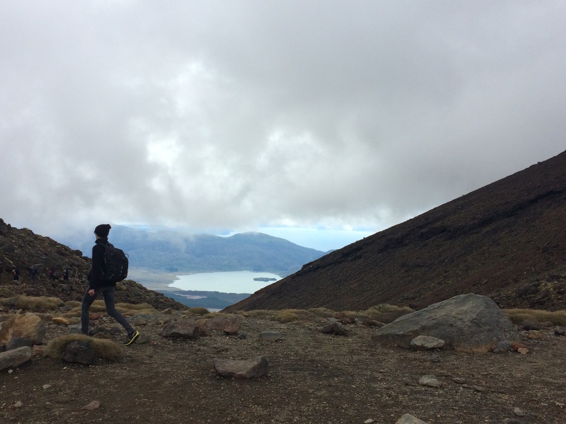
And you can sometimes glimpse State Highway 46 and Ketetahi Road at right angles to it. There it is, the end of not only this day but also these 13 days, where the short, silvery road peters out into the bushy foothills:
The track winds down through the tussock past the Te Maari crater, which blew in 2012 and wrecked a hut. You can still shelter in the hut, at Ketetahi Springs, but not sleep there. DOC is turning it into an interactive display on the eruption, and you can see into the closed-off bunk room, where a boulder left a suitcase-sized hole in the iron roof.

Here’s Te Maari, bubbling away, biding its time, aware now that, whenever it likes, it can shrug off boulders, huts and trampers like so many sandflies:

Closer and closer you get to Lake Rotoaira. Taupō comes and goes through the cloud and steam.
There’s a long section along a valley floor and through a lovely patch of mature bush; signs warn of mud flows down the wide river flats.

Finally we came blinking out of the bush into the harsh glare of the sun off the gravel road, and we were at the same dusty shuttle-bus pickup point I’d reached, from the other direction, two days earlier. We grinned at each other and broke out the chocolate.
Around us, crossing conquerers whooped and flopped and hollered and posed; buses roared and wheezed.
The mountain looked on, ageless, patient, untouched by the scramble and welter of it all.
And that was it for this leg of Te Araroa, after 268km, 13 days, dozens of excellent fellow moon- and sun-lit trampers, and one magnificent land.
Thanks for reading! If you haven’t already, you can catch the rest of the journey from Cape Rēinga to this point by clicking here.
I’ll be back on Te Araroa and this blog at some stage, tramping on from Mangatepopo to the Whanganui River, and on and on.
Cheers, and mauri ora.
Tongariro Crossing Haiku
Thousands climbed. But I
mainly chimed inside for two:
the mountain, and you.
******************************
* “Hutia te rito o te harakeke
Kei whea to kōmako e kō?
Ki mai ki ahau
He aha te mea nui o te Ao?
Maku e kī atu,
he tāngata, he tāngata, he tāngata…
If the heart of the harakeke was removed,
where would the bellbird sing?
If I was asked what was the most important thing in the world
I would be compelled to reply,
it is people, it is people, it is people.”
(You can read an enlightening discussion of the meaning of this whakataukī, with reference to recent events, by AUT’s Khylee Quince here.)

Kiaora fellow wonderer … I’ve really enjoyed these tales . I’ll say a prayer for the battered wild life in our land …. in a wood St Francis Assisi walked .
Good to see you using your skills fully … you seem happy and at peace with things .
LikeLike
Thanks mate! Lovely to hear from you. Wish I could have caught up with you more when you were at the cricket. Hope 2019 brings you every good thing – Kia ora.
LikeLike