

I rode an Intercity bus an hour and twenty minutes north, got out and walked home.
As stints on the Te Araroa trail go, it had an enjoyable simplicity.
Since January, 2017 I’ve been slowly working my way down the North Island via the length-of-NZ trail, which runs from Cape Rēinga to Bluff. Initially I’d drive north to wherever I reached the last time – Mangamuka, Mangawhai, Huntly, Tongariro – park up and start walking. After a couple of hundred kilometres or so, I’d hitchhike or bus back to the car.
But as I’ve drawn closer to Wellington, where I live, the logistics have gotten easier. For this stint, in September 2021, they were the simplest yet.
The plan had originally been to follow the Te Araroa route from Ōtaki Forks in the Tararua Range to Wellington, via the trail’s network of national parks, local reserves and other pathways. But bad weather had nixed the previous three-day, very exposed section through the Tararuas (to be completed later).
So I had a problem: getting from Ōtaki town, to which I could get public transport, to Ōtaki Forks, to which I couldn’t (it being in the ranges). Hitchhiking in a pandemic didn’t appeal, and adding to the difficulty was that the road to Ōtaki Forks is closed due to an active slip, 11 kms from Ōtaki town.
From the closure, pedestrians can do the remaining six or seven kilometres via a temporary, hilly detour. There would have been ways to get a ride to that point, but I decided to walk the whole way – it just felt right.
Day 82: Ōtaki to Ōtaki Forks (18km, to get back on trail)
So I clip-clopped my way south out of town, with a familiar out-of-place feeling – all got up in outdoors gear, complete with walking poles, but tramping along a street instead of a bush track. Over the bridge across the big, blue-and-silver Ōtaki River at the town’s southern entrance, where State Highway 1 traffic piles up and groans, yearning to get through the bottleneck and roar on and on.
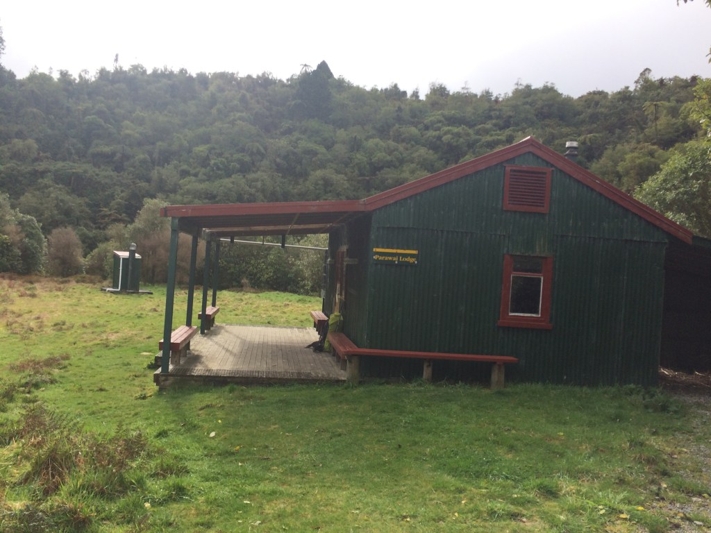
A death-dash across the nation’s clogged main artery got me onto the Old Gorge Road, which turns off east, at a right angle to the main road. It would take me all the way, basically, to my bed that night, in a hut called Pārāwai Lodge.
I was soon glad I’d walked. The Horowhenua plain spread out like a great, green lake around me, and the ranges were straight ahead, beckoning, coming closer step by step. I’d been feeling frustrated about having to skip ahead on the trail because of the weather – I’m trying to do my trail sections as contiguously as possible, to preserve the sensation of walking the whole trail in one hit. But if long-distance tramping teaches you anything, it’s to be adaptable, and the frustration evaporated as I got into another familiar, favourite feeling: eating miles. That old exposed ridge would keep.
“You will be mine,” I told it, swinging towards it along the Old Gorge Road and quoting the old movie, “oh yes, you will be.”
I came to a long corridor of native bush that lined the road and reached over it in places, making a peaceful green tunnel.

Just as I was entering it a pilot ute with a “wide load follows” sign came zooming out of the emerald shadows and paused beside me.
“Two trucks coming,” said the driver through the open window. “Wait for the second.”
Another small truck, loaded with landscaping supplies, came up behind us and its driver got the same message; he pulled off onto the verge just in front of me and got out. We both watched, he leaning on his cab and me on my poles, as a flatbed truck carrying an enormous forestry digger swallowed the road. It loomed closer and closer, the edges nearly touching the overhanging trees, then rumbled by.
While we waited for the second one, the driver of the landscaping truck strolled over to me.
“Where you off to?”
“Wellington.”
“Oh, doing the ‘TA’ are you?”
“Yep. Ōtaki Forks tonight, over Pukeatua tomorrow, out to Waikanae, then down the coast.”
“Oh yip. You know the road’s closed at Blue Bluff?”
I nodded. He and gave me some useful advice about the route ahead, and we chatted a bit about Te Araroa – he’d done some of the North Island, in sections, and knew the Tararuas well. He reckoned I’d made a good choice postponing the section prior to Ōtaki Forks, given the forecast: gales and snow to 800 metres. I told him I was hoping to get it done the following week and he eyed the waterlogged sky.
“Don’t like your chances for next week, either. But you might get a window.”
He looked down at my boots. “Those are Lowe Renegades, aren’t they? Great boots, I’ve had three or four pairs. Fit like slippers.”
He wished me well and zipped off up the tree-lined corridor, and I was alone again in the long green light. I smiled, grateful for his advice, and feeling vindicated after spending many hours over the previous few weeks, in several outdoors stores, choosing my new boots. A couple of pushy counter staffers tried to up-sell me more expensive boots, but the landscaper was right – these were like slippers. And I’ve had enough blisters and cramped feet on the ‘TA’.
I plinked along contentedly and didn’t pause again until I saw these brand-new rural residents:

Tramping in spring is a bit dodgy weather-wise, but it has many compensations. Like magnolia blossoms:

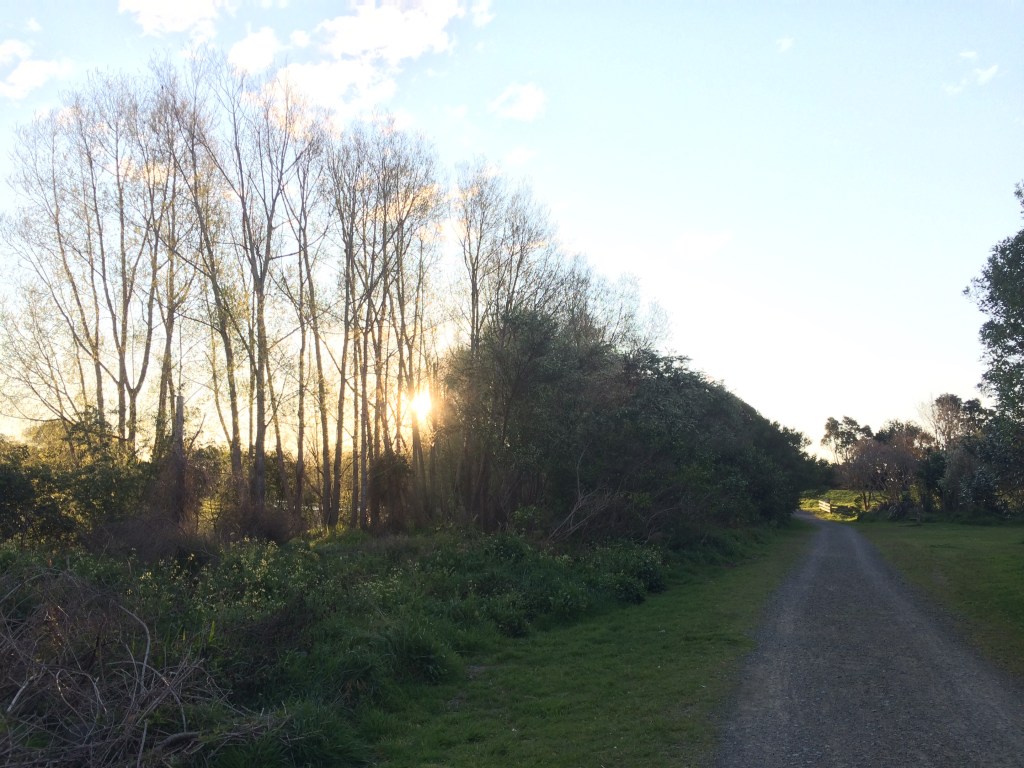
That was one of many logging juggernauts to come clanking and roaring by. But before long I was getting sumptuous views of my preferred kind of juggernaut, the Ōtaki River, which was giving off a steely blue glow in the cloudy light:
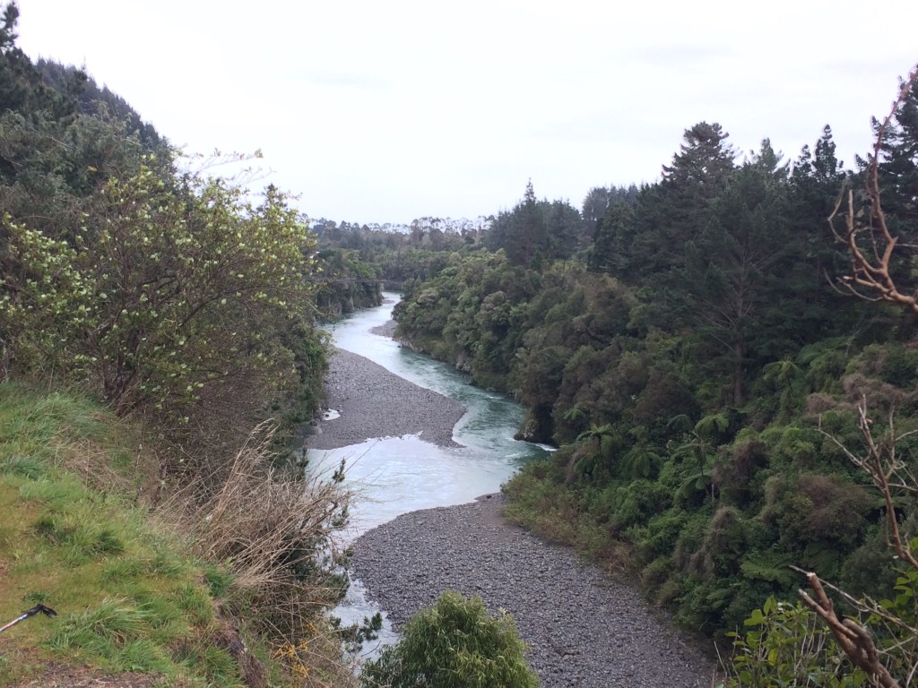
The banks of the river were getting more wild, less farmed and steeper. It was a real pleasure to walk all the way into the ranges from the coastal plains, feeling the hills draw in, the valley steepen, the wild wrapping me up and welcoming me back.

Rivers acquire more wild force, too, the deeper you go into the hills:

The human stuff was changing too – fewer industrial-sized farms, and more baches, hunting huts, alternative lifestyle-looking places.

I passed a hectic logging operation – diggers lifting freshly harvested logs onto a queue of waiting trucks. Then I crossed a shallow ford and, seeing the bush was right down to the road’s edge at last, I ducked a few metres up the stream to a very quiet, lucent lunch spot. The morning’s road walk had been fine, but it was, as always, such a joy to sit back against a tree in the actual, untracked, unspoiled bush.

Not long after I came to Shield’s Flat, in the Hautere district, where during the Great Depression work-gangs of unemployed stacked river rocks into miles of dry-stone walls. The walls are there still, but there appears to be nothing, now, in the small paddocks they created, except rabbits, bullrushes and thistles. The part-tumbled walls emphasise the emptiness – they contain nothing, and keep nothing out. But they gave a basic income and dignity for the workers employed here to pull up and stack the stones, which they called “Hautere Turnips”. And land development for the farmer, and some extra life in what would then have been a pretty remote district.
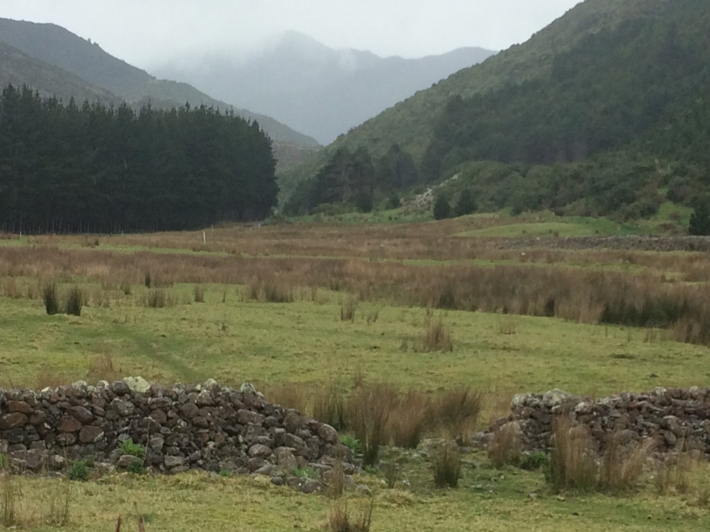
The farmers in this particular spot were Jean Shields and her husband Patrick, who came here with and their 10 children in the 1930s to farm potatoes. I imagined the crews of unemployed, mostly single men living way out here, bunked in little huts, learning the subtle, ancient art of drystone wall-building. Then moving over these flats, backs bent, stacking stone after stone into carefully balanced walls, wondering if all their effort would make any difference to anything.
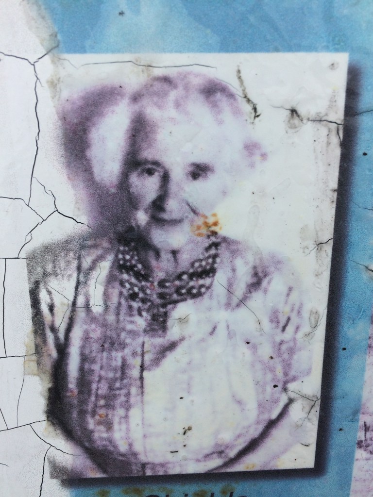
It must have caused quite a stir in the pioneering district, though, with its fresh-felled virgin forest, miles of muddy cart-tracks to the outside world, and stoic, self-sufficient families. Jane Shields looks like the kind of warm, optimistic person who would have made that harsh world a bit easier to live in:
Further on I came to the locked gate that keeps cars out; walkers can climb over and carry on a little further to a sign pointing to a detour around the nearby slip. It goes up a hill, along through private land then back down onto the gorge road, adding a good two hours to the trip.
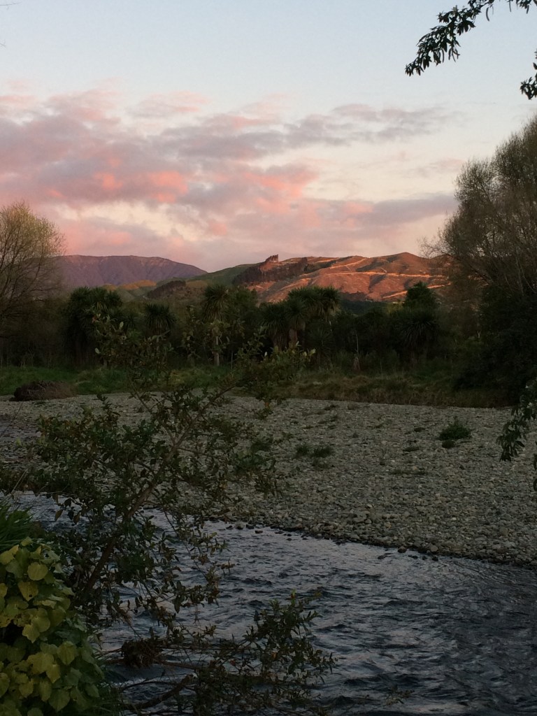
From the gorge road, the countryside was getting more and more wild. Before the road was built, the Ōtaki River must have seemed, to early European pioneers, to traverse quite the jungle.

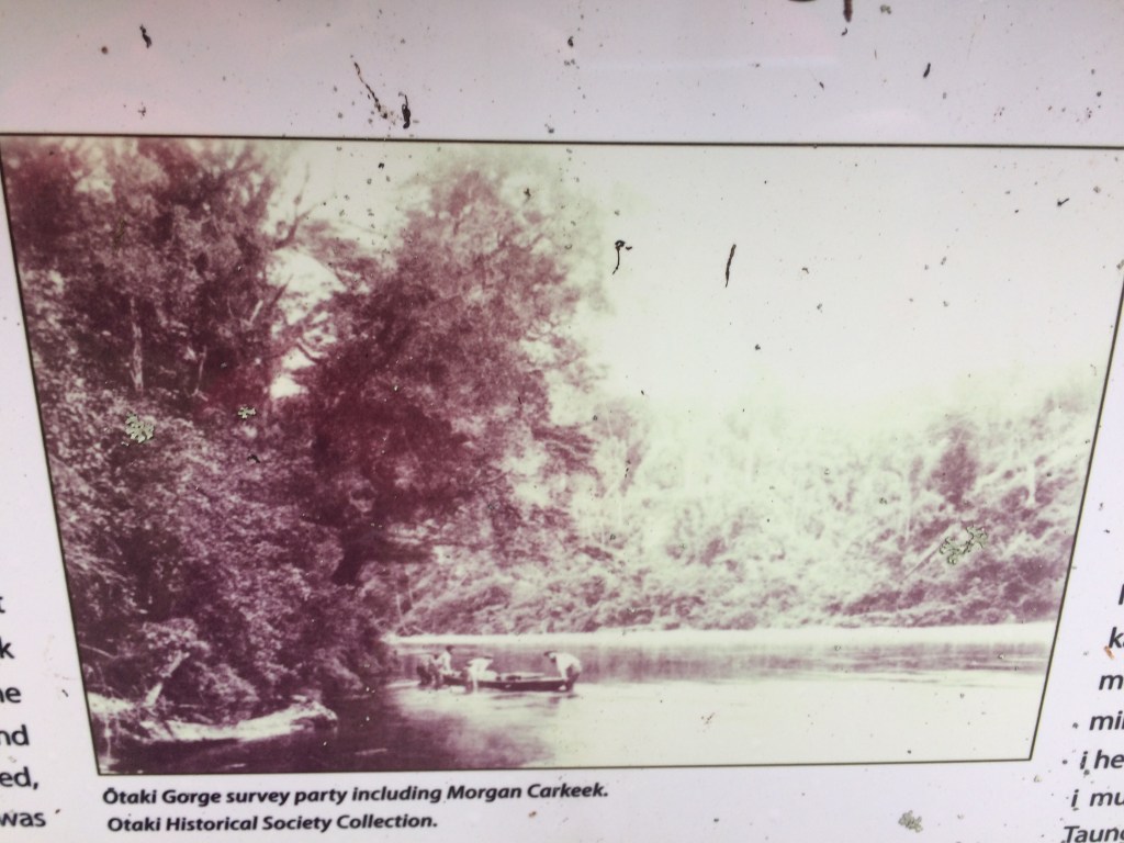
An info sign nearing Ōtaki Forks has the evocative photo below, showing some of the early Pākehā explorers surveying this very gorge, well over a century ago. Carkeek, mentioned below, has a ridge named after him in the Tararuas. Of course, Māori explorers began criss-crossing the whole range, and all its river systems, close to a thousand years before that. The whole system of ranges is named after one of them: Tara.
Tara was the son of Whatonga, one of the first navigators to arrive in Aotearoa; among his descendants (along with his brother Tautoki) are the tribes of Ngai Tara, Rangitāne, Muaupoko, Ngāti Apa, and Ngāti Ira, who still populate this area, and beyond. It’s their ancestral lands I would be walking over on this trip. As the link above details, they named these mountains after a saying honouring their famous ancestor: “Ngā waewae e rua a Tara” or “the spanned legs of Tara” – because his people had a place to stand on either side of the ranges.
Here’s a view upriver into the heart of Tara’s territory.

A few more kilometres of gravel road took me to the main Ōtaki Forks overnight carpark and a foot-track down past the cartaker’s house to a picnic area above the river. The path goes over a footbridge and a few hundred metres more to Pārāwai Lodge, built and maintained by a local club. It was a welcome sight after a good first day back on the trail. That was even allowing for a fair amount of rodent poo on the steel bench. Oh well: for five bucks a night you can’t really mind the odd incontinent, squeaky hut-mate. After noodles and biltong I turned in early, and slept like I’d stacked a thousand Hautere turnips.

Day 83: Ōtaki Forks to South Mangone Road end carpark (16km)
Here’s the hut in the morning, with its ring of thick bush that crowds, a little darkly, around the clearing, as if resentful of the intrusion of humans (and rats).
From there it’s a couple of kilometres back across the footbridge and upriver to the start of the Pukeatua Track, which heads off roughly south toward Wellington.
As it climbed, intitially via the Fenceline Track, I got a glimpse back to the north of what I would have been hiking through had I not skipped the previous section (Makahika Outdoor Pursuits Centre to Pārāwai Hut, via Pukematawai peak and Mt Crawford):
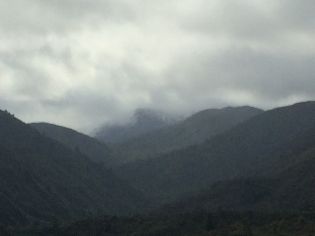
As you can see there would have been very limited visibility up there. And with gales and snow, it would have been pretty dangerous on top of Pukematawai (1432 metres) and Crawford (1462m). They’ll keep.
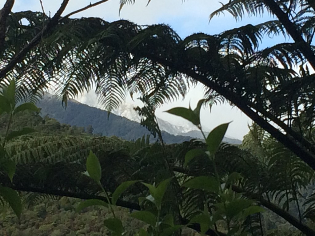
A bit further on I got my first proper glimpse, on this leg, of snow. This is looking east toward Mt Hector, on the famous Southern Crossing route:
As usual when I’ve been off the trail for a while, it was a special moment to find myself, once again, fully immersed in the forest. There’d been smatterings of bush the day before, but it was around mid-morning that I looked up and saw the sky was full of branches. The canopy had closed over me and the light had turned green; I felt my heart-rate drop an extra beat. In Europe, I think it is, they call it “forest bathing”. It’s pure medicine.

The canopy cleared a moment and I got a better view of the fresh snow on the peaks around Mt Hector.

I think this is probably part of the long ridge that heads roughly northward from Renata (924m) to Elder (1110m) and Aston (1376m), then the “Dress Circle” through to Atkinson (1472m) and Hector (1529m).

Down here at around 500 metres it was cold, all right, but there was no snow yet and it was fine as long as you kept moving. Despite that, every so often it’s good to take a break, put on a warm jacket, and drink it all in.

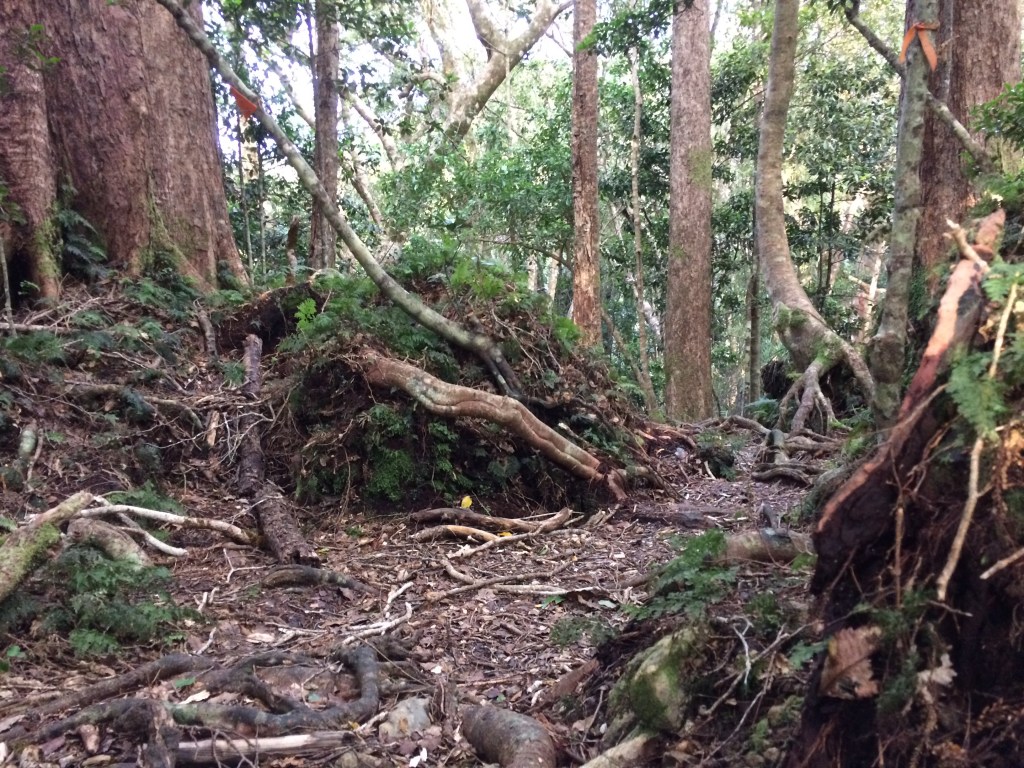
Recharged, I charged on. It was a fairly obvious track but not all that often travelled by. I really like the way this kind of trail seems barely there, always hovering on the edge of being swallowed by the quietly ravenous bush.

Should you doubt, though, an orange triangle will appear, tacked to a trunk by your trail forebears, to guide you and draw you on, further and further into the wild, but also closer and closer to Bluff.

It was a steady, three-hour uphill hike. Finally I reached some grassy clearings, remnants, I suppose, of failed farming attempts. There were a few glimpses of the plains I’d schlepped the day before, in from the coast:

And my first glimpse, on this leg, of Kāpiti Island, a place full of history, familiar but shadowy, like a half-remembered family story.
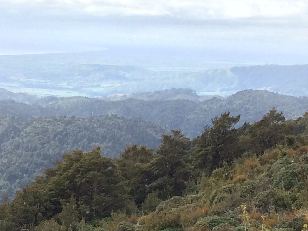
Finally I was on the tops proper, with tussock and sunshine, and the Tasman Sea gleaming beyond Ōtaki Beach:

Kāpiti’s jagged spine sharpened:

The peak I was on, Pukeatua, is only 812 metres, but I’d climbed there from nearly sea level so it was satisfying enough. And it has a good name: as far as I know, Pukeatua means something like “hill of god”. In any case, it was good to stand on an open, breezy mountain top, sun and cold and wind on my face:

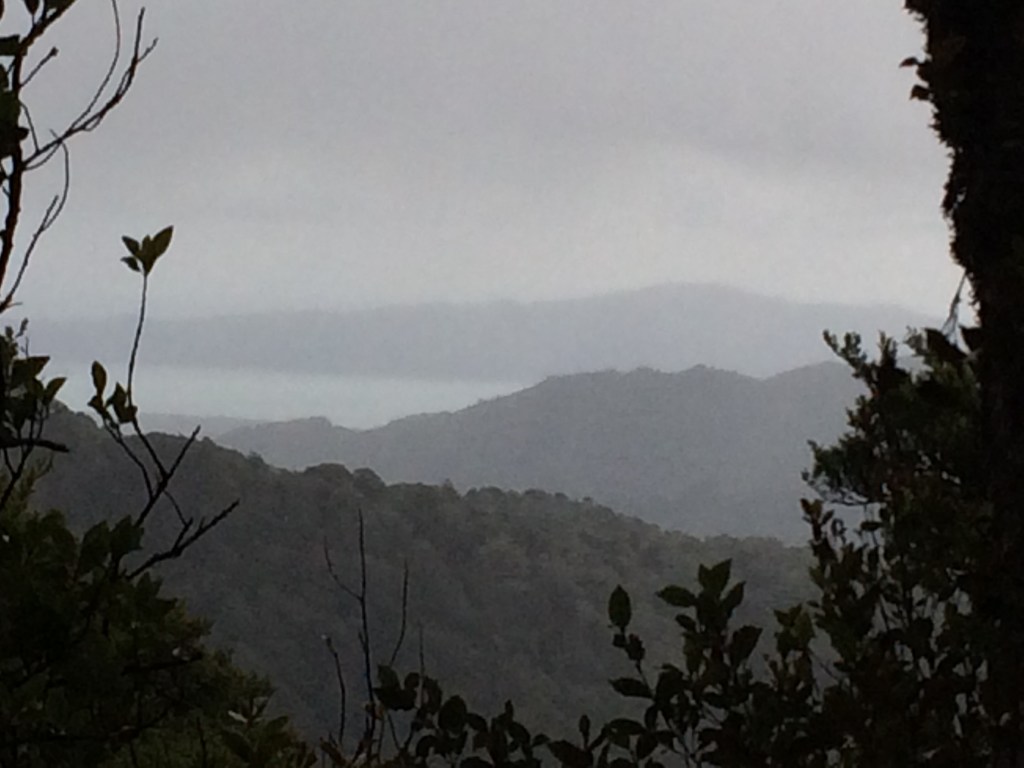
To the east, Judd Ridge led up to Table Top, Bridge Peak, Hut Mound, Field Peak and the tops around Kime Hut, where the conditions looked considerably less idyllic:

Here’s a shot of the Ōtaki Gorge area, where I’d walked the day before, along the gorge road and into the ranges:
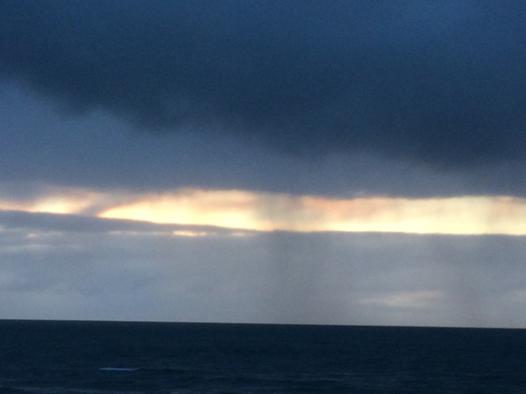
As I was watching, the sky darkened and the promised snow came. Just a flurry, but it was still a thrill watching the flakes dance in the strong south-easterly and settle on my gloved palms.
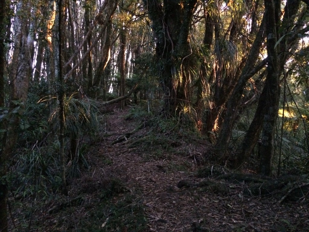
Time to head down. The trail flowed down long switchbacks and the forest thickened. I stopped to rest as the sun began to gild the moss:

The floor was thick with roots and there was a bit of wind-fall – sometimes even the hallowed orange triangle is not protection against getting toppled:
As the afternoon deepened the gold on the floor and leaves grew warmer.

I was so engrossed in the wintry luminescence I got slightly lost, and ended up walking up this little rise twice:
What happened was I got distracted by this kind of thing:

And this: a tree, cleanly split by recent wind, the wood still silky and fresh, coloured a warm coral in the evening light.

I walked up the rise, noticing the sun setting on my left. I mislaid the track at the top of that rise, thought I’d found it again and carried on down a short descent. That’s funny, I thought, the track must have done some weird curve, because now the sunset’s on my right. Then I saw a fresh-split tree, the wood still smooth and warm, coral-coloured in the evening… hang on a sec, I thought.
Once I was sure of my way again it wasn’t long before I came out into the felled remnants of a large pine plantation. The sky, open to the west, carried the last traces of the sun.

Red eyes glowed in my torch light; it was this guy, invasive and unwelcome visitor from Australia, destroyer of native trees, eater of native birds and their eggs, general hoon and persona non grata. I counted seven of them over the next kilometre or so:

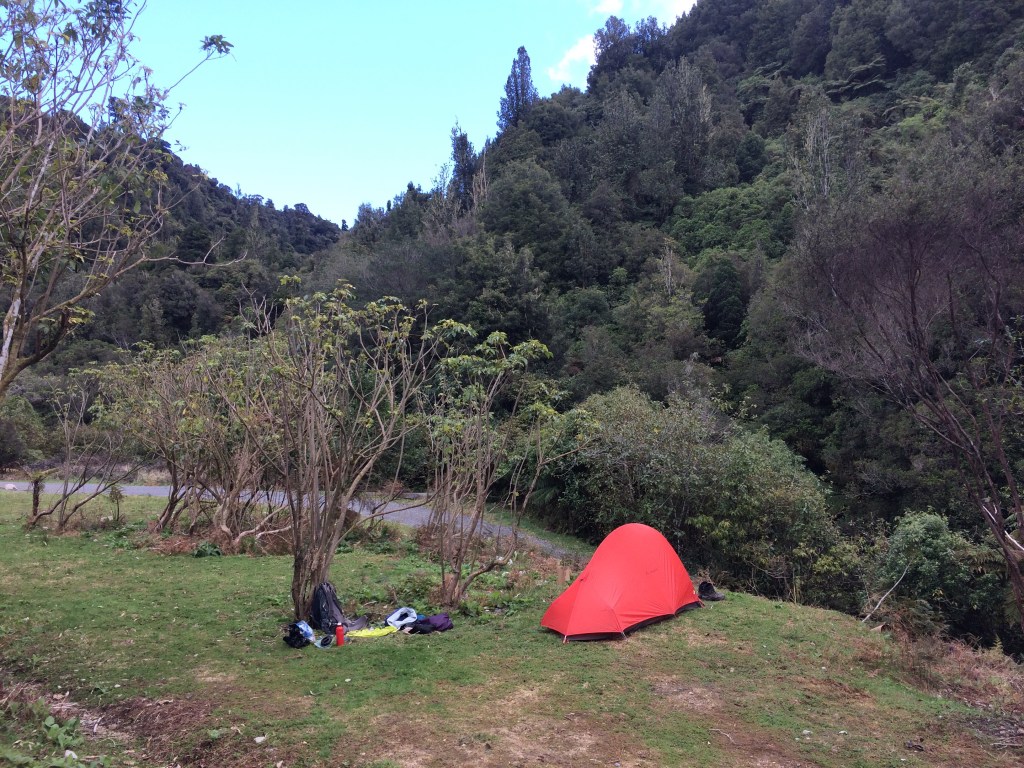
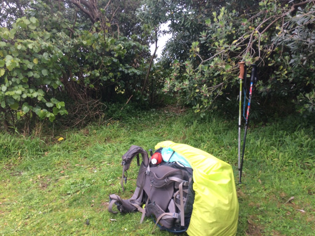
Finally the track dropped into a creek then along a four-wheel-drive track, thick with storm-felled timber, massive pine stumps that were tricky to scramble over by torchlight. Finally a footbridge took me over the Waikanae River, just a bush-lined stream this high in the hills, and to my campsite. It’s a brand new one, put in by the Te Araroa Trust, and it’s a beauty. I ate my noodles under the starlight, listening to the river and the silence.
Day 84: South Mangone Road end campsite to Waikanae river mouth (17km)
This was the lovely spot I woke up to – complete with freshly planted native seedlings and a new track down to the river for drinking water. I was tempted to stay the day, enjoying the solitude, but the trail beckoned so after porridge with goji berries I set off for Waikanae.
It’s five kilometres of easy gravel alongside the upper reaches of the Waikanae River until you get to the tarsealed Ngātiawa Road. I paused at the intersection to boil the billy in a bus shelter – there was a chilly northerly whistling down the valley off those snowy tops. Just as I stopped a mob of at least a dozen kererū came bursting out of the pine forest by the crossroads. The combined noise of all those wing-beats was like a helicopter; their pāua-shell shoulders caught the sun.
After a kilometre along Ngātiawa Road the trail turns into Reikōrangi Road, and follows it (and the Waikanae River) five kilometres into Waikanae township.
The route is flat and easy and I made pretty good progress, despite the distractions of the spring:

After lunch and a re-supply in Waikanae I was off down the riverside path, an easy ramble in the golden afternoon.

Looking back upstream I could see the first row of hills you look up on as you drive along State Highway 1 through Waikanae. So many times I’ve seen these hills, driving to and from Wellington. It was satisfying, now, to know exactly what the country was like behind them, having walked through it all the way from the ranges.

I carried on west, straight toward the sea. The sun lead me on, dropping lower, silvering the trunks of the still-bare trees.
Looking east again, back the way I’d come, a stand of kōwhai blazed in the last of the sun:

The fading light went rose-coloured on the bulldozed slopes, newly cleared of pine.
A low booming hum began to come over the water; I was nearing the new motorway. It felt good to stand below it with my feet on the ground, reading stories of the people who lived here, making lives, cultivating, fishing, fighting, making peace, walking and canoeing up and down this very river, long before this concrete behemoth got rammed through.

A wider view of the behemoth:

Following a recommendation in the Te Araroa trail notes, I’d been planning to camp at El Rancho, a holiday park right on the trail, not far from the rivermouth. But In Waikanae I’d rung to confirm an earlier attempt at booking online, and been told they were not accepting casual campers in Covid times, only school groups.
“There’s a freedom camping spot at the end of the river track, on the same side as us,” she said. “But if you get stuck let me know.”
So I pushed on past El Rancho, looking for the campsite. I was getting very close to the sea now, so close I could hear it, and Kāpiti island beckoned me on:
It was nearly dark though and I was wondering if I’d missed the camping area somehow when a woman came walking towards me with a small dog on a lead. She had an unfussy, cheery way about her, with her close-cropped blonde hair and brisk walk.
“Excuse me,” I said, “is there a freedom camping area up ahead?”
“There is!” She sounded delighted. “Why? Are you going to set up?”
I nodded.
“Oh, bless you,” she smiled. “Yeah, follow your nose another five minutes, you can’t miss it. There’s a whole bunch of campervans parked up.”
I got a little nudge of doubt – usually tents aren’t welcome at campervan freedom sites. “Can you put up a tent there as well?” I asked.
“Oh yeah!” she said, emphatic. Doubt flickered across her face, but she chased it away with another “yeah”, with even more conviction, as if delivering a generous and obvious ruling.
“Course you can, it’s Kāpiti!”
She wished me luck, adding: “Have fun! It’s just gonna be you and a bunch of old people in motorhomes!” I laughed, thanked her and we parted.
She’d gone about thirty metres when she stopped and called after me: “If you have any problems, you can come and camp in our back yard.” I yelled my thanks and she yelled her address, gesturing: “Just over there.”
It would have been a pretty good welcome to the famously hospitable Kāpiti coast, but I decided to stick to the plan.
The motor-homers seemed to have all turned in for the night and nobody seemed to know or care that I put up my one-person tent under these trees (this photo was taken in the morning):
I got the impression the place wasn’t really for tents, but supposed I was just as self-contained as a motorhome, given the reserve had a public toilet (the hand-basin tap was fine for drinking and cooking water). So I was pretty sure I wasn’t doing anything too terrible.
I drifted off to the sound of the waves, after watching the All Blacks play South Africa, live, on my phone.
Day 85: Waikanae river mouth to Paekākāriki (17km)
It was still dark when I was woken by what sounded like a four-wheel-drive reversing onto my tent. My heart thudding, I slowly realised it had backed right into the other side of the same bushes I was camping under. Its bumper was probably no more than two metres from my head, luckily protected by some solid shrub trunks. Then came a complicated series of clacks and rattles, as if someone were assembling a green-house using those long plastic sticks you get from garden centres, alongside an endless amount of door-opening and slamming. More cars arrived, mostly grunty utes and SUVs by the sound of it, developing a sympony of revving, slamming and rattling.
In my sleep- and ache-addled state it took me a while, but I worked it out: it was white-bait season, and this carpark was a a prime base for bagging a perfect possie by the rivermouth.
Mystery solved, and reasonably sure no one would actually run me over, I put in my ear plugs back in and got another hour’s sleep.
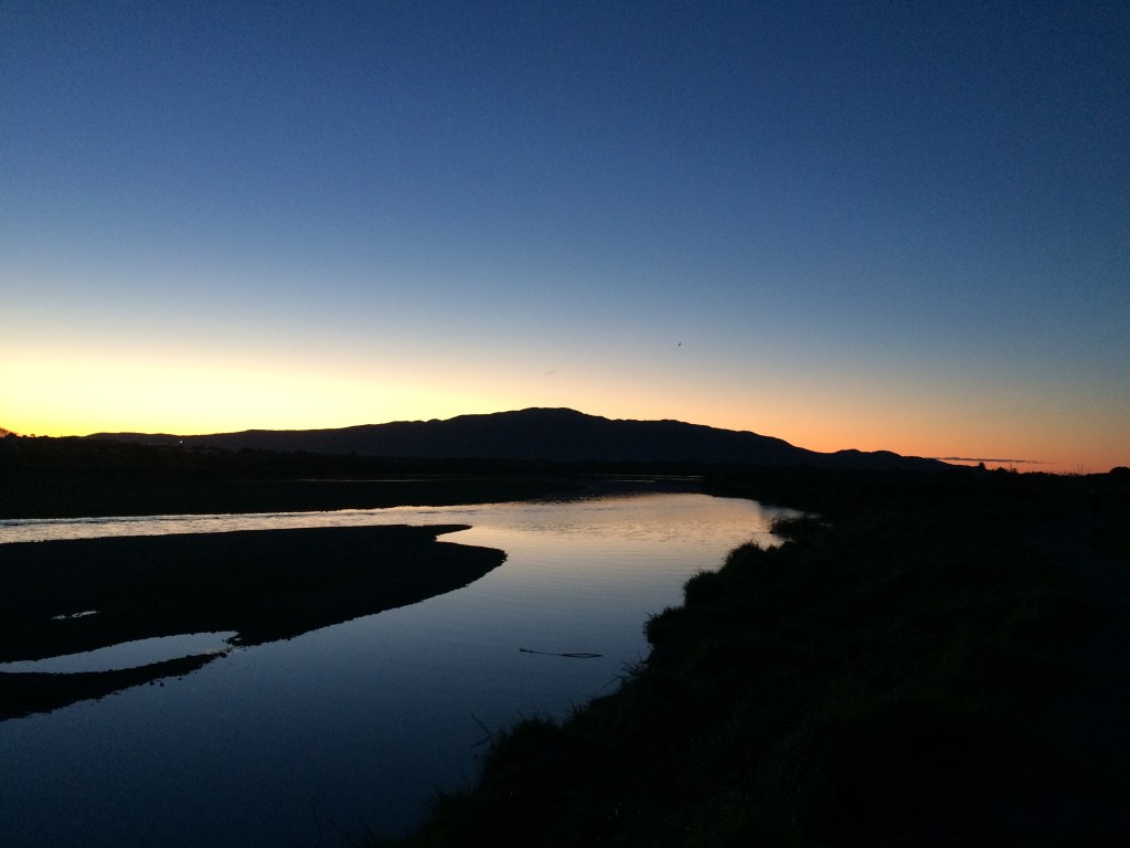
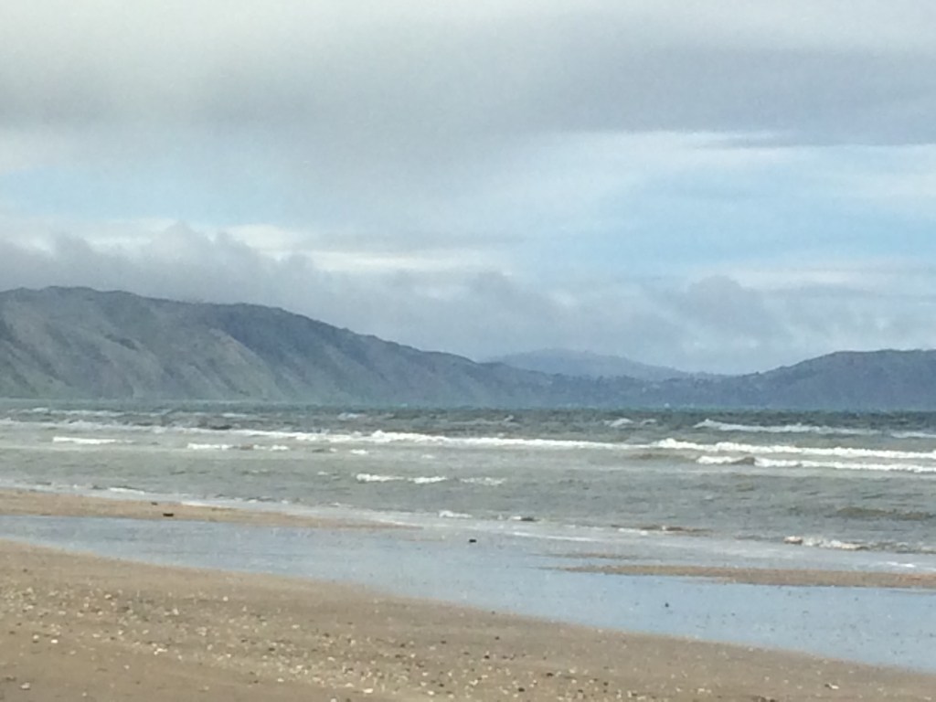
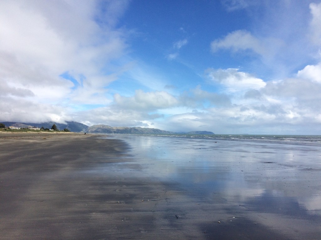
After breakfast I packed up and went down for a look at Waikanae Beach, it being only a hundred metres or so from where I’d slept. Here’s the view north:
And here it is to the south, including a bit of Kāpiti, the legendary and ripple-spined island I was to spend the day walking beside.

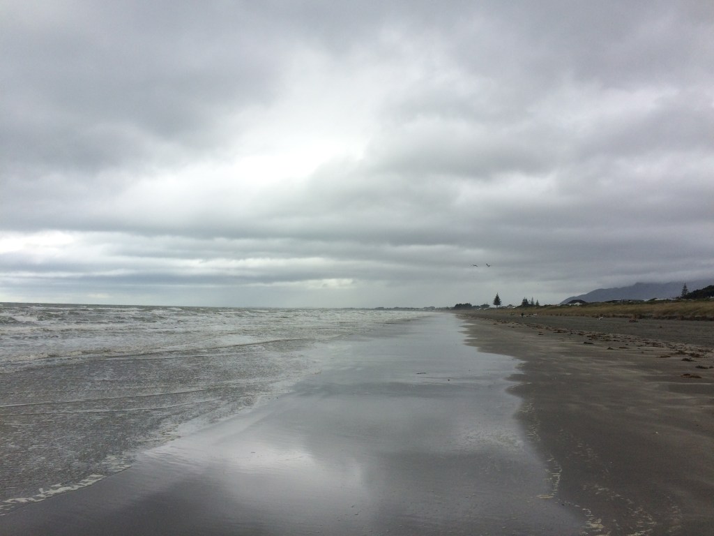
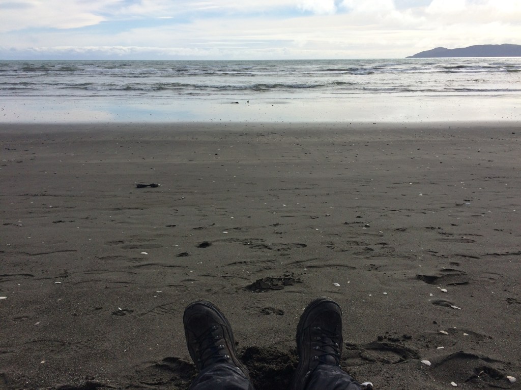
I walked down and let the Tasman Sea touch my boots. It the first time they’d tasted saltwater on the trail since it turned inland from the Santoft coast, south of Whanganui, 207 kilometres back.
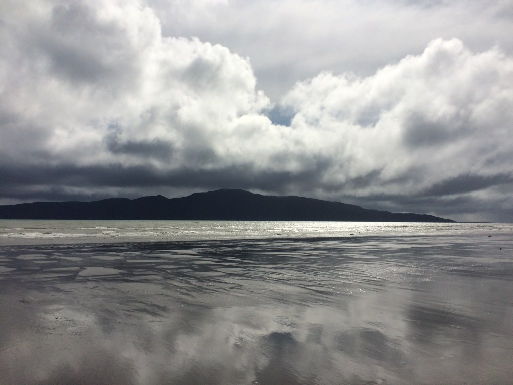
And there it was, the full length of Kāpiti; I don’t think I’d ever really looked at it from this beach, more to the north than where I usually see it from, and it looked different. I liked how you could see layers to it, peaks further back than the main one, new lights and shades to the bush.
I also liked the storm-coloured sea; normally it’s a brilliant, sunny blue, but not that rainy old week in spring.

I backtracked a kilometre or so, crossed the Otaihanga Domain footbridge and I was back on the trail. It goes back down the river again, but on the south side now.
There was a tino rangatiratanga (Māori sovereignty) flag right beside the path. With Kāpiti as a backdrop, it reminds walkers that this land – and all of Te Araroa, all of Aotearoa-NZ – has an ancient and continuing connection with mana whenua: those whose relationship with the land goes far deeper than capital gains. Even if they have often been alienated from it by the complex forms of violence that are intrinsic to colonization.

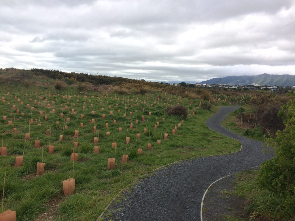
The tracks flows into boardwalks, part of a fantastic wetlands restoration scheme, run largely by volunteers. This is the Waikanae Estuary Scientific Reserve, a nationally significant and unusual coastal environment which is a real treat to walk through.

They Waikanae Estuary Care Group have planted hundreds of thousands of native trees and rooted out as many noxious, exotic weeds – reversing some of that colonial damage.
The Department of Conservation is the group’s main partner. I liked how government and citizen, each in their own language, communicates just how high the stakes are:

I liked the blunt warmth of the Care Group’s signage, and their obvious deep love for this special, vulnerable ecosystem.

I came across a peaceful-looking woman standing beside the track, her face full of dreamy repose, two dog leads dangling loosely from one hand. She was watching indulgently over two German shepherds nosing around in the long grass nearby. I saw her eye my backpack, then the lowering clouds, and smile.
“You picked a funny time of year to go camping.”
“Well, I’m walking the length of the country, so I have to take what I get.”
She nodded and asked where I’d come from, where I was going. She liked the idea.
“Oh, it would be great, you’d see all sorts of things you wouldn’t see from the road or the train. Are you doing it for anything in particular?”
“Nah. Just for the hell of it.”
She laughed. “Good on you.”
I asked if I could pat Jonty, the young male shepherd, and when she said yes he came straight over and leaned his big, warm body against me. Jonty knew when a pat was in the offing. I gave him a good old ruffle while the woman watched. An idea came to her.
“Imagine if you had a dog! To come with you, as a companion on your journey.”
“That’d be great, but there are long bits of trail where you can’t have dogs – they can damage kiwi, and that.”
She nodded, casting a protective look at her dogs.
“Mine aren’t bird dogs, so they’d be no problem. Although,” she thought it over, “I suppose they’d give a kiwi a fright.” She mused on it a bit more while I stroked Jonty’s ears. She perked up.
“You could get a little dog. Then you could just pop it in your back pack.”
It was a good image to part on.
The boardwalks curve past swamps and lagoons, then across some dunes.
I knew the main beach was coming but after chugging through the closed, intimate environment of the wetlands, it was still a thrill to round a dune’s steep corner and find myself out on the wide-open, salt-rinsed expanse of Paraparaumu Beach:
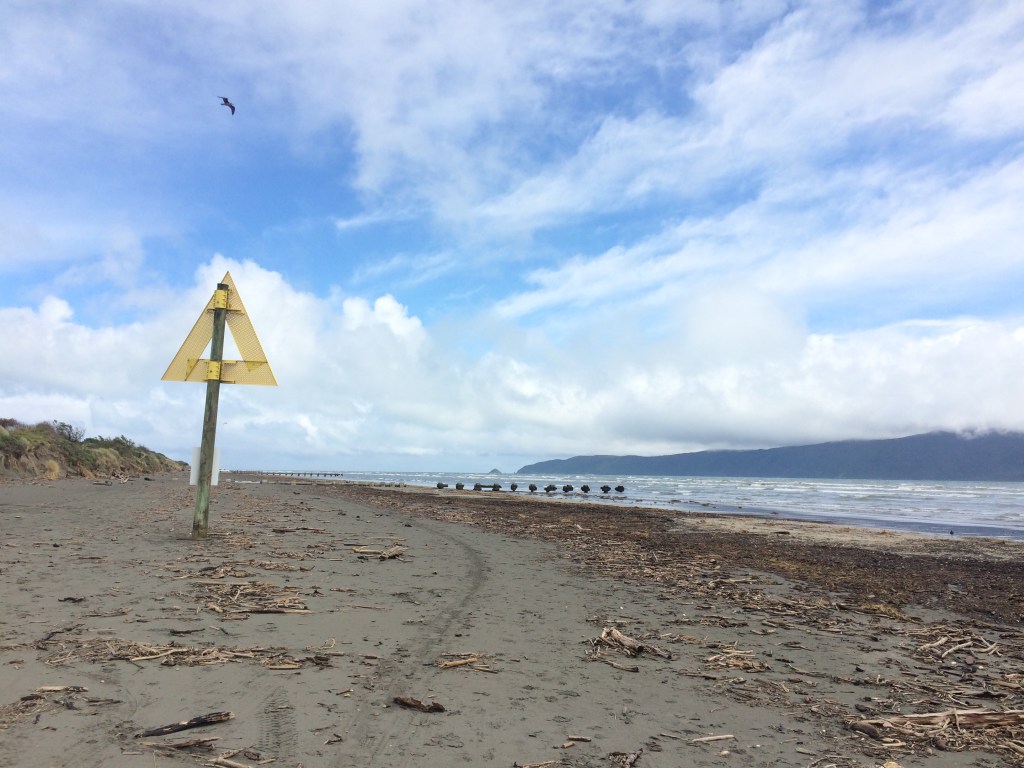
The wildness of it was somehow enhanced, not diminished, by the beach furniture: the big yellow marine reserve sign, a white cross on the dune, and some sort of decomissioned pipes mouldering into the sea on crumbling cradles.
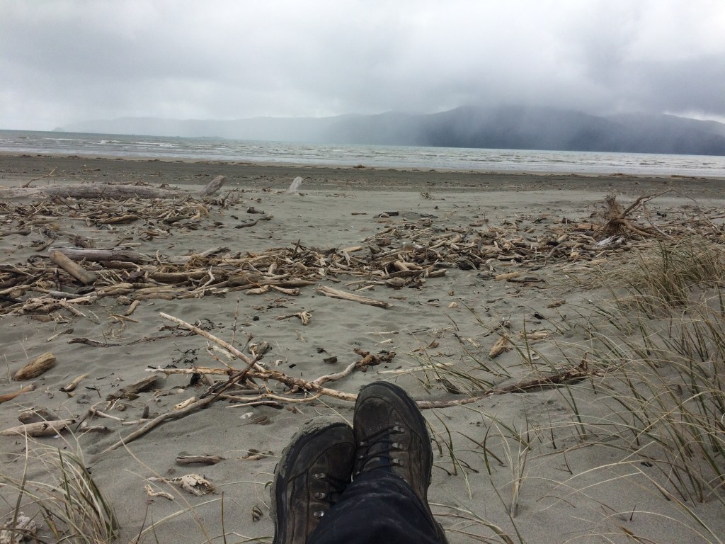
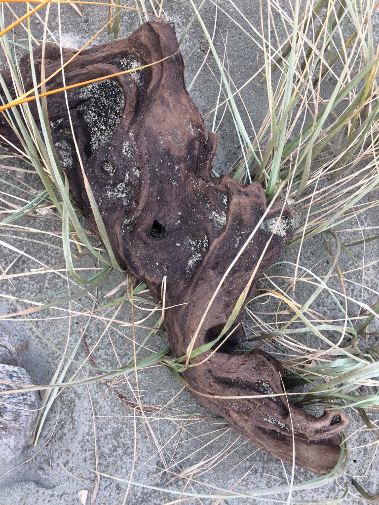
Slowly, surely, after a bit of eddying around the river mouth, I was moving south again. The island was fully present again, along with the open sea, the windy wastes of sky, and a long spray of bladder-wrack and driftwood, the latter carved into weird shapes by the waves.
I spied a man roughly my age walking toward me, following the same line where the dunes met the flat sand, picking his way, like me, through the driftwood. He wore jandals, rugby shorts, a hoodie and a wool beanie that looked home-knitted. His long, white legs had a springy stride and he gazed around himself constantly. He had a pleased, but guarded expression, as if the whole world was very interesting to him, but that he wasn’t going to rave about it.
We caught sight of each other at the same time, then quickly looked away, nonchalance being important. When we got close, our eyes met again, and he spoke first.
“GiddayHowAreYa.” He said it flat and fast, without breaking stride, but I knew there was no lack of courtesy; just a discomfort with banality.
“Good thanks,” I said. “You?”
“YES.”
Communication achieved, conversation over. And he was gone.

Further on, I looked back north and watched a guy using a kind of parachute, attached with lines, to sail a go-kart up the beach:

It was such a delight to be back in the groove of swallowing miles, just putting yourself in gear and feeling the cadence of your breath, heartbeat and stride merge. Much like the merging of sea, sky and land, as the tide lowered:

Kāpiti was a constant companion, along with the gulls:

I liked how travelling a long way down on the beach, on foot, revealed new things about this coast I’d never noticed. Like the small islands in the channel between the main island and the beach. This is probably Tokomapuna / Aeroplane Island, and there are two others: Motungarara / Fisherman’s Island, and Tahoramaurea / Browns Island. I hadn’t even known they were there.

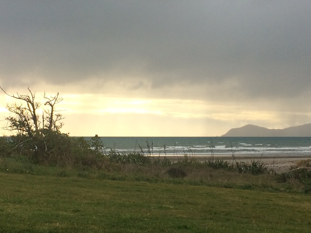
There are cafes near the beach where a couple of high rises poke their heads above the dunes, near a boat ramp. But I had no desire to leave this magnificent beach. Instead I sat down with my back against a sea-whittled log to have a cup of tea and a peanut butter wrap. I watched sheets of rain blow across the big island’s face, blotting out the small islands.
On I went, and as Paraparaumu blended into Raumati, then Raumati South the view began to change. Mana Island, off Porirua began to emerge. I’d be parallel with it the next evening; it’s one of the pleasures of this type of walking, to see the topography unfurl.

Wind- and wave-sculpted driftwood was still a big feature. Some intricate pieces looked like hey’d been carved by a skilful hand. I had to stop myself wanting to handle every little wooden jewell. A photo was a good substitute, especially for the bigger ones.
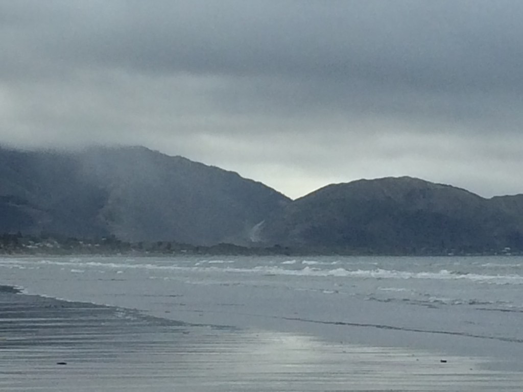
The sun came out, and to the south the day’s destination, the seaside village of Paekākāriki, began to appear.

Still the rain-clouds threatened, back-lighting the island and silvering the sand.
I kept an eye on the baches and homes along the waterfront, many of them palatial new-builds or builds in progress. I liked the humbler ones, reminders from childhood when stays at our “shed” at the beach made me feel like an explorer, sleeping rough in an untamed world:
Paekākāriki grew more distinct, and at its back the new highway going up through Transmission Gully, then still unopened.
I came across the two characters below, a father and son by the looks, in identical black hoodies, gumboots and black tracky daks. I think this was near the footbridge at the mouth of the Wharemauku Stream. The dad was teaching the son to surf-cast along the sand. They stood side-by-side, whipped their lead sinkers up and out of their long, supple rods, then paced out the silvery nylon lines to see who’d gone the furthest. The dad’s arm resting on his son’s shoulders.

It was interesting, in this age of climate crisis, seeing all the multitude of ways bach-owners had fortified their palaces and shacks against the sea. Logs, boards, boulders, stone-filled mesh, earth walls, native planting, reinforced fencing: people here obviously think a lot about the immense destructive power sloshing up against their sand-castles. Some of the barriers were simple and seemed homemade, some had the more elaborate look of a few neighbours clubbing together, and some were imposing, industrial-grade. There was something Quixotic about it all, or Canutian, perhaps. Good on them though – if I had a beach house I’d try to stop the sea eating it too, I suppose.
Here’s a bit of a shot of some of those beach defences, and the gathering storm they stand against:

That long-distance tramping thing of seeing your future rise above the horizon is evident in the next shot: pretty sure the hazy peak in the background, to the right, is Colonial Knob, above Porirua. I’d be going over it two days later. In the foreground is the steep face above the famous stretch of the Centennial Highway that hugs the rocky coast between Paekākāriki and Pukerua Bay. Along the ridge above them goes the new Escarpment Track, built especially for Te Araroa, and also known as the Stairway to Heaven. And those few white specks on the hillside to the right are Pukerua Bay.
Another look toward my destination for this day: Paekākāriki, just beyond Queen Elizabeth park.
I leaned back against one of those Quixotic retaining walls and had a snack, watching the endless emptiness of the horizon just south of Kāpiti Island. That was satisfying: that morning, I’d been looking at it’s northern end. Now I’d walked the length of it.
I especially liked the way this view organised itself into a rich variation on the theme of horizontal lines: beach, sea, sky. Kāpiti’s curves as a counterpoint.

There wasn’t all that much time to linger though, because the light was fading and the rain was brewing. It was tempting to watch the Apocalypse break, but it was time to go.

At the southern end of Raumati South beach you turn inland slightly through piles of driftwood and get onto the Coastal Track, part of Queen Elizabeth Park. You could keep going on the beach, if the tide’s right, but I reckon plump for this track. You get new perspectives on the land and sea, on the ways they’ve acted on each other, and on the community.

This is looking over the Whareroa Stream mouth toward Paekākāriki.

I still had a couple of kilometres to go before dark but it was hard to tear myself away from the intensifying sunset.
Just after the Whareroa there was a picnic area with a tap for drinking water and I stopped for a refuel. There was an info board with photos of the wildlife in the park and stream. My favourite was this truly terrifying photo of a giant kōkupu, rearing up to devour a moth.

Looks like something out of Creature From the Black Lagoon. It reminded me there are tiny, intricate multitudes in these parks and wetlands, more fierce and vivid than most of us probably realise.
The info and photos were courtesy of the Kāpiti Coast Biodiversity Project, another harakeke-roots environmental protection and restoration group. Kudos to them and to all their kind.
Another panel honoured the original and ongoing kaitiaki (guardians) of this moody, mighty place:

The undulating Coastal Path reached a highpoint, and a good view of the new Transmission Gully highway. A topographical illusion made the two paths blend: the gentle footpath and the multi-lane monster. The giant kōkopu and the moth?

On the other hand, that spectacularly perishing sun.

I came across a cool old touring bike, in great nick, lovely leather pannier, flung down casually. Stolen? A missing person? Melancholy was in the air and I felt a chill.

I went up the nearby knoll and was startled to find a youngish, quiet-looking guy sitting there, legs dangling over the sandhill’s lip, gazing out to sea.
“Checking traps?” he asked gently, seemingly unfazed by anything.
“What? No… just saw the bike and I wondered, um.”
“Oh yip,” he said. “It’s mine. I just like coming up here to…” – he gestured to the pyrotechnic grandeur unfolding in front of us – “you know.”
I did know. I left him to it and carried on. The path, the coast, Mana Island beckoning:

Have you ever gone down to the shops on a bike, then realised you’d forgotten to bring a bag? Like me, you might have solved the problem by tucking your coat into your belt, putting bags and bottles inside, then zipping up for the ride home. It works OK. (Though a Massey student I knew did it once with half a dozen lock-neck bottles of Tūī, and he fell off and ended up with quite a lot of stitches.) Anyway that’s how the sky burst just then: like a coatful of bags and bottles, suddenly unzipped.
It crashed down on me from the north-west, freezing and near-horizontal, a furious force at my back. I didn’t mind; it was the first real test of the new, storm-proof raingear I had – coat, mittens, leggings. It was great, actually. I felt like Scott of the Antarctic, “base camp too far away”.
Only it wasn’t. In minutes I was crossing a footbridge over the Wainui Stream, passing the surf club, turning onto Queen Elizabeth Road and reaching the Paekākāriki Holiday park.
The unflappable owners sorted me out a good campsite close to the ablution block and kitchen and soon I was cooking my noodles at the good old formica table under the good old flourescent lights.
You can meet some interesting characters in these places. That evening over my noodles I met a couple of mates who are pretty much living in the campground, each in a three-man tent, using the communal ablutions and kitchens. For entertainment they read, go for walks and watch DVDs together on a laptop.
One was slightly built, quiet and thoughtful, silver-blonde hair tied back. The other was tall and forceful, blonde locks also long but flowing freely, Norse warrior style.
They told me they’d got kicked out of their rental of many years some months before. Now they were living at the campground while putting together a legal case to get their old home back.
“We could have put our name on a register, got into a tiny cold pokey council flat or something,” the quieter one said. “But we want to go back to where we were. And meanwhile we prefer this lifestyle. More freedom, fewer hassles, and you’re by the sea, trees all around…”
They were biding their time until a Covid alert level announcement came out the next day, hoping it would allow them to travel to their home city, to work on their legal situation in a warmer climate.
We talked about tramping and books. They prefered true stories of pioneering courage, solo adventurers overcoming incredible odds, unbound by society’s conventions. Their favourite bookstore was Bob’s Books in Brown’s Bay, Auckland – now closed.
“He would write a note inside the front cover if he thought a book was truly outstanding. He was a legend.”
The awning of his shop was full of holes. The campground comrades didn’t have much funds, but they admired his bookselling ethos so much wanted to do something for him. They offered to buy him a new awning.
“I believe every creative person needs help. And if we can help them, we must,” the warrior explained. But Bob refused to be helped.
“He was too proud. But man, he had good books. The kind of books you’d only find once a year. Maybe twice. It’s hard to get books that good anymore.”
I could’ve yarned with those two for hours but I was done in. Drifting off to the rain pattering on my little tent, I reflected, not for the first time, what a luxury it is to be a voluntary nomad. To live precariously under nylon, to choose to walk all day and sleep on the ground at night. That there are many in our society who are more or less forced into it.
It was a good end to the first part of my 100km stint from Ōtaki to Wellington. Parts 2 and 3 follow in subsequent posts. You can read the whole journey from Cape Rēinga south by hitting the “home” button at the top of the page.
Thanks for reading! Mauri ora.

One thought on “Following the silvery line: Ōtaki to Wellington – Te Araroa Trail days 82-87, kms 1578-1672; PART 1 (to Paekākāriki)”